Net of Natural
Trails

Stage: Daroca - Calamocha
Description
Uniting provinces, districts and monumental cities.
This is a stage that connects Aragonese provinces and district capitals, beginning in Daroca and ending in the village of Calamocha. Under the gaze of the River Jiloca, there are numerous peoples who chose to settle nearby to exploit its fertile land. Cuisine, ethnography and cultural and natural heritage will delight the senses of travellers, not to mention the nearby Gallocanta Lagoon, a must-see for tourists with time to spare.

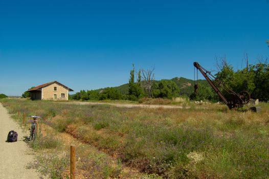
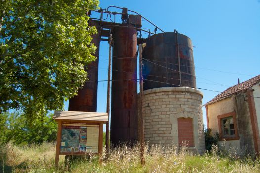
This stage of the Santander - Mediterranean Nature Trail starts at the old Daroca station, where the rest area and the interpretative panel mark kilometre 0. There is no doubt that this station was a strategic railway point in the past, hence the reason why it is still possible to see the old warehouse, the crane and the water tank, among other components.
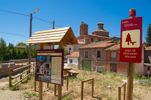
After enjoying the architectural heritage of the village of Daroca, of which its walls and gates (Puerta Alta and Puerta Baja, among others) are of particular interest, the traveller will slowly drift away. The fields alternate between cereal crops and riverside areas offering an attractive and colourful mosaic. Shortly before passing kilometre 4 of this stage, hikers can glimpse the hamlet of Villanueva del Jiloca on the horizon, and a few metres after passing this milestone, they finally reach it. A pleasant rest area welcomes travellers, offering views of the hamlet while they regain their strength. The area’s municipal park is dedicated to Arnaldo de Villanova, a famous local figure who was born here in about 1240. The church of San Gil Abad stands amid the hamlet. There are also two other hermitages, San Bartolomé hermitage, on the hill, and Our Lady of the Rosary hermitage in the meadow.

By the river, near a waterfall and a small shady meadow area, you will reach the signpost indicating that the route is leaving the province of Zaragoza and entering the province of Teruel, and will pass through the Jiloca District from this point on.
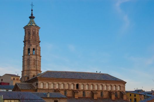
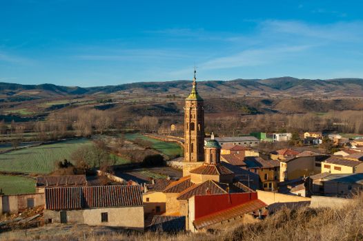
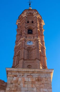
At this point you can see the village of San Martín del Río, on the right of the trail. As is usual, the Mudejar tower of the parish church stands out from the other buildings. The proximity of the Nature Trail provides the opportunity to stroll through the village’s streets to see the façade of the 18th century council building, the Wine Museum and, on the outskirts, two hermitages and several wayside crosses marking the entrances to the village.

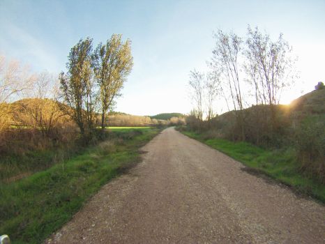
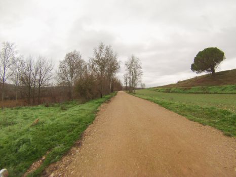
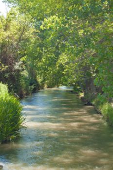
The trip continues on a slight ascent with the gentle slope percentages guaranteed by following the old Santander-Mediterranean railway. The kilometres follow one after another beside the River Jiloca, passing through numerous groves of poplar trees that exploit the optimal conditions offered by the alluvial plain to achieve excellent growth and quality. Next to them, some formations of dense reed beds (Phragmites australis) have developed because of the nearby water table, which is a perfect environment for numerous species of birdlife.
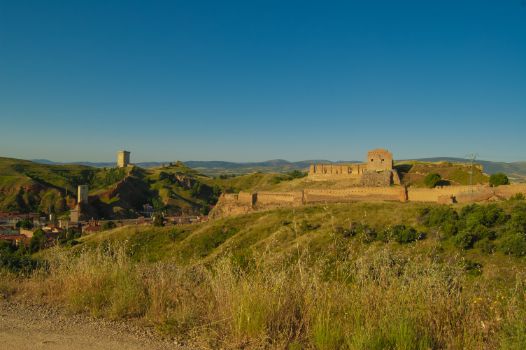
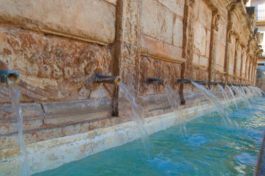
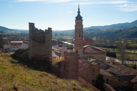
At kilometre 9 of the stage, on the left of the route and as you leave the Nature Trail, a crossroads brings you to the village of Báguena. Travellers will first encounter the old bridge over the River Jiloca and the washing place. Not to be missed is a visit to the church of the Assumption with its beautiful Mudejar tower and the council building, or a stroll up to the tower of what was formerly the mediaeval Báguena Castle.

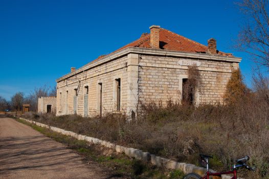
After this small impasse, you should return to the trail, although the old railway station of Báguena and its rest area, with tables and bicycle racks, is certainly worth a stop before you continue your journey with renewed strength. Shortly afterwards, the Jiloca briefly moves away from the almost straight old railway line, before again approaching it just before arriving at the town of Burbáguena.
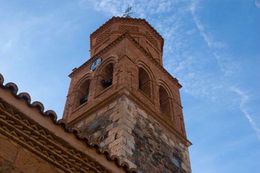
As on previous occasions, you must take a slight detour from the Nature Trail to visit this village. The extra effort will certainly be rewarded by the beauty of Burbáguena, whose architectural heritage includes its parish church, with its obvious Mudejar influence, and the ruins of its ancient castle.

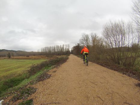
After the visit, cyclists who decide to follow this itinerary will continue along the Nature Trail, sometimes having to overcome small steps and fords over watercourses or small streams, which are dry for most of the year. Over the next few kilometres, cereal crops will become increasingly important at the expense of poplar groves.
After kilometre point 16 of this stage, you will reach a new rest area and, facing it, the old Luco de Jiloca station, which is currently used for a purpose very different from the original one. Behind the old railway building you can glimpse the nearby village of Luco de Jiloca, which is known for its famous carnival, where zarragones, madams and devils are the stars of the event.

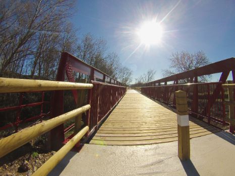
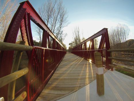
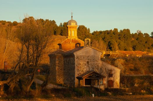
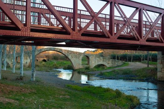
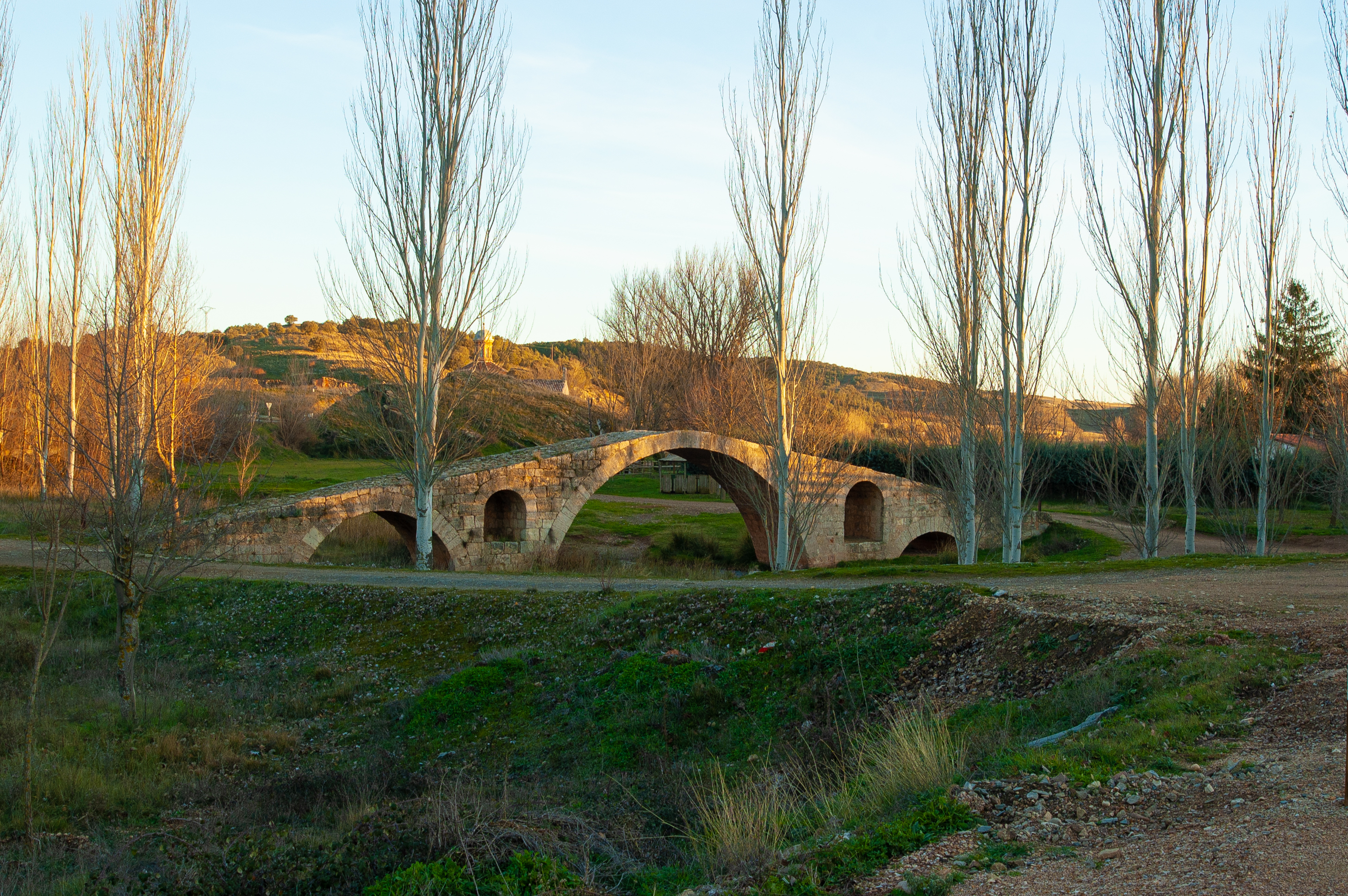
On returning to the railway line, and after passing kilometre 17 of the stage, the River Jiloca passes under the Nature Trail, forcing travellers to cross it over an impressive railway bridge that has been fully restored for this purpose, which offers unbeatable views of the river. From this point, you need only walk one kilometre to see the spot known as Entrambasaguas, so named because this is where the River Pancrudo ends its course, feeding the River Jiloca. The impressive Roman bridge over the River Pancrudo, which is in very good condition, also merits mention. The adjacent recreational area has the additional heritage value of the nearby Virgen del Rosario hermitage. The whole complex is among the most special places in this stage and in this area.
It is time to face the last kilometres of this fascinating stage, returning to alternating cereal crops and poplar groves in the landscape, until the small neighbouring orchards begin to appear, which indicate that the traveller is gradually approaching Calamocha. After crossing two access roads to the aforementioned village, in a section shared with road traffic for just over 300 metres, you will reach the rest area facing the village’s old station, which marks the end of this stage of the Santander – Mediterranean Nature Trail, and is the starting point for the next stage.
Managing Entities
Sites of interest
- Daroca Town Hall
- Villanueva del Jiloca Town Hall
- San Martín del Río Town Hall
- Báguena Town Hall (Electronic Headquarters Only)
- Burbáguena Town Hall
- Calamocha Town Hall
- Aragón Tourism
- Tourism of Zaragoza Provincial Council
- Tourism of Teruel Provincial Council
- Campo de Daroca Region Tourism
- Camino del Cid
Puntos de interés
Culture
- Ermita de los Dolores
- Ermita de la Virgen del Buen Reposo
- Ermita de la Virgen del Rosario
- Ermita de San Bartolomé
- Torre de Nuestra Señora del Pilar
- Ermita del Carmen
- Ermita de San Francisco
- Ermita de San Pedro Mártir
- Ermita de San Roque
- Casilla de Peones Camineros
- Puente romano
- Ermita de la Virgen del Rosario
- Murallas de Daroca
Hydrography
- Rambla de Valdeardiente
- Arroyo Val de la Parra y puente ferroviario
- Río Jiloca
- Lagunas de Gallocanta
- Entrambasaguas
Infrastructure
- Antigua estación de Luco de Jiloca
- Antigua estación de Daroca
- Antigua estación de Báguena
- Antiguo apeadero de Burbáguena
- Antigua estación de Calamocha
- Presa de Lechago
Municipality
- Báguena
- Anento
- San Martín del Río
- Daroca
- Villanueva de Jiloca
- Ermita de Santa Bárbara
- Luco de Jiloca
- Burbáguena
- Calamocha
Vegetation
Passport
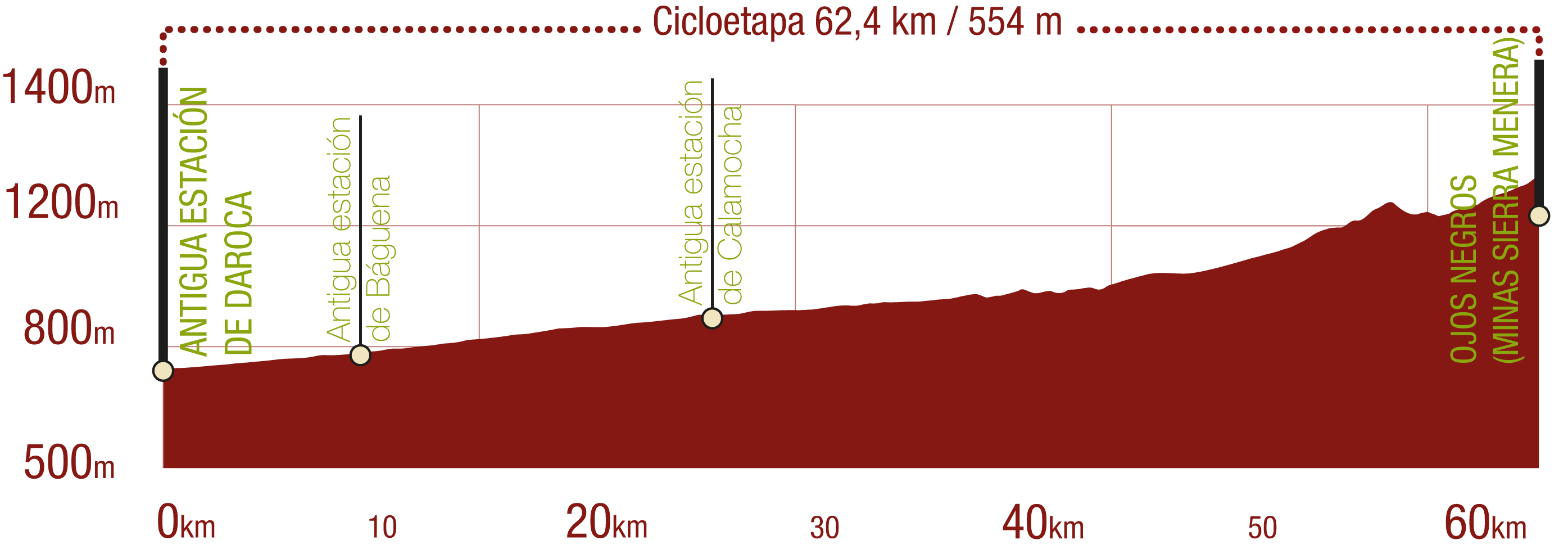
Profile
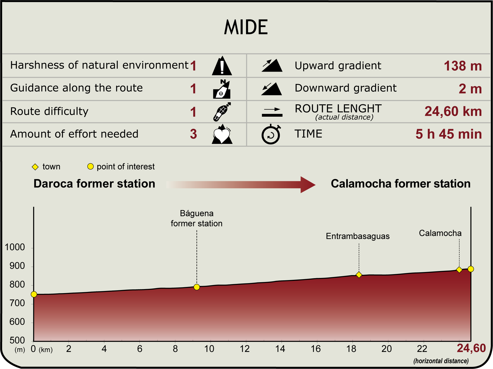
(Calculated according to the MIDE criteria for an average excursionist with a light load)
Highlights
Further information
Calamocha
This municipality, which belongs to the Jiloca District, owes its name to its founder, who, according to tradition, was Muza Ibn Muza 8th century), descendant of Count Cassius, although, since ancient times, it has been a place of passage, as attested by its Roman bridge. In the surrounding area, specifically in El Poyo, El Cid Campeador set up camp and carried out incursions into Levante from there. In 1706, it also witnessed bloody clashes in the War of the Spanish Succession. Its settlement on the banks of the River Jiloca has encouraged the use of its fertile lands and has developed, since the Muslim period, a complex and complete irrigation network with various hydraulic devices, as well as the current landscaping of a part of its banks to create a pleasant municipal park.
The arrival of the railway, in the early 20th century, brought a new boost to its economy, and today the agri-food industry linked to the famous Teruel Ham (P.D.O.) is highly developed. The “Museo del Jamón y de la cultura popular de Calamocha” (Museum of Ham and Popular Culture of Calamocha) is a landmark for learning about the traditional methods of producing all manner of pork products.
The patron saint festivities take place in mid-August with the traditional Baile de San Roque, featuring more than 300 dancers dressed in blue sashes and white costumes, and of course wearing a cachirulo around their necks. They roam the streets of Calamocha delighting locals and tourists alike.
Multimedia
Downloads
GPS Downloads
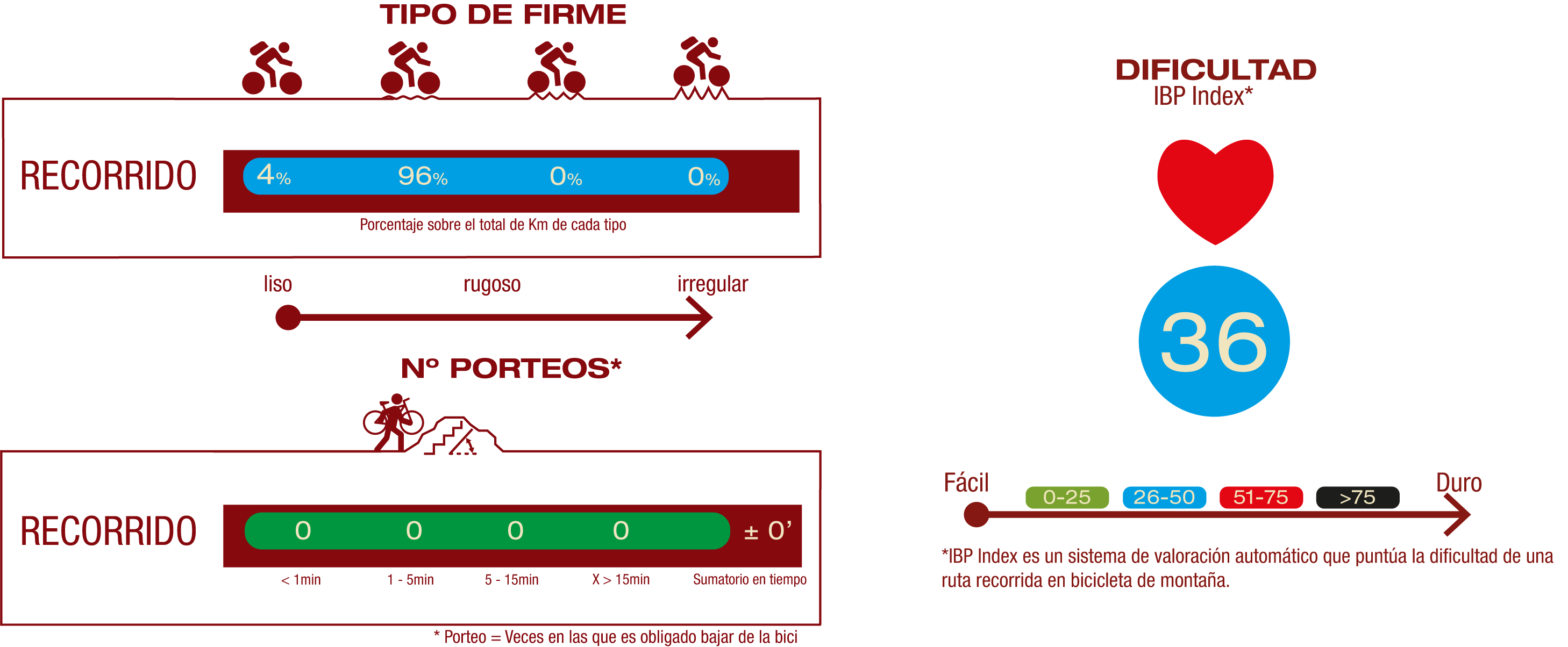
Cyclability
Esta Cicloetapa se corresponde con los Tramos Daroca - Calamocha y Calamocha - Ojos Negros (Minas de Sierra Menera) del Camino Natural
TIPO DE FIRME, PORTEOS Y DIFICULTAD
RECOMENDACIONES DE SEGURIDAD
- Precaución en cruce de carreteras y en paso por ramblas o arroyos temporales tanto por el caudal de agua como por la acumulación de piedras y restos vegetales arrastrados por la corriente.
- Precaución en los numerosos cruces de caminos, sobre todo en los localizados en el tramo compartido con vehículos a motor de 31,6 km de longitud, extendiendo este nivel de precaución a todo el tramo compartido.
RECOMENDACIONES GENERALES
-Infórmate sobre los aspectos técnicos de la ruta y sobre la meteorología del día.
-Cuida del medio ambiente. Procura no molestar a los animales ni deteriorar la vegetación. Respeta las zonas privadas.
-Debes dar prioridad a los peatones y cumplir con las normas generales de circulación.
-El entorno por el que vas a circular es abierto, de libre circulación y escenario de múltiples actividades (deportivas, forestales, ganaderas y agrícolas). Mantén una actitud comprensiva, prudente, responsable y respetuosa.


