


Puntos de Interés

Hydrography
Rambla de Valdeardiente
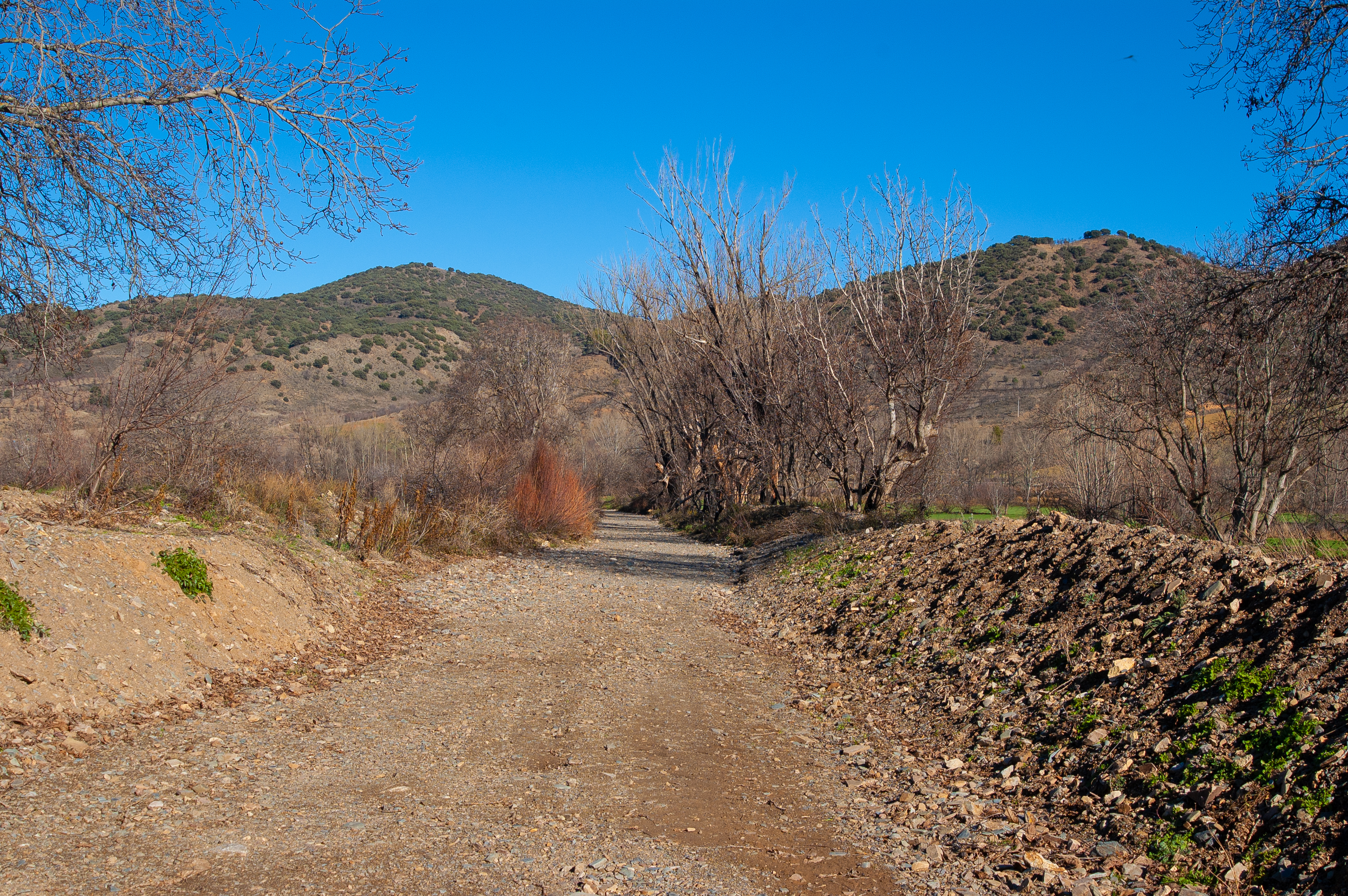
The Rambla de Valdeardiente is between the Teruel villages of Báguena and Castejón de Tornos, just on the natural border between the endorheic basin of the Gallocanta Lagoon and the Jiloca Valley.
This is a flat-bottomed torrent that emerges in the sierras near the Jiloca Valley. Its temporary and intermittent flow explains why it is dry most of the year.
This type of torrential watercourse is caused by heavy rainfall, which determines its flow rate and erosive force, and it is typical of Mediterranean climates. Specifically, in the Jiloca Valley, the ravines are notable for their density and power. Tumultuous streams that have determined the nature of the agriculture and life of the settlements and peoples near them.
The term rambla (ravine) comes from the Arabic word ramla, meaning sandy area, a concept used for this type of river flow, especially in areas or regions with a larger Muslim presence and influence, such as the province of Teruel.
As for vegetation, the area surrounding the Rambla de Valdeardiente is dominated by rye (Secale cereale (L.) M. Bieb.) and grass. This land is primarily and traditionally used for grazing and livestock. This type of economy is fostered by the various species of dry scrubland, characteristic chaparral vegetation, which grow there. Thyme (Thymus sp.), foxglove (Digitalis purpurea), holm oak (Quercus ilex) and centaury (Centaurea scabiosa) are among the species that dominate the landscape.
Because this riverbed is dry most of the year, what stands out most is the path or trail formed by the riverside vegetation that has developed in the area, riparian vegetation, which is dominated by black poplars or poplars (Populus spp.).
A 9 m-long viaduct has been erected over the course of the ravine, near what is known as Camino los Quemados. This railway structure formed part of the old Calatayud-Valencia line, which crossed the province of Teruel, and lies on the route connecting the municipalities of Báguena and Burbáguena.