

Net of Nature
Trails

Stage: Altura - Algimia de Alfara
Description
A stage with views of the Mediterranean Sea
This 21-kilometre stretch marks the transition from the province of Castellón into the province of Valencia, passing through the scenic Camp de Morvedre region. The final section of the old mining railway, once used to transport iron ore to the blast furnaces of Puerto de Sagunto—a place that still holds traces of this fascinating industrial heritage.

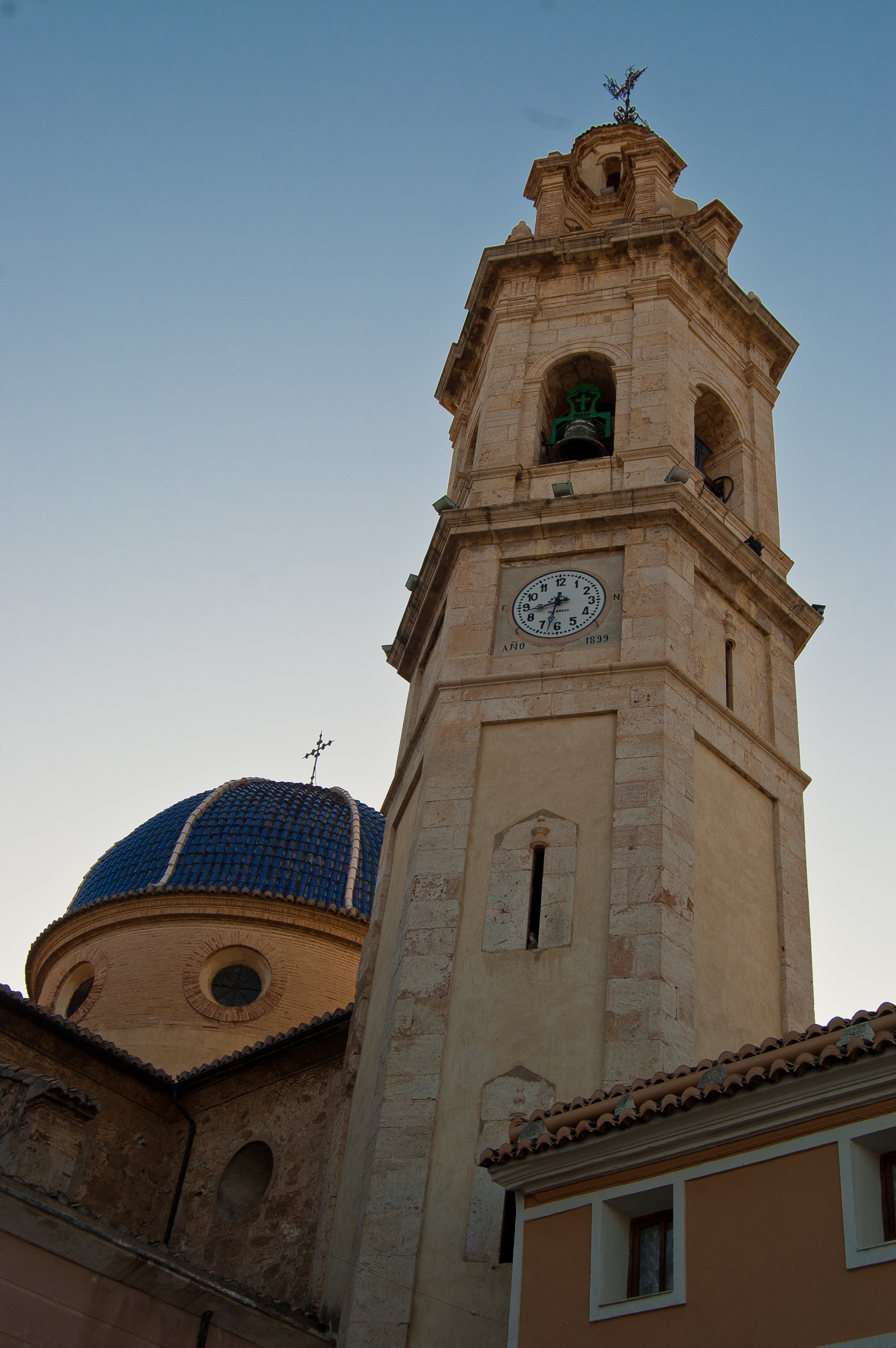
The stage begins in the town of Altura, known for its rich architectural heritage. Be sure to explore its charming main square and the historic Church of San Miguel Arcángel. We pick up the route right where the previous stage left off, on the old railway in the town of Altura. Soon after setting off, we reach the edge of a water pool, likely created after the final closure of the mining railway. Slowly leaving the town centre of Altura behind, reaching a small railway building that was renovated in 2007 and transformed into the Casa de Oficios Óleo-Altura.
After just under two kilometres, we come across the Rambla Monteros Rest Area. Here, crossing the Rambla Monteros viaduct, we can take in the meanders formed by the riverbed, sheltered by riverside vegetation that provides an ideal habitat for a diverse range of wildlife.
A kilometre further along, a crossroads and a signpost mark our arrival at Mas de Valero. The sign also tells us the distance to the end of the stage, along with other points of interest like the Mirador de Sot and El Juncar.

To the left of the route lies the historic town of Segorbe, well worth a leisurely visit. Take some time to explore its medieval walls, La Estrella Castle and the Prison Tower, all while enjoying its exquisite culinary offerings in a relaxed setting. Fruit crops are slowly becoming more prominent. After carefully crossing a small road, we arrive at the old Segorbe station, where a rest area and the ruins of the remaining railway building greet them.
Two kilometres later, we cross the Rambla Rovira, passing beneath its viaduct, with its three stone arches. Here, the path continues alongside the railway line on the left, with a forest of reforested Aleppo pines (Pinus halepensis) to the right. This forest, which was devastated by fire a few years ago, is slowly coming back to life with new growth, as young trees gradually take root and help protect the soil from erosion.
The trail continues for a few metres alongside the A-23 motorway, then veers left, leaving it behind. Further on, on the same side, lies the town of Soneja, an area that has been inhabited since Palaeolithic times. It was depopulated in 1609 during the expulsion of the Moors, but was repopulated shortly after with the signing of a new Charter. Due to its rich history, Soneja is well worth a visit, where you can admire the old palace of the Dukes of Montellano and the church of San Miguel Arcángel.

Returning to the trail, after tackling an uphill ramp and a brief, swift descent, we leave the old railway line at a crossroads leading to the access road of a quarry. Here, the path continues, leaving the active railway line on the left and the quarry, in a different stage of exploitation and restoration, on the right. The route then continues past a deep lagoon, once part of the quarry, which has now become a wetland, providing a habitat for a rich variety of wildlife, especially amphibians and birds.
The trail follows the old railway line, and we reach the Mirador de Sot de Ferrer viewpoint, which offers an unbeatable panoramic view and invites you to explore the Palacio del Señor and the Church of La Inmaculada Concepción. The white staircase leading up to the Shrine of San Antonio de Padua is a real spectacle.
Back on the route, after just over a kilometre, we cross the viaduct over the Barranco Juncar ravine. A kilometre further along, an underpass beneath the A-23 motorway diverts the route from the original iron path, leading us onto a dirt track between the access roads to the motorway.
The route then passes under the CV-216 road via a newly built underpass, followed by the A-23 motorway. At the end of the second underpass, the route offers two options: continuing along the old railway line or taking an alternative path, which in just over 500 metres reconnects with the main route, resuming the journey along the old railway line.
Just after the end of the alternative route, we reach the first houses of the town of Altura. After crossing several streets following the old railway line, we reach the final point of the stage. On arrival, we can enjoy the Church of San Miguel Arcángel, the Plaza Mayor, the 16th century Casa Grande and a whole network of historic aqueducts and bridges that invite you to wander through the streets of Altura.

The route returns to the old railway line, passing through an area of trenches carved into the natural rock. Shortly after, it briefly deviates from the railway line before reconnecting just a few metres before a new kilometre marker. The signposting invites us to take detour and visit the town of Algar de Palancia, located to the left of the route and the first town in the province of Valencia. There we can admire the 18th-century church of Nuestra Señora de la Merced and the 13th-century Árabe Tower, which now houses the town hall.
Upon returning to the route, we cross the N-225 via an underpass. Shortly after that, we the old mining railway line, leading to the Arquinas viaduct with its four stone arches.
Amidst orange and mandarin groves, the kilometres slip by, with the unmistakable scent of orange blossom filling the air and permeating the senses. At the top of a promontory, we can make out the Shrine of Nuestra Señora de los Afligidos. Behind this mountainous outcrop, hidden from view of the trail, lies Alfara de la Baronía, where we can explore the Plaza de la Mare de Déu and the Church of San Agustín Obispo.
The stage reaches its final stretch at the crossroads with the road leading to Algímia d'Alfara, where the impressive tower of the Church of Sant Vicent Ferrer stands out. A sign marks the end of the greenway at kilometre marker 184.557, where this journey, bringing us closer to the coast, concludes.
Beyond the route, there are many ways to reach Puerto de Sagunto and its beaches, completing the journey once travelled by the mining train to the iron and steel industries in the port. Here, you can explore and visit some of the buildings from this significant sector that played a key role in the town's development.
Managing Entities
Sites of interest
Puntos de interés
Culture
Geology
Hydrography
Information
Infrastructure
Municipality
- Altura
- Segorbe
- Algar de Palancia
- Sot de Ferrer
- El Port de Sagunt
- Geldo
- Alfara de la Baronia
- Algimia de Alfara
- Sagunto
- Soneja
Hostel
Vegetation
Passport
Profile

 Harshness of natural environment
- 1. The environment is not risk-free
- 2. There are more than one risk factors
- 3. There are various risk factors
- 4. There are quite a lot of risk factors
- 5. There are many risk factors
 Guidance along the route
- 1. Well defined trails and crossings
- 2. There is a clearly marked trail and signage
- 3. Requires the identification of geographic features and cardinal points
- 4. Requires off-path navigation
- 5. The trail is interrupted by obstacles that have to be gone around
 Route difficulty
- 1. Walking on a flat surface
- 2. Trails with different types of path
- 3. Walking on stepped paths or irregular terrain
- 4. The use of hands or jumping over the terrain is necessary
- 5. The use of hands is required to progress
 Amount of effort needed
- 1. Up to 1 hour of continuous walking
- 2. Between 1 and 3 hours of continuous walking
- 3. Between 3 and 6 hours of continuous walking
- 4. Between 6 and 10 hours of actual walking
- 5. More than 10 hours of continuous walking
(Calculated according to the MIDE criteria for an average excursionist with a light load)
Highlights
Segorbe
Segorbe, the capital of the comarca of Alto Palancia in Castellón, sits at an altitude of 394 metres, nestled between the Sierra de Espadán and Sierra d Calderona mountains, along the road connecting Aragon and the Valencian Community. With a population of over 9,000, Segorbe boasts a rich historical heritage.
Its strategic location, atop a mound with vertical walls that enhance its defensibility, has ensured it was continuously inhabited since prehistoric times. The earliest sites reveal remains from the Bronze Age, with additional traces from the Iberian period and Roman settlements also uncovered. Following the Moorish conquest, the area became a small fortified rural town with a castle. In 1245, it was captured by James I the Conqueror, becoming part of the Aragonese crown through an agreement with King Zeyt Abuzeyt. For many years, it was a manor house, which led to a renovation of the castle over time. After the Middle Ages, Segorbe remained an important centre in the Valencia region until the onset of its decline in the 19th century.
Regarding its architecture, notable buildings include the La Estrella Castle, the Prison Tower, located on the old wall next to the 16th century Teruel Gate, 11th century medieval walls, and the La Verónica Arch.
From this municipality, there are six routes that offer the chance to immerse yourself in the natural landscapes surrounding the town centre, highlighting its significant environmental richness. Other key sites include the spring and the area surrounding the Shrine of La Esperanza, outside the town. Segorbe hosts a variety of religious, cultural, and tourist festivals throughout the year. Notable events include the festivals of San Antonio Abad, the patron saint festivals, and the medieval market. There are also celebrations centred around the region's rich culinary culture, such as the Segorbe Ham and Artisan Sausage Fair.
Multimedia


Downloads

GPS Downloads


Documents

Cyclability
CICLABILITY
This Cyclostage corresponds to stage Caudiel - Altura and stage Altura - Algimia de Alfara of the Nature Trail
PROFILE

TYPE OF ROADS, PORTAGES & DIFFICULTY

TEST

SAFETY RECOMMENDATIONS
- There are eleven tunnels, eight of them without artificial lighting.
- Urban sections through Caudiel, Jérica and Altura with road crossings and three sections shared with motor vehicles.
GENERAL RECOMMENDATIONS
- Find out about the technical aspects of the route and the weather on the day.
- Take care of the environment. Take care not to disturb animals or damage vegetation. Respect private areas.
- You must give priority to pedestrians and comply with general traffic rules.
- The environment in which you will be riding is open, free to move around and an area where many activities are carried out (sporting, forestry, livestock and agricultural activities).
- Always have an understanding, prudent, responsible and respectful attitude.