

Net of Nature
Trails

La Palma Nature Trail. GR 130: Royal Road of the Coast and Middle Lands
Description
select a stage:

- - - - - - - -
IMPORTANT NOTICE!
DUE TO THE VOLCANIC ERUPTION THAT BEGAN ON 19/09/2021 IN CUMBRE VIEJA, THIS ROUTE IS NOT PASSABLE IN THE SECTION BETWEEN LOS LLANOS AND JEDEY.;
DUE TO ROADWORKS ON THE LP-1 ROAD, THE ROUTE MAY BE AFFECTED IN THE SECTION BETWEEN TIJARAFE AND LOS LLANOS.
- - - - - - - -
A historical route around the island, connecting its main towns and offering a complete immersion in the diversity of the landscape, culture and heritage of La Palma.
The Royal Way of the Coast and Middle Lands Nature Trail is an historic route that circles the island of La Palma for 159 kilometres, connecting the main towns and villages and offering a complete immersion in the rich diversity of the island's landscape, culture and heritage. Following the old Camino Real, this trail not only links the different regions of La Palma, but also invites hikers on a journey through the history and culture of La Palma, for a comprehensive exploration of its geography and heritage.
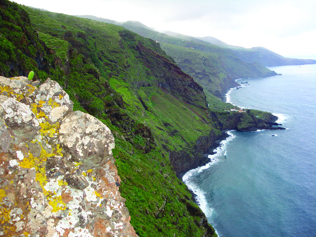
Along the route, an impressive variety of landscapes unfolds: from urban and rural areas, to rolling fields of crops, along the coastline, deep ravines and pine and laurel forests as well as the arid badlands dotted with cardon, a cactus-like shrub. This geographical diversity offers a unique experience, allowing you to enjoy panoramic views and discover varied ecosystems.
The Trail crosses emblematic places such as the Barranco del Agua ravine, the Special Nature Reserve of Guelguén, and the Los Volcanes de Aridane Natural Monument, offering a deeper connection with the nature and history of La Palma every step of the way.
In its origins, the Camino Real de La Costa was vital for the communication and development of the island. Although some of the original layout has been absorbed into the road network, in many areas, especially in the north, the original cobblestone pavement is preserved, allowing users to experience the landscape in an authentic way, just as the island's ancient inhabitants did, and to connect with traditional ways of life.
The circular route allows you to freely choose the starting and finishing point, although the Plaza de España in Santa Cruz de La Palma is the long-established recommended starting point, from where you can start in the direction of Puntallana. The trail is divided into eight stages, each starting and finishing in the main urban centres of the island, making it easier to plan your trip on the route depending on the time available, physical condition and interests.
Highlights
Further information
Island of La Palma
La Palma is one of the seven islands that form the Canary archipelago. It is known as "Isla Bonita" (the beautiful island) both for its spectacular natural landscape, of which laurel and Canary pine forests are a highlight, and for its old colonial style villages and towns.
The early inhabitants of the La Palma called their island “Benahoare" (“My land”), and divided it into 12 cantons or dominions, each of which was ruled by a lord or “mencey”. The aboriginal population lived mostly off grazing (goats, sheep and pigs). Currently, livestock farming is a marginal activity and tourism has become the main economic engine of the island.
The island of La Palma was named a Biosphere Reserve in 2002, since it has two Natural Parks, as well as the National Park Caldera de Taburiente. These natural areas have been exceptionally well preserved thanks to the implementation of an economic model that combines sustainable tourism and traditional agriculture.
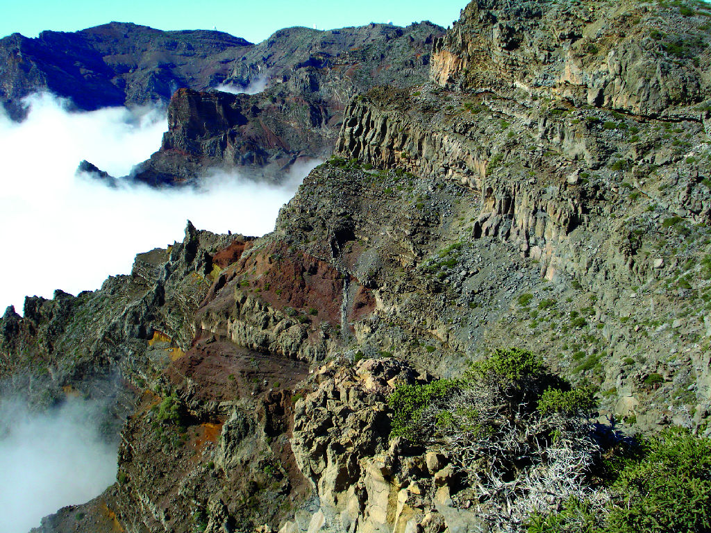
National Park of La Caldera de Taburiente
Caldera de Taburiente, with an area of 4,690 ha, was named a National Park on October 6, 1954. It is formed by a huge caldera-shaped cirque with a diameter of 8 km created by volcanic eruptions, massive landslides and the erosive action of wind and, specially, water.
The Caldera has elevation changes of up to 2,000 m, as well as an important network of brooks and streams that remains practically unspoiled thanks to the good preservation of the vegetation cover.
Among the many plant species this area is home to, the most important ones can be found in laurel forests: Canary Island fire tree (Myrica faya), tree heath (Erica arborea), and Canary Island pine (Pinus canariensis), main plant formation in the Park, and remarkable for its adaptation to fires.
Multimedia


2_141039.jpg)

Downloads

GPS Downloads


