
 del Camino Natural de La Palma")
Net of Nature
Trails

Stage 4: Santo Domingo de Garafía - Puntagorda - Tijarafe
Description
Ethnographic heritage on a route through the ravines of northwest La Palma
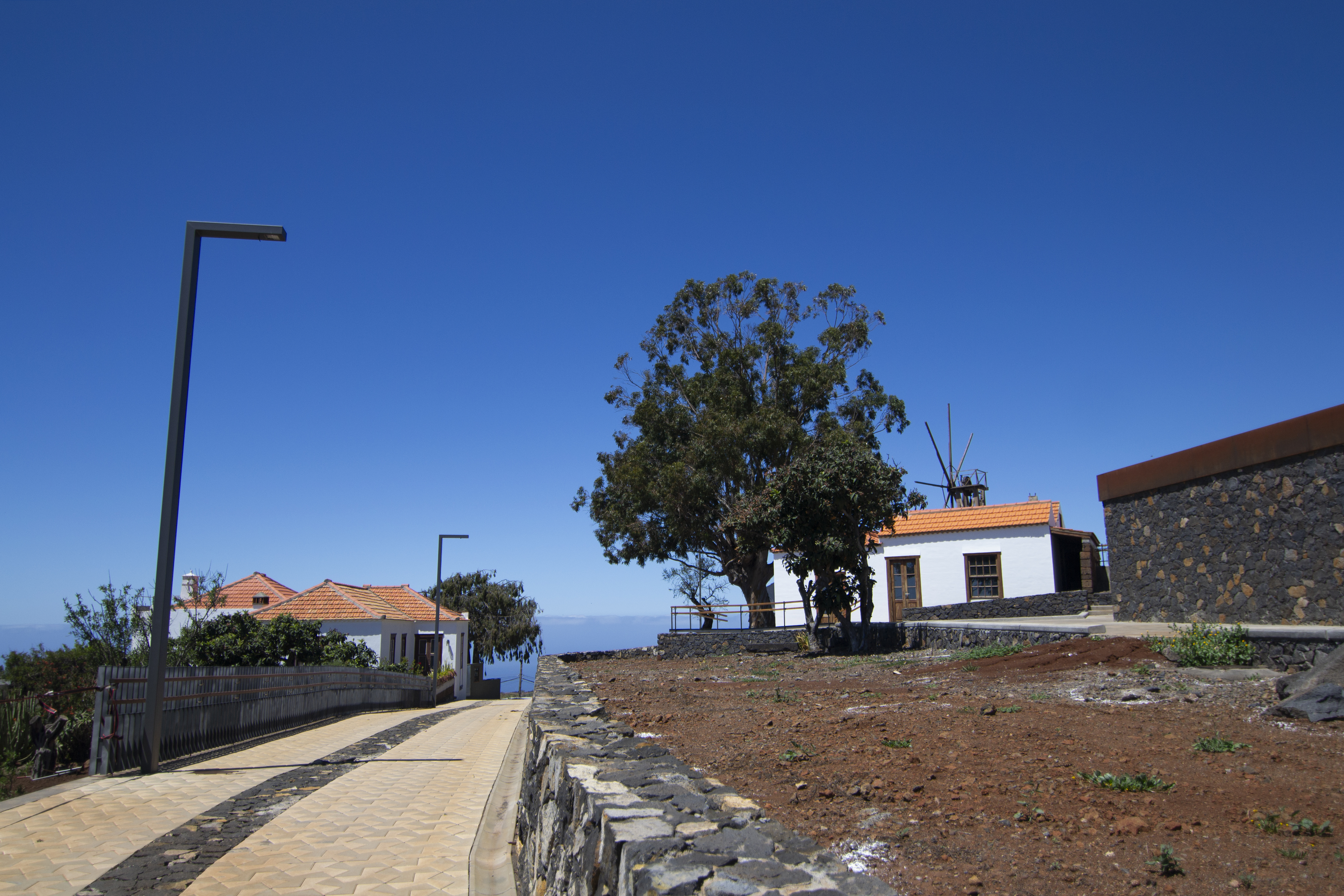
This is another long and challenging stage of the GR130, and although perhaps less intense than the last one, the descent and ascent of several ravines remain a constant feature. These include the imposing Izcagua and Briesta ravines, typical of the rugged landscape of the island’s northwest. As well as enjoying the spectacular landscape of the ravines, with the ocean almost always in view, you’ll learn about the island's rural heritage as you pass old water cisterns, threshing floors and traditional mills, and villages of houses that preserve the traditional architecture of the island.

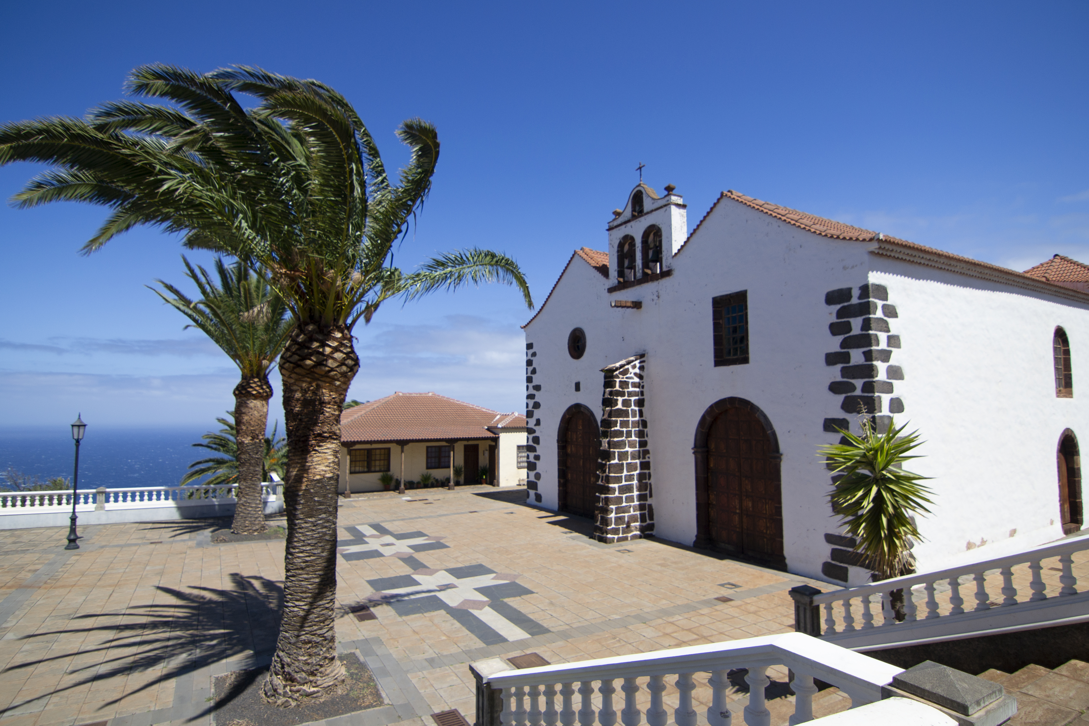
This stage starts right where we left off, at the exit of the Sables ravine. Soon we reach the Plaza Baltasar Martín, next to the Church of Nuestra Señora de la Luz. This church has the unique feature of two naves, something unique in La Palma and even rarer in the rest of the Canary Islands, while it also features a beautiful Mudejar coffered ceiling.
The first few kilometres of this stage run along the LP-114 road, as it follows the route of the old Camino Real or Royal Way route. It is important to exercise extreme caution on this section, especially on sharp bends and changes of gradient, where visibility is limited. We soon leave the municipal capital of Santo Domingo de Garafía behind passing by the town hall and the football pitch. Although the first ravines are crossed by asphalt paths, the landscape on both sides of the road, covered with vegetation that fills the ravine depths, offers a beautiful contrast and a visually attractive experience.
After overcoming the Fernando Porto ravine, take an asphalted track next to a bus stop that ascends to area of Cueva de Agua. Less than a kilometre later, the route leaves the asphalt in favour of a path next to a small square with a statue of the Virgin. The descent to the barranco del Atajo ravine begins, followed by a demanding climb to the Lomo de Briesta. This section is particularly challenging due to the loose road surface and steep gradients.

Having climbed up the ravine, we leave the path to continue along a track that crosses a few agricultural holdings and we pass some impressive Canary Island pines (Pinus canariensis). The track gives way again to a path that begins to descend as it enters the Briesta ravine, one of the largest of those found on this stage. At the bottom of the ravine, the path meets the LP-114, along which you walk briefly before turning off again to ascend a path that crosses a cultivated area. After passing some buildings, the route returns to the road, offering a moment to regain strength before continuing the journey.
Back on the road, it is important to walk with caution, especially on the first stretch of curves where visibility is poor. After almost a kilometre, passing some scattered houses with their vegetable gardens and a small ravine, we take a detour to the right along a dirt track.
After about 700 m, at the bottom of a ravine and next to a rural tourism complex, there is the option of taking an alternative route. Although it does extend the route a little, this branch offers walkers the chance to enjoy some of the most beautiful Canary Island dragon trees (Dracaena draco) in Buracas, home to the highest concentration of these iconic trees in all the Canary Islands. The route also passes through the archaeological and ethnographic site of the Buracas Caves, consisting of several natural cave settlements, petroglyphs and necropolises. This detour, a little over 1600 m along a track and cobbled paths, reconnects with the main route just before reaching the area of Las Tricias.

Returning to the main route, the path gains height, crossing the ravines of La Mejera and Corchete. Here, the landscape is enriched by the presence of an aqueduct and by a beautiful route surrounded by dragon trees and other vegetation at the bottom of the ravine. Soon we reach the point where the alternative branch returns to the main trail and continues southwards between the scattered houses Las Tricias, crossing, on a couple of occasions, an asphalted track that leads to the Gofio Interpretation Museum (MIGO).
Gofio, one of the essential ingredients of the traditional Canarian diet, is an unsifted flour made from toasted cereals, usually wheat or maize, known locally as millo. This food, which has its roots in the culture of the aboriginal Canary Islanders, has endured as a gastronomic symbol of the islands. The MIGO was inaugurated in 2016, is located in the old Las Tricias mill, which remained in operation until the mid-20th century. All locals went to this mill with their grain and, due to its location, the neighbours could see if the blades were working before making a visit. The long waits, especially on windy days, turned this place into a meeting place for the locals.
The path then goes over the Corchete ravine again, but without descending, and returns the road, which it follows for half a kilometre before leaving it again next to a large house. As you walk through the scattered buildings, you can appreciate the valuable ethnographic heritage of the area, with traditional architectural elements such as threshing floors and cisterns. After crossing a small ravine, the descent begins, along a paved track protected by a fence, towards the Iznaga ravine. Both the descent and the subsequent ascent are in the shade of a pine forest, making this demanding section of the stage somewhat more bearable.

Once the ravine is crossed, in the municipality of Puntagorda, and after crossing the road, the path continues through pine trees until it reaches La Rosa Nature Centre. Here, we begin a slight descent between mansions and vegetable gardens until we cross the road again in the direction of the town of Puntagorda. Our route does not venture too far into this town, as it turns off at the next point without reaching the large Pino de la Virgen, one of the most characteristic elements of this town.
The path continues its course around Puntagorda, running parallel to the LP-1, which it crosses near some industrial warehouses. Continue just 300 m along the other side of the road, passing another traditional mill, before crossing the road again. Here the path runs along a track that connects with scattered houses and crosses the Barranco de El Roque ravine. After crossing yet again, the route follows a path that skirts the Barranco de Garome ravine about halfway up the side, winding through pinegroves. The path gradually gains altitude before reaching a track that descends towards the Casa del Trigo recreational area. Near here, just across the road, is a viewpoint that offers an impressive panoramic view of the Garome ravine, with the Atlantic Ocean as a backdrop.

Once in the municipality of Tijarafe, the path enters the village of Tinazara. At first it winds its way between scattered houses surrounded by fruit trees and orchards, and then continues along a fully developed street that passes by the Shrine of the Sagrado Corazón de Jesús, a simple temple, but one with special views. Just over a kilometre after the shrine, the asphalted road becomes a cobbled track that descends to the Barranco de la Baranda ravine.
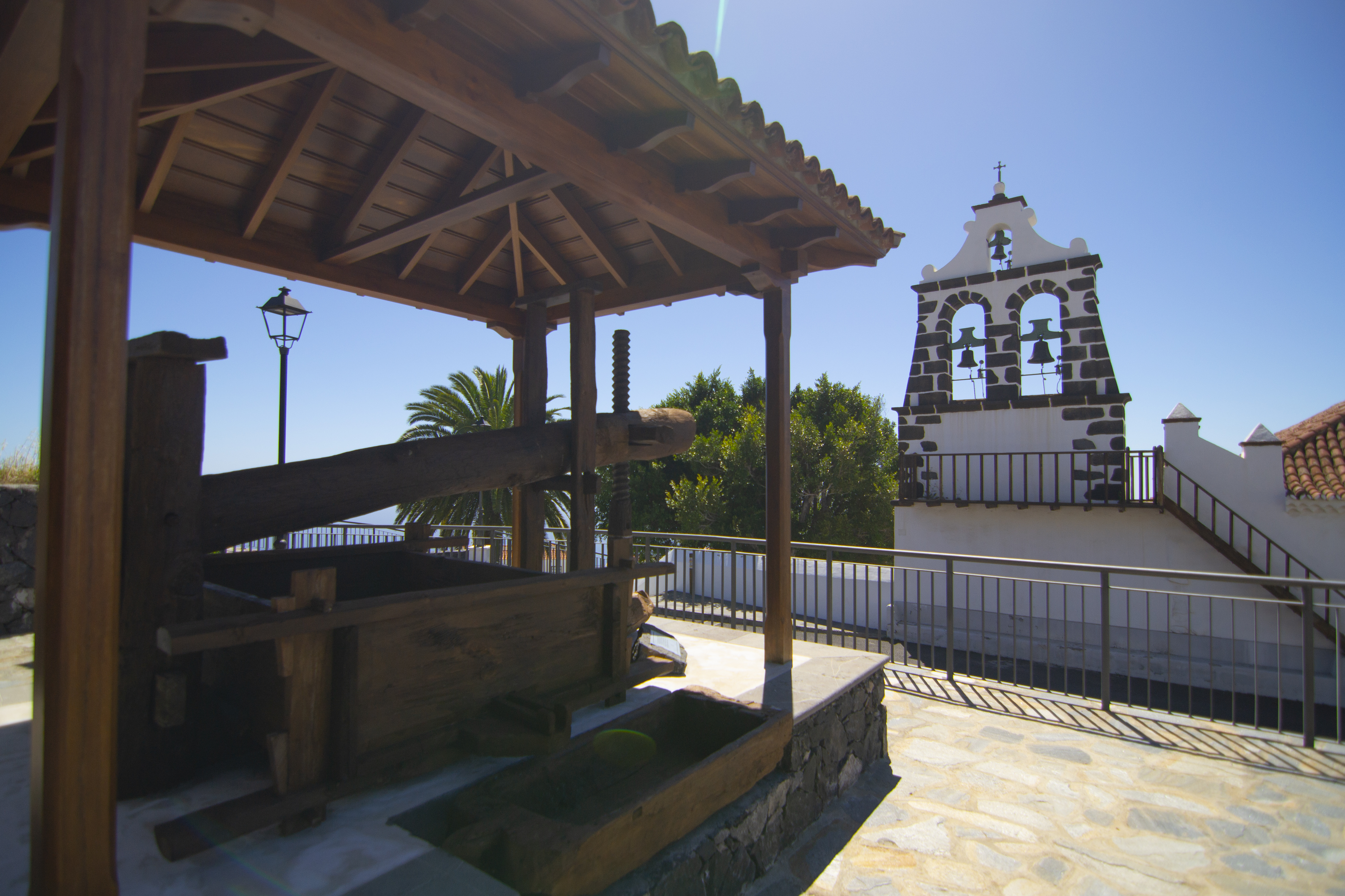
The last 5 km of the route follows a similar pattern, alternating between cobbles and tarmac between scattered houses and fruit orchards. The route also crosses several ravines, some quite large, such as the Pinillo, Cueva Grande and Aserradero. Along the final stretch, the path enters the asphalted streets of El Pueblo de Tijarafe, the municipal capital. The route then crossed the LP-1 once more, next to the Tijarafe fairground, recognisable by its large white textile cover. On the other side of the road, we continue on Calle Alcaldesa Mª Nieves Martín, which leads to the end of the stage next to a square where a traditional wine press has been restored just behind the Church of Nuestra Señora de la Candelaria.
Puntos de interés
Culture
- The Archaeological-Ethnographic Complex of Buracas
- The Puntagorda Farmers' Market
- The Gofio Interpretation Museum
Municipality
Profile

 Harshness of natural environment
- 1. The environment is not risk-free
- 2. There are more than one risk factors
- 3. There are various risk factors
- 4. There are quite a lot of risk factors
- 5. There are many risk factors
 Guidance along the route
- 1. Well defined trails and crossings
- 2. There is a clearly marked trail and signage
- 3. Requires the identification of geographic features and cardinal points
- 4. Requires off-path navigation
- 5. The trail is interrupted by obstacles that have to be gone around
 Route difficulty
- 1. Walking on a flat surface
- 2. Trails with different types of path
- 3. Walking on stepped paths or irregular terrain
- 4. The use of hands or jumping over the terrain is necessary
- 5. The use of hands is required to progress
 Amount of effort needed
- 1. Up to 1 hour of continuous walking
- 2. Between 1 and 3 hours of continuous walking
- 3. Between 3 and 6 hours of continuous walking
- 4. Between 6 and 10 hours of actual walking
- 5. More than 10 hours of continuous walking
(Calculated according to the MIDE criteria for an average excursionist with a light load)
Highlights
Further information
Tijarafe
Tijarafe is a charming municipality located in the northwestern part of the island of La Palma, in the province of Santa Cruz de Tenerife. Its municipal boundaries border Puntagorda to the north, the Sierra de la Cumbre mountains to the east, the ocean to the west, and the municipalities of Tazacorte, Los Llanos de Aridane and El Paso to the south.
Its name has its roots in the aboriginal languages of the Canary Islands, though the exact etymology of "Tijarafe" is unknown. There are several interpretations, including a connection to the words tigad or tigaday, referring to a species of bush in the area, or the term tigarafe, which means a meeting place.
Tijarafe's history dates back to the arrival of the Castilians in 1492, led by Alonso Fernández de Lugo. After the conquest, the area underwent land redistribution and became home to a diverse society of Iberian settlers, slaves, and the aboriginal population. The 19th century brought change as many poor peasants emigrated to Cuba due to the agricultural hardships. In the early 20th century, the arrival of water and banana cultivation transformed the economy. Agriculture and livestock remain the economic pillars today, with bananas accounting for 69% of the workforce.
The municipality’s geography features mountainous terrain with gentle slopes between 400 and 800 meters above sea level, where most of the population resides. The 11.5 km of coastline are lined with dramatic cliffs that are difficult to access.
Despite its calm appearance, Tijarafe boasts spectacular natural sites such as the Barranco del Jurado, a dramatic ravine filled with rock formations and caves that leads to the scenic Cala del Jurado. Nearby is the Cueva Bonita, a sea cave famous for its colorful reflections at sunset and pirate legends. The coast also features the Prois de Candelaria, an iconic historic dock turned summer retreat, and the cave complex of Pozo de Tinizara at the mouth of the Barranco de Garome.
One of the region’s highlights is the volcano La Caldera de Jieque, known as the mini “Taburiente.” This rugged, microclimate-rich area supports endemic flora and is a favorite among mountain shepherds.
Local festivities are celebrated around September 8 in honor of Our Lady of Candelaria. A standout event is the Danza del Diablo (Devil’s Dance), a vibrant and traditional celebration. The festivities also include religious pilgrimages, wrestling, food fairs, and activities for children.
Archaeological-ethnographic complex of Buracas
The archaeological-ethnographic complex of Buracas, discovered in 1941 in the lower section of the Barranco del Corchete ravine in the municipality of Garafía, in northern La Palma, is a remarkable site of pre-Hispanic heritage. This ancient settlement, inhabited by the Benahoaritas — the island’s original inhabitants — features natural caves used as homes and decorated with mysterious petroglyphs in geometric patterns.
Buracas consists of several settlements on three levels of a hillside, showcasing three groups of petroglyphs with spirals and meanders made using the picado (“pricking”) technique.
In addition to its archaeological value, Buracas holds ethnographic significance. Its caves have been reused over the years as homes, barns, and livestock pens, thanks to the presence of two permanent natural springs that historically attracted people from all over the island.
Multimedia


Downloads

GPS Downloads


