
 del Camino Natural de La Palma")
Net of Nature
Trails

Stage 2: San Juan de Puntallana - Barlovento
Description
Touring the most fertile lands of La Palma
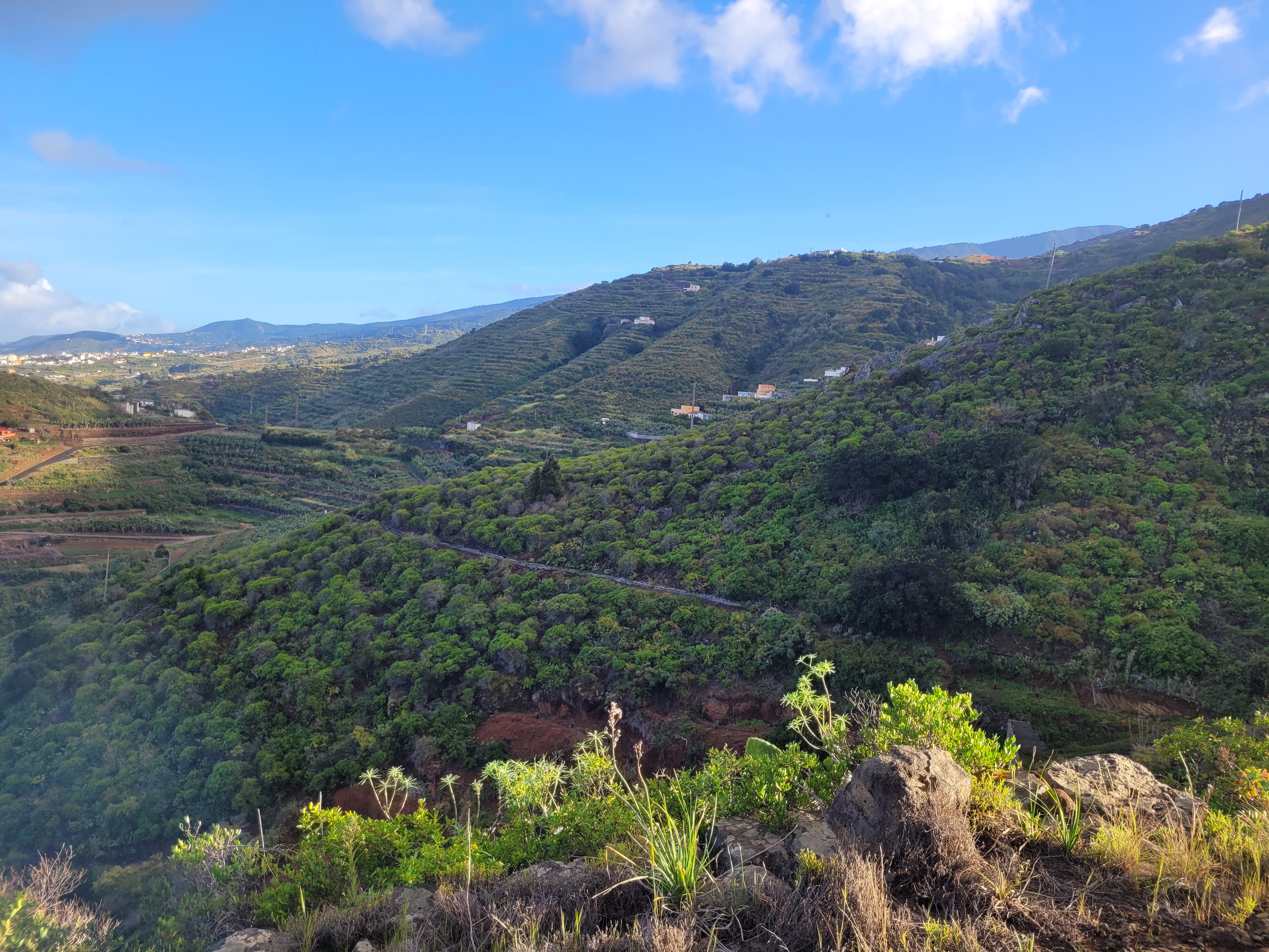
The second stage of the Royal Way of the Coast and Middle Lands offers a pleasant walk from the Church of San Juan de Puntallana to Barlovento, in the extreme north of La Palma, crossing some of the most fertile and best conditioned agricultural lands on the island. With a cumulative difference in altitude of 1,110 metres due to the five deep ravines traverse, this stage is packed with legends, such as that of the site known as Salto del Enamorado or “Lover's Leap”. Some must-see stops on the route include the historic centre of San Andrés and the Barranco de Nogales ravine, highlighting the historical richness and natural beauty of the area.

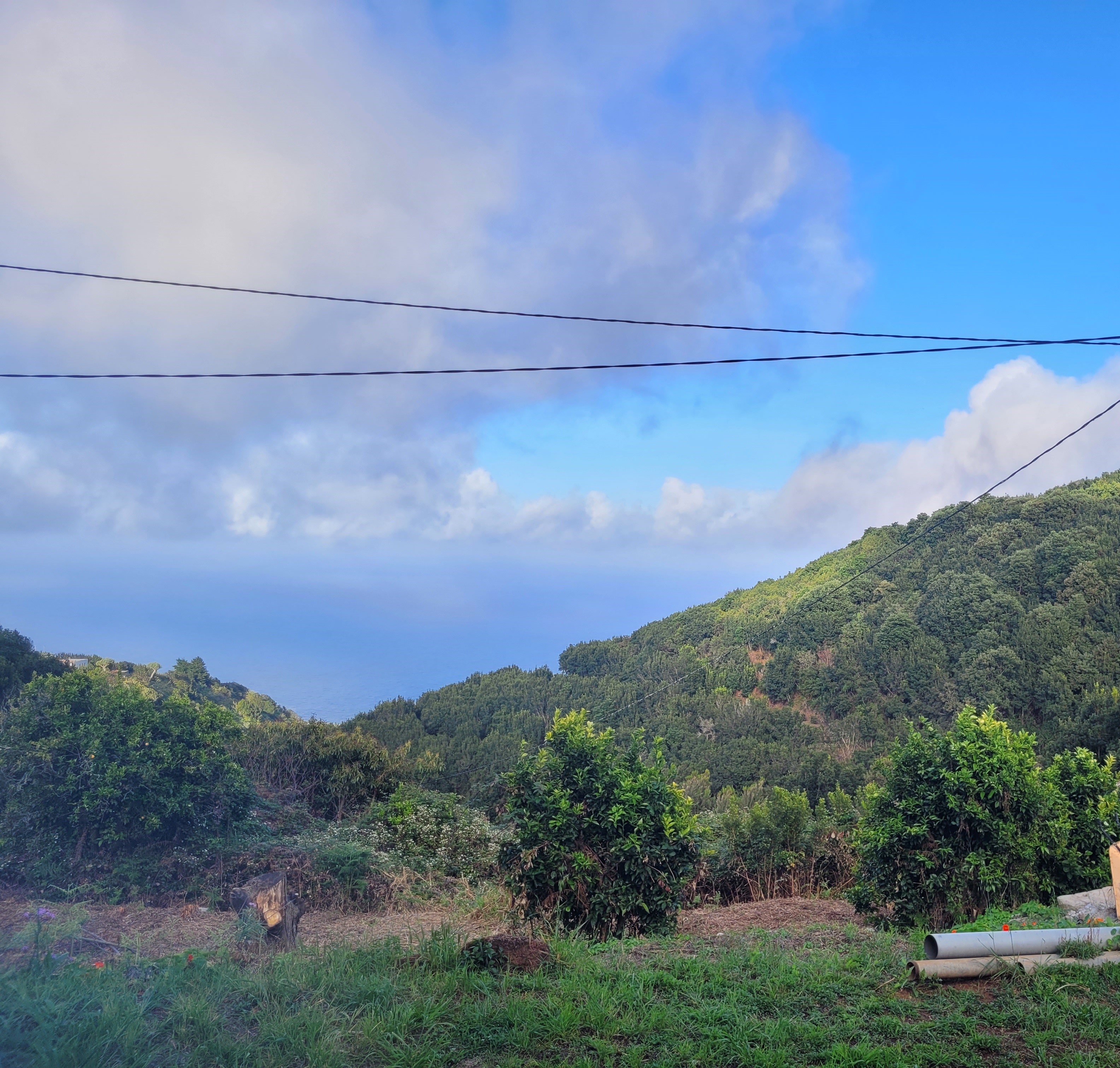
The stage starts next to the Church of San Juan de Puntallana, beginning a route that winds up hill and down dale through some of the oldest ravines on the northeast coast of the island, ending in Barlovento. On Calle Procesiones, just behind the Puntallana square and next to the aforementioned church, there is an information panel indicating the start of the stage. From this point, you can already enjoy the impressive panoramic views of the route, with the rural surroundings of the town, the cliffs and the Atlantic Ocean, which will accompany the route all the way to the east.
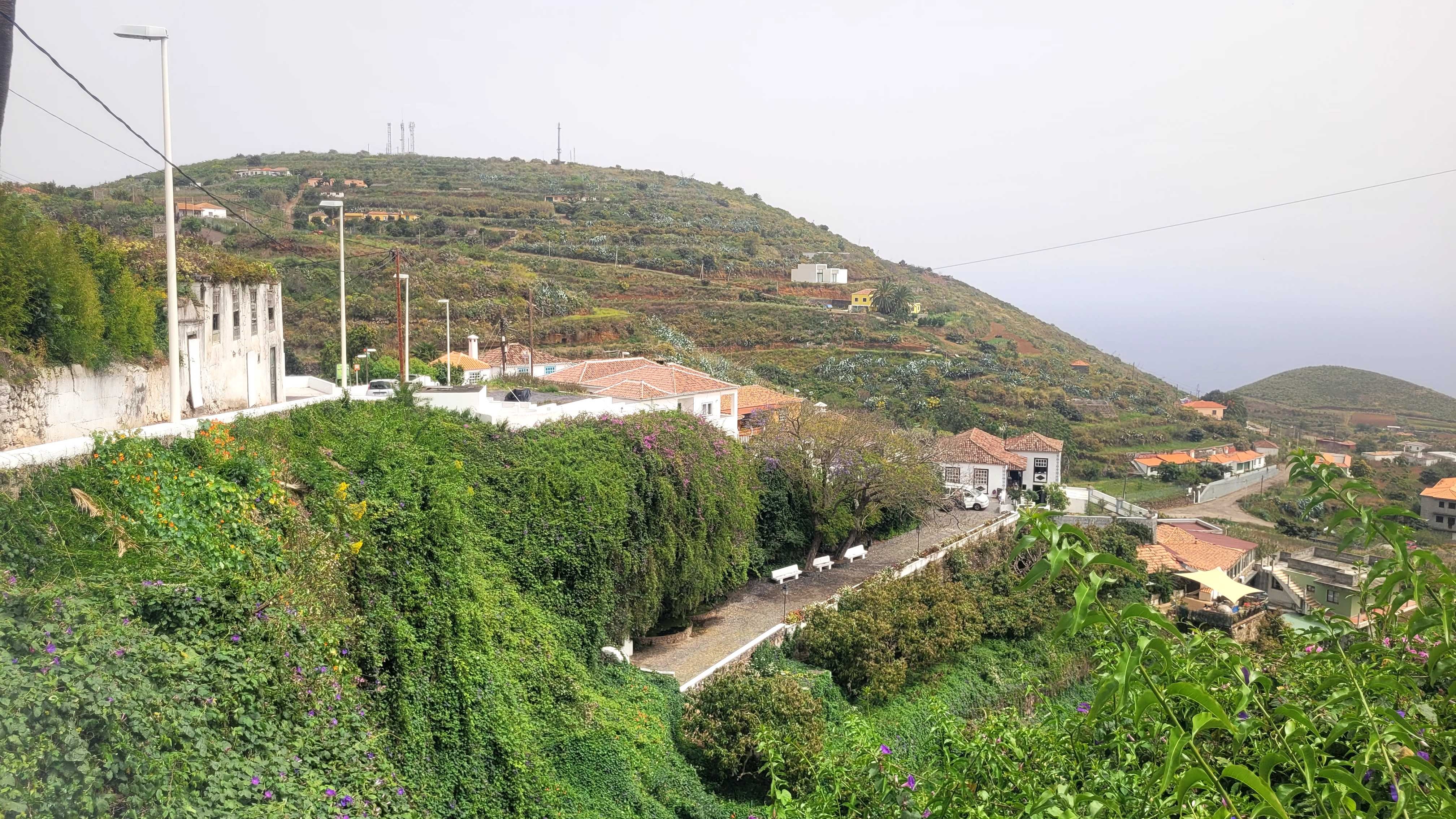
The route starts to the north, beginning a steep descent through the streets of the urban area of Puntallana, at an altitude of 410 metres, characterised by its traditional architecture and agricultural environment. On the way we pass by the Casa Luján Ethnographic Museum, the Fuente de San Juan, an ideal place to enjoy the calm and beauty of the Medianías landscape, and a youth hostel. Shortly afterwards, at a crossroads, the path turns off to the right, reaching the LP-102 road along Calle Martín Luis.
This stretch, which is asphalted and flanked by rock walls protecting the farms, leads to the main road, where you turn left and walk a few metres before turning off again, this time onto a farm track surrounded by vineyards and banana plantations. This detour marks the point at which the traveller leaves the asphalt and enters the rural roads, connecting with nature and moving away from the urban environment.
The path continues for about a kilometre and a half, well signposted and marked at several points, overcoming the steep slopes of this part of the island. Here, ravines and ancient volcanic lava flows, vestiges of the primitive volcano that gave rise to La Palma more than two million years ago, dominate the landscape. Along the road, surrounded by lush coastal vegetation and extensive agricultural estates, mainly banana plantations, some covered by greenhouses, the beautiful green landscape of the coastal cliffs stands out. These halophilic plant species have adapted to the saline environment. These include, among others, the tobacco tree (Aeonium palmense), the sowthistle (Sonchus bornmuelleri), the saltbush(Schizogyne sericea) and (Limonium pectinatum and solandri, L. imbricatum).

In a small watercourse, a prelude to the deep ravines to be negotiated, there is a rest area ideal for recharging your batteries. After crossing this watercourse, the route continues descending through three small ravines. Once you have crossed the last of these, the road turns slightly to the right to join the paved road to La Lomada. After a 300 m downhill stretch, the route turns left and continues northwards for about 400 m along the Nogales road.
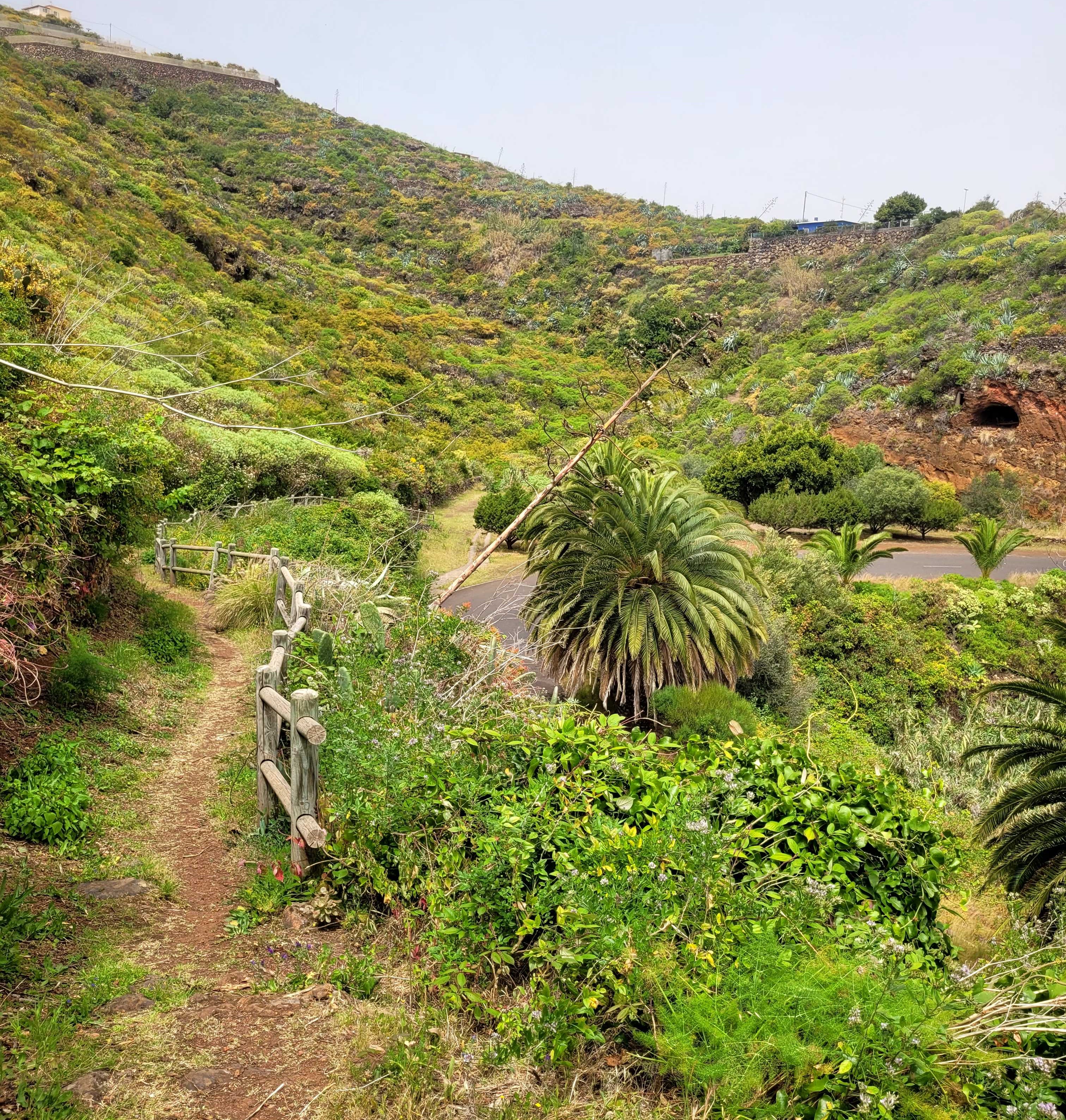
This road has a turn-off that leads to the popular Nogales beach. Afterwards, the path enters a farm track that crosses a small ravine and approaches the first great challenge of the stage: the imposing Barranco Hondo de Nogales. Here the route drops almost 100 m in altitude, to reach just 20m above sea level before ascending along a zigzagging, fenced path that climbs to 230 m in altitude.
Once this major obstacle has been overcome, the second stage of the route continues for 2 km, skirting the cliffs of Bajamar de La Galga. Along this stretch, the traveller will pass through narrow paths, banana plantations and rural tracks providing access to the plantations. Local legend places the island myth Salto del Enamorado, or Lover's Leap, on this cliff, when a young shepherd fell to his demise in an attempt to earn the love of beloved. During this stretch, the route is again surrounded by native coastal vegetation, along with banana trees, vineyards and small vegetable gardens, before entering the area of La Galga. Here we can observe species of rock vegetation such as spurge (Echio breviramis-Euphorbietumcanariensis) or coastal tamarisk (Tamarix canariensis).
After skirting Punta de La Galga, the path crosses the small ravine of the same name and descends along the Bajamar path to the bottom. From there, turn left and climb up a path that runs along the walls of the ravine, made up of impressive basalt columns, until it joins the Garachico path. A few metres further on, the route comes to a crossroads where we turn right, joining a tarmac road. For just over a kilometre the road passes through banana plantations and irrigation ponds, skirting Punta del Guincho and passing number houses belonging to the Garachico and San Juan neighbourhoods before reaching the San Juan ravine.

The descent of this new ravine, which is approximately 100 m long, is well prepared with wooden handrails and rock steps to facilitate the descent and prevent any falls. Once in the deepest part of the ravine, we briefly pass along the beach before beginning a gentle ascent along a cemented track that will take us to the gates of San Andrés cemetery. This marks the halfway point of our route. It is a good time to stop and look back to contemplate the beauty of the ravine we have just descended and its surroundings. In the San Juan ravine there are several archaeological sites to visit in the Tendal Archaeological Park, located in the San Juan area.
The next section of the route runs for one kilometre through banana plantations, following the asphalted road to San Sebastián. It passes by the calvary, with its three crosses, and the Shrine of El Pilar and San Sebastián, before entering the picturesque coastal town of San Andrés. The town its traditional La Palma architecture and is one of the most beautiful and best-conserved on the island. Strolling through its cobbled streets, past the Church of San Andrés Apóstol, until you reach the ocean through the Barranco del Agua ravine, where an old lime kiln stands, surrounded by the imposing tops of the palm trees, for an experience that seems to stop time.
Continuing along the asphalted roads of La Cruz Grande and La Calzada, San Andrés and the ocean are left behind and a notable climb begins, a kilometre and a half long, to reach the centre of Los Sauces, 270 m above sea level, reaching the Plaza de Monserrat and the Antonio Herrera park. The parish of Monserrat boasts beautiful houses and buildings in the colonial style of the island, as well as shop, bars and cafés where walkers can recharge their batteries before tackling the last few kilometres of the stage.
From here, the stage crosses the LP-1 road and passes through the gate of the Town Hall. Turn right and walk onto Calle Ciro González. At the end of this street, turn right again along Calle Abraham Martín street and continue as far as the Cruz de La Loma viewpoint.
From here, the descent begins through the last large ravine of the stage: the Herradura or Barata ravine, located 100 m above sea level. The descent starts in the district of El Poiso, and follows a well-marked path. This path crosses the LP-1 road a few metres further down and descends until it reaches the deepest part of it, where the municipality of Barlovento begins.

Once you have passed the deepest part of the Herradura or Barata ravine, the route begins a steep climb. This ascent makes it possible to distinguish the changes in the landscape, as well as the different bioclimatic levels of the island. After a few metres of ascent, the stage crosses the LP-1 road for the last time, entering the steep wall of the ravine via a zigzagging path. Once again, the ascent is well marked and well equipped with handrails and cobbled steps to make the climb easier. The surrounding landscape on the ascent is spectacular, featuring rich soils and caves on the walls of the ravine, as well as the vegetation clinging to the rocks, including spurge and Hercules club.
Why stop and enjoy the views once you have completed this climb up the rocky face of the ravine. You can make out ocean in the distance, the town of Los Sauces and the nearby rainforests. The path continues into Las Cabezadas along Calle Loma de la Florida, where it turns left to join the LP-107, with which it will share part of the route in this last section of the stage. After walking about 600 metres along LP-107, the road turns to the right, passing in front of Las Cabezas primary school and enters a dirt track that leads to Calle Lomo Romero. There it turns left to rejoin the road after a steep climb.
Following the road in a northerly direction, the path reaches another climb on the left. This time, the path enters a dirt and rocky track. This climb winds through a beautiful forest, typical of this part of the island, which is much more humid and lush, as the conditions are typical for Monteverde vegetation. Specimens of the Canary Island pine, firetree, Bystropogon origanifolius var. palmensis), Cistus symphytifolius and Lotus hillebrandlii among other species will all be on display.

After continuing uphill through some 500 m of the thick forest, the path crosses the LP-107 road again. After a bend, turn left again onto a small path that climbs up to the hamlet of Lomo Machín. Here the trail continues straight between picturesque houses and small agricultural plots, as orchards replace the banana plantations. A little further on, turn right following the path to Lomo Machín Alto.
After a few metres, turn left again and continue northwards until you reach Calle Las Paredes. From there, the path leads to Calle Barranquito del Rey street, which itself, further and turning to the left, leads to the intersection with the LP-1 road. Crossing the road, next to a restaurant car park, an information panel indicates the end of this challenging but beautiful stage of the Nature Trail: Camino Real de La Costa and Midlands.
Puntos de interés
Culture
Municipality
Hostel
Vegetation
Profile
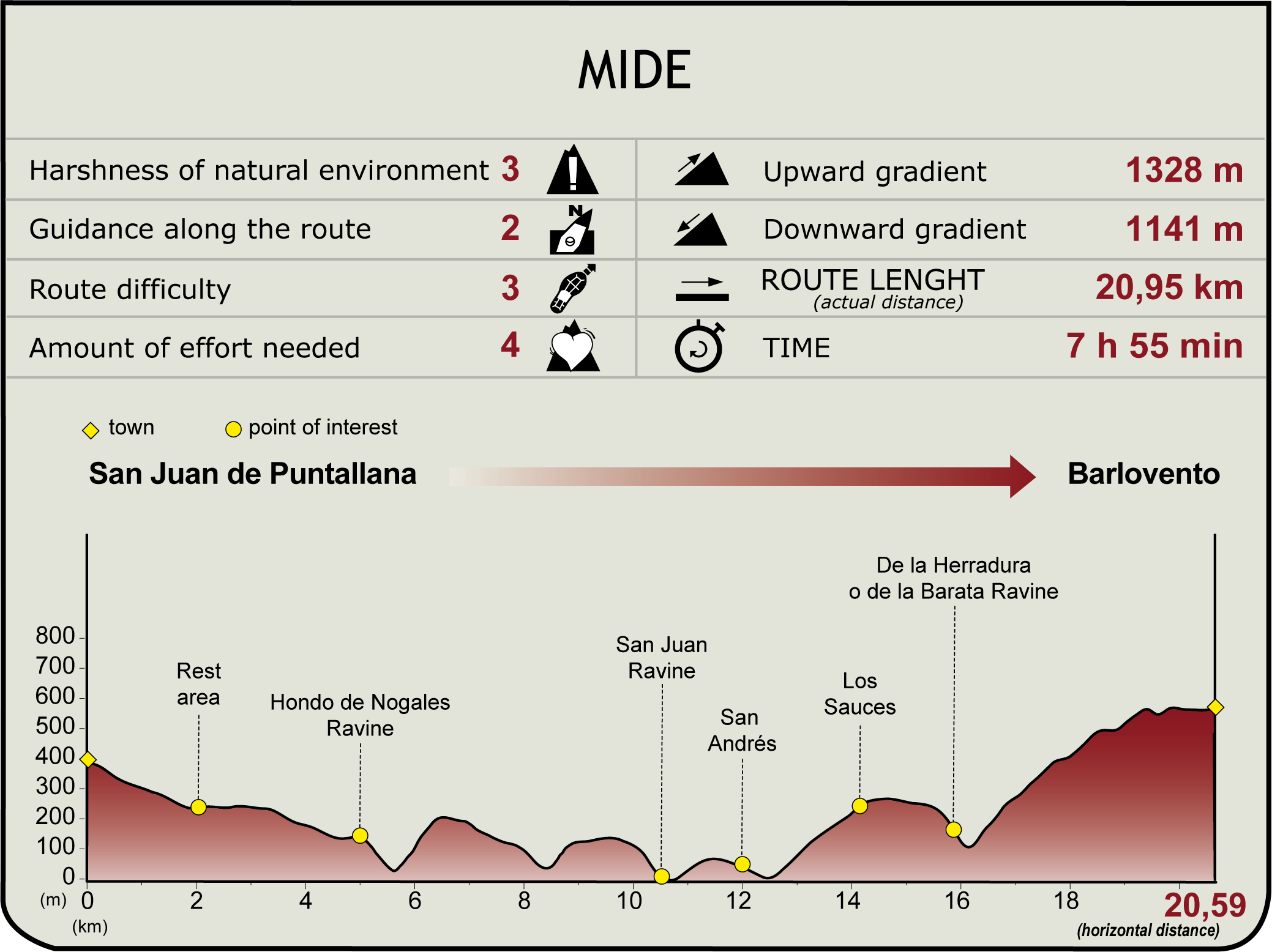
 Harshness of natural environment
- 1. The environment is not risk-free
- 2. There are more than one risk factors
- 3. There are various risk factors
- 4. There are quite a lot of risk factors
- 5. There are many risk factors
 Guidance along the route
- 1. Well defined trails and crossings
- 2. There is a clearly marked trail and signage
- 3. Requires the identification of geographic features and cardinal points
- 4. Requires off-path navigation
- 5. The trail is interrupted by obstacles that have to be gone around
 Route difficulty
- 1. Walking on a flat surface
- 2. Trails with different types of path
- 3. Walking on stepped paths or irregular terrain
- 4. The use of hands or jumping over the terrain is necessary
- 5. The use of hands is required to progress
 Amount of effort needed
- 1. Up to 1 hour of continuous walking
- 2. Between 1 and 3 hours of continuous walking
- 3. Between 3 and 6 hours of continuous walking
- 4. Between 6 and 10 hours of actual walking
- 5. More than 10 hours of continuous walking
(Calculated according to the MIDE criteria for an average excursionist with a light load)
Highlights
Further information
Las Nieves Natural Park
Las Nieves Natural Park was declared a Natural Park in 1994 and a Biosphere Reserve by UNESCO in 1983. It extends across the eastern and north-eastern slopes of La Palma, covers 5,094 ha and extends through the municipalities of Santa Cruz de La Palma, Puntallana and San Andrés y Sauces, reaching up to 2,300 metres at the upper edge of the Taburiente Chain.
This park is an outstanding example of Canarian laurel forest, with high humidity and a number of natural water springs like the Cubo de la Galga and Bosque de Los Tilos. It also features different levels, from scrubland and pine forests to savin forests and thermophile forests, and is home to endemic species such as the Canary Island pine and the La Palma cabezón. Fauna includes birds such as canaries and kestrels, reptiles like the Western Canaries lizard, and amphibians such as the San Antonio frog.
San Andrés y Sauces
San Andrés y Sauces, located in the northeast of La Palma in the province of Santa Cruz de Tenerife, was once the Benahorita canton of Adeyahament, known for its water springs. The municipality includes several towns and villages, the most important of which are Villa de San Andrés, with its colonial architecture and the Church of San Andrés Apóstol; and Los Sauces, named after the Canarian willow tree, known for its lively squares. It is home to the Bosque de Los Tilos forest, part of Las Nieves natural park, stretch of coastline that’s home to the Charco Azul natural pools and the beaches of Espíndola.
Since the 16th century, it has excelled in agricultural production, growing bananas, yams and sugar cane, and offering a rich local gastronomy. The municipality celebrates numerous cultural, sporting and festive events, including festivals in honour of the patron, the Virgin of Montserrat in September, and the 60s Wedding and the Burial of the Sardine during Carnaval.
Multimedia


Downloads

GPS Downloads


