
 del Camino Natural de La Palma")
Net of Nature
Trails

Stage 1: Santa Cruz de La Plama – San Juan de Puntallana
Description
Leaving the city behind, the adventure begins
Spectacular opening stage of the Royal Way of the Coast and Middle Lands (GR-130) starting in the island's capital, Santa Cruz de La Palma, with its impressive architectural heritage. There is a succession of ravines, including the Barranco del Agua ravine, declared a Site of Scientific Interest, until it ends in the quiet and peaceful town of San Juan de Puntallana.

The first stage of the La Palma Nature Trail, specifically the GR-130, also known as the Camino Real de la Costa y Medianías, starts at the iconic Plaza de España in Santa Cruz de La Palma.
Before setting off on the 11 km stage, take a moment's pause in this historic square and admire the Church of El Salvador, its beautiful fountain and the majestic Town Hall building. The church, built after the Christian conquest, has been remodelled and enlarged over time, while the Fountain and the Town Hall are more recent. The latter were built after the attack of the French pirate Leclerq, destroying much of the city, including the old town hall. This made it necessary to build the current town hall in 1588, using stone brought from the neighbouring island of La Gomera.
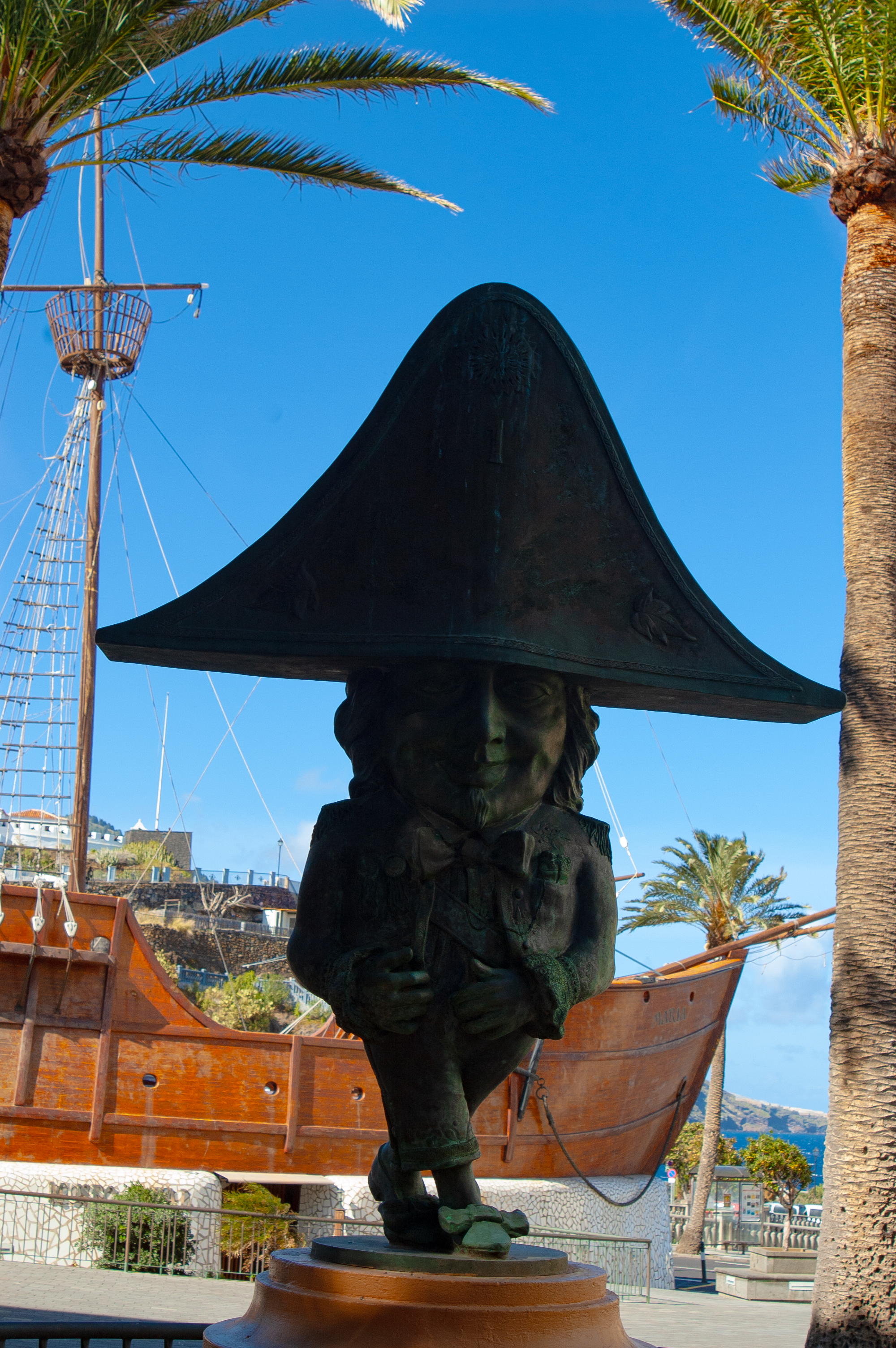
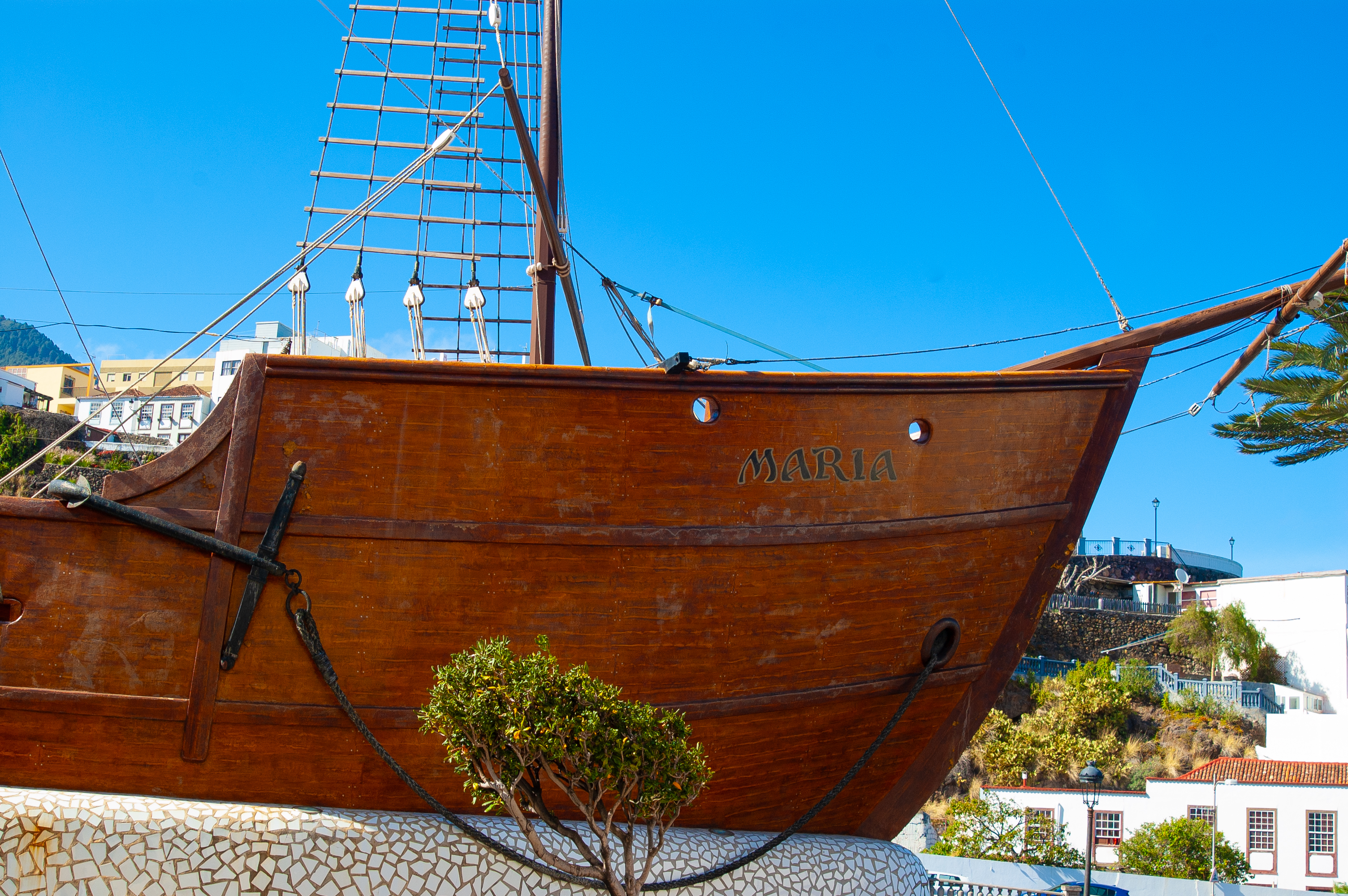
The stage begins at the aforementioned Plaza de España, before following Calle O'Daly, one of the main shopping areas of Santa Cruz de La Palma. A few steps away, when crossing the Avenida del Puente, it is possible to see the city beach, decorated with a striking sculpture of a cetacean that embellishes the landscape. Following the route along Calle Anselmo Pérez de Brito, we come to the El Enano Monument, located next to the Museo Naval - Barco de la Virgen. This museum is located inside a replica of the Santa Maria, the famous ship that took Christopher Columbus to the Americas.

Afterwards, the route continues crossing the Avenida de las Nieves and the ravine that gives it its name, the Barranco de Las Nieves, still in the city centre. Further on, after crossing the LP-1 road, take Calle Abenguareme for the last stretch before leaving the city behind and immersing ourselves in the island’s natural environment.
The route continues to the left along a dirt track, clearly signposted, reaching the first banana plantations shortly afterwards. After a short zigzagging stretch, the ascent begins along the Barranco de Carmen ravine to the LP-1 road. At this point, continue along the pavement before crossing the road at the zebra crossing at the roundabout connecting the LP-1 and the LP-20 ring road, which is also served by a pedestrian crossing.
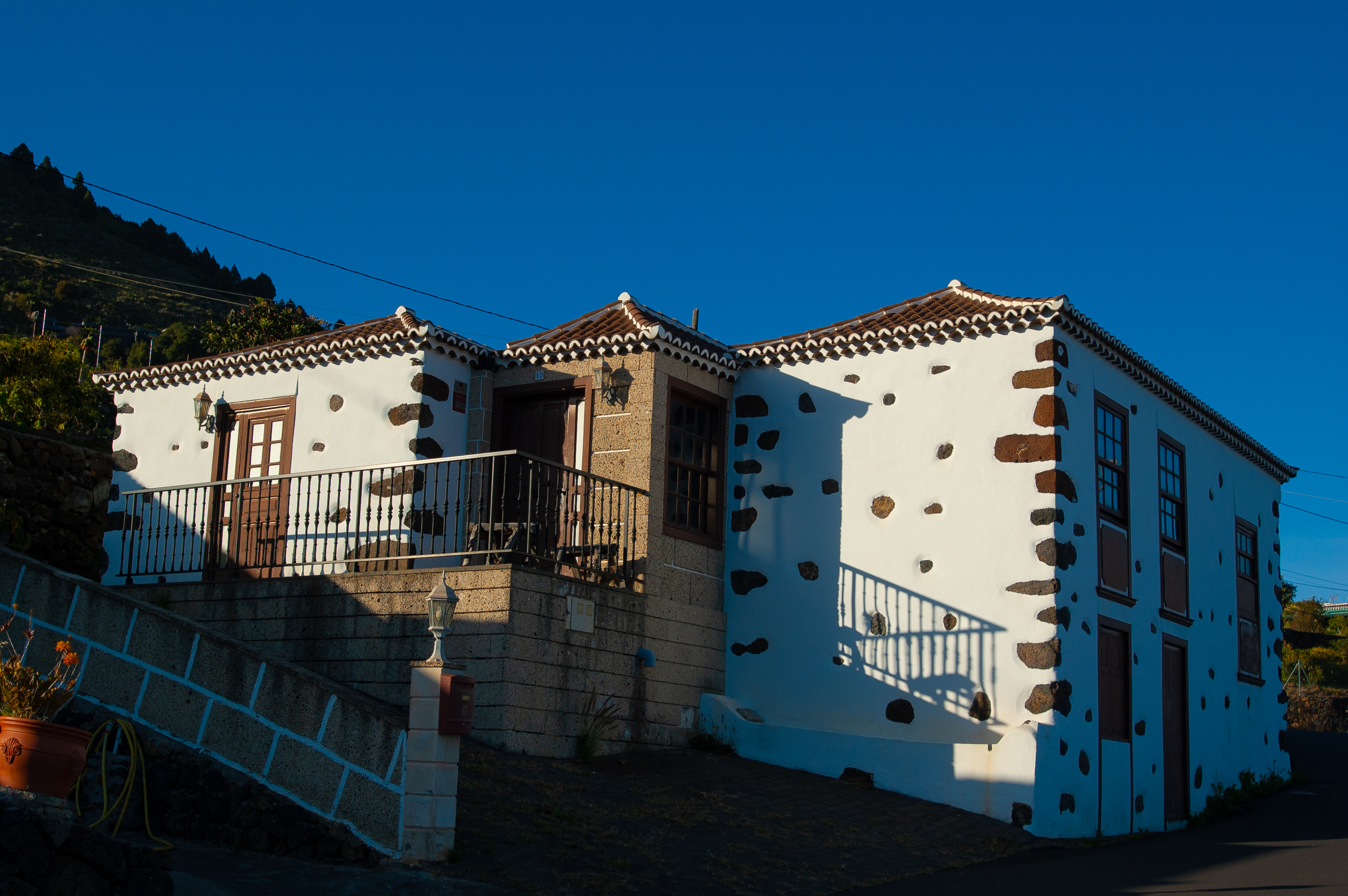
The road continues uphill on a tarmac road reaching La Palmita, a quiet hamlet with a tradition of livestock farming, especially goat rearing. Then continue parallel to the LP-1 road, leaving it after crossing the LP-4 road, taking a dirt track shortly afterwards.

A few metres further on, the route continues parallel to the LP-1 road, but this time along a narrow path that runs along the right-hand side of the road. A little further on, we reach the Los Gomeros sculpture, erected in honour of the neighbouring islanders.
After another stretch parallel to the LP-1 road, it is time to cross the road, taking extreme precautions to begin the demanding ascent along a dirt and stone path that starts at the lower part of the Barranco Seco ravine. The effort of the ascent is amply rewarded by the spectacular views of the ravine and the immense Atlantic Ocean stretching into the distance.
The route continues along an asphalted road, passing through the houses of La Verada, surrounded by small orchards with different plantations. You then reach Lomo del Pino, crossing the La Lomadita local road and continuing along a dirt track. Descend again to cross the LP-1 road, always taking extreme precautions. From here, the route continues parallel to the road along a path protected behind the bionda, until it reaches the southern mouth of the Barranco del Agua Tunnel. At this point, take the tarmac track on the right, which serves as an alternative to the tunnel for motor traffic.

In the middle of the Barranco del Agua ravine, itself a site of special importance declares as a Site of Scientific Interest, we cross the LP-1 again to begin a short but intense climb along a path. This ascent culminates at the chapel of Santa Lucía, a simple traditional Canary Island building that houses a Flemish carving from the early 16th century, one of the oldest across the islands.
It begins a descent along an asphalted road that crosses the quiet and scattered district of Santa Lucía, until it crosses the familiar LP-1 road once again. After the crossroads, the route continues along a tarmac road, which soon becomes a dirt track between scattered houses. After passing two crossroads, a short stretch of road leads the traveller to the Avenida de Atabara, next to the Puntallana Public School.
The last few metres of the stage run along the aforementioned avenue, leaving the town's town hall on the left, until reaching the Church of San Juan Bautista, where this first stage of the GR-130 comes to an end.
Puntos de interés
Culture
Municipality
Hostel
Vegetation
Profile

 Harshness of natural environment
- 1. The environment is not risk-free
- 2. There are more than one risk factors
- 3. There are various risk factors
- 4. There are quite a lot of risk factors
- 5. There are many risk factors
 Guidance along the route
- 1. Well defined trails and crossings
- 2. There is a clearly marked trail and signage
- 3. Requires the identification of geographic features and cardinal points
- 4. Requires off-path navigation
- 5. The trail is interrupted by obstacles that have to be gone around
 Route difficulty
- 1. Walking on a flat surface
- 2. Trails with different types of path
- 3. Walking on stepped paths or irregular terrain
- 4. The use of hands or jumping over the terrain is necessary
- 5. The use of hands is required to progress
 Amount of effort needed
- 1. Up to 1 hour of continuous walking
- 2. Between 1 and 3 hours of continuous walking
- 3. Between 3 and 6 hours of continuous walking
- 4. Between 6 and 10 hours of actual walking
- 5. More than 10 hours of continuous walking
(Calculated according to the MIDE criteria for an average excursionist with a light load)
Highlights
Further information
Barranco del Agua
The Barranco del Agua is a protected natural area, belonging to the territory of the Canary Islands, which is included in the Natura 2000 Network, as a Site of Community Importance, under the name of Barranco del Agua Site of Scientific Interest.
TIt is located in the north-eastern sector of the island of La Palma, in the municipality of Puntallana. Its course runs from the Caldera de Taburiente to the Martín Luís cove, between the Tenagua and Santa Lucía mountains, covering an area of just over 74 ha.
This ravine is one of the island's natural treasures, attracting many visitors both to study and to enjoy its ecosystems and biodiversity. Its value lies in the representation of almost all the vegetation levels recorded in the archipelago in a single space. These floors have been generated thanks to the different altitudes between the highest and lowest areas, the different types of volcanic soil, the concentration of humidity, the proximity to the ocean or the solar exposure, which depends on the orography of the ravine.
Among the plant formations that can be seen in this area, the cardonal-tabaibal stands out in the low area near the coast. This is one of the most important communities on the island, with xerophytic scrub species adapted to dry places or environments, such as cardon (Euphorbia canariensis), tabaiba (Euphorbia sp.) and broom (Retama rhodorhizoides). Although, in the deeper areas, you can find some specimens of Canary Island pine (Pinus canariensis). In these areas, it is also common to spot some birds, reptiles and amphibians such as the canary (Serinus canarius), the Tawny Pipit (Anthus berthelotii), kestrels (Falco tinnunculus), palm frilled lizards (Gallotia galloti ssp. palmae) and the San Antonio frog (Hyla meridionalis).
Meanwhile, in the upper-middle sections of the ravine, areas of thermophilic forest, famous for its high mountain palm trees (Phoenix canariensis), still resist agricultural and environmental pressures. Areas where it is easy to distinguish characteristic scrubland species like rockrose (Cistus monspeliensis), granadillo (Hypericum canariense), verodes (Kleinia neriifolia) and Canary Island juniper (Juniperus canariensis).
Although the most prominent ecosystems are the middle and lower areas. In the upper part there is a wooded mass of pine forest and woodland, with samples of species such as faya (Myrica faya), laurel (Laurus novocanarensis), viñatigo (Persea indica), heather (Erica arborea), bejeque (Aeonium canariense), bicarera (Canarina canariensis) and Canary Island pine, among others. A sector of the ravine inhabited by birds such as the common ringdove (Columba junoniae), the turquoise (Columba bollii), the chaffinch (Fringilla coelebs) and the sparrowhawk (Accipiter nisus).
The Barranco del Agua is a route of great scenic beauty, combining environmental richness and cultural landmarks. Some of those cultural landmarks date back to the collection and use of water since Guanche times. Although no clear sites have been found, there is evidence of the historical importance of this area as a shelter or corral. A great archaeological potential worth discovering.
Multimedia


Downloads

GPS Downloads


