
 del Camino Natural de La Palma")
Net of Nature
Trails

Stage 6: Los Llanos de Aridane - Los Canarios (Fuencaliente)
Description
From Los Llanos de Aridane to Los Canarios through traditional and volcanic landscapes.
Stage 6 of the La Palma Nature Trail stretches for almost 22 kilometres, starting in Los Llanos de Aridane and boasting a rich variety of landscapes. The route passes through urban areas with traditional architecture, fields of crops and spectacular volcanic formations. Although the route is briefly interrupted by volcanic lava flow forms from the recent Tajogaite volcano eruption, we return to the trail at Las Manchas, offering impressive views of the volcano and the coast. Continuing towards Jedey and crossing the Tamanca Protected Landscape, the path allows you to observe endemic species and vineyards.
Finally, the route climbs through lush pine forests on the Cumbre Vieja Ridge, culminating near the majestic Pino de Santo Domingo, in the vicinity of Los Canarios, where it connects with stage 3 of the GR-131.

Stage 6 of the La Palma Nature Trail, also known as the “Camino Real de la Costa y Medianías” or Royal Way of the Coast and Midlands, starts at the iconic Plaza de España in Los Llanos de Aridane, between the Town Hall and the Church of Nuestra Señora de los Remedios. From here, the path runs along Calle Real for a short stretch, where traditional buildings stand alongside lively shops, restaurants and terraces.
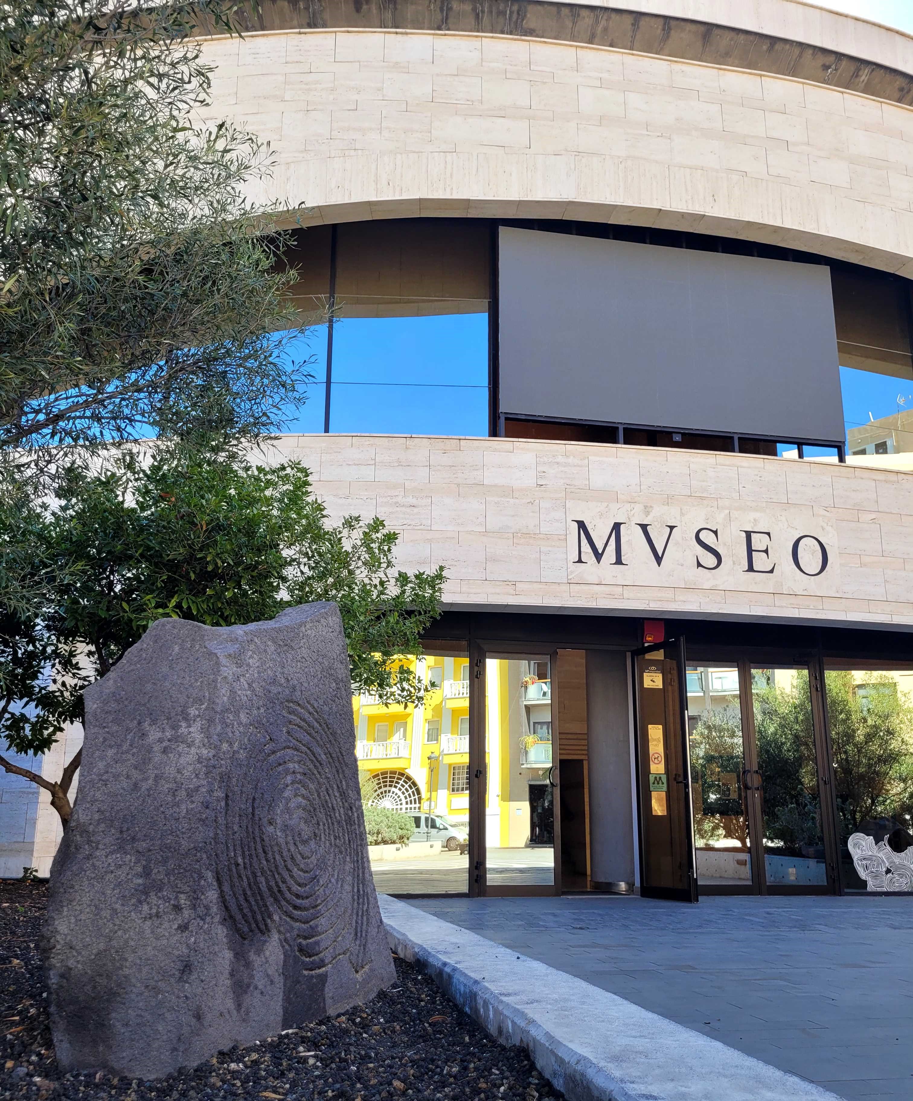
Following the signs, we turn left at Calle Benigno Carballo until it reaches the LP-2 road, passing the Benahorita Archaeological Museum.
After crossing the road and taking Calle Barranco Tenisca, we walk along the banks of the ravine of the same name before turning south on to Calle Pedro Miguel Hernández Camacho. The route climbs up the Camino de Triana and, a litter further on, we enter Camino de Malpaís de Triana, passing under the LP-21.
Due to the volcanic lava flow forms from the Tajogaite eruption in 2021, the route is temporarily interrupted at this point. The trail resumes 2.9 kilometres further on, at the Las Manchas football pitch and athletics track, just at the intersection of the LP-2 and LP-212 roads.

From here, we have the opportunity to visit the impressive viewpoints of the volcano, signposted by the island council, and located along the LP-212.
The eruption of the Tajogaite volcano, which began on 19 September 2021 and lasted until 13 December of the same year, was the most extensive in the history of La Palma. This eruption, preceded by thousands of earthquakes, dramatically transformed the landscape by covering 1,200 hectares with lava and destroying more than 1,600 buildings. The event was an impressive natural spectacle, marked by phreatic explosions, huge ash plumes and rivers of lava in Strombolian phases. However, it also brought with it an unprecedented humanitarian crisis, with thousands evacuated and devastating economic losses, especially in the agricultural and tourism sectors.
After this natural interruption, the Camino Real resumes its course along the middle of the island, flanked by the Atlantic Ocean to the west and the Cumbre Vieja Ridge to the east. This section of the route offers a landscape of contrasts: rural dwellings, agricultural plots, some in use and others abandoned, and extensive areas of badlands. This volcanic terrain, marked by its arid and slightly eroded rocks, despite its desolate appearance, can become fertile soil under the right conditions, favouring both agriculture and urban development.

The path climbs to 800 metres above sea level for approximately 4 kilometres, until it enters an area of pine that marks the last kilometre before rejoining the LP-2. For about 800 metres, the path follows a signposted and paved walkway, crossing the road next to an old maintenance hut to enter a forest track.
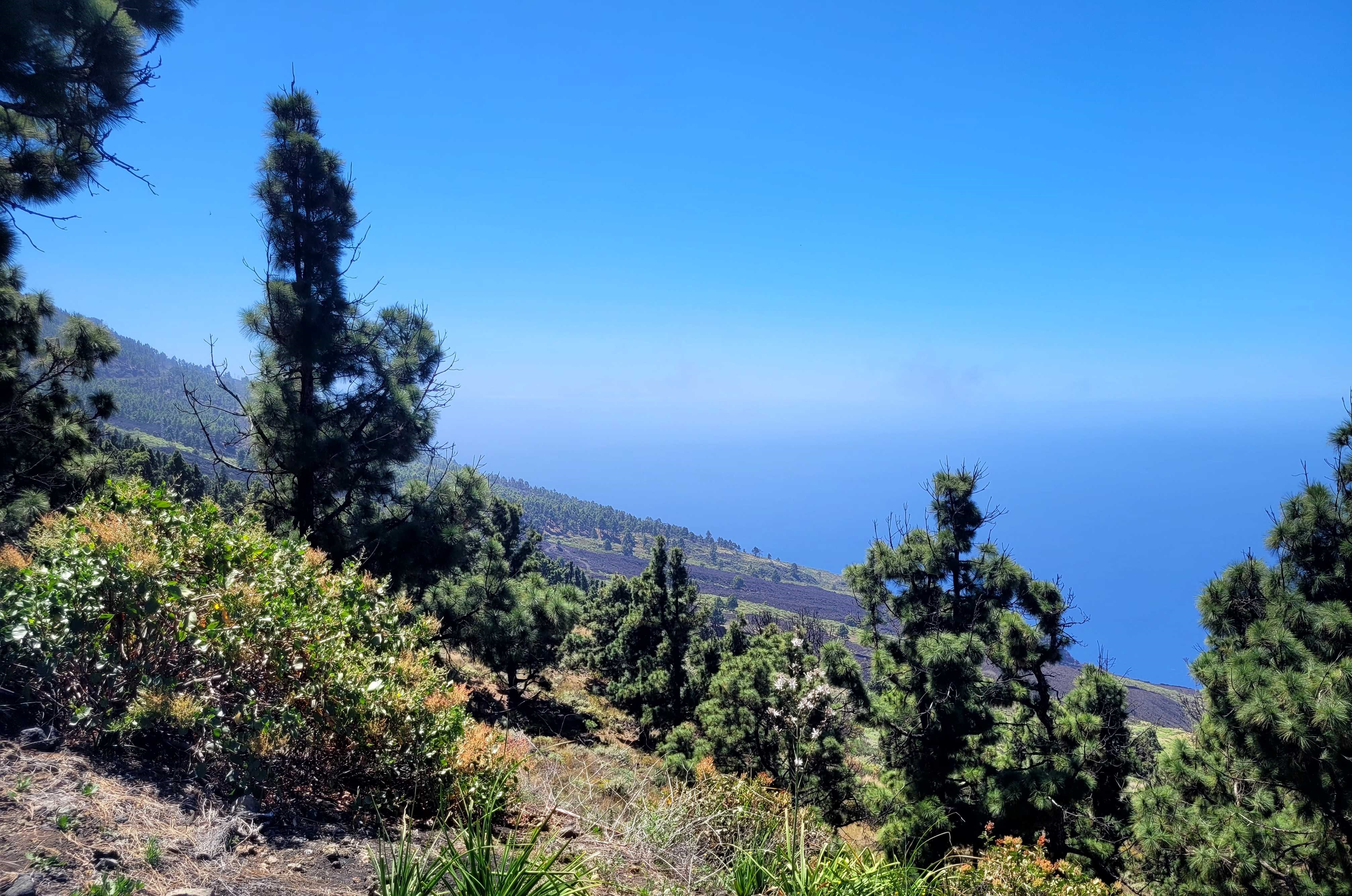
This track, on sandy volcanic soil, continues to climb and crosses the first of many calderas that make up the Cumbre Vieja Ridge. The caldera, known as Hoyo Frio, is a small, relatively flat volcanic formation. From here, the path plunges into a dense pine forest, heading towards the southern tip of La Palma. On a clear day, the views are spectacular, with the ocean stretching both south and west, and even the silhouette of the island of El Hierro visible on the horizon.

After 5 kilometres through a landscape of pine forests and vineyards, the path reaches 920 metres above sea level and arrives at the majestic Pino de Santo Domingo, an iconic landmark close to Los Canarios, in the municipality of Fuencaliente. Here, the trail turns east, leaving behind the picnic area often used for cultural events, and enters a small valley, flanked by pine trees and vineyards. Some 400 metres later, stage 6 ends at the junction with stage 3 of the GR-131. From this point, walkers can continue on to Los Canarios, explore the salt flats or head towards the iconic lighthouse of Fuencaliente, marking the end of a fascinating journey.
Sites of interest
Puntos de interés
Geology
Municipality
Hostel
Vegetation
Profile

 Harshness of natural environment
- 1. The environment is not risk-free
- 2. There are more than one risk factors
- 3. There are various risk factors
- 4. There are quite a lot of risk factors
- 5. There are many risk factors
 Guidance along the route
- 1. Well defined trails and crossings
- 2. There is a clearly marked trail and signage
- 3. Requires the identification of geographic features and cardinal points
- 4. Requires off-path navigation
- 5. The trail is interrupted by obstacles that have to be gone around
 Route difficulty
- 1. Walking on a flat surface
- 2. Trails with different types of path
- 3. Walking on stepped paths or irregular terrain
- 4. The use of hands or jumping over the terrain is necessary
- 5. The use of hands is required to progress
 Amount of effort needed
- 1. Up to 1 hour of continuous walking
- 2. Between 1 and 3 hours of continuous walking
- 3. Between 3 and 6 hours of continuous walking
- 4. Between 6 and 10 hours of actual walking
- 5. More than 10 hours of continuous walking
(Calculated according to the MIDE criteria for an average excursionist with a light load)
Highlights
Further information
Los Llanos de Aridane
Los Llanos de Aridane, the second largest municipality of La Palma, is located on the western slope of the island on the plain of the Taburiente volcanic complex. The town consists of several neighbourhoods, each with its own history and features, many of which were affected by the eruption of the Tajogaite volcano in 2021. It is also the island's main sun and beach destination, featuring coastal areas such as El Remo, Charco Verde, La Bombilla, and Puerto de Naos.
The town centre includes landmarks such as the Plaza de España, the Church of Nuestra Señora de Los Remedios, and the Benahoarita Archaeological Museum. Cultural attractions and events are abundant, particularly the June festivities in honour of Nuestra Señora de Los Remedios. A visit to Los Llanos wouldn’t be complete without tasting traditional dishes like Papas Arrugadas and Sancocho.
Fuencaliente de La Palma
This picturesque municipality in the southern part of La Palma is renowned for its rich cultural and natural heritage, with origins dating back to the Spanish colonial period of the 15th century. Its main towns are Los Canarios and Las Indias, along with historic neighbourhoods such as Los Quemados and La Fajana, all of which reflect the area's traditions and history.
Natural attractions in Fuencaliente include the Cumbre Vieja Natural Park, the Fuencaliente Salt Flats, and the dramatic San Antonio Volcano. The municipality’s iconic lighthouses stand as historic maritime markers along the coastline. Agriculture, particularly banana and grape cultivation, plays a vital economic role here. This region is home to many wines with the La Palma Designation of Origin, celebrated annually during the Fiesta de la Vendimia (harvest festival).
Visitors can enjoy fresh fish and seafood, as well as participate in active tourism experiences such as hiking and diving, making Fuencaliente a rewarding destination for both nature and culture enthusiasts.
Multimedia


Downloads


