

Net of Nature
Trails

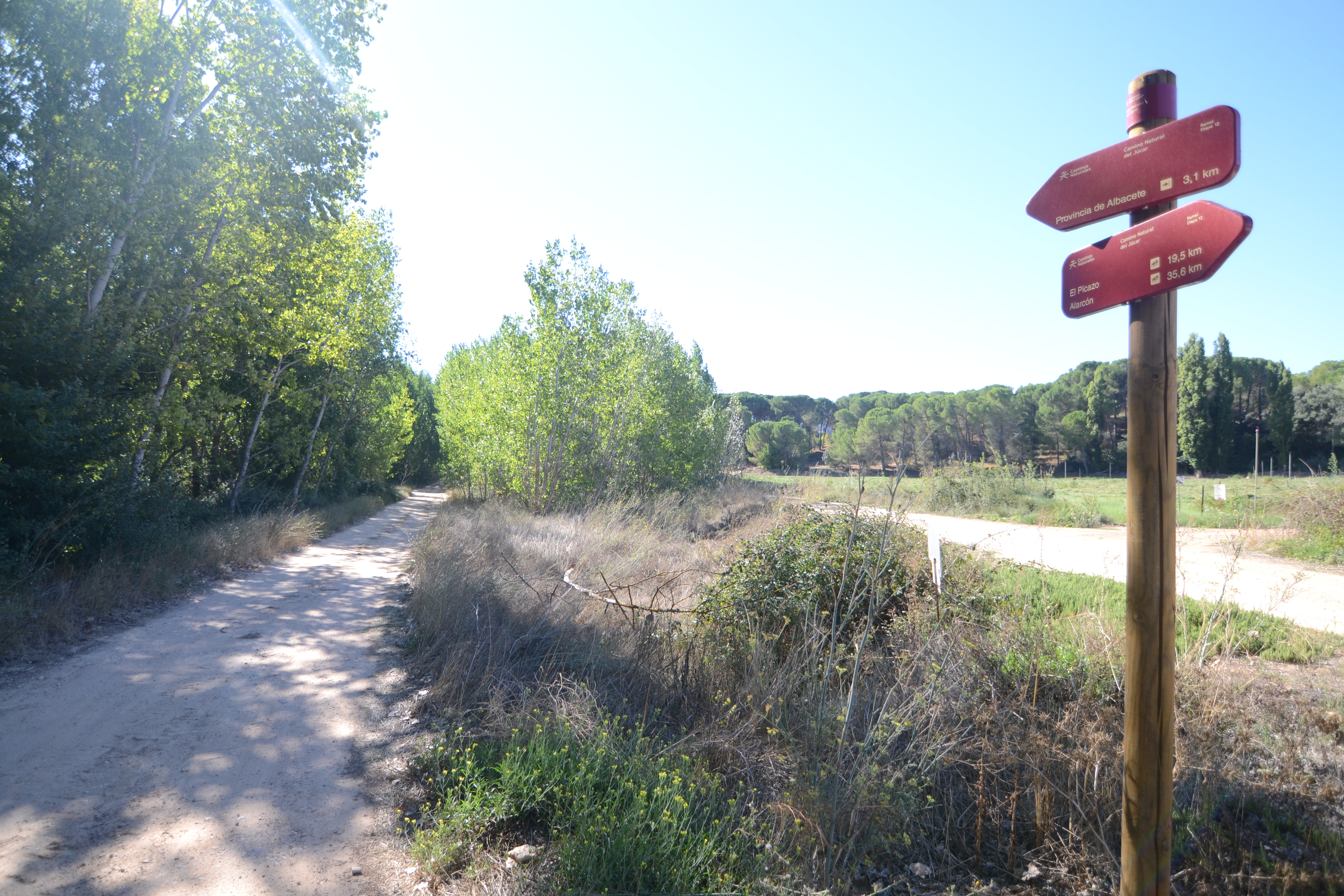
Stage 12 Branch: El Picazo - provincial boundary Cuenca-Albacete
Description
Towards the provincial boundary between cultivated fields.
With this branch, the Júcar Nature Trail allows you to continue to get to know the banks of the river in a mainly agricultural environment, reaching the provincial boundary between Cuenca and Albacete.

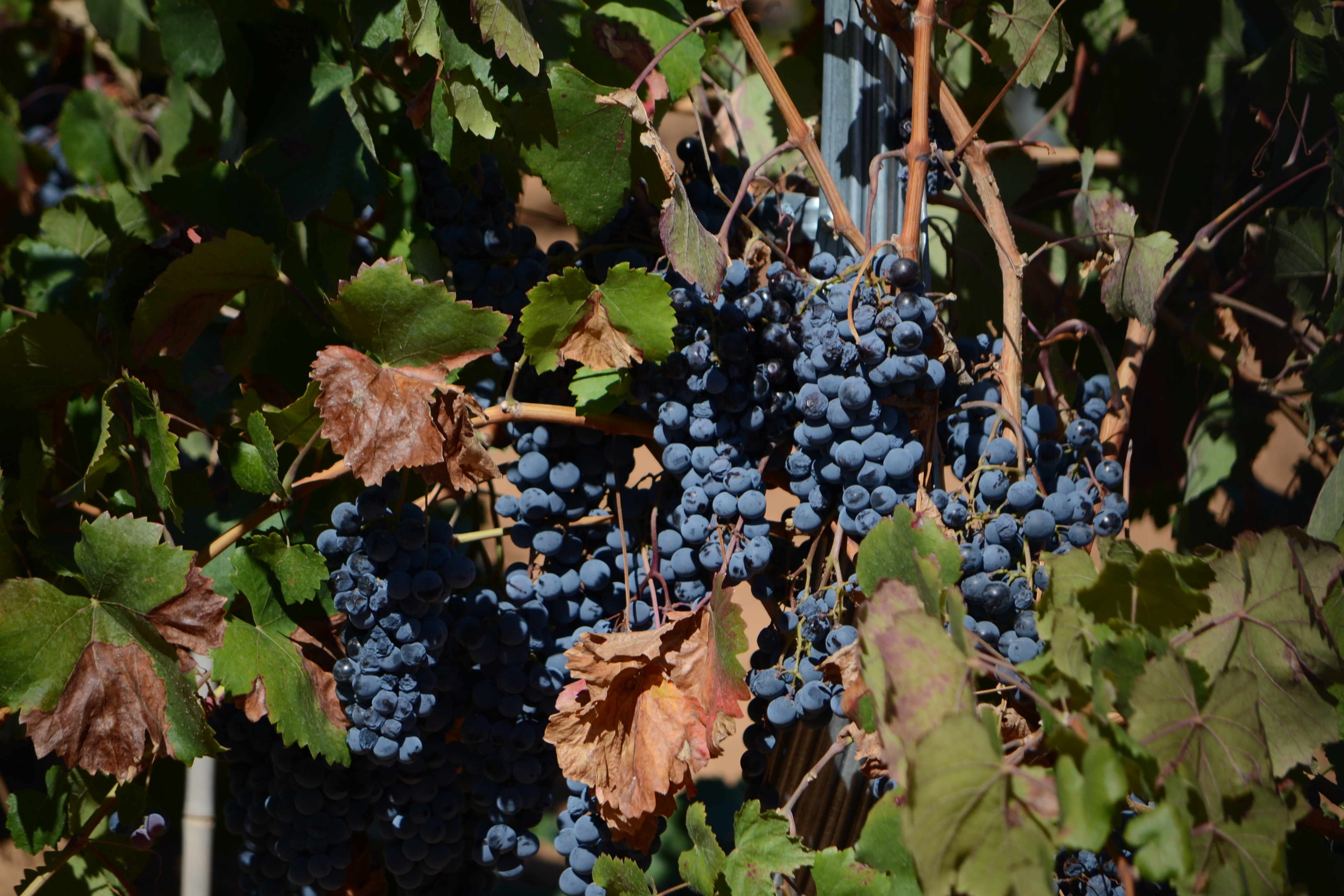
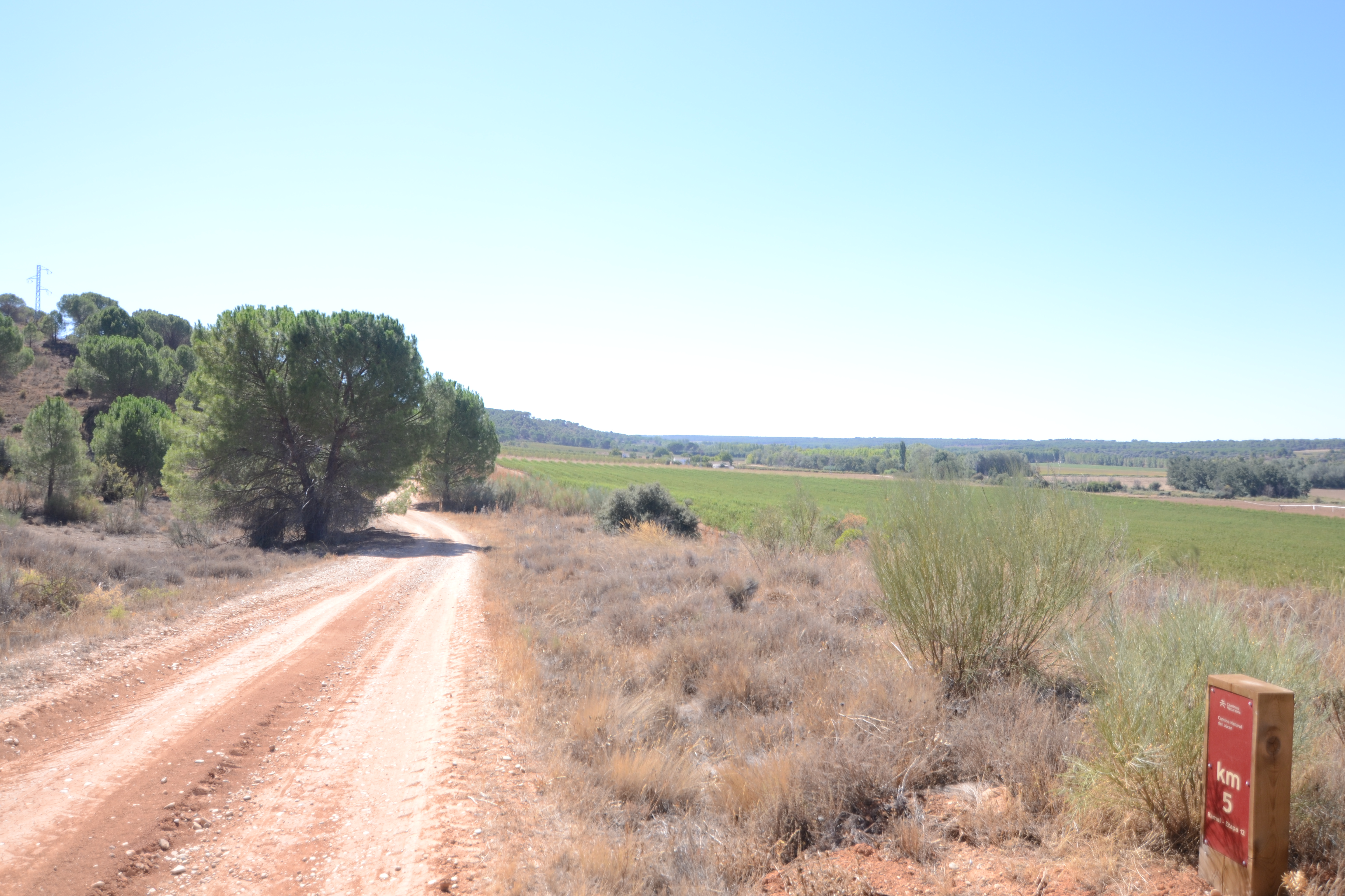
This branch starts on the outskirts of El Picazo, just before crossing the N-310 road. Although this section of the road is considered a crossing with the corresponding speed limit, great caution should be taken when crossing as, on the left-hand side, the curve of the road reduces visibility. Once you have crossed the road, the path enters a wide dirt track that runs through the fields of cereal crops and fruit trees and vineyards of El Picazo. A good example of this agricultural vocation is the presence, right at km. 1, of an irrigation channel that runs towards the river Júcar.
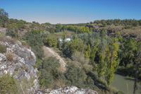
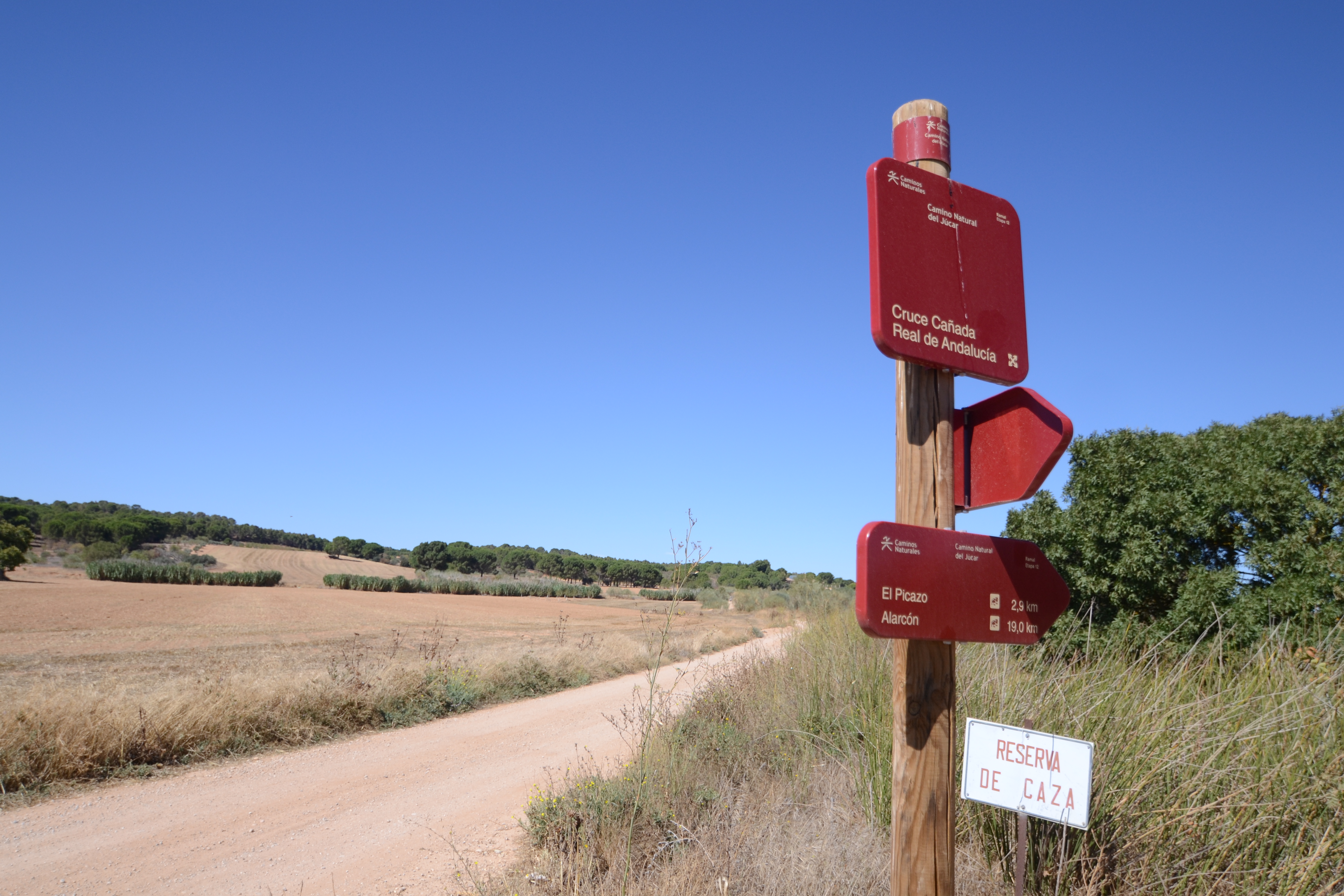
This track leads to the path along which the Cañada Real de Andalucía runs, which is taken to the left, in the direction of the San Benito bridge. After half a kilometre you reach this bridge (whose origin dates back to the 15th century), which takes its name from the shrine on the other side of the river, on a promontory offering magnificent views of the Júcar valley.

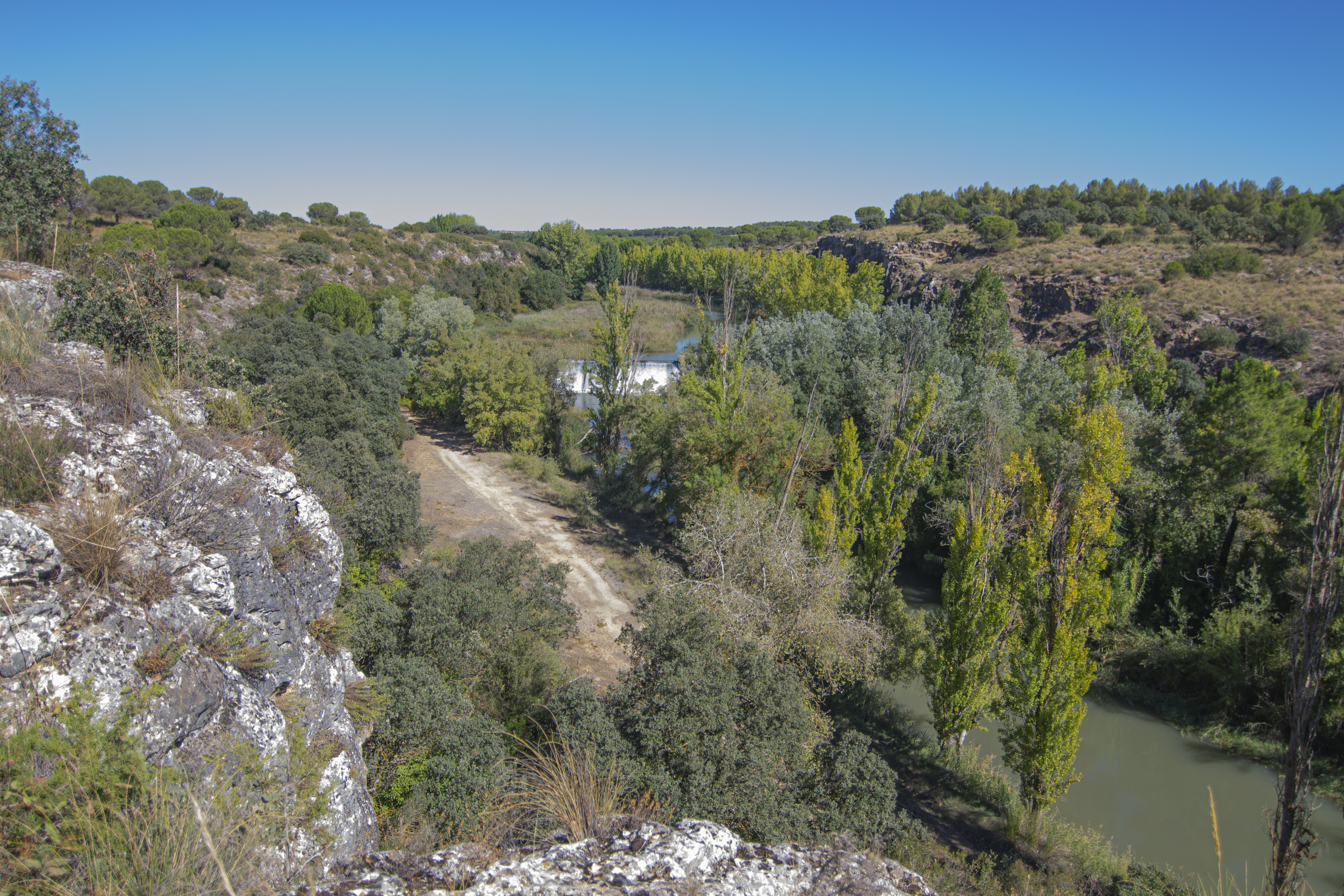
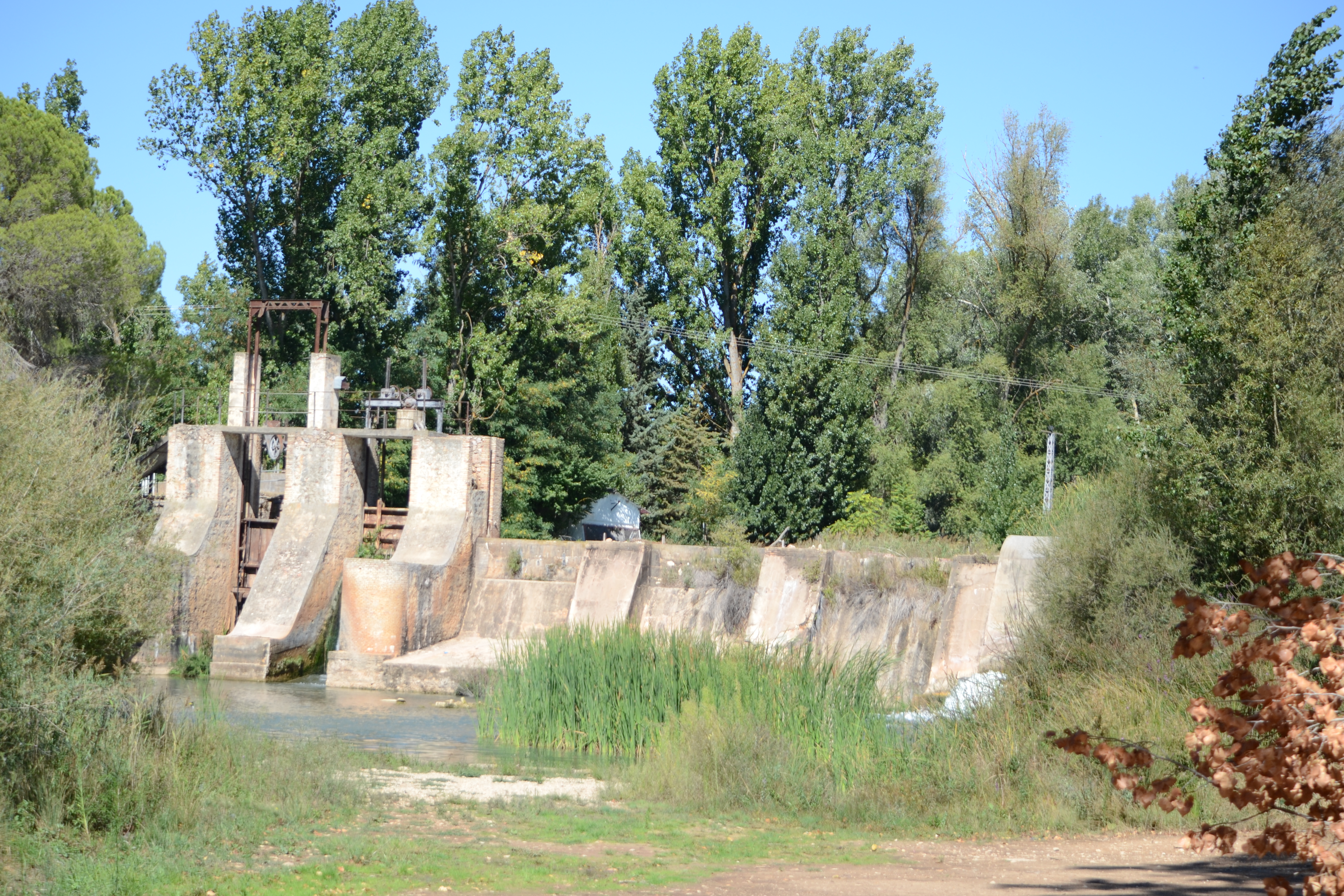
Once on the left bank of the Júcar, the Nature Trail turns south, again passing through crops, but this time with the company of Mediterranean scrub on the slopes to the left of the path and the odd country house. This landscape remains the same for the next few kilometres, with the track running close to the river at times. One point at which the Trail approaches the Júcar is next to La Losa, a village belonging to the municipality of Casas de Benítez whose origin is linked to one of the traditional uses of the waters of the Júcar, the flour mills. Today a weir dams the waters of the river and serves a small hydroelectric power station.
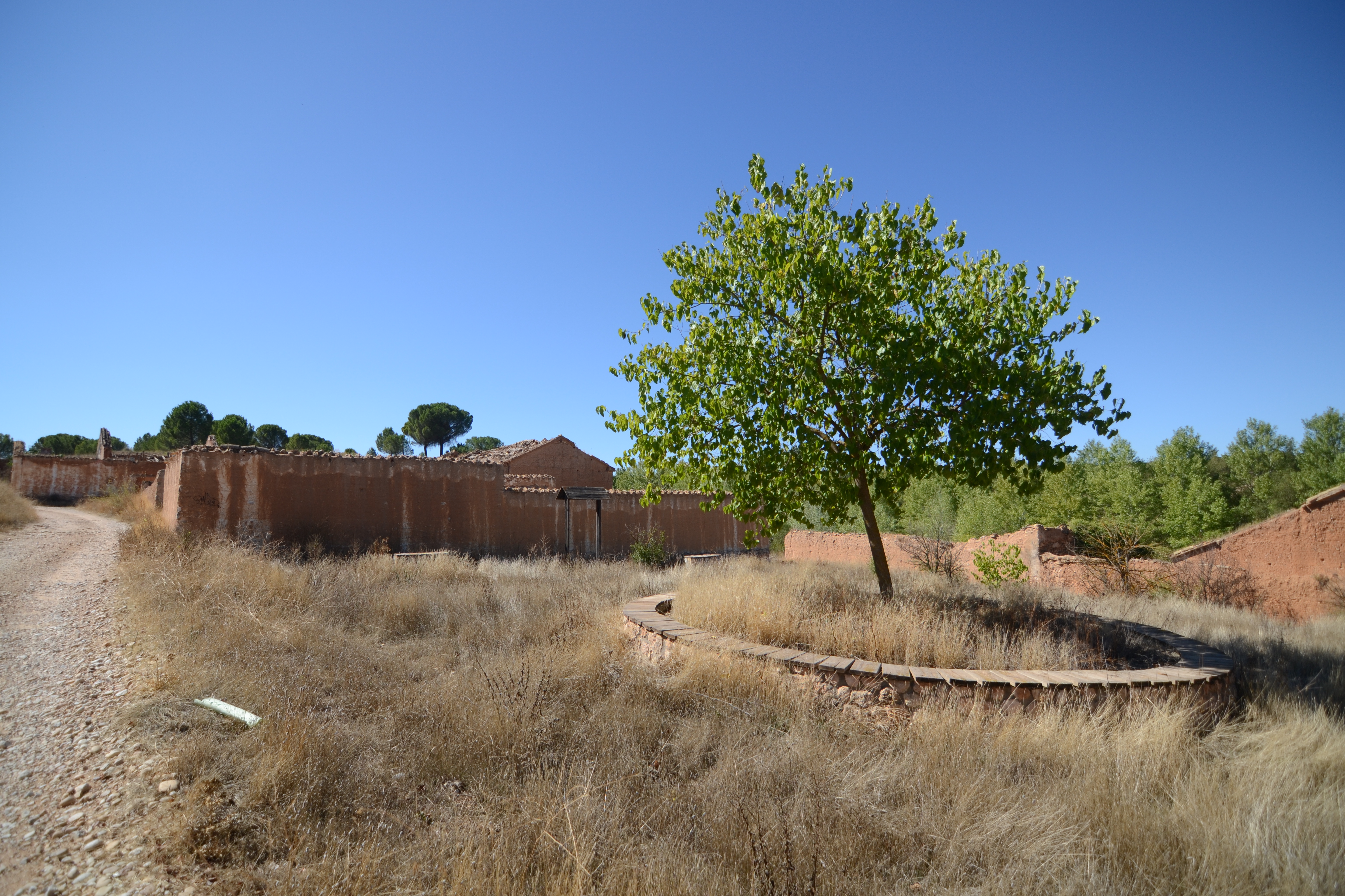
Continuing through the same landscape described above, after crossing the Cañada stream, you reach the ruins of Los Nuevos, an uninhabited village belonging to the municipality of Casasimarro. The Los Nuevos Agro-environmental Centre has been created around this village, with rest areas, environmental itineraries that allow visitors to look out over the river, and access has even been provided to see the ruins of another of the flour mills that were built on the banks of the Júcar, in this case at Los Nuevecillos. As is the case at La Losa, near this mill there is another weir for a small power station.

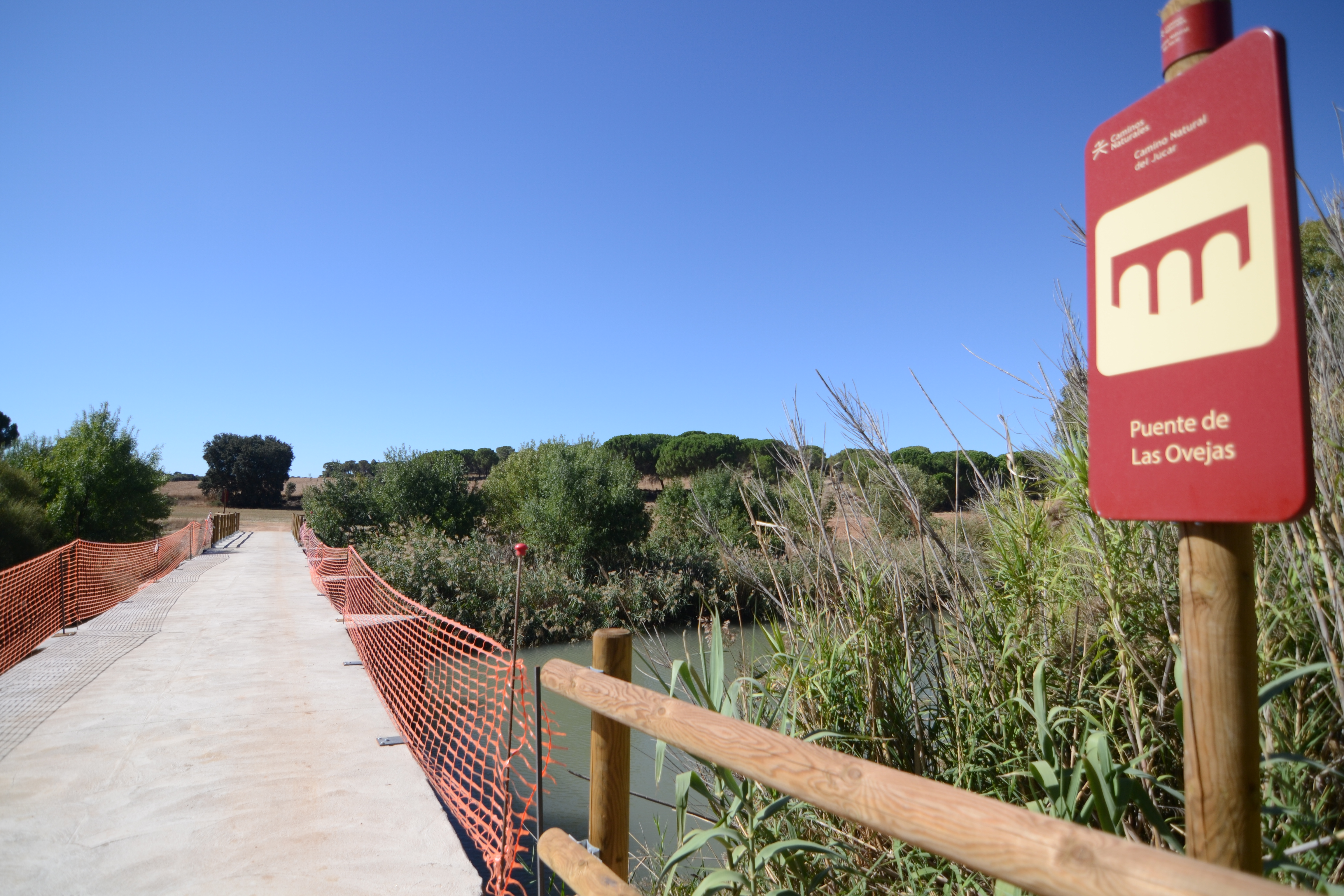
The route continues along the river, passes under the viaduct of the CM-3124 road and, after less than a kilometre, reaches Las Ovejas bridge. This simple structure, which crosses over the riverbed, will take us to the right bank of the river, on which we’ll stay until the end of the route.
On the other side of the river, after almost a kilometre, the track becomes a footpath for another kilometre. Cycling can be dangerous here because the path is very narrow and the road surface is very uneven. Along the footpath, amidst the Mediterranean scrubland, the Nature Trail rises in altitude, providing beautiful views of the Batanejo gorge and river Júcar. Looking at the river you can also see the weir that diverts its water through a channel to the hydroelectric power station at El Batanejo.
Half a kilometre after leaving the footpath and returning to the wide track, we reach the Casas del Batanejo, a hamlet of Villalgordo del Júcar that has been converted into a centre for farming and rural tourism, recovering buildings from the 17th and 18th centuries.
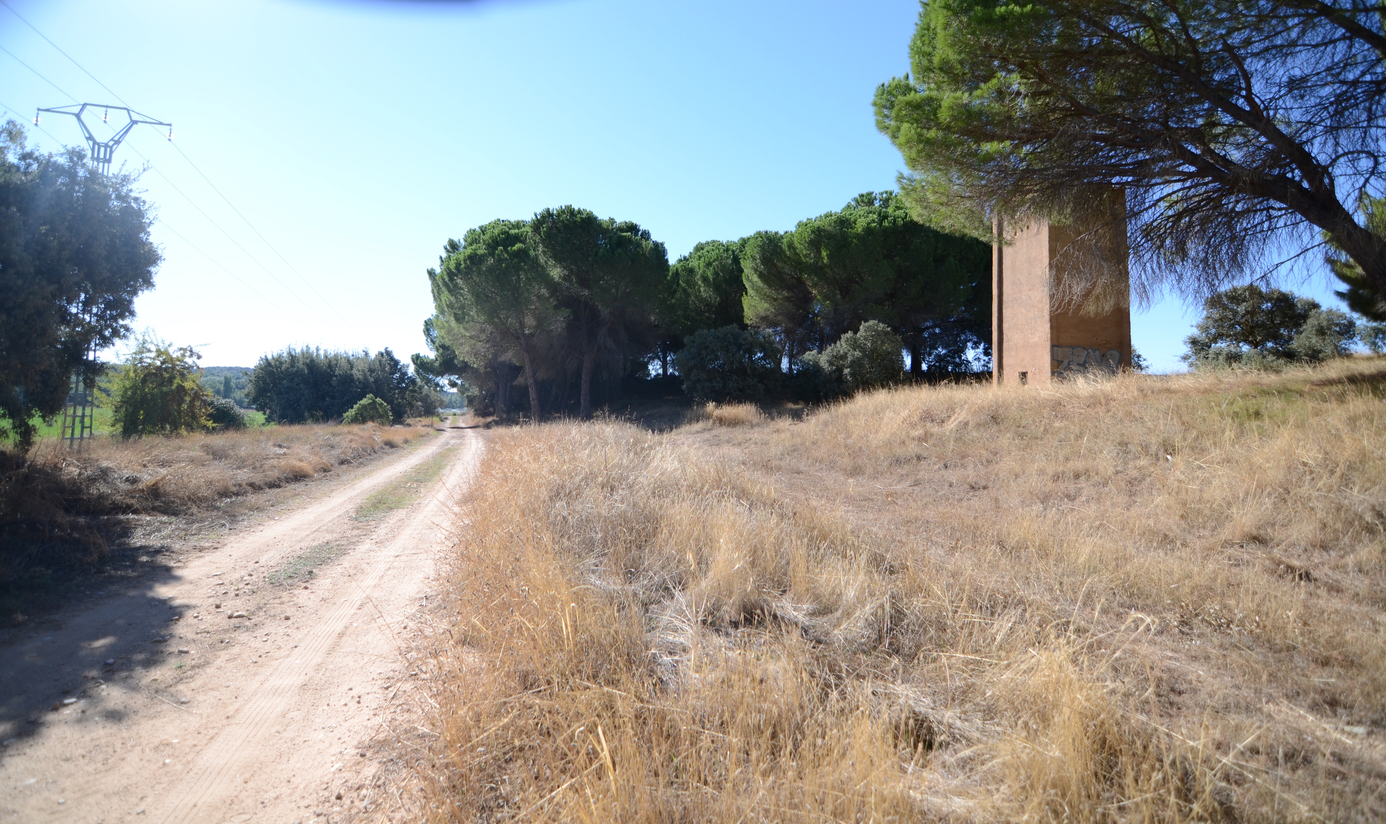
After leaving El Batanejo behind, the route continues through fields of crops (vineyards on one side, cereals on the other), crossing some patches of pine forest (Pinus pinea) and passing by farm buildings and some rural accommodation. This leads to the crossroads with the CM-3114 road that leads to Villalgordo del Júcar, a town notable for being the second village in Spain to have electricity.

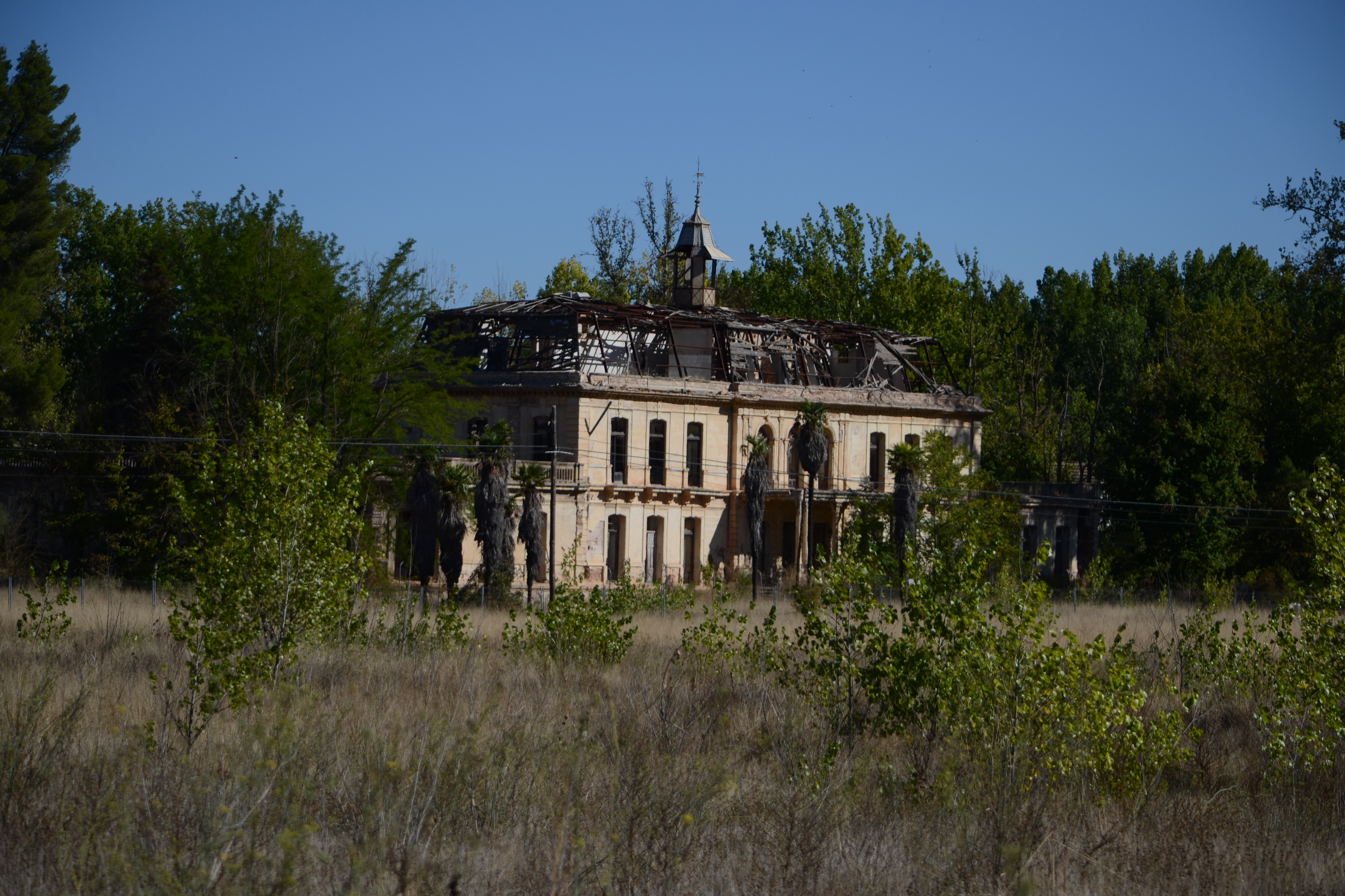
Just after crossing the road, the ruins of the Gosalvez palace stand out on the left-hand side of the road. This Versailles-style palace complex was commissioned in the early 20th century by the Gosálvez family, who were responsible for the industrial development of Villalgordo del Júcar from the mid-19th century. Despite being declared an Asset of Cultural Interest in 1993, it is still in ruins, although its restoration is planned.
The remainder of the route is again completed by passing through crops, farm buildings and some patches of pine forest, although in the last two kilometres the vineyards and cereal crops are replaced by large expanses of irrigated land, especially alfalfa.
The branch line ends after almost 23 km in a small pine forest, on the provincial border between Cuenca and Albacete. Although the route ends at this point, the town of Fuensanta, in the province of Albacete, is just over 3 km away.
Sites of interest
Puntos de interés
Culture
- Ermita de Santiago Apóstol
- Santuario de Nuestra Señora de los Remedios
- Palacio de los Gosálvez
- Los Nuevos (Ruinas)
- Ermita de San Benito de Palermo
- Molino del Concejo
- Cueva de Catalina Cardona
Hydrography
Infrastructure
- Central hidroeléctrica de La Manchega
- Puente de las Ovejas
- Molino de los Nuevecillos
- Central Hidroeléctrica del Batanejo
- Cañada Real de Andalucía
- Puente de San Benito
- Canal de riego
- La Losa (presa, antiguo molino)
- Presa de Batanejo
Municipality
Hostel
Vegetation
Profile

MIDE (Method for the Information of Excursions)
 Harshness of natural environment
- 1. The environment is not risk-free
- 2. There are more than one risk factors
- 3. There are various risk factors
- 4. There are quite a lot of risk factors
- 5. There are many risk factors
 Guidance along the route
- 1. Well defined trails and crossings
- 2. There is a clearly marked trail and signage
- 3. Requires the identification of geographic features and cardinal points
- 4. Requires off-path navigation
- 5. The trail is interrupted by obstacles that have to be gone around
 Route difficulty
- 1. Walking on a flat surface
- 2. Trails with different types of path
- 3. Walking on stepped paths or irregular terrain
- 4. The use of hands or jumping over the terrain is necessary
- 5. The use of hands is required to progress
 Amount of effort needed
- 1. Up to 1 hour of continuous walking
- 2. Between 1 and 3 hours of continuous walking
- 3. Between 3 and 6 hours of continuous walking
- 4. Between 6 and 10 hours of actual walking
- 5. More than 10 hours of continuous walking
Highlights
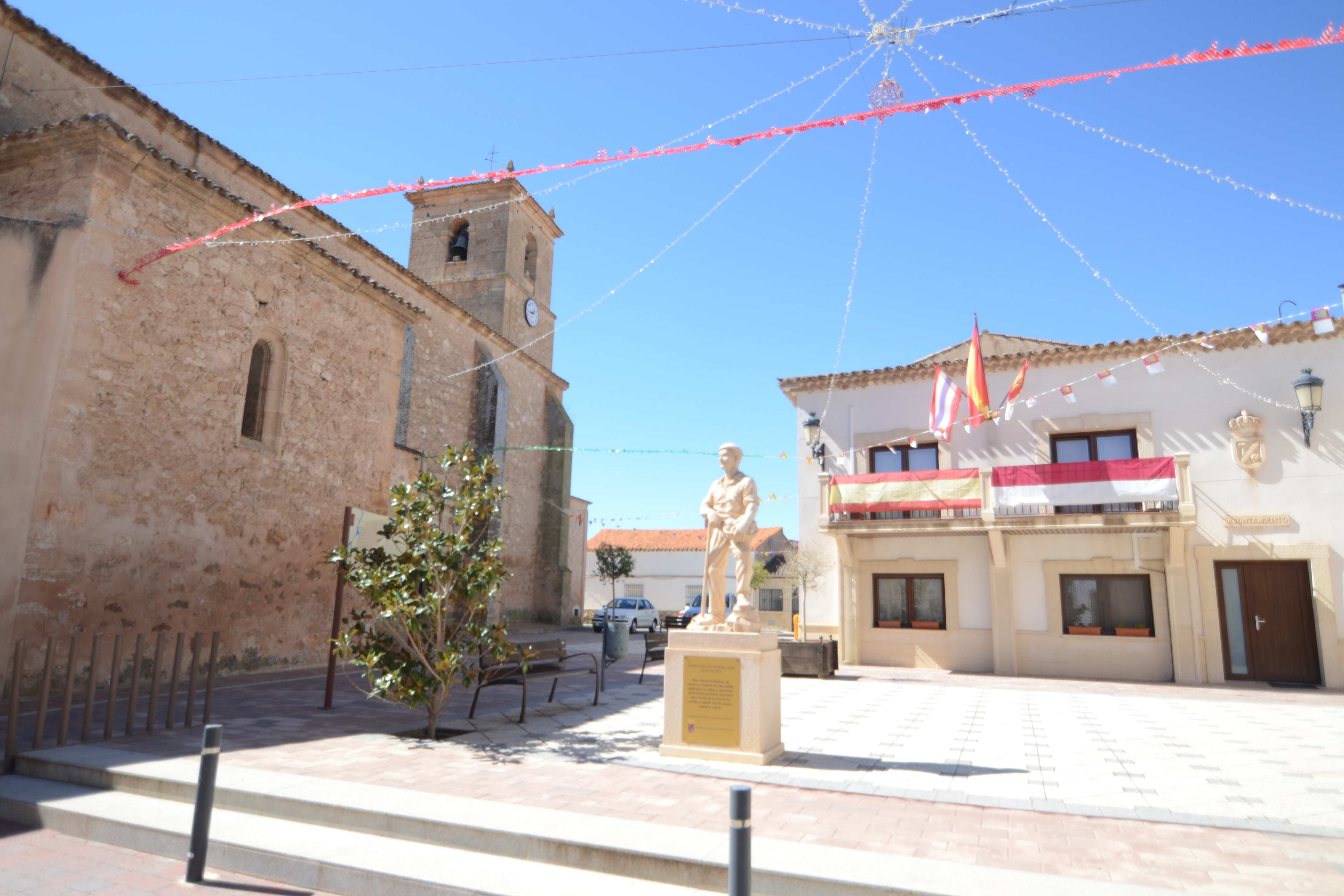
El Picazo
The municipality of El Picazo, in the province of Cuenca, sits in a deep valley on the banks of the river Júcar. Its origin is uncertain, as it is not known exactly when the first inhabitants settled here.
It was not until the 17th century that the council began to gain a certain relevance, with some documentary mentions appearing. The Boletín de la Provincia de Cuenca mentions this village in 1839 as Picazo de Alarcón, although it was finally separated in the 19th century from the village of Alarcón, of which it had been a hamlet until then.
Despite this, it is believed that the area may have been inhabited since the Ancient times by Celtiberian peoples who, attracted by the fertility of the land, settled on the top of the hill of Santa Quiteria. It was normal at that time to locate settlements in places that were easy to defend, and in this case, the hilltop location gave these first settlers a privileged position in terms of the defence of this settlement, of which numerous remains of buildings have been found.
Later, with the arrival of the Romans and the disappearance of the need for defence, the old site was abandoned and replaced by its current location, much more convenient, on the banks of the river.
The church of La Inmaculada Concepción stands out in the municipality. Built on the site of an earlier church at the beginning of the 16th century, it has a single nave. The town also conserves a number of country homes scattered throughout the village, such as that of Mateo Jerónimo de Villanueva, which today houses the Social Centre, that of Diego Villanueva and that of the Ruiz de Monsalve family.
Today, agriculture, as always, is still the main activity in the area, especially cereals, vines and olives, although rural tourism is becoming more and more important. This is complemented by some livestock farming, mainly sheep.
The local festivals of El Picazo take place on 2 October, with a popular procession in honour of Nuestra Señora del Rosario.
Multimedia


Downloads

GPS Downloads


Documents

Cyclability
This Cyclostage corresponds to part of stage 12 and stage 12 branch of the Nature Trail
PROFILE


TEST

GENERAL RECOMMENDATIONS
- Find out about the technical aspects of the route and the weather on the day.
- Take care of the environment. Take care not to disturb animals or damage vegetation. Respect private areas.
- You must give priority to pedestrians and comply with general traffic rules.
- The environment in which you will be riding is open, free to move around and an area where many activities are carried out (sporting, forestry, livestock and agricultural activities).
- Always have an understanding, prudent, responsible and respectful attitude.
SAFETY RECOMMENDATIONS
- The trail runs mainly along tracks with access to farms and rural holding, so there is a certain risk of collision.
- Caution is advised at the junction of the N-310 and CM-3114 roads.
- There are two walking sections where cyclists must dismount (one of which takes about 25 minutes, the other 14 minutes) along sections of uneven footpath with some danger of falling