
Net of Nature
Trails

River Segre and Utxesa Reservoir Nature Trail







Description
Wetlands and migratory birds
Early last century, the company Riegos y Fuerzas del Ebro, which belonged to FECSA and was known as “La Canadiense”, managed by the American engineer Frank Pearson, began the construction work of the Seròs Canal. The purpose of this major project, rounded off with the Utxesa reservoir which served as a regulating tank, was to produce electric power and to water non-irrigated crops, representing an enormous economic and social revolution for Lleida.
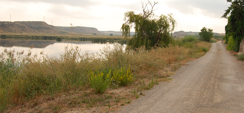
Today, this heritage can be explored via two walking routes that start from an information panel situated next to the bridge leading to Torres de Segre. The first offers a gentle walk along the River Segre, with access to two birdwatching spots, whilst the second leads to the Utxesa reservoir, largely following the old FECSA patrol path.
River Segre section
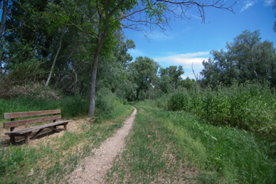
This route begins next to the bridge at the entrance to the village of Torres de Segre, opposite the Church of La Asunción and the Town Hall square. From here, a ramp leads down to the riverbank, where the path continues along the left bank.
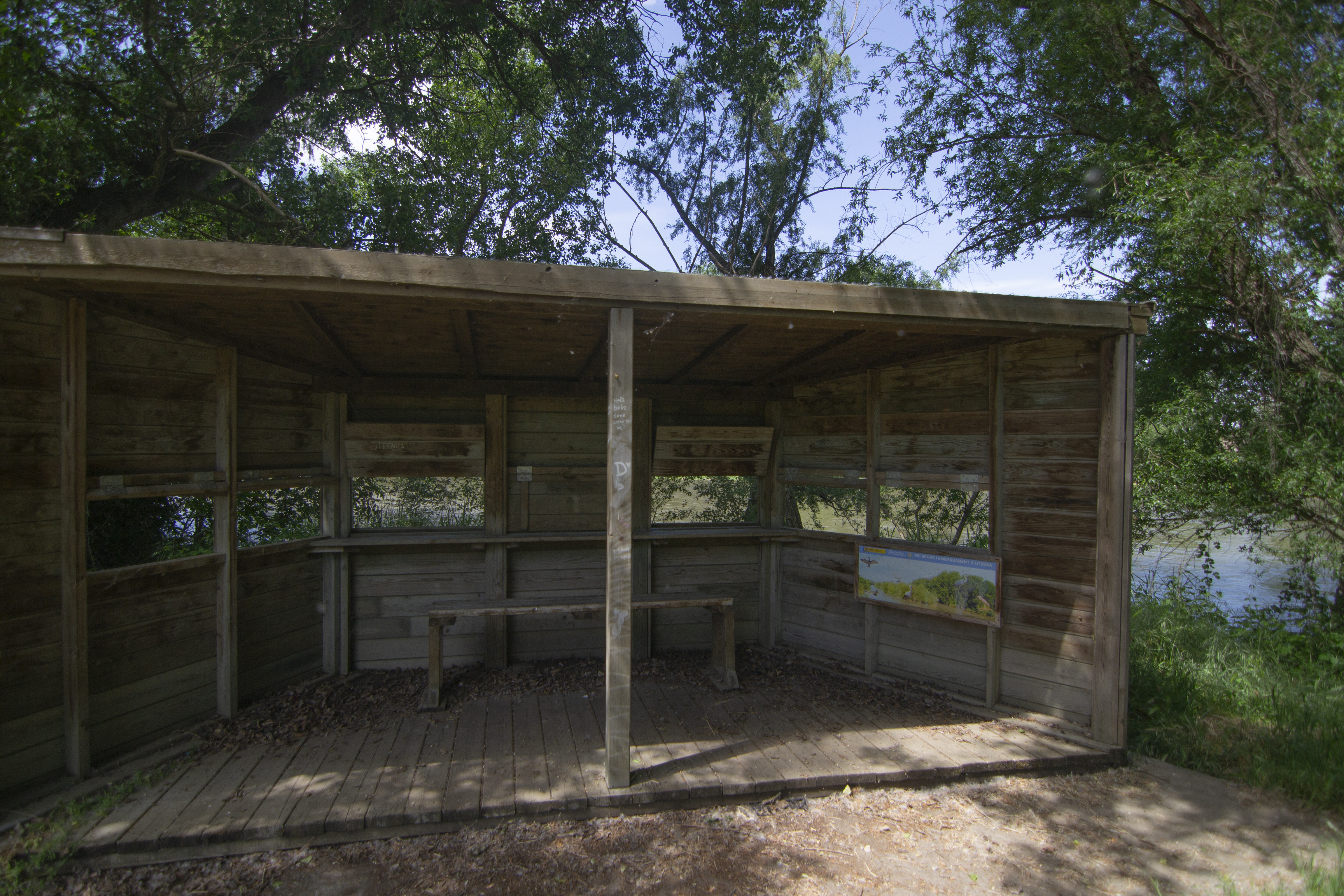
Before setting off on this route, it is well worth taking a detour of just 200 metres to see one of the birdwatching spots, from where the area’s rich birdlife, enhanced by the still waters of the Torres reservoir, can be appreciated.
Back on the main route, the route winds its way through a grove of poplars (Populus spp.) in pleasant surroundings, leading to a rest area near the town’s sports facilities. As the route continues, it runs closer to the river, sheltered by the riverside vegetation, consisting of poplars, elms and ash trees.
After just over a kilometre, the route reaches a second birdwatching hide situated opposite a river island that provides a refuge for different species of birds. The walk ends by returning along a path that goes round a small lake and rejoins the original path about 300 metres before reaching the rest area mentioned earlier.
Utxesa reservoir section
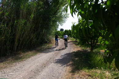
The second route starts at the same point, although in this case it passes through the town centre of Torres de Segre. After crossing Passeig del Segre with care – as the bridge is the main access point to the town – the route continues along several streets in the municipality, passing by the monumental parish church, home to a significant colony of white storks (Ciconia ciconia), and the Torres de Segre Town Hall. Continue along Carrer Vall and then along Carrer de Creu, which becomes Avinguda Pau Casal as the route leaves the town centre.
The path leads towards the Serós Canal; in some sections it runs alongside the road, so please proceed with extreme care. After crossing the Séquia de Torres, an irrigation canal that runs from Lleida, the route comes come to a roundabout and turns right here onto Carrer de Antoni Gaudí. After passing through another roundabout, from which it exits onto Carrer Pirineus, the route leaves the village of Torres de Segre behind for good, passing between a number of industrial buildings.
This “Caminet del Pantà” leads to a crossroads with the Utxesa road, which you must join on the left to reach, at kilometre 7, the Joquers viewpoint, where you can contemplate another bird’s eye view of the Secà reservoir. On going back to the tarmacked road, you will come to a point where the circular route that goes round the Utxesa reservoir joins together.
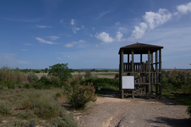
This brings the route to the Serós canal; without crossing it, keep to the right, alongside the wooden fence. During this first section, the route follows the Camí de Tingudes for around one and a half kilometres, running alongside the canal and through fruit orchards until it reaches the area around the reservoir.
At kilometre 5, the route reaches the ‘19th elevated observation point’, a prime spot for spotting such striking species as grey herons (Ardea cinerea) and purple herons (Ardea purpurea), great crested grebes (Podiceps cristatus), Western cattle egrets (Bibulus ibis), mallards (Anas platyrhynchos) or black-winged stilts (Himantopus himantopus) as well as birds of prey such as Western marsh harriers (Circus aeruginous), red kites (Milvus milvus) or common buzzards (Buteo buteo).
Continuing along the track, the route passes the crest of one of the dams that created this reservoir. This section runs alongside the reservoir, offering views of a stunning landscape featuring typical wetland species such as common reed (Phragmites australis) and rushes (Juncus sp.). The well-known Cabinet del Pantà leads to a junction with the Utxesa road, which it follows for a short stretch.
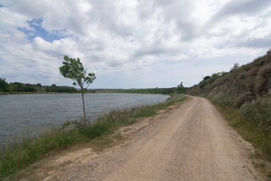
The road crosses a second dam and follows a wide bend that climbs gently. Taking advantage of this incline, an area with wooden railings has been set up to the left of the path: the Joquers viewpoint. Shortly afterwards, the route reaches a car park where, as will become clear later, the loop around the reservoir ends. Extreme caution will be required on these shared sections of road.
A little further on, the road passes the last of the dams on the Utxesa reservoir, and a turn-off takes to the Fonteneta rest area, where it is possible stop to rest and recharge.
After returning to the route, the road ends at the Information and Welcome Point, located in the building that formerly housed the FECSA facilities. This site provides information and guided tours of both the River Segre and the Utxesa reservoir, and also houses a small museum.
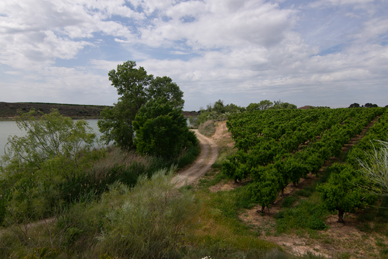
Just before reaching the visitor centre, the path turns off onto a track through a grove of Arizona cypresses (Cupressus arizonica), which goes past the old FECSA staff houses and a picnic area before rejoining the main road. After crossing it, the route continues for a few metres alongside the Serós Canal, which is crossed via a footbridge.
On the other side of the canal, the route alternates between tarmac road and dirt track until it reaches the Utxesa housing estate. After leaving it behind, the route reaches the banks of the reservoir once again. Right before kilometre 10 of the route, there are several fishermen stands where fishing competitions, popular in the area, are often held.Just before reaching the visitor centre, the path turns off onto a track through a grove of Arizona cypresses (Cupressus arizonica), which goes past the old FECSA staff houses and a picnic area before rejoining the main road. After crossing it, the route continues for a few metres alongside the Serós Canal, which is crossed via a footbridge. On the other side of the canal, the route alternates between tarmac road and dirt track until it reaches the Utxesa housing estate. After leaving it behind, the route reaches the banks of the reservoir once again. Right before kilometre 10 of the route, there are several fishermen stands where fishing competitions, popular in the area, are often held.
Continuing along the track, the route passes a junction on one side and, after going past a rest area, the route joins another track that runs along the southern end of the reservoir. The route leaves this track shortly afterwards, at the Mirador del Molí, situated on a small rise in the ground next to the ruins of an old watermill. Continuing along the track, the route passes a junction on one side and, after going past a rest area, the route joins another track that runs along the southern end of the reservoir. The route leaves this track shortly afterwards, at the Mirador del Molí, situated on a small rise in the ground next to the ruins of an old watermill.
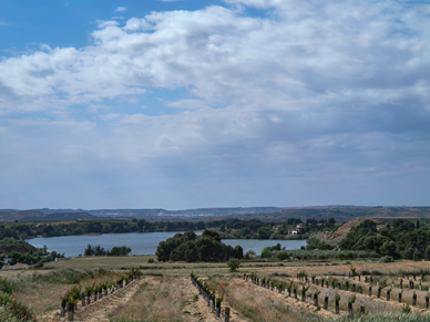
From the viewpoint there is an splendid panoramic view of hte reservoir, which was granted status of Nature Wild Fauna Reserve in October 1990 due to the considerable diversity of species it is home to. Furthermore, it forms part of the Plan for Areas of Natural Interest in Catalonia (PEIN) and is a key site for migratory birds.
The Camino Natural winds its way round the viewpoint along a dirt track, through fruit orchards which, on the left, are now interspersed with stands of poplars and ash trees rather than reed beds. This track leads onto a tarmac road to the left, once it is inside the Utxesa-Molí housing estate. After crossing it, the trail comes to a junction where it turns left again. From here, it is possible to take a short detour to the Mirador de les Comportes viewpoint and enjoy a different view of the reservoir.
Back on the road, it leaves the built-up area behind and heads once again into a predominantly agricultural landscape dominated by fruit trees. After a few hundred metres, the road leaves the tarmac behind and heads towards the shore of the reservoir along a dirt track. Here, a concrete platform marks the site of a former birdwatching post, which no longer exists, although the spot is still frequented by birdwatchers. The route becomes again a tarmac road just before crossing the bridge leading to the car park, where the circular route around the Utxesa reservoir comes to an end, marking the conclusion of this second section of the Segre River and Utxesa Reservoir Nature Trail.
mANAGEMENT ENTITIES:
Sites of interest
Puntos de interés
Culture
Geology
Hydrography
Information
Infrastructure
- Birdwatching hide
- Séquia de Torres (irrigation canal)
- Seròs Canal
- Elevated birdwatching hide
- Molí d’Utxesa (Utxesa mill)
- El Molí viewpoint
- Las Compuertas viewpoint
Municipality
Hostel
Passport
Profile
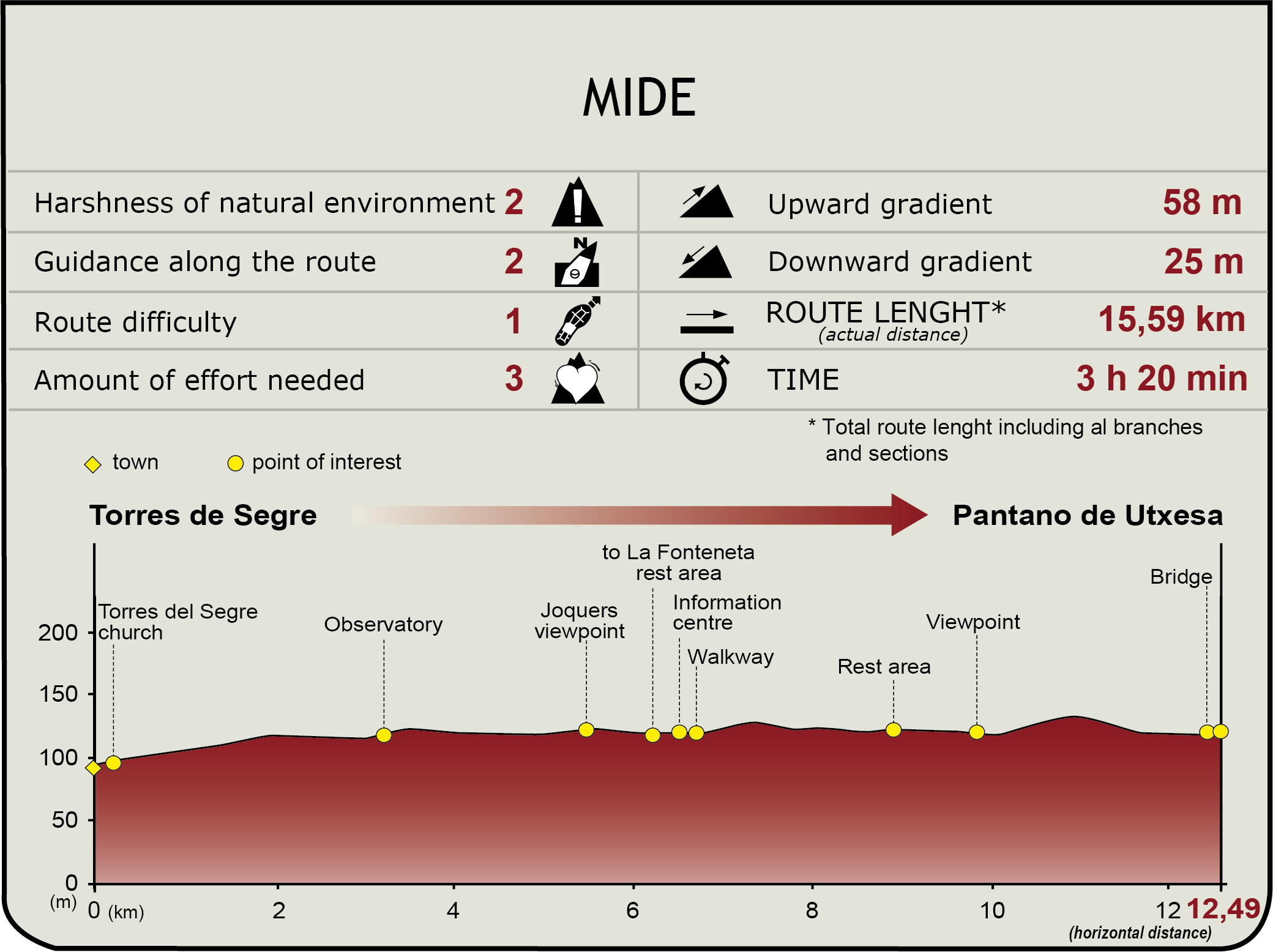
 Harshness of natural environment
- 1. The environment is not risk-free
- 2. There are more than one risk factors
- 3. There are various risk factors
- 4. There are quite a lot of risk factors
- 5. There are many risk factors
 Guidance along the route
- 1. Well defined trails and crossings
- 2. There is a clearly marked trail and signage
- 3. Requires the identification of geographic features and cardinal points
- 4. Requires off-path navigation
- 5. The trail is interrupted by obstacles that have to be gone around
 Route difficulty
- 1. Walking on a flat surface
- 2. Trails with different types of path
- 3. Walking on stepped paths or irregular terrain
- 4. The use of hands or jumping over the terrain is necessary
- 5. The use of hands is required to progress
 Amount of effort needed
- 1. Up to 1 hour of continuous walking
- 2. Between 1 and 3 hours of continuous walking
- 3. Between 3 and 6 hours of continuous walking
- 4. Between 6 and 10 hours of actual walking
- 5. More than 10 hours of continuous walking
(Calculated according to the MIDE criteria for an average excursionist with a light load)
Highlights
Further information
Bird migration
Bird migration is a phenomenon caused, rather than by changes in the climate, by a drop in the availability of food, which can largely be verified on the Iberian Peninsula in autumn and in spring.
Many migratory species, generally insectivores, choose our latitudes to spend the winter, feeding during this period on grain and seeds, but returning in the early months of the year to their places of origin in central and northern Europe, where they breed. Unlike these species, which are called over-wintering species, there are others that only stay here from the spring to autumn and are summer migratory birds. They take advantage of their stay to breed, returning to their winter encampments at the end of the summer.
But there are also sedentary birds, which choose to spend the whole year in the same place, adapting to a very varied diet.
Birds of passage are those that take advantage of wetland areas to rest on their long migratory journeys and which have planned their routes over generations. Hence, maintaining wetlands such as the Utxesa reservoir is essential for species which, although they do not nest or spend the winter in Spain, need them to exist so they can survive their migration.
Thanks to animal migrations, nature succeeds in using its resources efficiently, ensuring an optimum balance between different ecosystems.
The Utxesa reservoir
Located between the municipalities of Torres de Segre and Sarroca in Lleida, this reservoir was built in 1914 as part of the Seròs Canal hydraulic system, promoted by the company "La Canadenca" for the production of hydroelectric power. Over time, the large, artificially created body of water transformed into a wetland of immense ecological value.
Covering approximately 70 hectares, the reservoir is surrounded by reedbeds, floodplains, riparian forests, and agricultural fields, forming a landscape characteristic of the Segrià region. This combination has fostered a high level of biodiversity, especially among waterfowl and migratory birds, leading to its designation as a Wildlife Nature Reserve and making it one of the most important ornithological sites in inland Catalonia.
In its waters and surrounding areas, you can observe herons, ducks, cormorants, storks, and various other birds associated with wetlands and reedbeds. The tranquility of some areas facilitates nesting and resting for birds during their seasonal migrations.
The reservoir has evolved over time: from an industrial and energy infrastructure site to a landmark natural area where human activity and biodiversity coexist. Paths, viewpoints, and interpretive areas allow visitors to discover this environment from an environmental and educational perspective.
Currently, the area is part of the Els Secans del Segrià i Utxesa Protected Natural Area, consolidating itself as one of the main ornithological enclaves in the interior of Catalonia and a landscape reference linked to the lower course of the River Segre.
Multimedia




Downloads

GPS Downloads


Documents

Cyclability
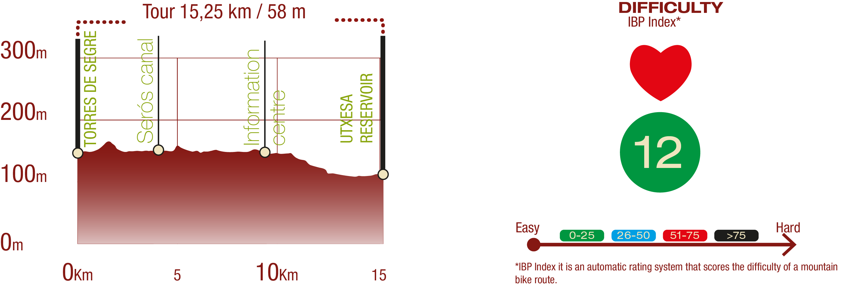
PROFILE & DIFFICULTY
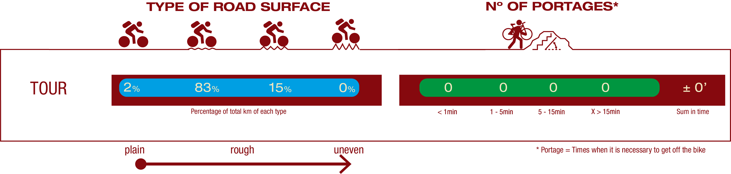
TYPE OF ROADS & PORTAGES
TEST

SAFETY RECOMMENDATIONS
- Much of the route follows roads and tracks shared with motorized traffic. Special care is advised, particularly at intersections and narrow passages, and on the streets of Torres de Segre and the residential areas around the Utxesa reservoir.
- Exercise extreme caution when crossing the walkway over the Serós canal and the bridge just before the end of the route.
GENERAL RECOMMENDATIONS
- Find out about the technical aspects of the route and the weather on the day.
- Take care of the environment. Take care not to disturb animals or damage vegetation. Respect private areas.
- You must give priority to pedestrians and comply with general traffic rules.
- The environment in which you will be riding is open, free to move around and an area where many activities are carried out (sporting, forestry, livestock and agricultural activities).
- Always have an understanding, prudent, responsible and respectful attitude.