

Net of Natural
Trails

Sierra de Alcaraz Greenway Nature Trail. Balazote - El Jardín Section
Description
We bid farewell to the plains of La Mancha as we enter the Sierra de Alcaraz.
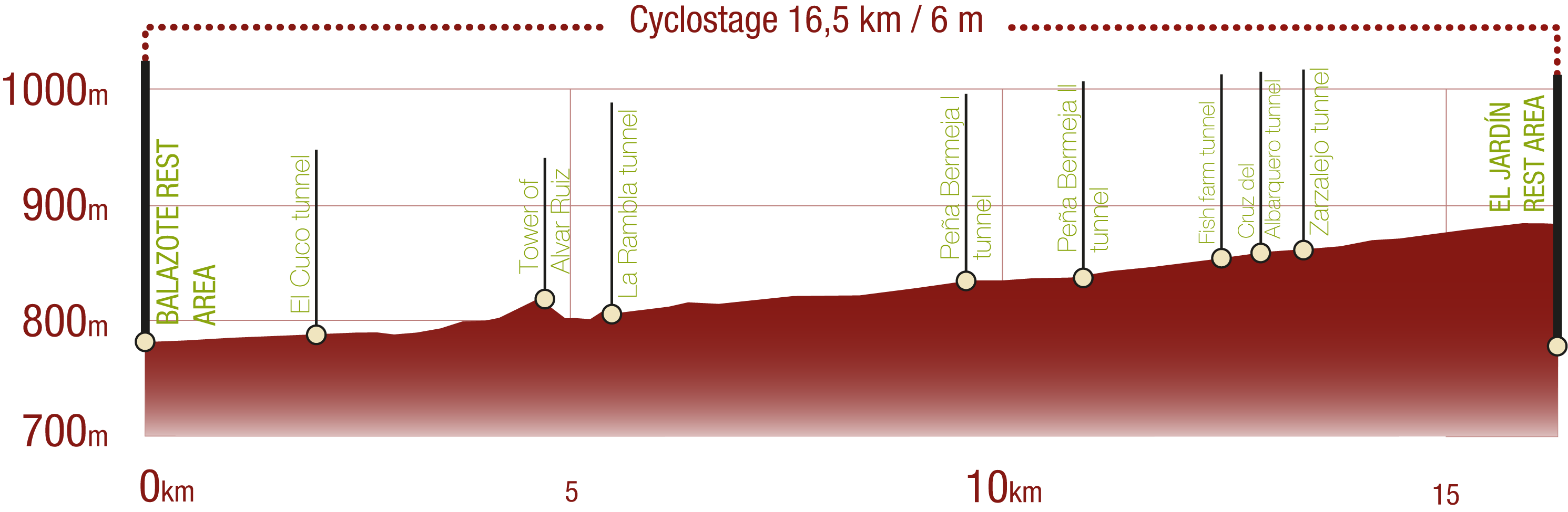
The second stage of the Renacimiento Greenway Nature Trail connects the Balazote Bridge over the Mirón River (currently the Balazote Rest Area) and the El Jardín Rest Area, marking the transition from the plains of La Mancha to the reliefs of the Sierra de Alcaraz. A little over 16 km, it packs in plenty of railway history, Mediterranean nature and eight tunnels that evoke the old dream of the never-to-be-completed Utiel-Baeza railway.

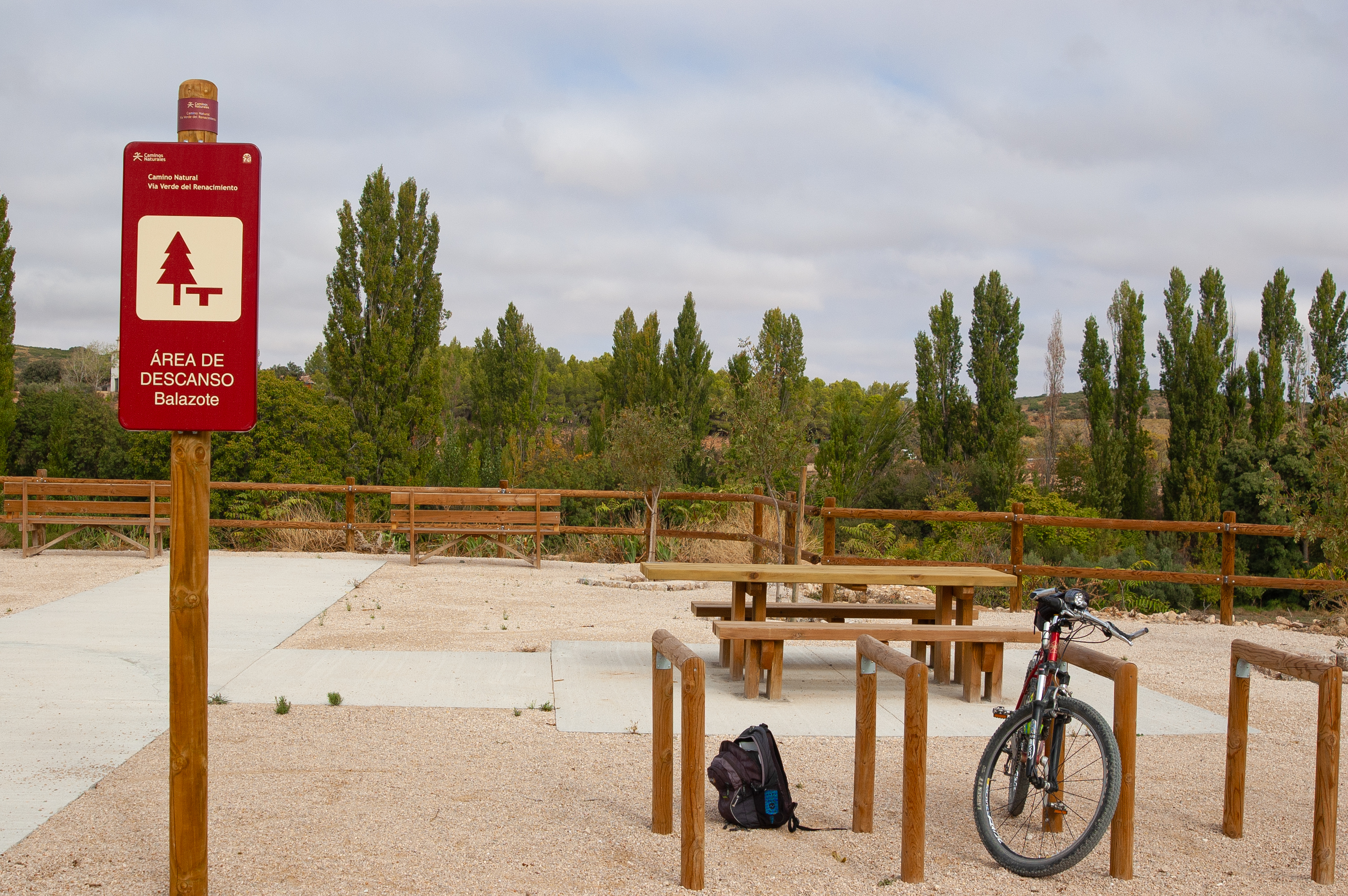
The usual starting point of this second stage of the Renacimiento Greenway Nature Trail is the Puente de Balazote bridge over the Mirón River, although due to the current works on the A-32 motorway, the starting points is provisionally located at the Balazote Rest Area., located just over 2 km from the town. This is a modern and accessible space, thanks to its paved areas and it also has benches, tables, bike racks and a bike repair station that might just come in handy for travellers who make the itinerary on two wheels.
Shortly after setting off, we reach the marker for kilometre 34, where the identifying stamp of this Renacimiento Greenway Nature Trail appears in the upper right-hand corner, which can be collected in the Nature Trails and Greenways Passport, which can be obtained from any of the participating organisations, creating a beautiful souvenir that will take you back to places visited along the Nature Trails Network travelled in the past.

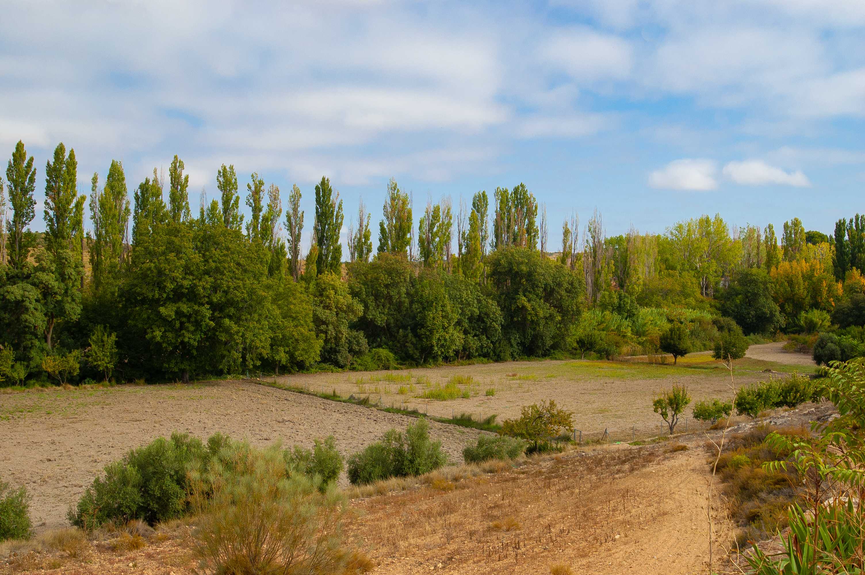
The old route of the unfinished railway between Utiel (Valencia) and Baeza (Jaén) runs through the typical vegetation of Mediterranean scrubland, mostly located to the left of the route, and native riverside woodland together with plantations of poplar trees for timber production located on our right, on the banks of omnipresent El Jardín River.
The route faithfully follows the old railway line, turning south-west, at which point a junction of dirt tracks marks the beginning of a 773 metre-long section shared with vehicle traffic. A few metres further on, we cross Tunnel 1 El Cuco, the first railway tunnel of this Renacimiento Greenway Nature Trail. The tunnel is 150 metres long and has no interior lighting, so it's advisable to carry a torch. Shortly after exiting the tunnel a new dirt road junction marks the end of the section shared with motor vehicles.

After the kilometre 36 marker, the route temporarily leaves the old railway line veering to the right, reaching the El Jardín River between the cornfields, before crossing the river by a wooden footbridge with views of the river. After a left turn, the route continues to run parallel to the N-322 road. After another kilometre, you reach the sign indicating that you are about to face the toughest section of the stage, with 1,800 metres of steep uphill and downhill slopes.
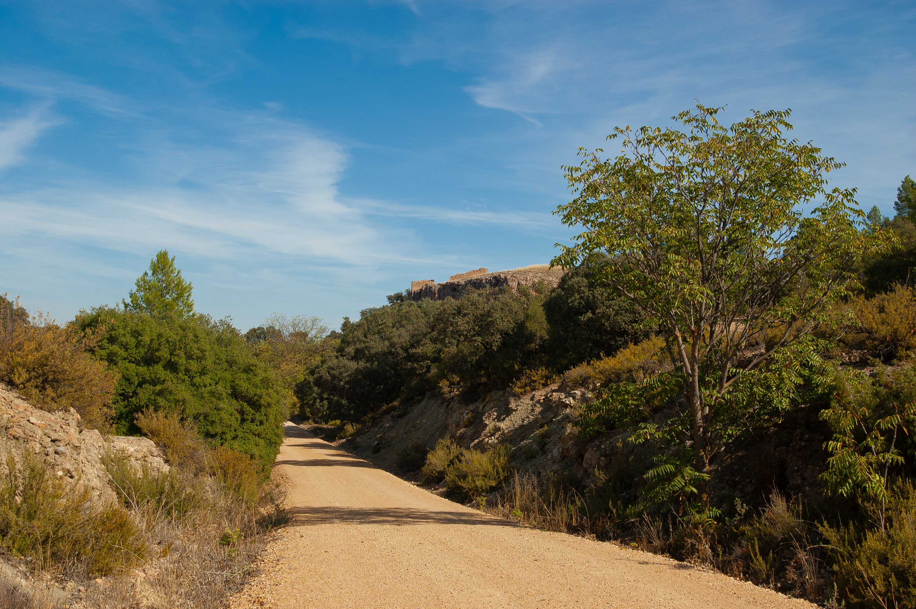
After the first downhill and uphill ramp, dotted with beautiful specimens of holm oak (Quercus ilex), you reach a barn and the 38 kilometre marker before reaching the medieval Tower of Alvar Ruiz, today a private property, so a sight we can only admire from outside the fenced-off property.
A rapid descent culminates in a curve to the left, at which point we stop walking parallel to the N-322 road, looking once again for the El Jardín River, which we cross again over a wooden footbridge, and then immediately face the ascending ramp that culminates at the entrance to Tunnel 3 La Rambla, which is 105 metres long and also unlit. The second tunnel of the old railway line, located on a private property, is not accessible, so the route diverts from the railway line here.

Returning to the railway line and after passing through Tunnel 3, on the left we can see the remains of the Casas de Lázaro Castle on the crest of a hill. Further on, we leave the Venta de La Rambla area to the right and then cross the CM-313 road over an elegantly designed metal footbridge.
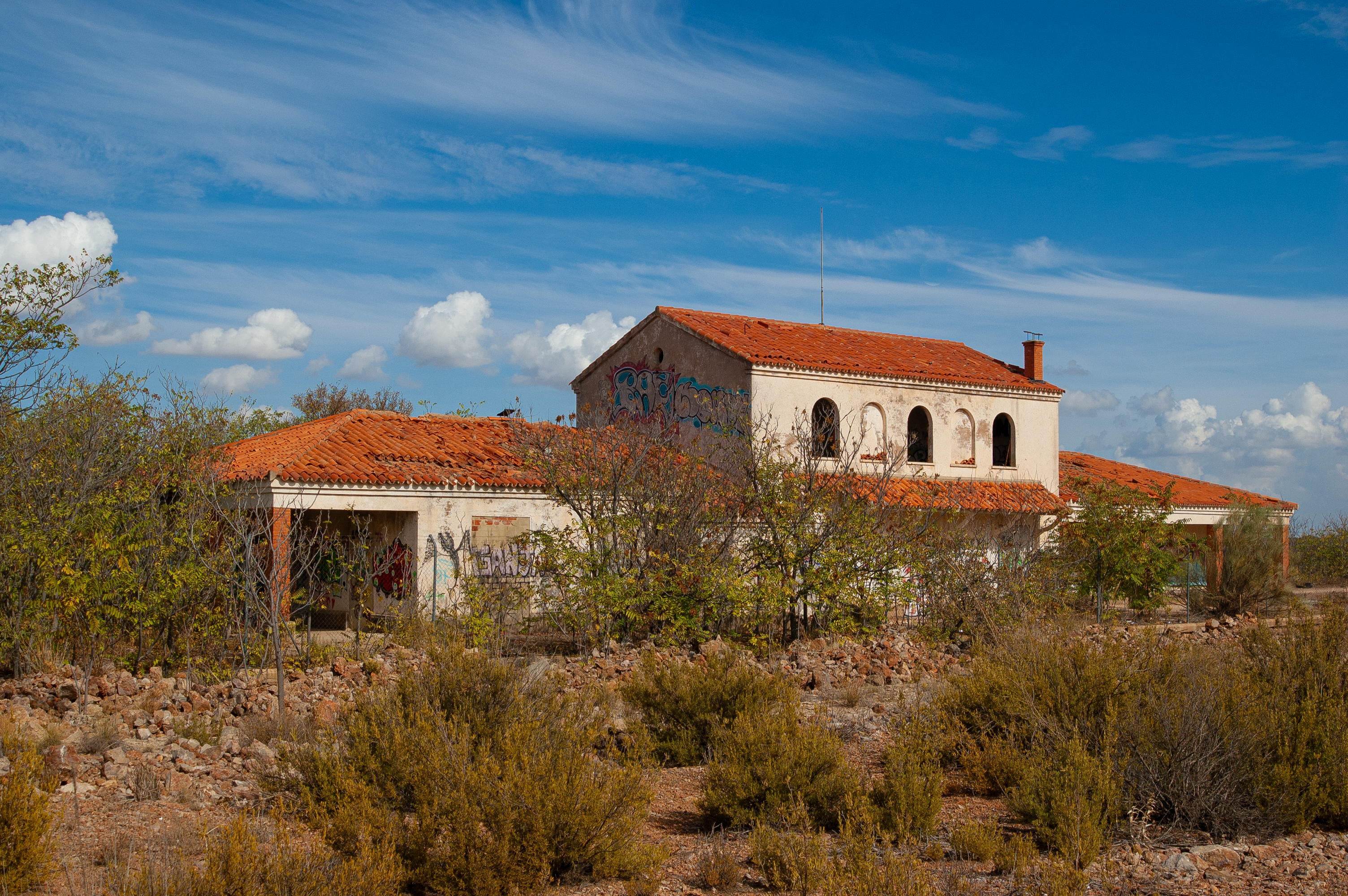
Passing kilometre marker 41, we reach an abandoned building that resembles guesthouse. Although this project was never finished, it’s something of an important landmark as it stands where the old La Rambla station once did.
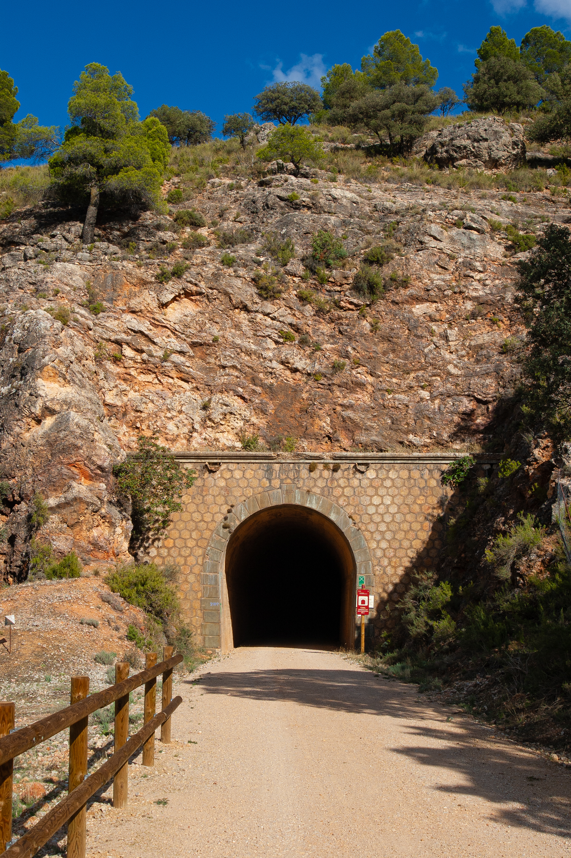
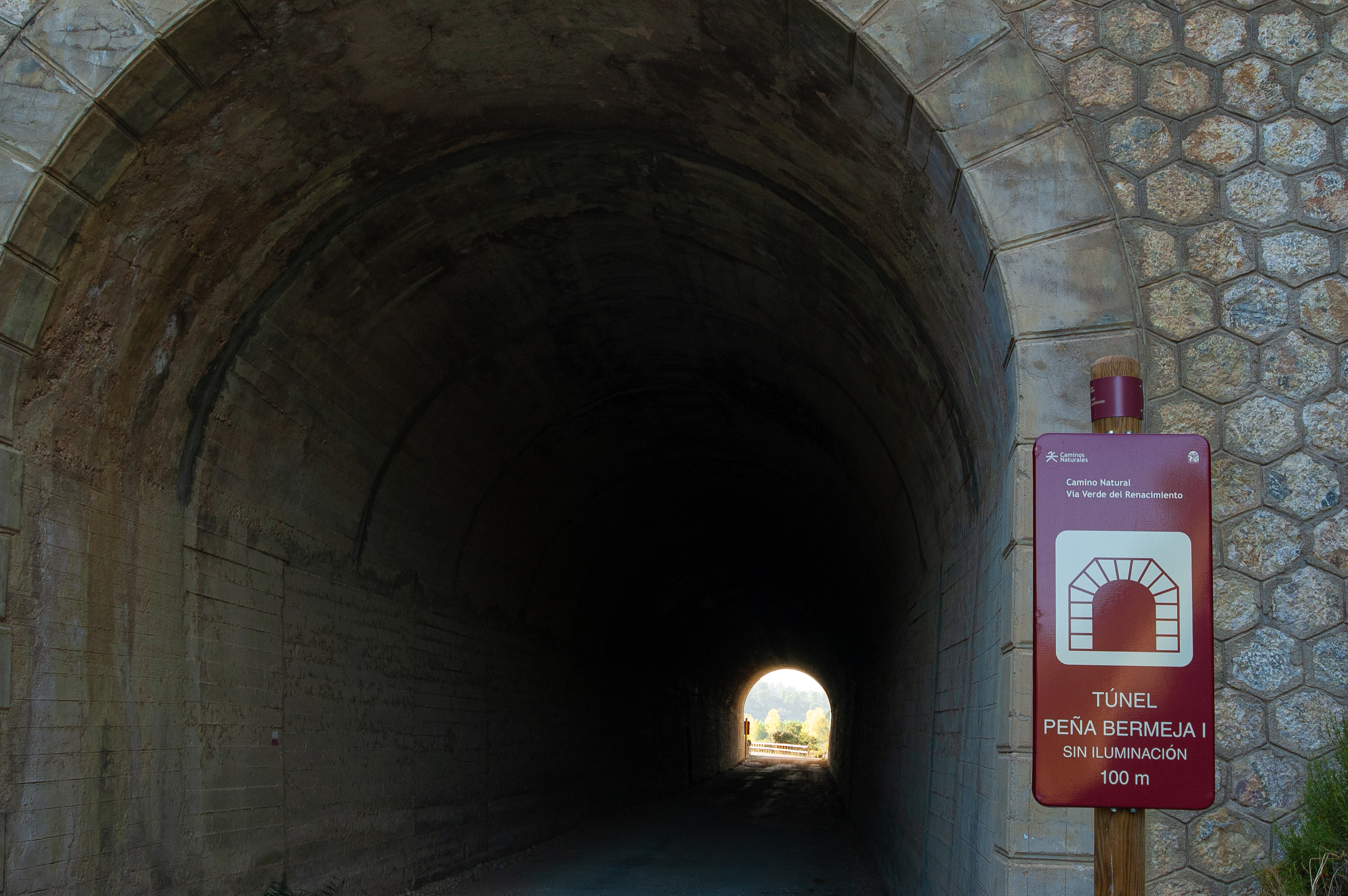
Two kilometres further along the route, we reach Tunnel 4 Peña Bermeja I, 100 metres long, and then shortly after kilometre marker 44, the entrance to Tunnel 5 Peña Bermeja II, 310 metres long. Neither of these tunnels are equipped with interior lighting. The second of the two tunnels covers a left curve so it is completely dark in the middle so access without some class of torch is prohibited.

The N-322, never far away, with its numerous curves, contrasts with the old railway route, much more comfortable, which managed to circumvent the orography of these first foothills of the Sierra de Alcaraz thanks to the numerous tunnels, facilitating the rail transport of the time. Today, it's a delight for hikers and cycling tourists, making the passage through these tunnels a fully-fledged immersive experience.
The trail crosses the Mitras stream over a small railway bridge and enters the 330 metre-long Tunnel 6 Piscifactoría, also on curve. Its name refers to the fish farm located just at the exit. It is followed by Tunnel 7 Cruz del Abarquero, the longest tunnel on this stage at 540 metres long, and Tunnel 8 Zarzalejo, 265 metres long. It is important to remember that none of these tunnels is equipped with lighting within.
A new section shared with motor vehicles precedes leads us last tunnel of this second stage. After the 112 metre-long Tunnel 9 Bado, similarly devoid of interior lighting, the route opens up to the final section, flanked by the El Jardín River, the N-322 road and the mountains of the Sierra de Alcaraz.
The information panel located next to the entrance to the next tunnel, just past the kilometre 50 marker and the El Jardín rest area, fully equipped like the one in Balazote, marks the end of this second stage of the Renacimiento Greenway Nature Trail.
Management Entities
Puntos de interés
Culture
- Alvar Ruiz Tower
- Molino de la Torre
- Ruins of the Castle of Casas de Lázaro
- Ghost Hotel
- Bazalote Bridge
Hydrography
Infrastructure
- Old Balazote Station
- Tunnel 2
- Tunnel 3 La Rambla
- Tunnel 4 Peña Bermeja
- Tunnel 5 Peña Bermeja II
- Tunnel 7 Cruz del Abarquero
- Tunnel 8 Zarzalejo
- Tunnel 9 Bado
- Tunnel 6 Piscifactoría
- El Cuco Tunnel
Municipality
Profile

 Harshness of natural environment
- 1. The environment is not risk-free
- 2. There are more than one risk factors
- 3. There are various risk factors
- 4. There are quite a lot of risk factors
- 5. There are many risk factors
 Guidance along the route
- 1. Well defined trails and crossings
- 2. There is a clearly marked trail and signage
- 3. Requires the identification of geographic features and cardinal points
- 4. Requires off-path navigation
- 5. The trail is interrupted by obstacles that have to be gone around
 Route difficulty
- 1. Walking on a flat surface
- 2. Trails with different types of path
- 3. Walking on stepped paths or irregular terrain
- 4. The use of hands or jumping over the terrain is necessary
- 5. The use of hands is required to progress
 Amount of effort needed
- 1. Up to 1 hour of continuous walking
- 2. Between 1 and 3 hours of continuous walking
- 3. Between 3 and 6 hours of continuous walking
- 4. Between 6 and 10 hours of actual walking
- 5. More than 10 hours of continuous walking
(Calculated according to the MIDE criteria for an average excursionist with a light load)
Highlights
Additional information
Balazote
Balazote is a town located in the heart of the province of Albacete. Archaeological excavations confirm that it has been inhabited for thousands of years, with important Iberian-Roman remains. Among them is the famous Bicha de Balazote, a sculpture dating back to the 6th century BC and considered one of the most representative works of Iberian art, together with the Dama de Elche. This figure was believed to be able to deflect evil influences from the municipality. It is currently in the National Archaeological Museum, although a reproduction can be seen in the Archaeological Museum of Albacete. The remains of a Roman palace, complete with baths and mosaics have also been found in the vicinity of Balazote. The name of the town comes from the Latin word palatium, which the Arabs transformed into balat.
Balazote has always been closely linked historically with the municipality of Alcaraz. It was administratively dependent on the Alfoz of Alcaraz until the early 14th century when it was donated to the Order of Santiago, tasked with the conquest and subsequent Christian repopulation of the area. After this, it came under the jurisdiction of Villanueva de la Fuente, today a municipality in the neighbouring province of Ciudad Real. Its location, between the plain and the first mountains of the Sierra de Alcaraz, makes it a natural transition between the Spain’s eastern Mediterranean, known as the Levante, and Andalusia. Its economy is based on irrigated agriculture, with crops such as potatoes, maize, alfalfa and garlic, which is also one of the essential components of its traditional gastronomy.
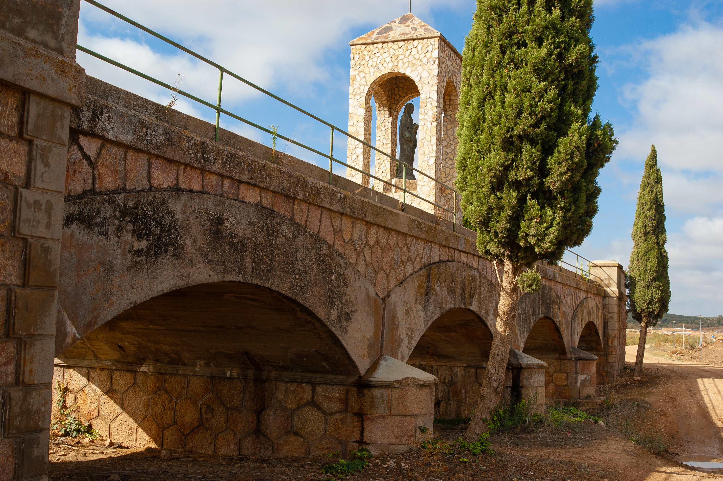
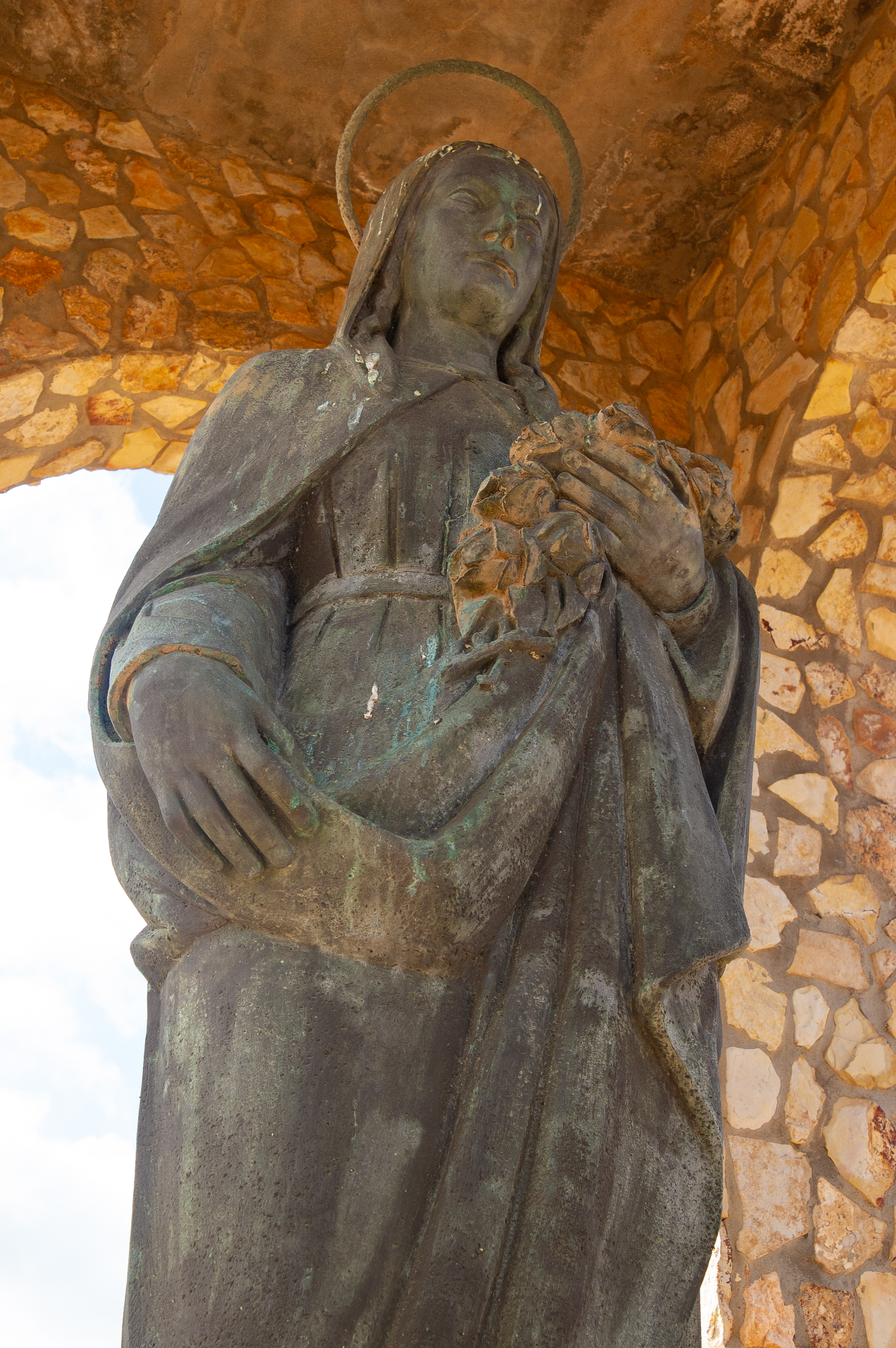
Monuments here include the church of Nuestra Señora del Rosario, which dates from the 16th century and in which it is possible to find elements from the neighbouring Franciscan convent of Alcaraz, such as the Baroque altarpieces. The Shrine of Santa Monica, located on a hill in the vicinity of the town, is also worth a visit. Of the traditional civil architecture of the area, the old washing place is still preserved, located in the lower part of the municipality, and which for many years became a meeting point mainly for the women of the locality.
Among its festivities, the celebration in honour of San Blas, in February, and the traditional pilgrimage of Santa Monica, during which the residents of Balazote travel to the hill where the hermitage in honour of their patron saint is located and where the events of this celebration take place, stand out.
The Garden
El Jardín is a hamlet of the Albacete municipality of Alcaraz, located some 30km from this historic town, in the region of the Sierra de Alcaraz and Campos de Montiel.
El Jardín, terraced on a hillside and located next to the N-322 (Valencia-Córdoba), has developed along a linear layout, with numerous commercial and hotel establishments built. It is surrounded by a fertile plain irrigated by the El Jardín River, where poplar groves, orchards and cereal crops thrive, as well as small livestock farms.
Its most outstanding building is the parish church of Santa Lucía, located in the upper part of the town centre. It is a modest building belonging to the diocese of Albacete and the archpriesthood of La Roda.
The main festivities are in honour of St. James the Apostle, on 25 July. Santa Lucia, the local patron saint, is also celebrated on 13 December.
Multimedia


Downloads

GPS Downloads


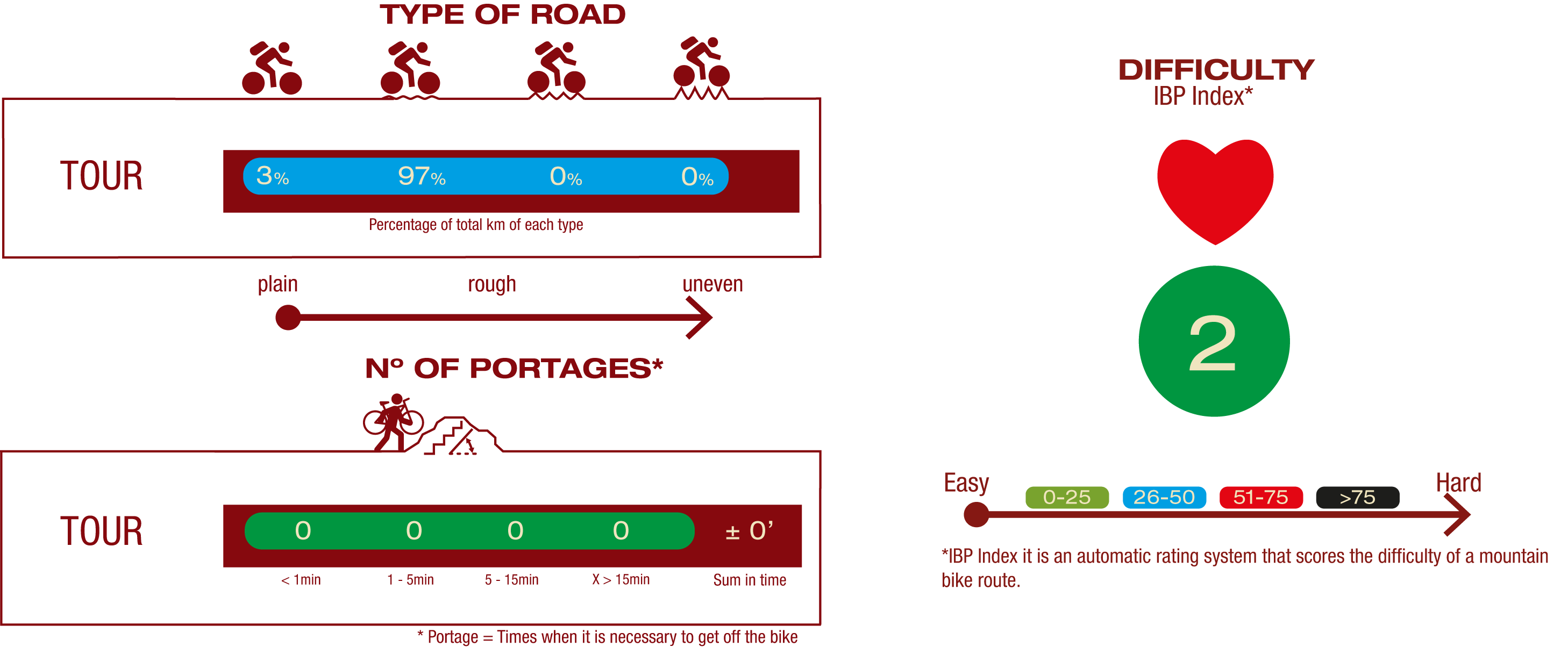
Cyclability
TYPE OF ROAD, PORTAGES & DIFFICULTY
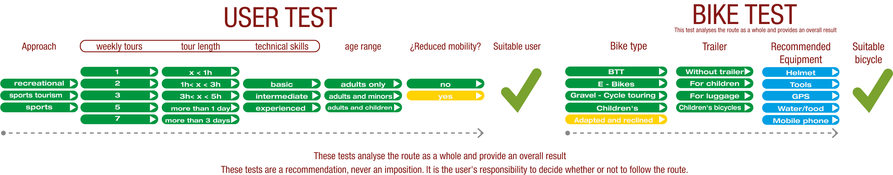
TEST
SAFETY RECOMMENDATIONS
- The route has 8 tunnels in all, none of them equipped with interior lighting, with lengths ranging from 100 to 540 metres, some of also curved. For all these reasons, must bring their own torch or lighting system.
- There are also 5 stretches shared with motor vehicles, the longest of which is 900 metres long, so extreme caution is advised on all of these sections.
- Finally, there are small flood zones at the crossing of small watercourses.
GENERAL RECOMMENDATIONS
- Find out about the technical aspects of the route and the weather on the day.
- Take care of the environment. Take care not to disturb animals or damage vegetation. Respect private areas.
- You must give priority to pedestrians and comply with general traffic rules.
- The environment in which you will be riding is open, free to move around and an area where many activities are carried out (sporting, forestry, livestock and agricultural activities).
- Always have an understanding, prudent, responsible and respectful attitude.