
Net of Nature
Trails

Stage: Quintanarruz - Burgos
Description
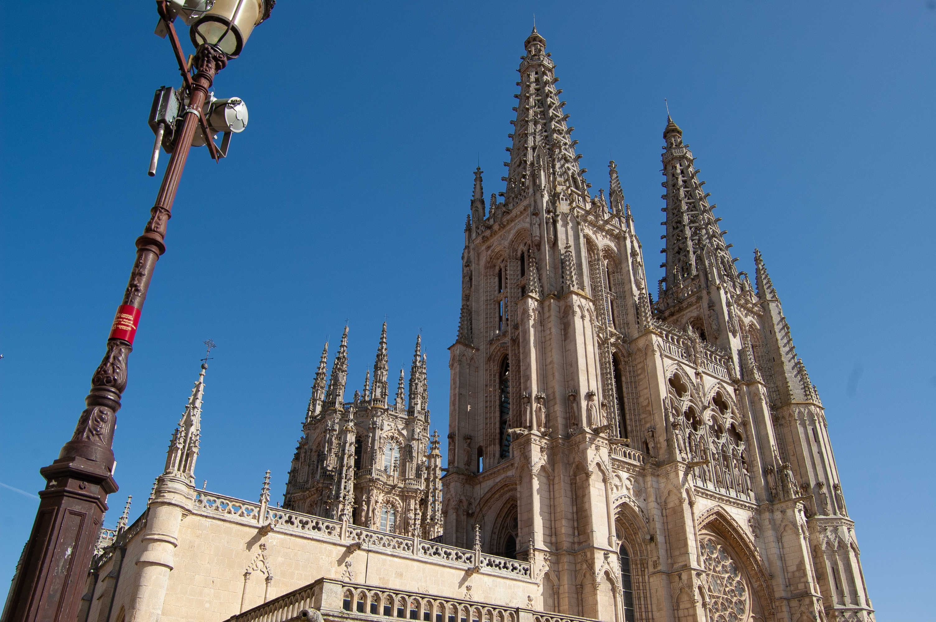
The Santander-Mediterranean railway shows its best face as it passes through the city of Burgos.
The highlight of this section of the old Santander – Mediterranean railway is the passage through the city of Burgos, notwithstanding the valley of the River Ubierna, where other great routes and travellers converge, including the Camino de Santiago, the Route of El Cid and the Saint Olav Way. This convergence allows travellers to mingle and share experiences from the road in the incomparable monumental setting of the city of Burgos.

Kilometre marker 0, located next to the Nature Trails interpretative panel, marks the beginning of this stage. The course is along what was once the old railway line and features gentle uphill and downhill slopes along the entire route. The small hamlet of Quintanarruz is crossed by Calle La Vía. Leaving Quintanarruz behind, we head south where the cork oak forests increasingly abound.
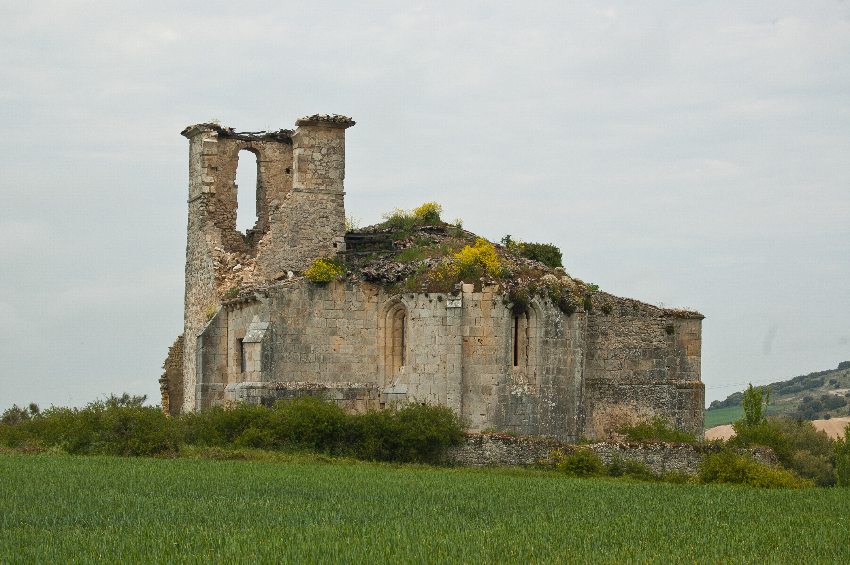
On the top of a small headland stand the ruins of what was once the Shrine of Nuestra Señora de los Ángeles, and, shortly afterwards , a wooden bench offers a brief respite to enjoy for the botanical richness of the River La Molina. After passing the 4-kilometre marker, the hamlet of Cobos Junto a La Molina and the Church of San Torcuato come into view.
Continuing comfortably the kilometres pass by, until we reach the small La Molina de Ubierna Rest Area, for well-earned break to regain strength. After passing the 7-kilometre marker, the Church of San Román comes into view. This is where various scenes of the Passion of Jesus are reenacted by the residents of La Molina de Ubierna every Good Friday. At the crossroads that provides access to the hamlet, there is an interpretive panel inviting travellers to pay a visit.

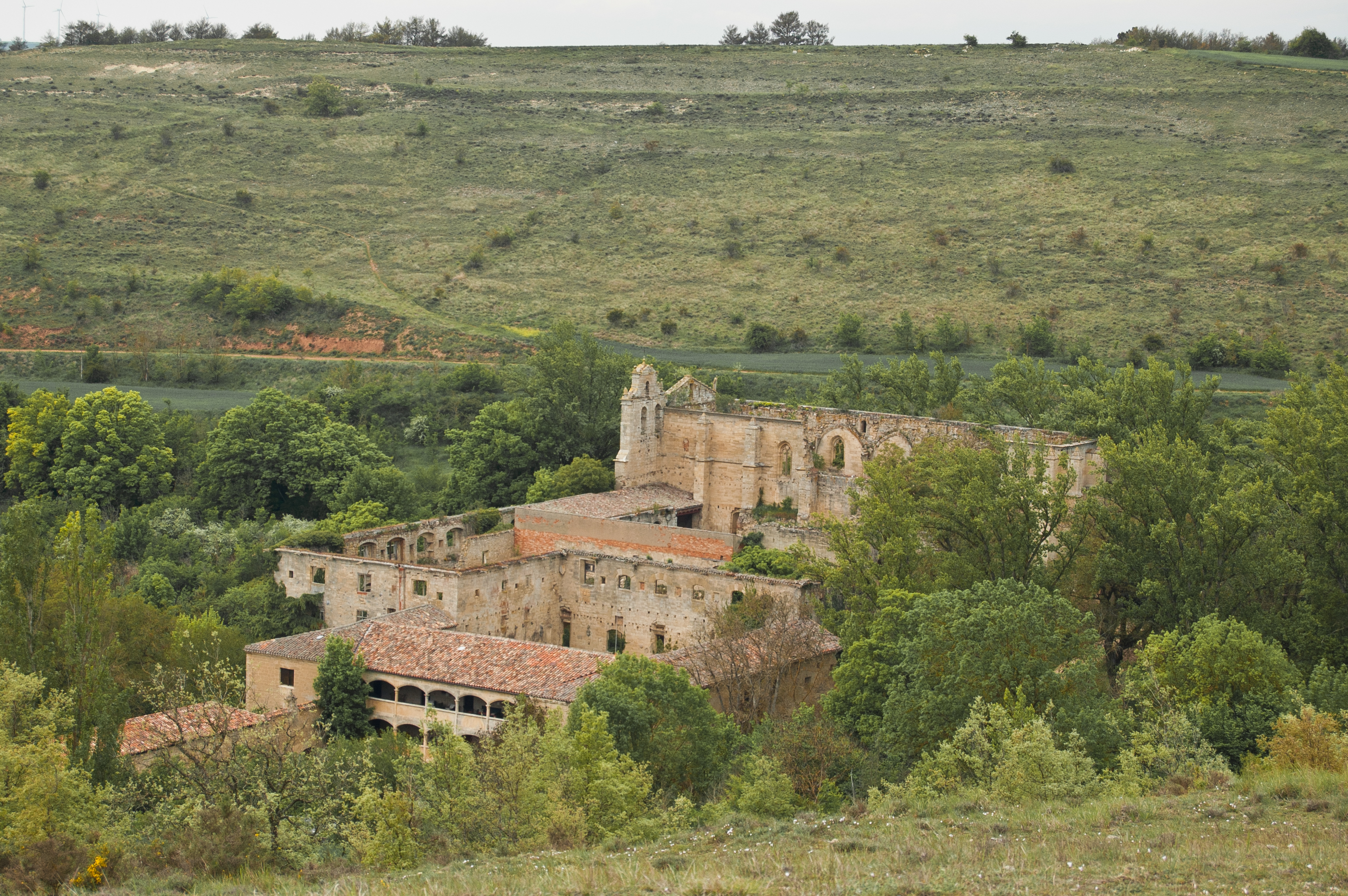
The route continues with no major interruption to an old gatekeeper’s hut, today converted into housing, just before carefully crossing the CL-629 road. Soon we reach the town of Peñahorada is where there is another Rest Area. Around kilometre point 11, the traveller reaches the old station of Peñahorada, where the passing of time is noticeable just by observing its current state.
The route continues in parallel with road CL-629, leaving a well-conserved old mineral loading bay in a good condition on the left. Just past the 12-kilometre marker come the 120-metre Callejón tunnel and the 84-metre La Hoz tunnel. Being short tunnels, they have no artificial lighting, so it is recommended to carry a torch. Immediately afterwards, we cross the road CL-629 via a purpose-built elevated bridge and the rocky mountains covered with scrubland of evergreen oaks are left behind.
We pass the gothic Church of La Mota before the old Halt Station of Villaverde Peñahorada, both to the left of the route. Crossing the BU-V-5008, we encounter more and more rain-fed cereal crops and plains. Once again, we find ourselves sharing a road with motor traffic, so we have to stay alert and take precautions. After passing the 16-kilometre marker, we cross the bridge over the Ubierna River, which is the entrance to Sotopalacios. Los Adelantados Castle dominates the village architecturally. Sotopalacios is famous the production of local black pudding, so why not take the opportunity to sample this delicacy.

After just over a kilometre, we reach the old Terminón-Castellanos station, located, as its name suggests, between the two towns. Next to the old building, an interpretive panel and a rest area offer the perfect opportunity to take a break, peruse some information about the route and the surroundings and take stock of how far we’ve come and what lies ahead.
The old railway route is left momentarily upon reaching the village, continuing along the footpath of the N-623 road inside the village. Known as the Burgos-Santander road, it is crossed at a traffic light controlled pedestrian crossing. Shortly afterwards, we turn right to return to the old railway route at the old Sotopalacios station, where a rest area offers the chance to take a break beneath two large horse chestnut trees (Aesculus hippocastanum).
The town is left among cropland, leaving behind the trail that provides access to Quintanilla Vivar, located less than 1 km from the Nature Trail. A short while later, we cross the A-73 motorway using an underpass. We return to the old railway line once again, crossing a bridge over the River Ubierna. Without further delay, we reach kilometre point 22, passing the BU-V-6279 road to Sotragero, taking the necessary precautions.

On the first few kilometres of the route, as we pass through fields of cereal crops, we leave behind the villages of Villarmero and Quintanadueñas, both to the right of the route, and the old Villarmero station and rest area. The route crosses the BU-30 ring road over a footbridge and a short while later reaches the Villalonquéjar industrial estate, where the route forks in two, adapted for cyclists and walkers at all times.
Once the industrial section is finished, the route continues along a cycle lane that will take walkers and cycle tourists to the city of Burgos. After the first few residential buildings, the route forks again, with cyclists, continuing straight along the cycle path and walkers taking the left hand path.
Its immense architectural and cultural heritage makes Burgos a must-see and a compulsory stop on this tour. Among the attractions, its world-famous cathedral undoubtedly stands out; it was declared a World Heritage Site by UNESCO in 1984 and, much earlier, in the late 19th century, a National Monument.

Burgos is also a busy transit point for other important national and international routes: The Camino de Santiago, specifically the French Way route, sees many pilgrims pass through the city. The Route of El Cid is another example; it begins with the exile of Rodrigo Diaz (El Cid), a native of the nearby town of Vivar del Cid. The Saint Olav Way, which begins in the city of Burgos and ends at the original Shrine of San Olav, was inaugurated in 2011 in the Valle de los Lobos located in the town of Covarrubias.
A university city, one of Burgos’s great attractions is the local cuisine, a magnet for the immense majority of visitors. They cannot leave without tasting some of the local delicacies like roast suckling lamb, delicious Burgos black pudding, both with Protected Geographical Indication (PGI) for their quality and heritage; all combined with the famous wines from the Ribera del Duero and Arlanza Protected Designation of Origin (PDO) regions.
After a good meal, travellers can make their way through the city of Burgos where, just before the old Burgos railway station, the cycling and walking routes meet again. Travellers will only have to let themselves be guided through the city by the plaques on the streetlights to find the path that will take them out of the capital of Burgos, which will remain stuck in their minds.
Managing Entities
Links of Interest
Puntos de interés
Culture
Hydrography
Infrastructure
Municipality
Passport
Profile

 Harshness of natural environment
- 1. The environment is not risk-free
- 2. There are more than one risk factors
- 3. There are various risk factors
- 4. There are quite a lot of risk factors
- 5. There are many risk factors
 Guidance along the route
- 1. Well defined trails and crossings
- 2. There is a clearly marked trail and signage
- 3. Requires the identification of geographic features and cardinal points
- 4. Requires off-path navigation
- 5. The trail is interrupted by obstacles that have to be gone around
 Route difficulty
- 1. Walking on a flat surface
- 2. Trails with different types of path
- 3. Walking on stepped paths or irregular terrain
- 4. The use of hands or jumping over the terrain is necessary
- 5. The use of hands is required to progress
 Amount of effort needed
- 1. Up to 1 hour of continuous walking
- 2. Between 1 and 3 hours of continuous walking
- 3. Between 3 and 6 hours of continuous walking
- 4. Between 6 and 10 hours of actual walking
- 5. More than 10 hours of continuous walking
(Calculated according to the MIDE criteria for an average excursionist with a light load)
Highlights
Soto Palacaios
A town in Burgos belonging to the municipality of Merindad de Río Ubierna, which is its capital. The first documentary records of this town date back to the 12th century, although its origin was probably prior to this. It has a rich architectural heritage made up of the Castle of Los Adelantados, the Church of Nuestra Señora del Acorro, the Church of San Martín, Cariño as the shrine of the town, and the Casa de Los Tiros building, declared as a Site of Cultural Interest in 1992. It has its patron saint festivities on 8 September and on the second November the fair takes place for the town’s most famous product, morcilla (black pudding).
Burgos
This city, the capital of the autonomous community of Castilla-León, is considered the cradle of the human being in Europe due to the fossil remains found belonging to five different species of hominids. The site of Cerro del Castillo and the nearby Atapuerca archaeological site, declared a World Heritage Site in 2000, also proves the presence of human beings in this land since prehistoric times.
Historically, it was the capital of the kingdom of Castile under the reign of Ferdinand I and, for a few months, the capital of Spain in 1939. Due to its geographical location, it has always been of great interest from a commercial point of view, and currently has an important industrial fabric, which is one of the pillars of its economy.
The city's architectural heritage is innumerable, which provides the city with a great tourist attraction, a sector which is also of key importance for its economy. At the top of the heritage list is, without a doubt, the Cathedral of Santa María, a World Heritage Site since 1984, followed by an endless list of monuments, such as the Cartuja de Miraflores, the Monastery of Las Huelgas, the Arch of Santa María or the monument to El Cid Campeador.
Burgos is a modern city with an important university and a great and varied transport network, it is also a major transit point for a number of national and international pilgrimage routes like the Camino de Santiago and the Route of El Cid. All told, it's a great place to live or visit, to enjoy its incredible cuisine or the local festivals of San Pedro y San Pablo held on 29 June in honour of St. Peter and St. Paul.
Multimedia


Downloads

GPS Downloads


Cyclability
CYCLABILITY
This Cyclostage corresponds to stage Oña - Quintanarruz and stage Quintanarruz - Burgos of the Nature Trail
PROFILE

TYPE OF ROADS, PORTAGES & DIFFICULTY

TEST

SAFETY RECOMMENDATIONS
- Caution when crossing roads present in the stage.
- Extreme caution should be exercised on the 2.5 km long section of the Villalonquejar industrial estate on the 30 km/h regulated cycle lane shared with motor vehicles.
- The urban section of the city of Burgos runs along a cycle lane with no technical difficulties whatsoever, only at the numerous crossings of roads and streets within the city with motorised traffic, caution should be exercised. All these crossings are perfectly signposted and some of them are equipped with traffic lights adapted for cycle tourists.
- There are two tunnels (Túnel del Callejón 121 m and Túnel de la Hoz 84 m) that do not pose any difficulty or risk, despite this it is recommended to have a flashlight.
GENERAL RECOMMENDATIONS
- Find out about the technical aspects of the route and the weather on the day.
- Take care of the environment. Take care not to disturb animals or damage vegetation. Respect private areas.
- You must give priority to pedestrians and comply with general traffic rules.
- The environment in which you will be riding is open, free to move around and an area where many activities are carried out (sporting, forestry, livestock and agricultural activities).
- Always have an understanding, prudent, responsible and respectful attitude.