

Net of Nature
Trails

La Palma Nature Trail. GR 131 "El Bastón"
Description
- - - - - - - -
IMPORTANT NOTICE!
FOR SAFETY REASONS, THE TRAIL WILL REMAIN TEMPORARILY CLOSED DUE TO A LANDSLIDE OCCURRED AT THE BEGINNING OF STAGE 1 OF THE EL BASTÓN NATURE TRAIL (GR 131), BETWEEN PUERTO DE TAZACORTE AND EL TIME.
ALTERNATIVE ROUTES ARE RECOMMENDED AND EXTRA CAUTION SHOULD BE TAKEN NEAR THIS AREA. INFORMATION WILL BE UPDATED AS THE EVALUATION AND REPAIR WORK PROGRESS.
THANK YOU FOR YOUR UNDERSTANDING.
- - - - - - - -
select a stage:

La Palma Nature Trail: El Bastón (GR 131)
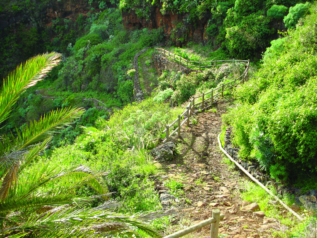
El Bastón Nature Trail is one of the most challenging and at the same time impressive routes on La Palma.
El Bastón Nature Trail is one of the most impressive and demanding routes on La Palma, a route that combines the Volcanoes Route and the Crest Route, offering an unforgettable experience for nature and hiking lovers.
This trail, officially known as GR-131, stretches from Puerto de Tazacorte to the Faro de Fuencaliente lighthouse, passing through some of the island's most impressive landscapes, including the Caldera de Taburiente National Park and the Cumbre Vieja Natural Park.
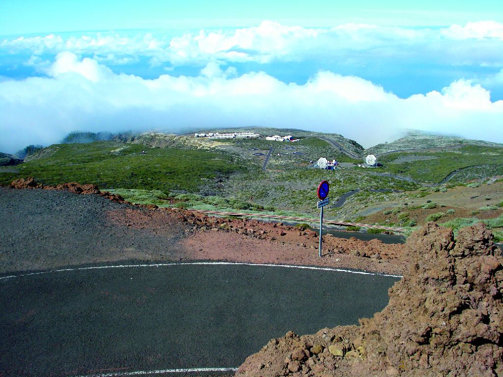
The adventure begins in Puerto de Tazacorte, where the path ascends from sea level to the highest point of the island, the Roque de los Muchachos, at an altitude of 2,426 metres. From there, the trail follows the edge of the Caldera, offering panoramic views of the Aridane Valley and Santa Cruz de La Palma, before descending towards the El Pilar Refuge. On this stretch, it crosses a variety of ecosystems, from scrubland and pine forests to the steep ridges of the island, showing the transition between high mountain vegetation and cultivated areas. The trail follows the iconic Ruta de los Volcanes, passing craters with names like Hoyo Negro, Duraznero and Montaña de Fuego. The trail skirts the San Antonio volcano and ends at the Fuencaliente lighthouse, where the landscape changes radically, with coastline, salt flats and beaches, and, weather permitting, views of the neighbouring islands of Tenerife and El Hierro.
Beyond its natural beauty, this route has a profound historical value, as it follows ancient paths used by the island's inhabitants to connect communities. Along the way, you will experience a stunning transition of ecosystems, from coastal areas to arid peaks, offering a unique experience on every stage. It is an epic challenge that reveals the incredible natural and geological diversity of La Palma, and a unique opportunity to connect with the landscape and history of the island.
Highlights
Further information
Island of La Palma
La Palma is one of the seven islands that form the Canary archipelago. It is known as "Isla Bonita" (the beautiful island) both for its spectacular natural landscape, of which laurel and Canary pine forests are a highlight, and for its old colonial style villages and towns.
The early inhabitants of the La Palma called their island “Benahoare" (“My land”), and divided it into 12 cantons or dominions, each of which was ruled by a lord or “mencey”. The aboriginal population lived mostly off grazing (goats, sheep and pigs). Currently, livestock farming is a marginal activity and tourism has become the main economic engine of the island.
The island of La Palma was named a Biosphere Reserve in 2002, since it has two Natural Parks, as well as the National Park Caldera de Taburiente. These natural areas have been exceptionally well preserved thanks to the implementation of an economic model that combines sustainable tourism and traditional agriculture.
National Park of La Caldera de Taburiente
Caldera de Taburiente, with an area of 4,690 ha, was named a National Park on October 6, 1954. It is formed by a huge caldera-shaped cirque with a diameter of 8 km created by volcanic eruptions, massive landslides and the erosive action of wind and, specially, water.
The Caldera has elevation changes of up to 2,000 m, as well as an important network of brooks and streams that remains practically unspoiled thanks to the good preservation of the vegetation cover.
Among the many plant species this area is home to, the most important ones can be found in laurel forests: Canary Island fire tree (Myrica faya), tree heath (Erica arborea), and Canary Island pine (Pinus canariensis), main plant formation in the Park, and remarkable for its adaptation to fires.
Multimedia


2_141039.jpg)

Downloads

GPS Downloads


