Net of Natural
Trails

Stage 23: Gallur - Alagón
Description
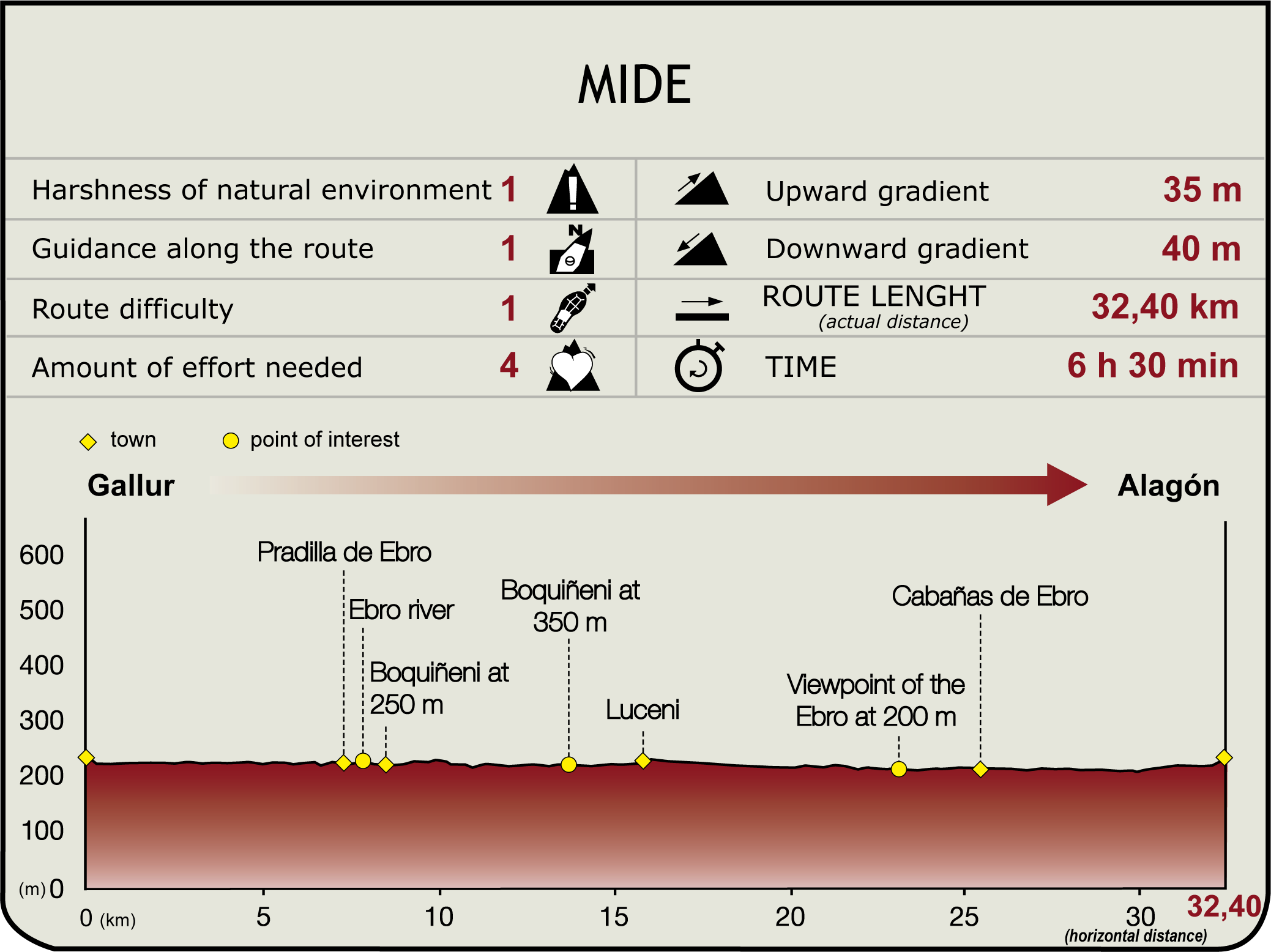
The route starts at Gallur's Hierro Bridge (235 m) and ventures east surrounded by crops. Past La Vega, and skirting around Troco Ravine, the trail follows the bend of a meander in the Ebro. Further on appears the silhouette of Pradilla de Ebro and the church of Nuestra Señora del Rosario with its slightly inclined Moorish tower (7.2 km, 1hr 30 min).
Leaving the town behind, the road continues east to the bridge on the right bank that connects Soto Island and the town of Boquiñeni. The ferry crossing of Virgen del Rosario, used by the residents of Pradilla to cross over to Boquiñeni, may be visited first. From the bridge, the trail continues along the Ebro River, leaving the village behind at 250 m. This town boasts the parish church of Virgen de la Asunción and its "dance" in honour of the Santo Cristo de las Capillas (May 25).

Once out of the urban area, the Ebro Nature Trail continues along the levee, past the boat used by Boquiñeni’s residents to cross over to the left bank and tend their orchards.
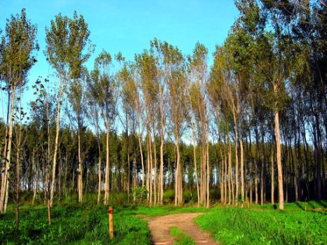
The road runs parallel to the Ebro, heading towards Boquiñeni's groves, along three kilometres of lush green banks strewn with gravel beaches. It immediately turns right, disregarding an abrupt road, and ventures into Boquiñeni's lands. The trail traverses through poplar groves and orchards towards the eastern edge of the town, past a feed mill.
It then ventures into the Tejar reed beds, an abandoned channel of the Ebro. Further on, atop a small hill to the left, lie the remains of the Muslim site of El Calvario, from where Luceni is but a short stroll away (16 km, 3hr 15 min). The village boasts the church of Purificación de Nuestra Señora, the former palace of the Counts of Fuenclara (current town hall), as well as its "dance", which is performed on San Pedro Martir's feast day (April 29).

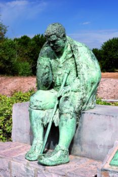
The route heads east, along a poplar-lined sheep road that leads to a levee. From here, it continues towards a wide branch of the river, separated from the main course by a leafy grove, which literary experts consider as the island of Barataria in Don Quixote. A levee protecting the town from river avenues gives access to Alcalá de Ebro. The route reaches the monument to Sancho Panza, in his role as "governor" of the island of Barataria.
The trail continues north along the levee to Cabañas de Ebro. It then turns east, venturing into a poplar grove surrounded by crop fields, and heads south along the road to Matillas. Immediately after, the path reaches the Ebro viewpoint (23.2 km, 4hr 40 min), with excellent views of the islands, river branches, riparian vegetation, and the groves of Matillas and Pulliguera. Only 2.2 km further on, the route reaches Cabañas de Ebro (219 m), a low-lying town protected from flooding by a levee. It is home to the church of San Ildefonso and the remains of a Roman river port. It is also the birthplace of Casta Álvarez, a heroine of the Siege of Saragossa.

From Cabañas, the road continues southeast onto a track along the riverbank. The trail winds between orchards until it crosses a tunnel under the A-126. The GR 99 continues east until it reaches the Alagón irrigation ditch, where it turns south towards the AP-68, which it crosses via an overhead bridge.
Once on the opposite side, it continues along the railway to the east, crossing the railway bridge to enter Alagón (230 m, 32.1 km, 6hr 30 min) of Iberian Alaun origin. The town is home to the church of San Juan Bautista, the shrine of Nuestra Señora del Castillo, and the Gothic-Mudejar church of San Pedro and its octagonal tower.
Sites of interest
Puntos de interés
Culture
Information
Infrastructure
Municipality
Profile

Highlights
Further information
Cervantes and the Ebro
Aragón is the setting for Part II, Chapters XXV – LX of Don Quixote. Cervantes situated the funniest and most far-fetched episodes in the Ebro. From the 18th century to date, Alcalá de Ebro has been regarded as the island of Barataria, and its ducal palace is considered the house of the Villahermosas in Pedrola. This hypothesis is based on the fact that the Dukes of Villahermosa hosted Cervantes in 1569. He used his knowledge of Alcalá and nearby towns to depict them in his work.
Flooding of the Ebro
Owing to its location along the banks of the Ebro, these towns suffer periodic flooding. Two floods were especially devastating. In 1961, 90% of the orchards were flooded when the river reached a width of 2.5 km. In February 2003, a huge flood caused major damage to 37 towns in the province of Saragossa and its capital. In March and April 2007, the river yet again burst its banks with incredible force. A monument to the floods stands in Pradilla, next to the Ebro, in reminder of the importance and dangers posed by the river to the towns in this corner of the valley.


