Net of Natural
Trails

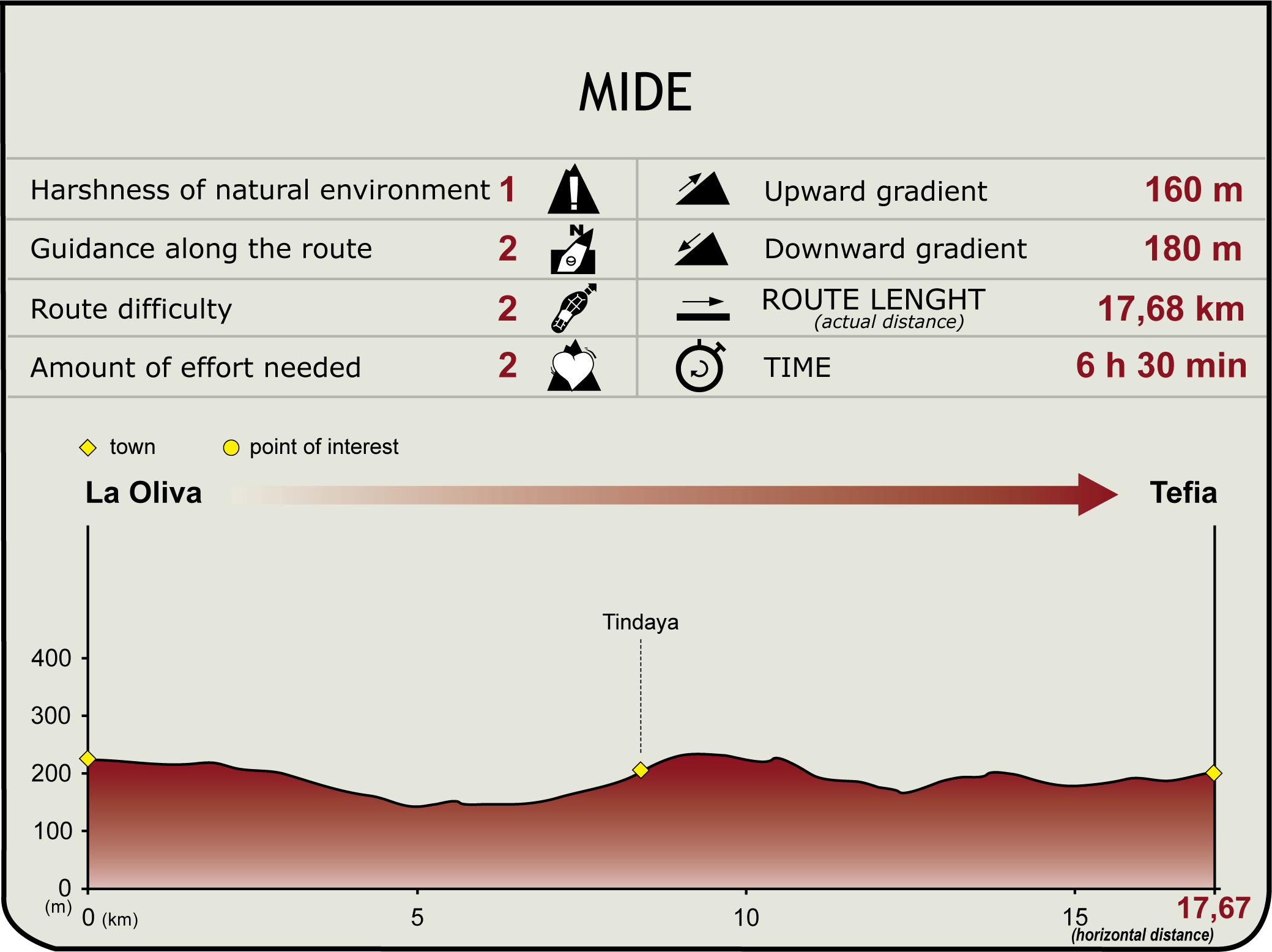
Stage 3: La Oliva - Tefía
Description
At the Foot of the Sacred Mountain
This stage of the trail leads to the iconic and legendary Montaña de Tindaya, a mountain sacred to the natives of the island whose vision accompanies travelers for most of the road. After passing through the town of Tifandaya, the Nature Trail reaches Montaña Quemada (Burnt Mountain) and goes through the beautiful plains of Tablero Blanco and Tablero de las Avutardas, to conclude in the chapel of San Agustín de Tefía.

The stage begins in La Oliva, seat of the administrative and political power of the island in the eighteenth century, following the decline of Betancuria, the historic capital of the island. The first leg of this section heads west, through the Lomo de la Virgen, until we reach Montaña de Tindaya (Tindaya Mountain), which we will see during this entire part of the road, until we reach the village that bears its name.
Starting from the church of Nuestra Señora de la Candelaria in La Oliva, we head out to La Orilla Street, and, following the directional signs of the trail, we turn left down Las Tuneras street. Then we turn right down Capellán de la Rosa Blanca Street, until we reach an open space where the road, which becomes now a dirt track, turns westward allowing us to glimpse Tindaya Mountain in the distance.
Continuing along the dirt track that goes through the plain, we leave behind us, on the right, La Oliva Mountain, after which we find an information panel which displays information on the mountain range that looms on the horizon (Tindaya, La Muda, Montaña Quemada).

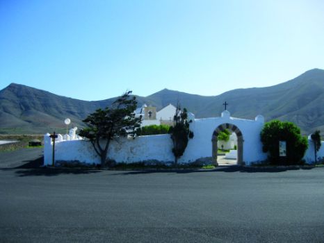
Before reaching the town of Tindaya, we shall skirt the western side of Tindaya Mountain, at whose foot we see a path that leads up the mountain. Once in Tindaya, about 50 m before reaching the shrine of Nuestra Señora de la Caridad, located next to the main road, the path takes a right turn at a junction that will allow us, if we choose to do so, to take a straight path, PR FV 9, leading to Vallebrón, which later on reconnects with the main path.
In the vicinity of Tindaya we can see groups of palm trees (Phoenix canariensis) and Canary Island tamarisks (Tamarix canariensis), as well as plantations of agave (Agave americana) and prickly pear (Opuntia spp.). The prickly pear is a species introduced into the island for the breeding of cochineal carmine (Dactylopius coccus), a parasitic insect used in the production of dyes. Further on, in Montaña Quemada, we can see communities of sweet spurge (Euphorbia balsamifera) and wild spurge (Euphorbia regis-jubae).

The animal species most representative of this environment are birds such as the Houbara Bustard of Fuerteventura (Chlamydotis undulata fuertaventurae), the Thick-knee (Burhinus oedicnemus), the Cream-colored Courser (Cursorius cursor), or the Lesser Short-toed Lark (Calandrella rufescens). At this section of the trail, the path borders several SPAs (Special Protections Areas for Birds) created for the preservation of these species.
In accordance with the indications on the signs, we leave Tindaya and continue our way to Montaña Quemada through the badlands of Malpaís del Sobaco, formed out of materials originated in an eruption of this volcano/mountain.
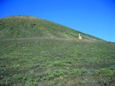
In Montaña Quemada we reach a crossroads that offer us the opportunity to follow a detour toward a statue erected in 1980 in honor of Don Miguel de Unamuno, who was exiled to the island in 1924. The white color of this monument, designed to be seen from a distance, stands out from the base of the mountain on which it has been constructed.

Once this point has been reached, the path turns south, past Montaña Quemada, and goes on to Punta del Sobaco through the plains of Tablero Blanco, until we reach a junction with the road leading up to Tefía. We move forward toward the ravine of Risco and, once past Rincón del Cercado, where we can see crop lands, we reach the point where the main path connects again with the small distance path PR FV 9 Tindaya-Tefía, which comes from the protected landscape of Vallebrón.
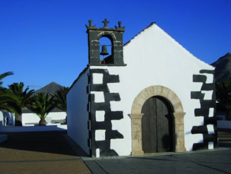
The last leg of the trail continues through Tablero de Las Avutardas, another plain of outstanding beauty which we will leave behind us on the west while we turn left – near a plant nursery - in order to follow our way toward the shrine of San Agustín de Tefía, end of this section of the trail. In front of the shrine, we can see the cultural center of Tefía, as well as several information panels about sections 3 (La Oliva-Tefía) and 4 (Tefía-Betancuria) of the Nature Trail. In the village of Tefía, we can see an iconic monument: Molina de Tefía, a mill whose architectural characteristics differentiate it from older mills.
Puntos de interés
Culture
- Iglesia Nuestra Señora de la Candelaria
- Plaza de la Iglesia Nuestra Señora de la Candelaria
- Ermita de San Agustín
Municipality
Orography
Profile

(Calculated according to the MIDE criteria for an average excursionist with a light load)
Highlights
Further information
Tindaya Mountain
Tindaya Mountain - which has been listed a natural monument within the framework of the Canary Islands Network of Protected Areas and Assets of Cultural Interest (Monumento Natural de la Red Canaria de Espacios Protegidos y Bien de Interés Cultural) - stands isolated on the plain of Llano de Esquinzo, a few miles from the ocean, in the northwest of Fuerteventura. Having its origins in the basal complex of the Betancuria massif, the elevation of the mountain (400.5 m) is such that it enables it to capture the drops of humidity brought by the trade winds when they blow down in the summer months, so that the resulting water is stored in the fissures of rocks and moves downhill to the foot of the mountain through three small springs.
Tindaya is more than just a mountain highlighted by the beauty of its profile; it is also a feature of the myths of Fuerteventura from the beginning of its cultural history. It was a sacred mountain to the natives of the island, the “Majos”, who inscribed on the rocks that crown the mountain over three hundred silhouettes of human feet called podomorfos (podomorphs). The historical and archeological interest of this place is also underlined by the discovery of several burial mounds.
This peg (remains of an eroded volcano) was a subject of controversy in the mid-90s, when famous sculptor Eduardo Chillida presented a project to drill into the inner part of the mountain in order to create, in the words of the artist, “an inner space that could be offered to men of all races and colors”.


