Net of Natural
Trails

PR FV 15.1: Tefía - Valle de Tetir - Tetir
Description
A Path with a View
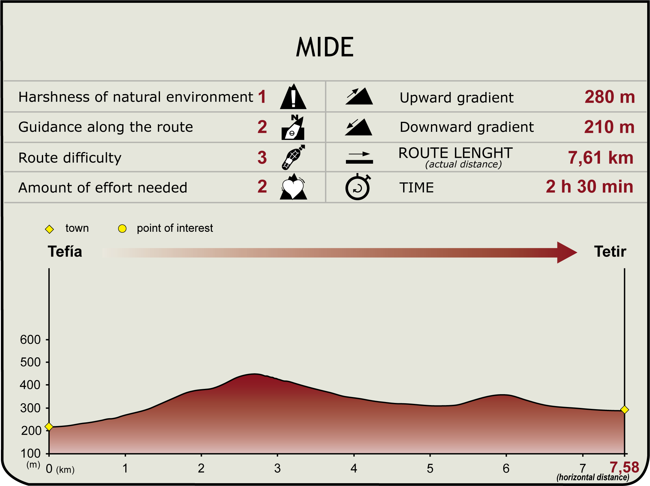
The short-distance trail PR FV 15.1 starts at the shrine of San Agustín de Tefía, goes up to Degollada de Facay and then descends through the Tetir Valley to La Solana, where it connects with PR FV 15 until it reaches the village of Tetir, boasting magnificent views all along the way.

Trail PR FV 15.1 begins on the left side of the shrine of San Agustín de Tefía, which is also the starting point of section 4 of the main trail; it then goes along a dirt track which offers spectacular views of the small village of Tefía and its surroundings.
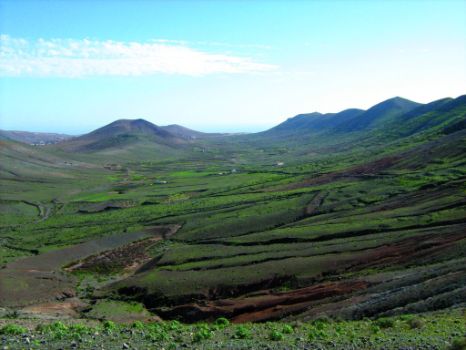
Later, the trail ascends gently to Degollada de Facay, from where we can see a magnificent perspective of Tefía, on the foothills of Montaña de Facay to the west, and of the Tetir Valley to the east. From this location, the path descends gently through the Tetir Valley, where we can see the shapes created by the traditional cultivation systems prevailing on the island of Fuerteventura (gavias or ditches, nateros or stone dams and cadenas or chains), until we reach a region called La Solana, where the path joins with trail PR FV 15, which comes from Casillas del Angel, until we arrive at the village of Tetir, where both trails come to an end.
Puntos de interés
Culture
Information
Municipality
Orography
Profile

(Calculated according to the MIDE criteria for an average excursionist with a light load)
Highlights
Further information
Traditional Crops
Fuerteventura has a strong tradition of agricultural activities, focusing on different cultivation techniques to take maximum advantage of the scarce rains that fall on the island, thus creating new soil for cultivation in places where no crops would ordinarily survive. Most characteristic among these techniques are the nateros, gavias and cadenas or chains. The nateros technique consists in closing up the bed of a small ravine by means of dry stone walls that serve as barriers to obstruct the passage of rain water and the sediments and nutrients dragged by it. These sediments are deposited on the soil creating fertile lands. Once a terrace is built using the dirt trapped in the barriers, it is conditioned to make it suitable for farming.
Gavias are parcels of land usually terraced and enclosed by dirt walls or “trastones” through which the rain water is drained in such a way that it floods one terrace after the other. Gavias, unlike nateros and cadenas, may be situated in plain areas, since the water rain is channeled by artificial means until it reaches each terrace. Once all plots are flooded, the water is filtered by the soil, ensuring that its quality is ideal for farming.
The cadenas or chains are a variant of nateros and, unlike them, they are situated in the middle of the slopes of the foothills, which means that they have different sizes. They are constructions consisting of dry stone walls that act as barriers to obstruct the passage of sediments dragged by water erosion; these sediments, over the years, create crop areas. Since the cadenas are not as deep as the crags where the nateros are built, they cannot have the same load volume. These structures play an important role in the fight against desertification of the island, since they retain the soil that is often dragged by the water into the sea.


