Net of Natural
Trails

Stage 42: Amposta - Riumar
Description
Through the Ebro Delta, towards the Mediterranean Sea
The Ebro Nature Trail ends at this stage, which is a long, flat route through the Delta Natural Park and the large rice fields created in the new floodplains. After Amposta, follow the canal on the left to cross the various neighbourhoods of Deltebre. Hugging the bank of the Ebro, it skirts the town’s new fishing port and climbs to the small Muntell de les Verges viewpoint, from where you can access the Garxal lighthouse, the official mouth of the Ebro. After going around the Garxal lagoon, now within the Natural Park, you will reach the finishing line of the Ebro Nature Trail, on the seafront promenade of the Riumar residential area.
You have travelled many kilometres to reach this last stage of the Ebro Nature Trail. This final section runs through the delta, a sedimentary formation formed by the deposits carried by the Ebro itself at its mouth. An accessible, almost flat route, passing through riverside woodland and rice fields, while enjoying the unique surroundings of the Ebro Delta Natural Park.

There is no better way to begin this stage than by crossing the magnificent suspension bridge (Pont Penjant) over the Ebro, which leads into Amposta. Then turn left, to not lose sight of the river. To do this you will have to cross some streets if you are on a bicycle, or simply go down some stairs leading from the bridge if on foot.
Once you are beside the Amposta jetty, follow a green cycle path that leads to a car park, where you will find some information panels that invite you to take a closer look at the riverside vegetation, which is currently being restored. The path remains straight and flat as it continues parallel to the river. It is unmistakable as it is flanked by a wooden balustrade, which clearly marks the route.
Along this stretch of the path, you will see black and white poplars, characteristic riverside vegetation, while in the distance the first rice fields and some orchards begin to appear, before you reach the Amposta water treatment plant. After passing the complex, a little further on, the path crosses another recreational area with a car park and several information panels, where you can relax before resuming your journey.

Several kilometres further on, the path runs alongside the river and the island of Sapinya emerges in the Ebro riverbed. At the end of the island, the wooden balustrade ends and a short section of shared path begins. It is advisable to pay attention, since hikers share the path with cars and agricultural machinery, so no caution is too much.
Soon, however, the wooden fences and the oleander and black poplar plantations return, accompanied by another sign explaining the area and the restoration of the riverside woodland that is being carried out. This is a time to enjoy the scenery and an opportunity the trail offers to take a break in any of the many rest areas, with views of the river and good shade, which are available to the user. Similarly, you will cross some wooden walkways over the rice field irrigation ditches, which drain into the river.
Over this stretch, you will see another island in the river, which is notable for its larger size (the island of Gràcia). Shortly after that, you will reach a recreational area, which is also larger than the previous ones, and which has a small jetty right next to Balada, a little village on the banks of the river. The route continues to the Sant Jaume d’Enveja jetty, almost under the Lo Passador bridge, the point where stage 42.2 begins.
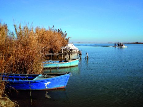
After crossing the bridge, and again next to the river, you can continue upstream and join stage 42.1. The main path continues along a paved stretch with lampposts, and you can optionally stop at one of the beach bars to recharge your batteries or simply stop and gaze out at the river. A peculiar sight is offered when passing by the jetty, from where the boats that travel along the mouth of the river depart.

At this point you will leave the riverbank, which has accompanied the route for so many kilometres, and arrive at the l’Esquerra canal, which can be reached by going around a roundabout. The road is now dirt and narrow, and flanked by numerous palm trees. The route continues along the edge of a road, and is signposted, with the handrails covered with wood. Continuing along the route between the canal and the road, you may pass by the occasional hut, a very characteristic building in the area that has been immortalised in some Spanish novels, until, after a few kilometres, you reach the Pont dels Moros. Ahead there is a roundabout with a passage for this path, which changes its position to the right of the road, while continuing towards Riumar and the island of Buda.
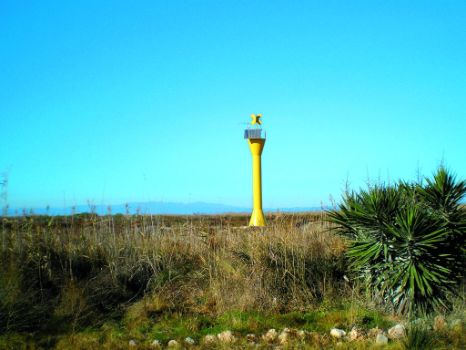
Between rice fields, you will reach another roundabout, where you simply follow the well-signposted road, which gradually approaches the river bank again, through a tourist area. Once again beside the Ebro riverbed, next to the paved road, the path goes around the small port of Deltebre until it arrives at a green cycle lane, which is signposted with panels next to the campsite, as far as a roundabout on the path itself. It may be said that this is the end of the River Ebro, virtually by the sea and facing the Garxal lighthouse and the Ziggurat viewpoint.
The stage will soon be over, upon reaching the Riumar residential area. To do so, simply take the interpretation trail that turns to the left, going around the lighthouse, and running along the edge of El Garxal. In this area there are several points from which you can observe the lagoon’s fauna, and a warning is given that this last section may be impassable when it is flooded. This stage and the Ebro Nature Trail end at the town’s seafront promenade.
Sites of interest
Puntos de interés
Hydrography
Information
Infrastructure
Municipality
Hostel
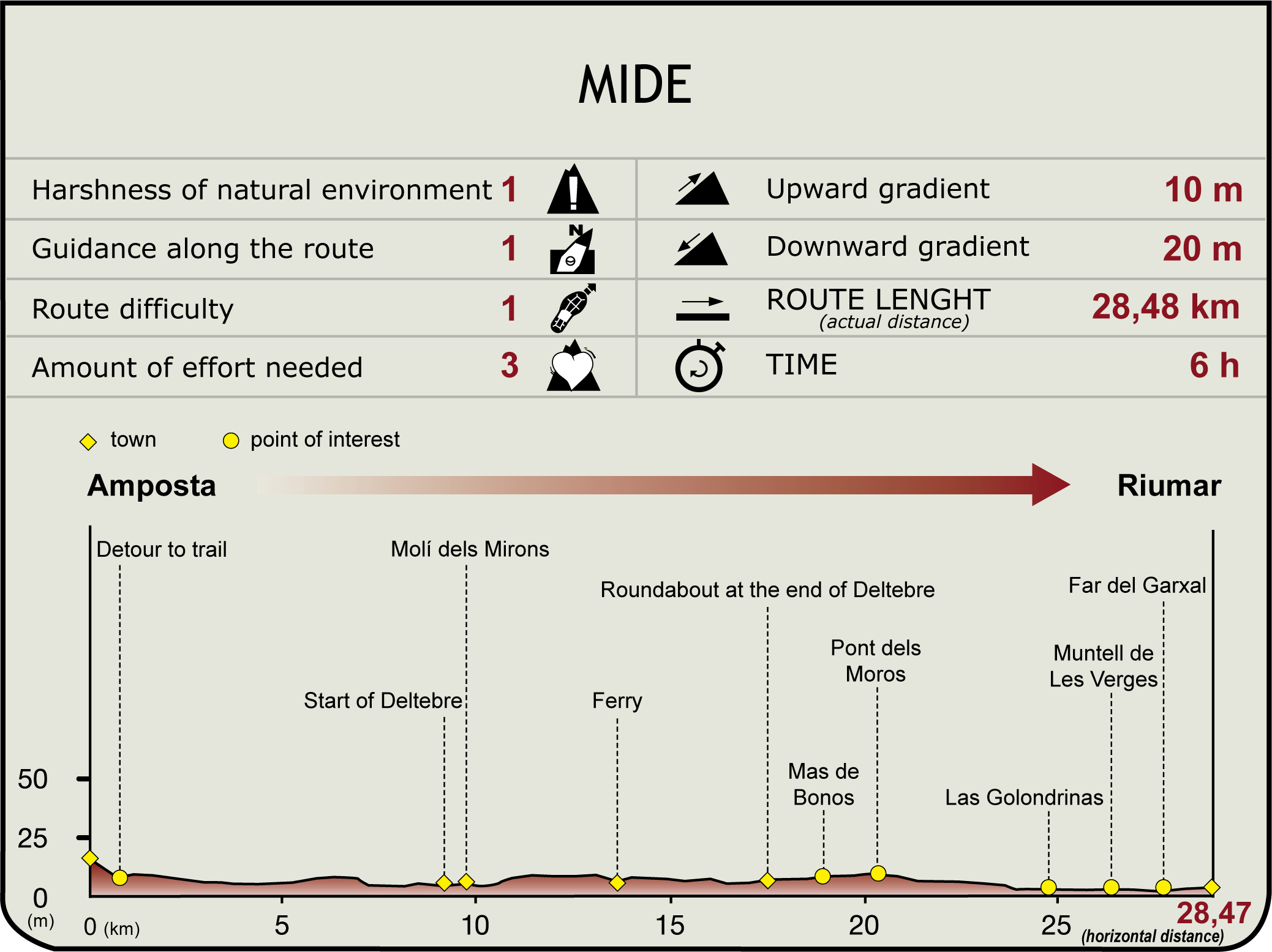
Profile

(Calculated according to the MIDE criteria for an average excursionist with a light load)
Highlights
Further information
The Garxal Lagoon
The Garxal lagoon is a 212-ha wetland which is shallow and highly dynamic, since it is in the process of formation. It is protected within the Delta de l’Ebre Natural Park and is also a Wildlife Refuge. It consists of small crescent-shaped islands that change their morphology depending on the Ebro’s inflow, since the lagoon is not directly connected to the sea. It is also surrounded by a system of dunes partially fixed by taray, which is a nesting area for kingfishers and terns, among other bird species, and a shelter for many other migratory waders.


