Net of Natural
Trails

Stage 26: Zaragoza - El Burgo de Ebro
Description
- - - - - - - -
IMPORTANT WARNING!
DUE TO RIVER EROSION IN THE RIVERBANKS, SOME SECTIONS OF THIS STAGE MAY BE IN POOR CONDITION OR CLOSED.
IT IS RECOMMENDED TO PLAN ALTERNATIVE ROUTES AND USE EXTREME CAUTION WHEN TRAVELING THROUGH THIS STAGE.
THANK YOU FOR YOUR UNDERSTANDING.
- - - - - - - -
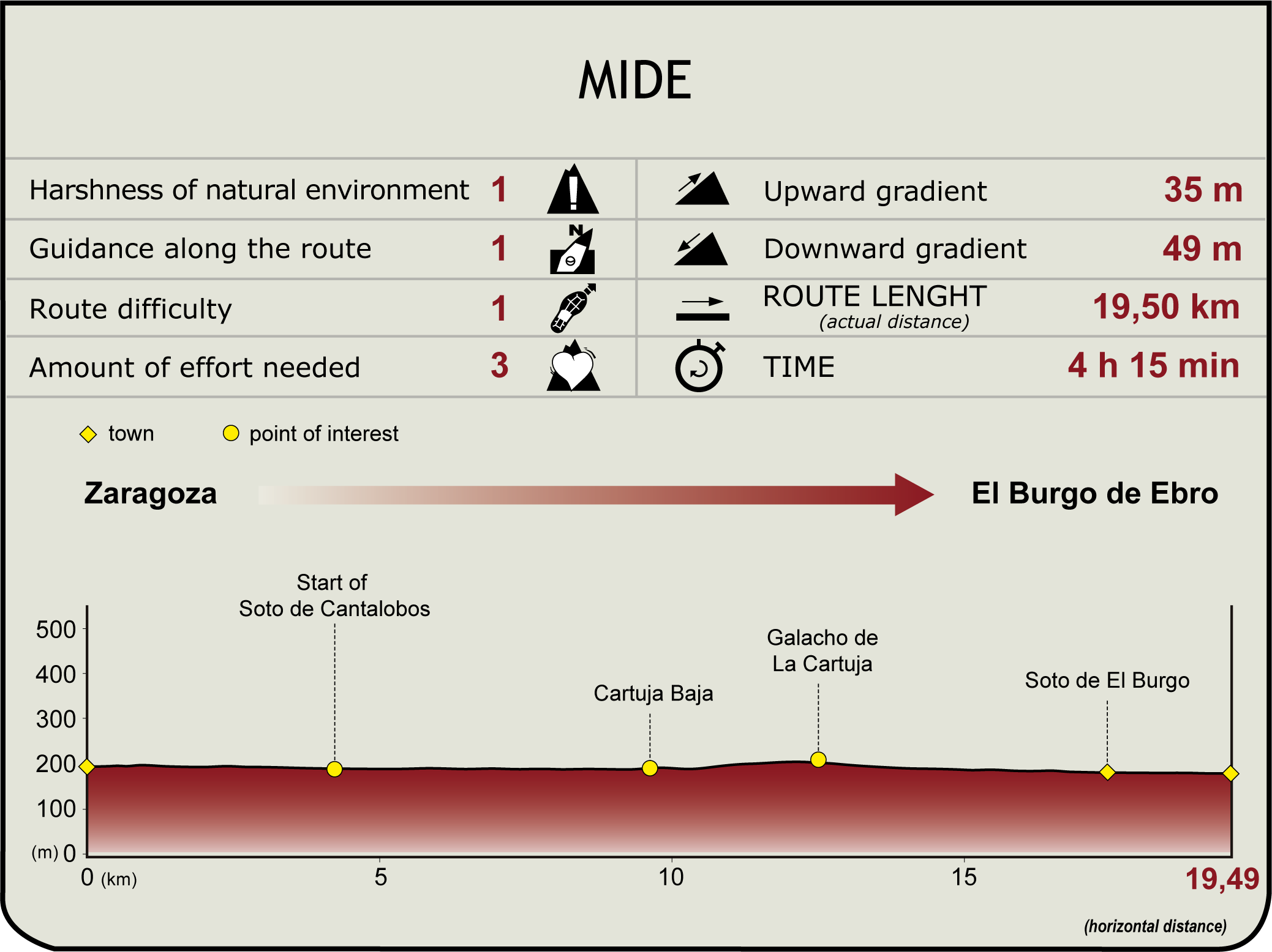
From Piedra Bridge (205 m), the route heads east along the right bank (Echegaray y Caballero promenade), past the Pilar (or Hierro) Bridge. It then ventures left into Unión Park, crosses a footbridge across the estuary of the River Huerva and continues under Unión Bridge, next to the waterwheel, onward towards Giménez Abad and Ferrocarril bridges, where Cantalobos grove and Los Sotos and Galachos del Río Ebro Nature Reserve begins (2 km, 25 min). This is also the starting point of the future greenway. The road skirts around Las Fuentes orchard, where the Ebro carves an arch, with the estuary of the River Gallego on the opposite bank. Leaving the grove behind, the trail ventures onto a dirt track next to a levee, past La Cartuja Baja. The urban area is located 800 m from the offshoot road (8.5 km, 1hr 45 min).

La Cartuja Baja or Miraflores (1651-1767) was a baroque monastery until it was abandoned during the War of Independence and the confiscation undertaken by the Liberal Triennium. Restored during the reign of King Ferdinand VII, it was definitely uninhabited between 1835 and 1836. La Cartuja Baja district was then built over the original layout of the galleries and corridors of the former buildings. Several elements of great value still survive, including the church, inn, porter's lodge, sacristy, refectory, and cloister (current Frisón Orchard).
The route continues east along the levee, overlooking the Cartuja (south) and the river (north). One kilometre from the offshoot road, the trail turns right (endpoint of the future greenway), past a riparian forest, leaving Saragossa's water treatment plant to the left (opposite the Benedicto grove). It continues east, parallel to the Ebro, past several beaches, to arrive at the sedimented meander of La Cartuja (11.7 km, 2hr 25 min), within the Galachos de La Alfranca de Pastriz, La Cartuja y El Burgo de Ebro Nature Reserve.

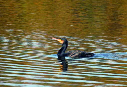
Widespread flooding and river dynamics have created a 775 ha mosaic of impressive landscapes and riparian ecosystems. This sedimented meander is the result of flood events in the 1950s and human action. Its river ecosystem is typical of the middle Ebro: riparian forests comprised of small groves with a large variety of autochthonous species. It is also a major bird sanctuary (listed as SPA), where black-crowned night herons, cormorants, purple herons, little egrets, cattle egrets and ducks can be found.
Past the sedimented meander, the trail winds parallel to the A-68 motorway. The route veers left (northeast) and continues along a drover's trail towards El Burgo sedimented meander (15.9 km; 3hr 10 min), near La Mejana. Past Santa Ana Tower, the route diverts again to the left, drifting away from the drover's trail.

Immediately after, there is a pond to the right, surrounded by greenery and a rest area. This track leads to the information panel on El Burgo de Ebro, from where the town is accessed. The town boasts a wide range of services. These days, irrigation agriculture has made way to industrial development (185 m, 19.6 km, 3hr 55 min).
Romans originally settled this area. The 2nd century B.C. military camp of La Cabañeta, which the Moors made their home with the passage of time, is testament to this past. El Burgo de Ebro was a hamlet of Saragossa until it was declared a town after the War of Independence. In its heyday, it boasted a late Gothic parish church of San Pedro, now a modern factory. It is also home to the chapels of San Jorge and Nuestra Señora de Zaragoza.
Sites of interest
Puntos de interés
Hydrography
Information
Municipality
Profile

(Calculated according to the MIDE criteria for an average excursionist with a light load)


