

Net of Nature
Trails

Stage 13: Cala en Turqueta - Cala Galdana
Description
From cove to cove among pine forests and ravines
During this stage, the Camí de Cavalls continues along the southern coast of Menorca, passing through the web of ravines where some of the island's most famous coves are located. During the uphill and downhill 6.5 km that separate En Turqueta Cove from Galdana Cove, the trail passes through the contrasting dry, high areas and the humid environments deep in the ravines,

The southern coast of Menorca is made up of carbonate materials whose origin dates back to 20 million years ago, when the organic marine deposits were formed and later emerged to the surface. This stage, therefore, runs over the enormous limestone platform that makes up the southern sector of the island and across the ravines that cut vertically through it, increasing in depth and width from north to south.
Near the access to the car park and in front of a rest area, there is an information board where a stony path, interspersed with sand and roots, starts. This path goes around En Turqueta Cove and ascends, between evergreen oaks (Quercus ilex) and Aleppo pines (Pinus halepensis), in order to climb out of the ravine in which the cove is wedged.
A few metres from the start, the path turns gently to the left to continue ascending towards the east. For a little over a kilometre the path leads away from the coastline, ascending to 55 m along a stony and rooted section with some sandy spots.

The first change in the in vegetation can be seen here, as it becomes more scattered, as it is characteristic of dry environments. Along the route, the low, thorny bushes known as socarrells can be seen. In addition, the surrounding area is dotted with rosemary (Rosmarinus officinalis), rockrose (Cistus sp.), wild thyme (Thymus mastichina) and green heather (Erica sp.), among which, if you pay attention, you can see rodents, reptiles and sea birds or birds of prey, such as the sea hawk (Pandion haliaetus). The keen eye will also be able to distinguish tree formations made up of Menorcan labiénago (Phillyrea latifolia var. rodriguezii), evergreen oaks and pines.
After the first kilometre and a half, the route changes turns south, beginning the descent of the ravine towards the south-west, where the path to the Macarelleta Cove branches off. In the deepest part of the ravine, sandwiched between the imposing limestone walls, the path is mainly sandy, except for a few scattered rock outcrops. In this sector, a cooler and shadier environment can be appreciated, where the vegetation thickens, and specimens typical of less dry areas such as fig trees (Ficus carica) appear.
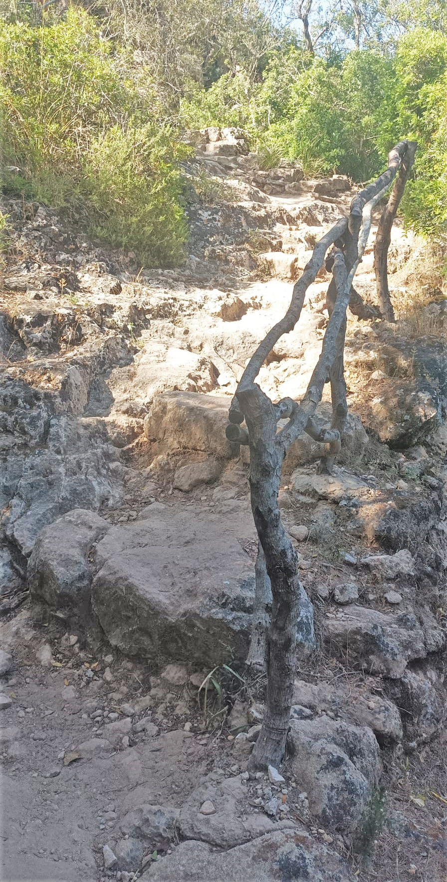
At this point, at the bottom of the ravine, the route changes direction again, this time to the north-west, before going up again towards the ravine that leads to Macarelleta Cove. A few metres away the Camí de Cavalls passes a small canyon, framed between the imposing limestone rock walls and lush vegetation. Once past the gorge, the uneven path continues ascending along some stairs carved into the rock until it joins a forest track, which is somewhat flatter and more homogeneous, and runs along it for a few metres before beginning the descent towards Macarella Cove.

The descent to Macarella Cove is made along the western side of the limestone ravine in which it is embedded, and involves climbing down 48 metres above sea level to reach 2 metres from the coastline. It is a steep path, with a gradient over 20% at some points, dotted by rocky outcrops and roots, not longer than 400 m.
Once you have crossed the Macarella Cove, you will start to climb up the eastern side of the Santa Ana ravine, where the beach is embedded, very similar to the descent along the western wall. Again, this is a short section, barely 600 metres long, which rises to approximately 58 metres above sea level. It is a challenging climb, since the path is steep and dotted with roots, and the gradient can reach and exceed 20% in some areas.
It is worth remembering that Cala Macarella is one of the most visited beaches by tourists arriving in Menorca and that many of them arrive on foot from the nearby Galdana Cove. For this reason, and to make access to it easier, the Ciutadella Town Council has installed wooden stairs next to the Camí de Cavalls path that will undoubtedly will make this route somewhat easier op top of stunning.

Once you have finished the climb up, the stage covers just over two kilometres over the limestone platform along a path that descends gradually to Galdana Cove. Although the next stretch is not different from the previous ones, it is quite busy, as it crosses a wooded area of pines, evergreen oaks and wild olive trees, with roots and rocks cutting above the surface of the already quite uneven path, which and makes it difficult for less experienced hikers. In any case, your efforts are rewarded with a panoramic view over Galdana Cove as the stage nears its end. Accessing to this small sandy beach is easy; stairs and ramps have been built, and there are several signs and a information board with information about the facilities and the last metres of the stage through the residential complex.
Once in Galdana Cove, the stage runs parallel to the Pasaje del Río until it crosses the first bridge towards the promenade. It continues for a few metres before turning left to climb up one of the ravines to the top of the residential complex. The last stretch of the ascent takes you up some stairs sheltered by pine trees that lead to Avenida de Sa Punta, along which the stage continues for about 300 m before turning left again onto the Camí de Cavalls carrier, where the end of the stage is located.
Links of interest
Profile

 Harshness of natural environment
- 1. The environment is not risk-free
- 2. There are more than one risk factors
- 3. There are various risk factors
- 4. There are quite a lot of risk factors
- 5. There are many risk factors
 Guidance along the route
- 1. Well defined trails and crossings
- 2. There is a clearly marked trail and signage
- 3. Requires the identification of geographic features and cardinal points
- 4. Requires off-path navigation
- 5. The trail is interrupted by obstacles that have to be gone around
 Route difficulty
- 1. Walking on a flat surface
- 2. Trails with different types of path
- 3. Walking on stepped paths or irregular terrain
- 4. The use of hands or jumping over the terrain is necessary
- 5. The use of hands is required to progress
 Amount of effort needed
- 1. Up to 1 hour of continuous walking
- 2. Between 1 and 3 hours of continuous walking
- 3. Between 3 and 6 hours of continuous walking
- 4. Between 6 and 10 hours of actual walking
- 5. More than 10 hours of continuous walking
(Calculated according to the MIDE criteria for an average excursionist with a light load)
Highlights
Macarella Cove and Macarelleta Cove
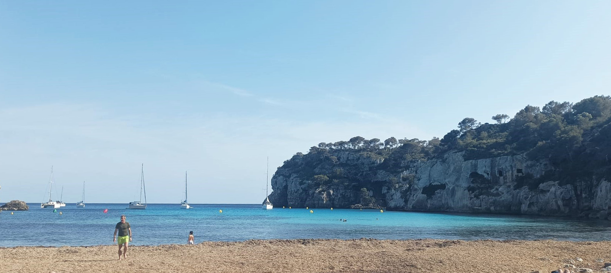
Macarella Cove and Macarelleta Cove are located in the southern part of Menorca, in the municipality of Ciutadella de Menorca. These are two of the most popular beaches in this part of the island, given the specificity of the environment that surrounds them.
Both beaches are unspoilt, and both are notable for their azure waters and shallow depths. The sea makes an inlet through the opening that the erosion of the sea and the freshwater torrent of the Santa Ana ravine have carved over millions of years. The two beaches are nestled between whitish limestone rock walls, covered with pine trees and with ancient caves.
Although they are somewhat similar, Macarella Cove is larger and has a small sandy area associated with the humid area of the mouth of the ravine and the remains of Neptune’s grass, which helps to fix the sand.
The Macarella and Macarelleta Coves are considered to be mother and daughter or big sister and little sister. Macarelleta Cove is located one kilometre to the west and can be reached by following the Camí de Cavalls or along a path that goes around the cliff that separates them. It is small in size and was created also by the action of the water coming down from the Santa Ana ravine.
Galdana Cove
Galdana Cove was for years one of the most popular unspoilt coves on the island. It is a long beach, which undoubtedly favoured the urban development of the area that has given rise to the current residential complex that has taken place at this point. The village is mostly dedicated to tourism has a wide range of services.
It is located between the limestone cliffs at the mouth of the Algendar ravine, one of the most important on the island as it has a permanent water regime and is channelled for use as a port for small boats. The beach is very similar to the rest of the coves located in the south of the island: the sea water penetrates into the mouth surrounded by pine trees, it has a shallow depth and there are hardly any waves at times of storm. This is a very popular holiday destination for families with young children.
Multimedia


Downloads

GPS Downloads


