

Net of Nature
Trails

Stage 12: Cap d'Artrutx – Cala en Turqueta
Description
Going into the blue cliffs of the south coast of Menorca
During this stage, the Camí de Cavalls leaves the west coast and enters the south coast of Menorca from Cap d'Artruxt. The stage runs along the Mediterranean Sea on a mostly rocky and eroded path without much elevation gain. After running for 13 kilometres through the unspoilt surroundings of Menorca's southern coast, made up of cliffs, pine forests, coves and sandy beaches of magnificent colours, the stage reaches its end at the famous En Turqueta Cove.

You will start this stage at the westernmost point of Menorca, specifically on the coastline that leads to the Paseo Marítimo street of the Cap d'Artrutx residential complex, from where, on a clear day, the island of Mallorca can be seen. It runs along the last kilometre of the west coast of the island following the Paseo Marítimo street until it reaches the Artrutx lighthouse. At this point the Camí de Cavalls turns eastwards towards the southern coast of the island.
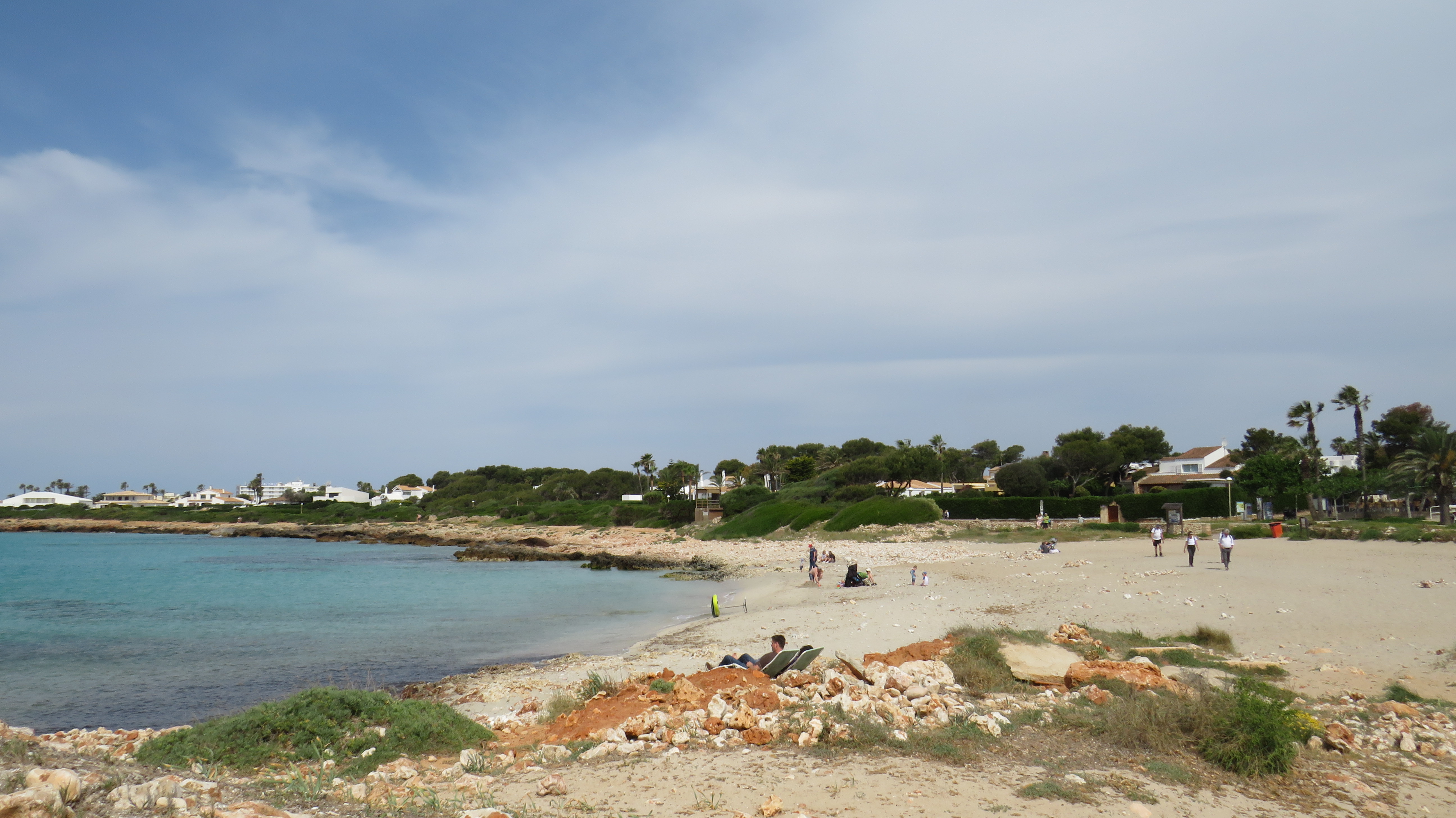
Following the Paseo Marítimo street, the stage runs through the Son Bosch housing estate where, a few metres after crossing the port bridge, it reaches the Cala en Bosch, the first beach in the southern sector. Once you have left this cove behind, the stage continues towards Platja de Son Xoriguer, beginning to show some of the characteristic features of the route, as it continues along a path next to the sea, on a low limestone cliff with hardly any slope, where you will find the first of the many bunkers that were built along the coast during the Spanish Civil War. After walking for 3.8 kilometres and crossing Platja de Son Xoriguer, the Camí de Cavalls leaves the urbanised area and enters the Red Natura 2000 space, where it is advisable to avoid to walk without leaving the signposted path.
The stage advances along an uneven and rocky path over the cliffs of marés (sandstone) or limestone rock, crossing small pebble or sandy coves, or passing over caves and cavities carved by the action of sea and wind. In this stretch, approximately 5.3 kilometres to Son Saura, the slight altitude of the cliffs and the clarity of the sea make it possible to make out the seabed. Weather permitting, we can see rustic limpets (Patella rustica), sea urchins (Paracentrotus lividus), snakelocks anemone (Anemona viridis) and various crabs. As well as small shoals of fish or underwater algae or plant formations such as Neptune´s grass (Posidonia oceanica). Neptune’s grass is washed ashore and that is important to retain the sand.

On the other hand, on the surface, there is hardly any vegetation. The only vegetations are the small thorny shrubs known as socarrells, as well as other species such as sea fennel (Crithmum maritimun), and formations of Menorcan labiénago (Phillyrea latifolia var. rodriguezii), lentisk trees (Pistacia lenticus) and savin junipers (Juniperus sabina). However, once the stage approaches the Platjas de Son Saura del Sur beaches, a slight change of scenery can be seen.
Son Saura del Sur is a spot made up of two beaches, Banyul and Bellavista, separated by a slight elevation of limestone rock and immersed in an extensive pine forest dotted with evergreen oaks and junipers. Both beaches cover an extensive stretch of sand almost a kilometre long, along which the trail runs. In Bellavista, you will walk along a wooden walkway to protect the dune system and the plant communities, composed, among others, from sea holly (Eryngium maritimum) or the European beachgrass (Ammophila areanaria). Furthermore, Bellavista beach is located at the mouth of the Ses Abelles Canal, which means that next to it there is a small wetland which is usually home to water birds.
Past Son Saura del Sur, the stage continues for just over a kilometre along a rocky path between pines and scrubland. It does so by skirting the Punta del Governador cliffs, which rise some 20 metres above the sea, until it reaches Des Talaier Cove, a small sandy cove on a sea inlet with an adapted rest area with tables and chairs at the entrance. From here, the stage covers its last 2.2 kilometres until it reaches En Turqueta Cove. This last stretch of the stage is the steepest. Once it ends, you will return once again to an uneven and stony path ascending over a cliff in which low scrubland is interspersed with the odd pine or wild olive tree(Olea europaea var.sylvestris), which become more lush as the end of the stage approaches.

It is interesting to note that the south coast of Menorca is made of carbonate materials from marine organic deposits that were formed more than 20 million years ago and which subsequently emerged to the surface, creating a progressive slope. This stage of the trail runs over the slope created by these deposits. This slope can be seen in an elevation along the course of the trail, since at the beginning the cliffs are no more than 10 metres high. However, in this last stretch, barely one kilometre from En Turqueta Cove, in front of the Talaia d'Artrutx watchtower, cliffs are up to 40 metres high.
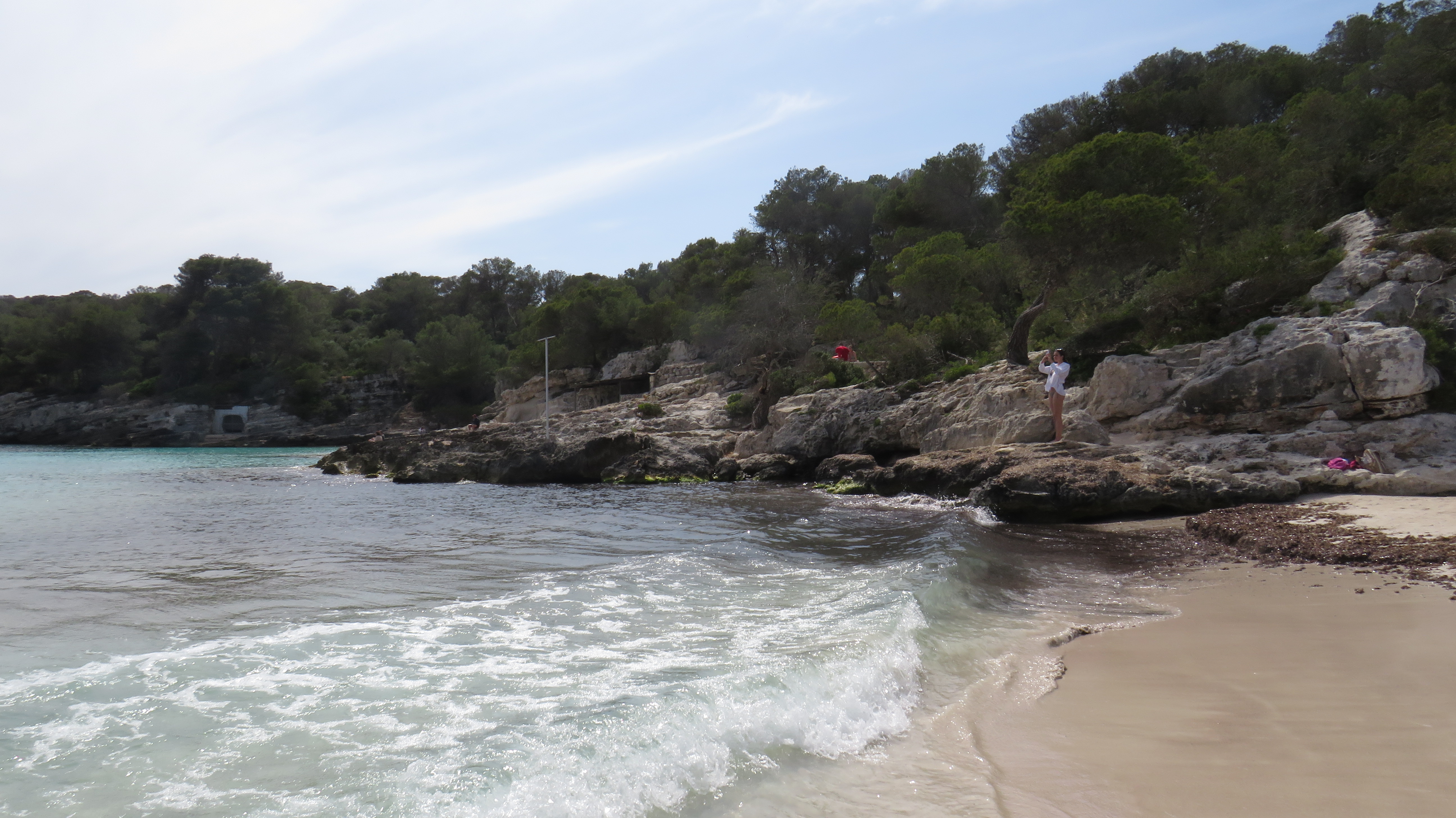
In the last few metres the stage goes down, among pine trees, towards the small gorge where the En Turqueta Cove is located, skirting it slightly access it through the car park, where there is a resting area an the information board that marks the end of the stage.
Links of interest
Puntos de interés
Culture
Infrastructure
Orography
Profile

 Harshness of natural environment
- 1. The environment is not risk-free
- 2. There are more than one risk factors
- 3. There are various risk factors
- 4. There are quite a lot of risk factors
- 5. There are many risk factors
 Guidance along the route
- 1. Well defined trails and crossings
- 2. There is a clearly marked trail and signage
- 3. Requires the identification of geographic features and cardinal points
- 4. Requires off-path navigation
- 5. The trail is interrupted by obstacles that have to be gone around
 Route difficulty
- 1. Walking on a flat surface
- 2. Trails with different types of path
- 3. Walking on stepped paths or irregular terrain
- 4. The use of hands or jumping over the terrain is necessary
- 5. The use of hands is required to progress
 Amount of effort needed
- 1. Up to 1 hour of continuous walking
- 2. Between 1 and 3 hours of continuous walking
- 3. Between 3 and 6 hours of continuous walking
- 4. Between 6 and 10 hours of actual walking
- 5. More than 10 hours of continuous walking
(Calculated according to the MIDE criteria for an average excursionist with a light load)
Highlights
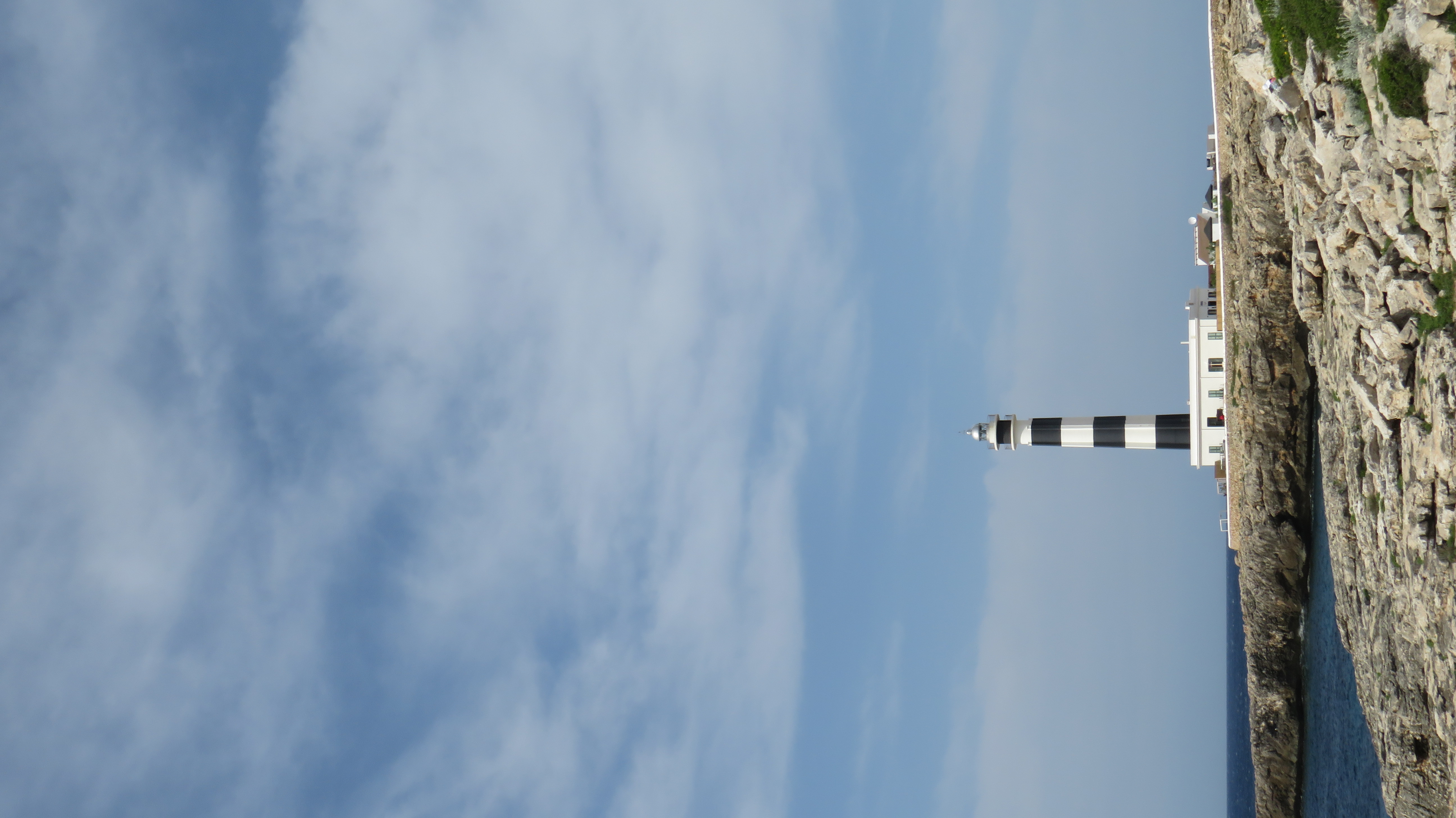
Artrutx Lighthouse
The Artrutx lighthouse is located on the cape of the same name, at the westernmost tip of Menorca, opposite to the Capdepera lighthouse in Mallorca. Together, they mark the so-called Canal de Menorca, that is, the 36-km corridor that separates the two islands.
It is part of the island's catalogue of historical heritage, as it was built in the mid-19th century (1858), with a height of 17 metres. In the 1960s, the height of the tower was doubled and the striking buttresses were added, so that it now has a total height of 45 metres, and the tower itself is 34 metres high.
Initially the lighthouse keepers lived in the lighthouse's solitary installations, and the lighthouse operated by burning first olive oil, then petroleum, until in the 1980s it was automated and tourism development in the area began to increase. This is why the lighthouse keepers' quarters now house a restaurant.
Talaia d'Artrutx watchtower
Between the coves of Es Talaier and Turqueta, the Talaia d'Artrutx watchtower can be seen on top of a hill. This is a circular watchtower, built of stone and covered with lime and sand, that has been in existence since the 13th century, although it was not documented until 1550.
Its appearance has varied long with the historical changes happening in the island. The last modification was carried out by the Spanish army in the 17th century, in order to strengthen the surveillance system against pirates, first, and enemy troops, later. It currently belongs to the Sa Marjal Vella private estate.
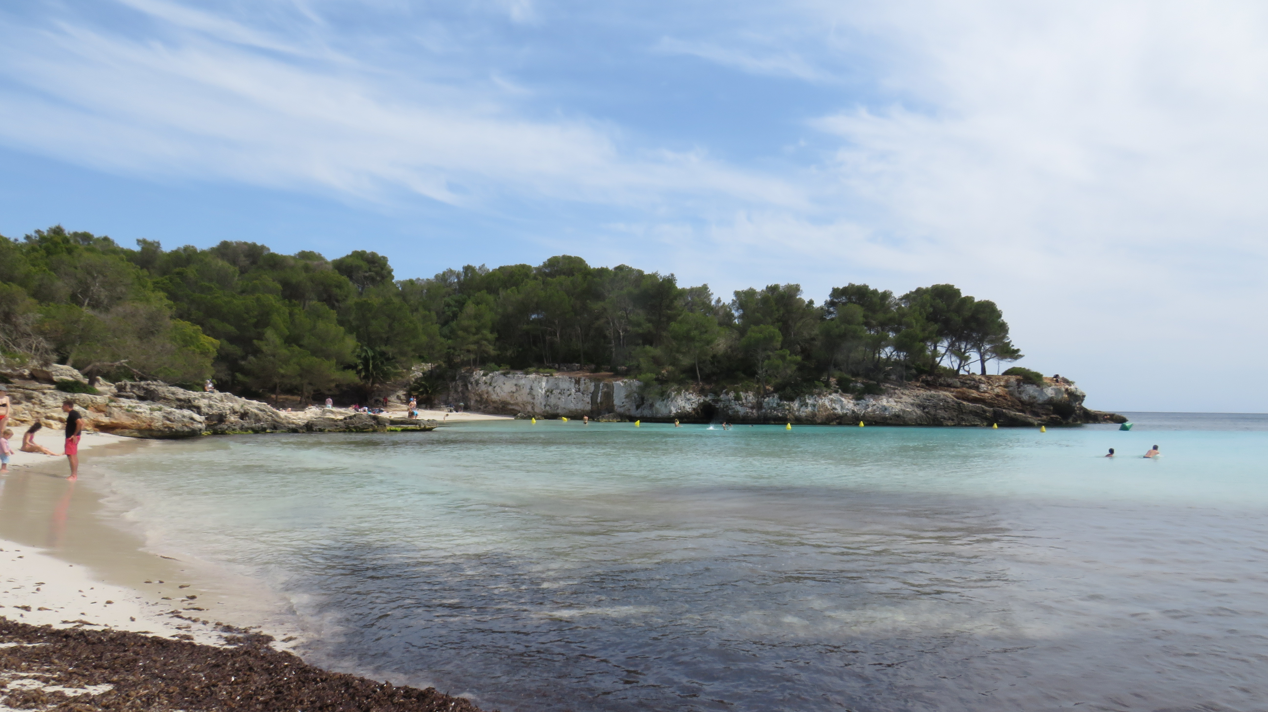
En Turqueta Cove
En Turqueta Cove is located on the south coast of Menorca within the municipal district of Ciutadella de Menorca, and is one of the best known beaches in Menorca. It owes its fame to the beauty of the outstanding environment in which it is located, which is the result of an interesting succession of physical and geological events.
This is the opening that the mouth of a small stream or torrent of water has created through the erosion of the limestone rock, of which the cliffs surrounding the cove are made, and into which the sea has carved a 400 m inlet.
These limestone rocks, which surround the cove, have undergone a process of karstic erosion by the action of the sea, wind and rain throughout the island's geological history, and this erosion has created galleries and caves. Erosion is how the fine white sand of the cove was created, on which the dune system and its vegetation developed. The shallow depth, the clear water, the high levels of oxygen provided by the Neptune’s grass meadows and the fine white sand sparkling under the sun causes the stunning azure water that this cove is famous for.
Multimedia


Downloads

GPS Downloads


