Net of Natural
Trails

Stage 6: Pesquera de Ebro - Manzanedo
Description
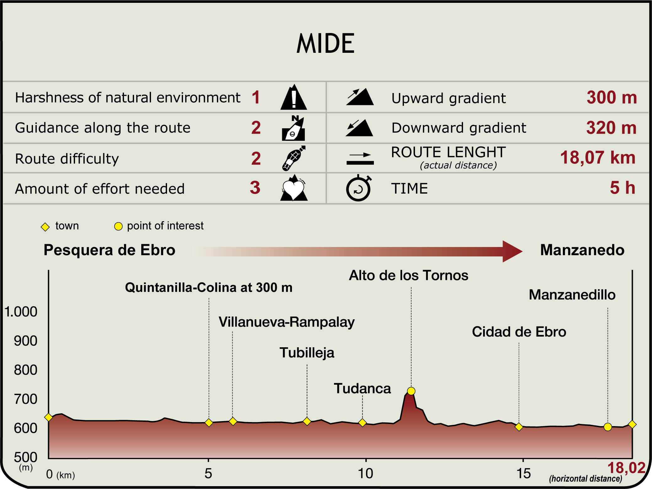
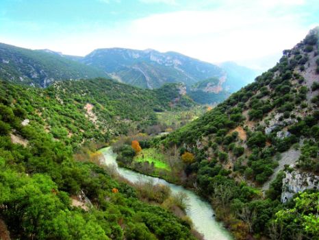
From the shrine of San Antonio (645 m), the route heads along a path to the right of the Ebro, wedged between walled barren fields and holm oaks that line the escarpment. Further on, it descends steadily, with views of Las Calzadas Gorge, and ventures into croplands, leaving behind a black poplar grove, several farmlands and the rhythmic sound of water. The path comes upon a road, but the route continues along the old path by the river. Through oaks and under crags, the Trail turns onto a track to the right that leads to the road through Las Calzadas Gorge (3 km, 1hr).
This road traverses the mountain pass and ventures into Zamanzas Valley, with views of Colina and its Romanesque church. Without entering the town, the track continues through crops and gall oaks towards another road to Quintanilla-Colina. This town has a folk-style church and fine examples of typical mountain valley-style architecture. It also has good views of the surroundings.

The road heads towards a paved track under the new road, which crosses the Villanueva-Rampalay medieval bridge with nine arches. The town is located on the opposite side of the bridge (5.7 km, 1hr 35min), whose houses feature traditional, local architectural elements. It is also home to the parish church of San Miguel, recently restored.
The route takes the road on the right (V-5147) towards Barrio la Cuesta. After about 200 m, it veers right in a new direction parallel to the river. Through dense vegetation, leaving some farmlands behind (with views of Tubilleja and its mountain pass), the path crosses a bridge, usually submerged due to floodwaters.
Tubilleja is accessed via the V-5146. Its sixteenth century parish church and traditional stone houses with solarium-galleries, coats-of-arms and Gothic window are worthy of note.
The road continues towards Tudanca along the road, and soon reaches the place known as Molinos del Canto: a weir and two windmills, one on each bank, form a pocket of high landscape value. The windmill on the left bank is part of a rural tourism centre. The road passes through a small gorge, and near the entrance to Tudanca, joins the GR 85 "Trail of the Senses”.

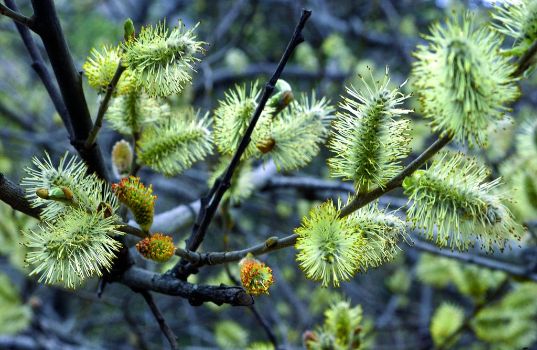
Tudanca (9.8 km, 2hr 40min), is one of the best preserved villages in Burgos with traditional narrow streets and charming folk architecture. Many buildings have constructive elements and decorative motifs that helped to elevate the social standing of its inhabitants: stone blocks, semi-circular arches, mullioned windows and coat-of-arms. Prominent amongst these is the 17th century baroque church of Magdalena. The village is tucked away in a breath-taking natural setting next to the Ebro, with a riparian forest populated by many species, including alders, willows, maples, black and white poplars, lindens, cork and common oaks.
Although, until recently, the village was only accessible by a track, or through the Tudanca mountain range, it can now be reached via a paved road. From the town, the route follows a bridle path along the right bank of the Ebro, through black poplars, past the cemetery, bridge and fountain.
Both the Ebro and the stone-paved path turn to the right, past the limestone cliffs of Tudanca mountain range, where the river has cut a gorge known as Los Tornos. The stone path winds and climbs up to Portillo del Oso (684 m), and then descends to Manzanedo Valley. The descent through kermes oaks leads to a fork, located just ahead of an expanse of croplands. The route heads down the path that leads to the river and reaches Fuente de la Olla, traversing through a breeding ground for protected species.
Hugging the river during 300 m, the path widens under a canopy of alders and leads into a clearing. Further on, it crosses a stream where Fuente de la Rosa can be found. The path reaches Cidad, near the Romanesque shrine of the Virgen Blanca (14.7 km, 4hr 15min).

Cidad de Ebro is home to the church of San Román, stone manors, coats of arms and the ruins of two mills. From its 17th century stone cross, the route climbs down to the medieval pilaster bridge, following the signs of the GR 85. Here starts a path to the right through oak trees and new buildings, moving ahead through orchards and fields. This area, known as La Vega, is a meander formed by the Ebro, carpeted by gall and kermes oaks, crops and black poplars. The path heads down a short stretch along the V-5741 to Manzanedillo, then continues along the riverside to the bridge of the town. This town has a derelict Romanesque church, several robust houses with Gothic windows and an 18th century baroque stone cross.
After crossing a pontoon over the Ebro, a path to the left climbs up to Manzanedo (625 m, 18.3 km, 5hr), with its Romanesque church of Nuestra Señora de la Asunción, and fine examples of traditional folk architecture with balconies, solarium-galleries painted in blue and green, small windows and semi-circular arched façades.
Sites of interest
Puntos de interés
Culture
- Ruinas de la iglesia de San Miguel
- Iglesia de San Román
- Ermita de San Antonio
- Ruinas de la iglesia de San Cipriano
- Ermita de la Virgen Blanca
Infrastructure
Municipality
Orography
Profile


