Net of Natural
Trails

Stage 11.1: Puentalarrá/Larrazubi - Miranda de Ebro
Description
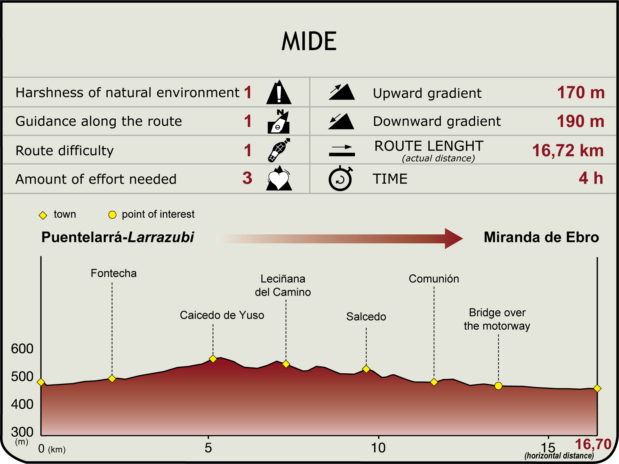
The route starts at the bridge (along the Bordeaux-Astorga Roman road and the Way of St. James) that connects with Section 11. It passes through Puentelarrá/Larrazubi estates (480 m) and approaches the Fontecha holm oak forest (Space of Natural Interest of the Basque Country), perched on a terrace over the River Ebro. The towers of Orgaz and Condestable, and the Romanesque church of Santiago are worth visiting in Fontecha. The Nature Trail crosses Lago Brook, passes next to the church and leaves the town along its fertile plain, parallel to Caicedo Stream, through fields, poplars and oaks. This route overlaps with GR 1 until Salcedo.

The track heads up Malilla Hill to a pasture dotted with oaks, then continues down a bridle path along the brook, through oak forests and past the shrine of San Miguel in ruins, to another track that leads to Caicedo de Yuso/Kaicedo Behekoa (5.1 km, 1hr 25min), with its parish church of Nuestra Señora de la Asunción and a bola-toki (Alava-style bowling).
Nearby is the 9th century necropolis of Magdalena, (a cluster of anthropomorphic tombs) 1.5 km from the town, on the road to Salinas of Añana. Further on along the route is Lake Arreo-Caicedo de Yuso/Caicedo Yusoko Arintzira Space of Natural Interest, one of few natural wetland lakes in the Basque Country, a 136.2 ha saline spring with a stable fish community. Coots, mallards, moorhens, common frogs and migratory birds inhabit its reeds and cattails. Furthermore, the shrine of Nuestra Señora del Lago is evidence of an ancient settlement.
The landscape of Saldo Valley in Salinas de Añana is shaped by its salt pans, platforms on wooden pillars and stone walls, arranged like “farms”, with one or two “terraced” deposits that date back to the Middle Ages.

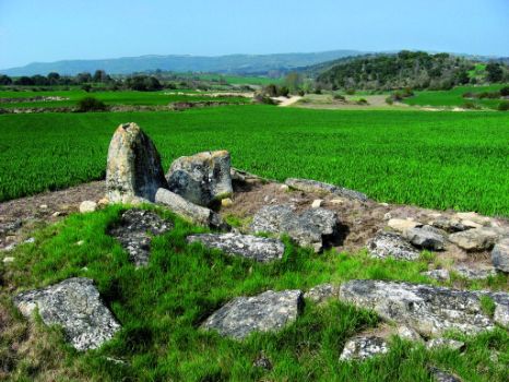
Immediately after leaving Caicedo behind along Real Street, the route meets the A-4323, and turns east onto the first paved track towards a hill that descends to Leciñana del Camino/Leziñana. The hamlet, whose parish church marks the Way of St. James, is located on what used to be the “salt route” from Salinas de Añana to the Ebro, and the old Roman road from Puentelarrá to Carasta. The Mora dolmen, situated on the road to Molinilla, is the other landmark of this town.
The route runs from the south of the town along a path that climbs through fields of crop in counties Mediavilla, San Andrés and Las Paulejas to a small hill overlooking Salcedo/Saratxu. Before starting the climb down, a visit to La Lastra dolmen, situated in a field next to a track that runs perpendicular to the Ebro Nature Trail, is worth the time.
In Salcedo, the church of San Pedro and its necropolis, the San Esteban church and the clock tower are worth a visit. In Roman times, this was a stopover for travellers along the Aquitaine Road towards Cabriana. Several sections of this road can still be seen today.

Comunión/Komunioi may be accessed via A-4321 (11.6 km, 2hr 55min). It has the Romanesque church of San Cornelio and San Cipriano and a bola-toki. The GR 99 begins in the south end, and heads towards Comunion's protected kermes oak grove, as it descends to the banks of the Ebro that leads to Miranda.
Once on A-2122, the route crosses over the motorway A-I/E-05 and continues along a track leading to Cabriana power plant. After about 300 m, the route turns left, through a poplar grove and an orchard, and ventures into Miranda, to the left of the Ebro. Here, at Carlos III Bridge, ends Section 11.1 and begins Section 12.1. To connect with Sections 11 and 12, cross to the opposite of the river (460 m, 16.4 km, 3hr 55min).
Sites of interest
Puntos de interés
Infrastructure
Municipality
Hostel
Profile


