Net of Natural
Trails

Stage 11: Baños de Sobrón- Miranda de Ebro
Description
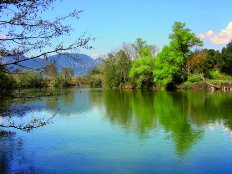
The route begins in the car park at Baños de Sobrón (495 m), crosses the bridge over the Ebro, whence the landscape scarred by the river can be seen. It then continues to the left, past Cueva del Agua (a medicinal spring). The route runs along the right bank of the river, through oaks, walnuts, linden trees, hazels, alders and willows, as well as backwaters and white waters, the natural habitat of otters and European minks. The Fontecha canal, an impressive stonework, leads to Covarana fountain.
- - - - - - - -
IMPORTANT WARNING: DUE TO THE MAINTEINANCE AND IMPROVING WORKS IN THE WALKWAY THAT CROSSES DE RIVER DONWSTREAM THE SOBRÓN DAM, THE WALKWAY IS TEMPORARY CLOSED TO USERS!
- - - - - - - -
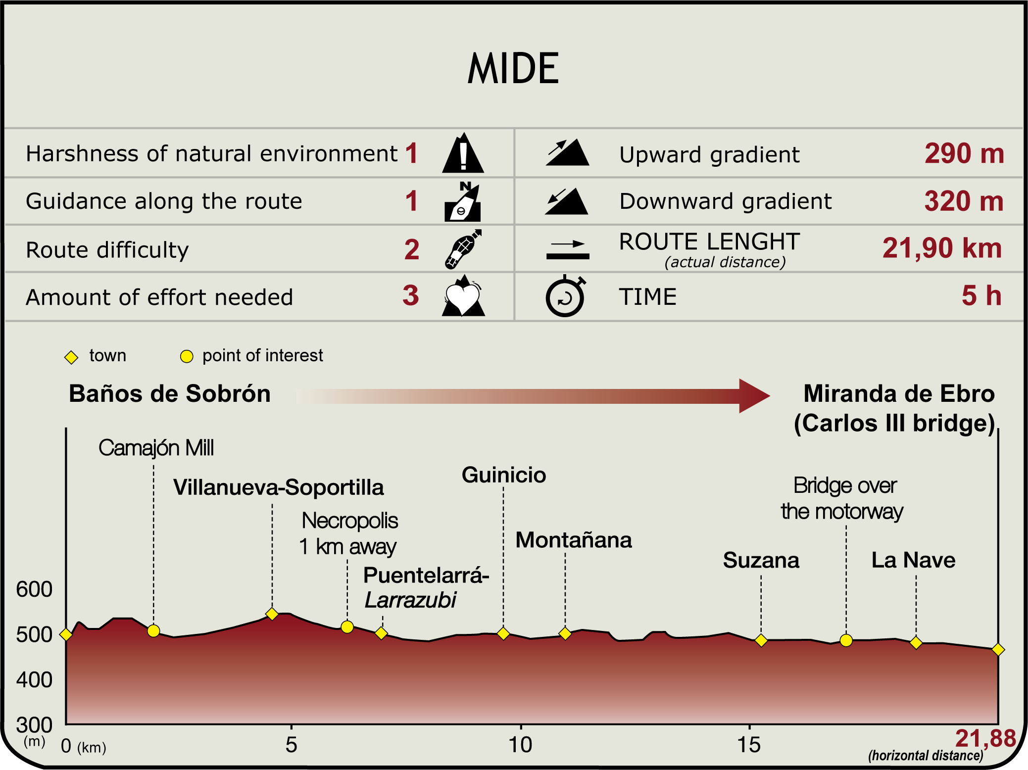
Past the enormous bend in the Ebro, the route arrives at Camajón Mill via the ancient Iberian road, which crosses the last part of Montes Obarenes Nature Reserve, its slopes and rock walls populated with common oaks, cork oaks, beeches, pines and boxwood. The mill uses a weir carved out of the limestone riverbed. The remains of the machinery shed and an ancillary building can still be seen. The road climbs to a plain rich in cereals, then turns onto a southbound paved track that leads to Villanueva-Soportilla, located between the tail of Sobrón Gorge and the edge of the plain towards Miranda de Ebro. The town is home to exceptional folk architecture, a 16th century parish church, and a beautiful cork oak grove.

The Ebro Nature Trail continues northeast to Puentelarrá-Larrazubi along a track that starts to the left. After skirting El Castillo Promontory along the north side, the route arrives at CL-625 that leads into the town. Here it merges with Section 11.1 (7 km, 1hr 55min), leaving behind Montes Obarenes-San Zadornil Nature Park.
The route continues by road, then turns onto a track to the left that runs parallel to the right bank of the Ebro through fields of cereal. It turns again to the left onto a former drovers' road, through kermes and gall oaks, towards Guinicio, home to the parish church of Santa María (16th-18th C.), a centennial pine-fir tree, several manors, and a stone basin.
Leaving the town behind, the route heads east along a paved road that crosses Guinicio Brook over a stone slab. From here, it continues to the right along the edge of the field until it reaches a track with several quarries to the left. The route passes in front of Montañana Cemetery, which may be accessed by a paved road.
The town is home to the parish church of San Andrés (13th-18th C.), a magnificent ash tree, and the artificial lagoons of Yelsos, situated in a bend of the Ebro, which were formed by extraction of gravel (11.1 km, 3hr). The road out of Suzana is located next to the church. Near the last houses, the path veers southeast onto the road to Carrasuzana and reaches the road to Miranda. About 200 m further on, the route turns south to the left. After about one kilometre, it turns again to the left to access Suzana, with sweeping views of the town and El Castillo Hill (519 m).

The town (15.3 km, 4hr) has a church and the 18th century Romanesque abbey of Santa María Magdalena, and a cluster of stone manors. On the southern edge, GR 99 continues along a vehicle track through wheat fields and quarries, crossing the motorway A-I/E-05 over a bridge and a local road. It continues along a path, leaving the motorway to the left, and a gravel pit to the right, and heads to La Nave, home to the church of San Antón (13th to 18th C.), which has a façade with ornamented capitals, and magnificent views of Miranda de Ebro and its surroundings.
The trail continues by road to the city. After crossing several bridges over the N-I/E-05 motorway and railway line, the route reaches Carlos III Bridge, the trail head of Section 12 and connecting point with Sections 11.1 and 12.1. The city, with an interesting old quarter, offers all types of services (460 m, 20.7 km, 5hr 5min).
After crossing Tobalinilla Bridge, (8.2 km, 2hr), the route heads up BU-530 for a kilometre, then turns onto a track to the right, and continues to climb through clusters of pine and boxwood. One kilometre further on, the road comes to a very sharp bend, where Sections 10 and 10.1 meet. Some 750 m further on from the last fork, the route arrives a San Martín de Don (540 m, 11.8 km, 2hr 50min).
Sites of interest
Puntos de interés
Culture
Information
Infrastructure
Municipality
Hostel
- Parador de Argómaniz
- Parador de Santo Domingo San Bernardo de Fresneda
- Parador de Santo Domingo de la Calzada
Vegetation
Profile

Highlights
Further information
Las Tumbas
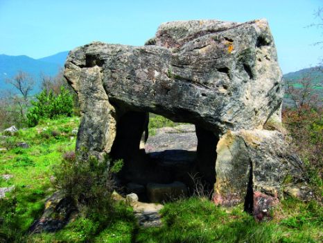
About 1.5 km from the Villanueva-Soportilla, in the direction of Puentelarrá/Larrazubi, is a path to the left (not included in GR 99) that leads to the important hermitic cave complex and pre-Romanesque necropolis of Las Tumbas, dating from the ninth century, nestled in a beautiful natural setting with magnificent views of Sobrón Gorge.


