

Net of Nature
Trails

Carrilet de la Cava Natural Trail
Description
By knowing the past, the present is understood and the future is improved.
This Nature Trail, which is less than 7 kilometres long, pays homage to the 27 kilometres of the old Carrilet de la Cava railway connecting Tortosa and La Cava (now Deltebre). This railway was vital for transporting the agricultural products of the Ebro Delta, which were cultivated thanks, among other things, to the Ebro Left Canal, inaugurated in 1912 by King Alfonso XIII.

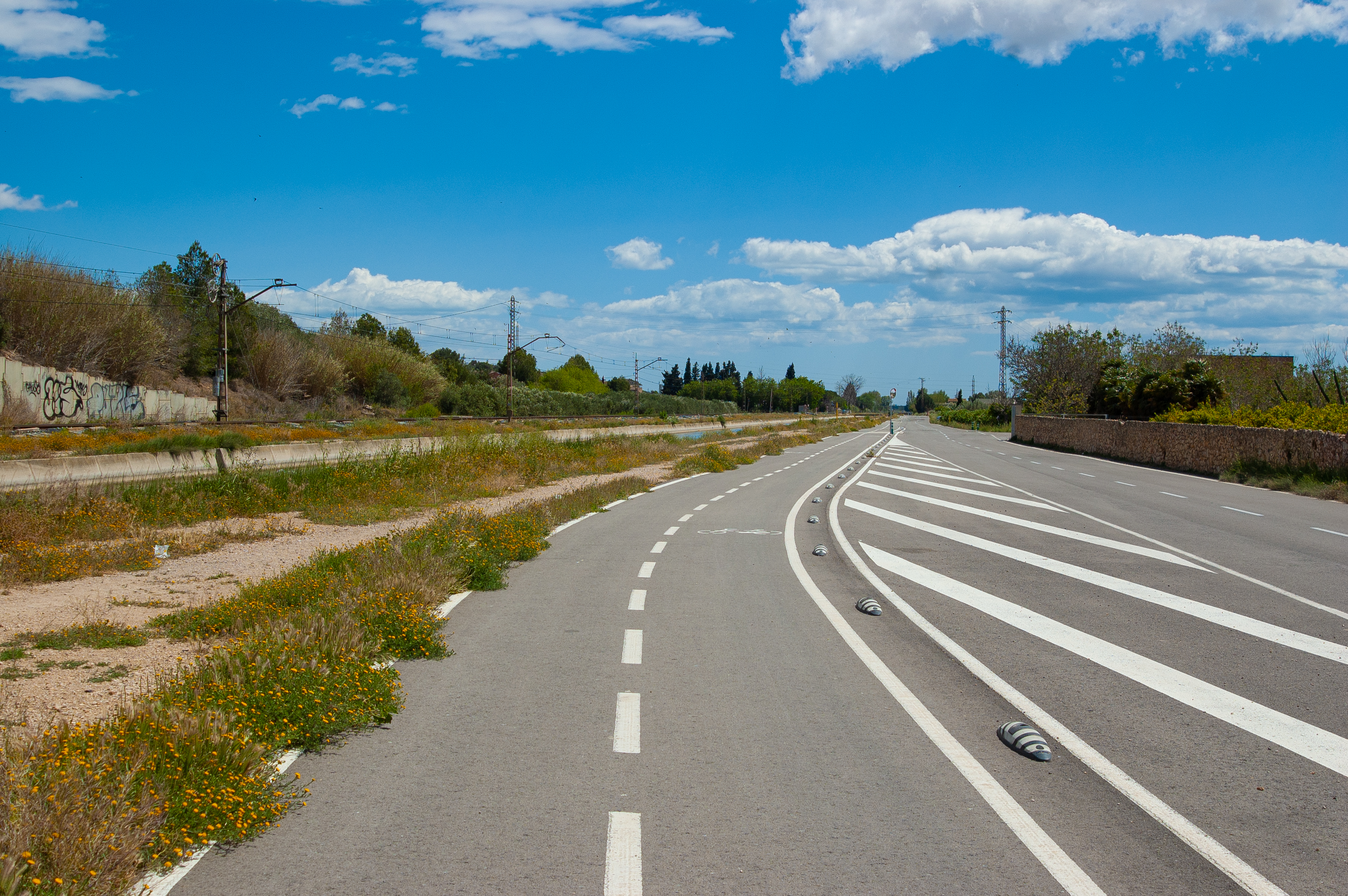
The route follows a short route of less than 7 kilometres along the Ebro Left Canal, along an asphalted cycle lane, following the course of what was once the old railway line known as the carrilet. Th line was 27 kilometres long, connecting the towns of La Cava (now Deltebre) and Tortosa.
The need for this railway arose to transport products, mainly rice, from the Ebro Delta to Tortosa, which had a railway connection with the interior of the country. In addition to freight transport, the railway was also crucial for passengers, facilitating movement between these two destinations of intense commercial and labour activity. It replaced the boats that used to sail up to Tortosa from the rice fields of La Cava, including the famous steamship Anita, which had been sailing up the river since 1915.
This hiking and cycling route coincides in its entirety with the Ebro Nature Trail, specifically stage 41, which begins in Tortosa and ends in Amposta. This is one of the longest Nature Trails, following the course of the Ebro from its source at Fontibre to its mouth at nearby Riumar, over 42 stages. The Ebro Nature Trail is connected to, and shares part of its route with, the Val de Zafán Greenway Nature Trail. These synergies open up a wide range of possibilities to complement the trip, within the tourist brand Terres de l'Ebre Biosphere Reserve.

The route begins to the south of the town of Tortosa, near the well-known Illa de Vinallop, a protected natural area within the Riberes i illes de l'Ebre. Before starting the journey, a visit to the monumental city of Tortosa is a must. Here, the Sant Joan and Castle of La Suda stand watch over the town. The Cathedral of Santa María, the convent of Santa Clara, the Episcopal Palace and other stately palaces are just some of the jewels that Tortosa has to offer visitors.
Our route begins on the bank of the Ebro Left Canal; an impressive work of hydraulic engineering inaugurated in 1912 by King Alfonso XIII. This canal, together with the Right Canal, which starts at the Xerta weir and ends in the Ebro Delta, have proven crucial for the economic development of the area, mainly centred on the cultivation of its famous rice. Over the years, the need to improve the transport of goods and labour led to the construction of the Carrilet de la Cava railway.
The journey begins next to the Nature Trails interpretative panel, from which you can see an old railway building nearby. From here, we take an asphalted cycle path that will accompany us along this short adventure through an area with a wealth of railway heritage. The route is by no means difficult in terms of the gradient o surface, which means we can enjoy spotting the many birds that inhabit the Ebro Left Canal and its surroundings. On the right-hand side of the route, we can see country houses surrounded by citrus groves over the first few kilometres. As the route progresses, the rice paddies will come to dominate the landscape.

Tortosa's industrial fabric is evident along the first part of the route, with the Ebro Left Canal, the railway line currently in service, the C-42 road and several industries well connected by rail and road. On the right is the Tortosa Rowing Club, with its own jetty directly on the River Ebro. A little further on, there are different greenhouses that produce horticultural plants, supplying these seedlings to the vegetable gardens of a large part of the peninsula.
After a regulation gate on the Ebro Left Canal, we reach the town of Campredó, a Decentralised Municipal Entity (EMD) in the municipality of Tortosa. Here you can enjoy its old railway station and the Church of San Juan Bautista, its patron saint. Curiously, the local festivities are celebrated in San Jaime, as San Juan coincided with the time of the heaviest work in the rice fields.

Returning to the route, we enter the area of Font de Quinto, crossing Ebro Left Canal over the bridge, so that it now runs alongside us on the right for these last few kilometres. The route winds through citrus groves and rice fields on both sides of the canal. On the left, on a small promontory, you can see the Campredó Tower, with a small information panel, providing information on this medieval construction. Together with the Carrova and Sant Onofre Towers, built in its image and likeness, it formed a line of watchtowers whose purpose was to protect the entrance to Tortosa via the estuary, a strategic place desired by a multitude of civilisations throughout history.
After just over a kilometre, we reach Estació de Bombeig La Pedrera, a pumping station, where an interpretive panel on the Carrilet de la Cava Greenway Nature Trail marks the end of the route. From here, there is the option of continuing on the Ebro Nature Trail, leaving behind the old railway line that ran from 1926 to 1968, fostering the economic development of the area.
Managing Entities
Sites of interest
Puntos de interés
Infrastructure
Municipality
Hostel
Profile

 Harshness of natural environment
- 1. The environment is not risk-free
- 2. There are more than one risk factors
- 3. There are various risk factors
- 4. There are quite a lot of risk factors
- 5. There are many risk factors
 Guidance along the route
- 1. Well defined trails and crossings
- 2. There is a clearly marked trail and signage
- 3. Requires the identification of geographic features and cardinal points
- 4. Requires off-path navigation
- 5. The trail is interrupted by obstacles that have to be gone around
 Route difficulty
- 1. Walking on a flat surface
- 2. Trails with different types of path
- 3. Walking on stepped paths or irregular terrain
- 4. The use of hands or jumping over the terrain is necessary
- 5. The use of hands is required to progress
 Amount of effort needed
- 1. Up to 1 hour of continuous walking
- 2. Between 1 and 3 hours of continuous walking
- 3. Between 3 and 6 hours of continuous walking
- 4. Between 6 and 10 hours of actual walking
- 5. More than 10 hours of continuous walking
(Calculated according to the MIDE criteria for an average excursionist with a light load)
Highlights
Comarca del Baix Ebre
The comarca Baix Ebre is made up of 14 municipalities: Aldover, Alfara de Carles, Benifallet, Camarles, Deltebre, El Perelló, L'Aldea, L'Ametlla de Mar, L'Ampolla, Paüls, Roquetes, Tivenys, Tortosa and Xerta. This area has a great diversity of landscapes ranging from the Ports Natural Park to the Ebro Delta Natural Park, as well as areas of traditional crops such as its famous rice fields. For this and other reasons, in 2013 UNESCO declared Terres de l'Ebre a Biosphere Reserve, promoting the conservation of the many environmental values and species of fauna and flora and promoting sustainable agricultural, tourist and industrial activities.
Multimedia


Downloads

GPS Downloads

Documents
Cyclability
CYCLABILITY
PROFILE

TYPE OF ROADS, PORTAGES & DIFFICULTY

TEST

SAFETY RECOMMENDATIONS
Caution at small road crossings and at farm exits along the route.
GENERAL RECOMMENDATIONS
- Find out about the technical aspects of the route and the weather on the day.
- Take care of the environment. Take care not to disturb animals or damage vegetation. Respect private areas. - You must give priority to pedestrians and comply with general traffic rules.
- The environment in which you will be riding is open, free to move around and an area where many activities are carried out (sporting, forestry, livestock and agricultural activities). Always have an understanding, prudent, responsible and respectful attitude.