Net of Natural
Trails

Stage 4: Ermita Virgen de los Reyes - Faro de Orchilla
Description
The road to the sea toward the prime Meridian
From the shrine of the Virgin, the trail leaves the inland region and heads for the seaside through a landscape of great contrasts full of iconic places, until it reaches the lighthouse at Orchilla, located at the westernmost point of the island, which was the Prime Meridian until it was replaced by the Greenwich Meridian.

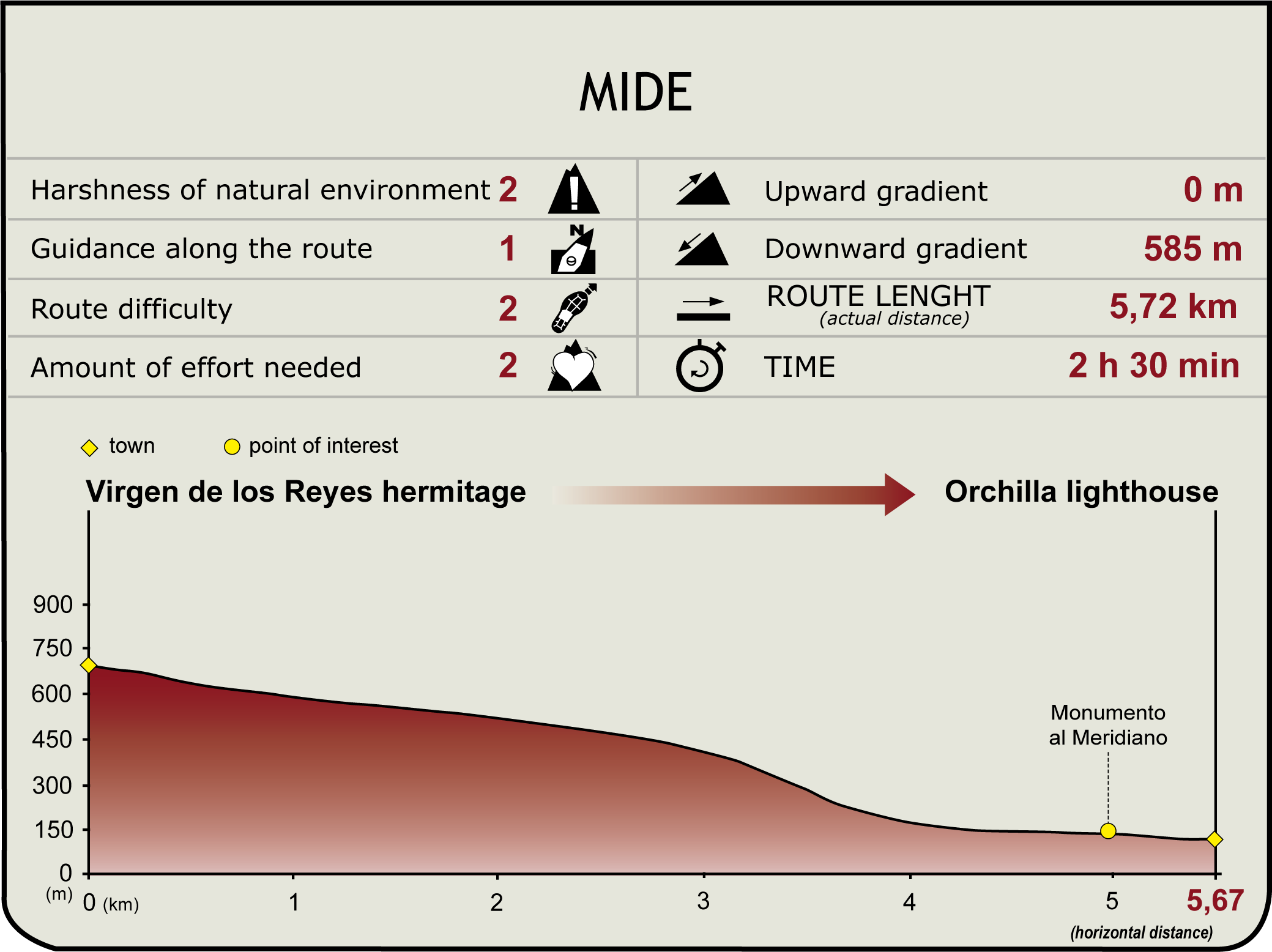
The fourth and last stage of trail GR-131 runs between the shrine of Virgin de los Reyes and the lighthouse at Orchilla, situated on the westernmost tip of the island.
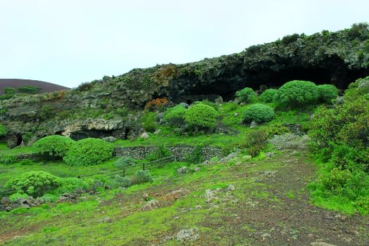
To begin our journey, we go back to the trail from the shrine of La Dehesa along the detour route, so that, after a few meters, we come to a spot where we can see large sized spurges (Euphorbia sp.) and there is a complex of caves cut into the rock - which were used in old times as pens for animals - called Cueva del Caracol (Snail Cave). This is an iconic place for the people of El Hierro, and it was used to house the image of the Virgen de los Reyes immediately after it was discovered and until it was moved to the shrine.
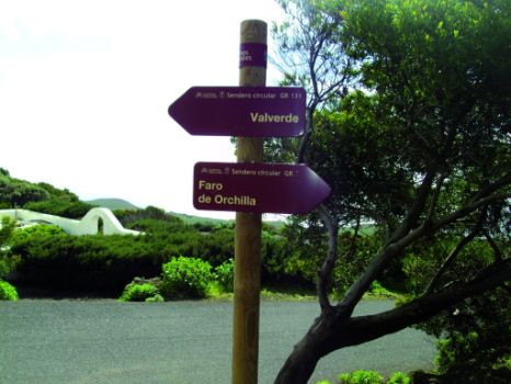
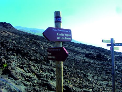
We continue the trail among tabaibas and junipers (Juniperus turbinata ssp. canariensis), and the path goes down along scattered hillsides until, gradually, we begin to see some of the most recent volcanoes, near the coast. In the descent, there are asphalt sections alternating with clearly signposted detours along dirt tracks.

In this stretch of the trail we can see a landscape full of contrasts, from the blue of the sea glimpsed in the background, through the green of surrounding vegetation struggling to invade this magnificent place, to the ochre and black hues of the ground.
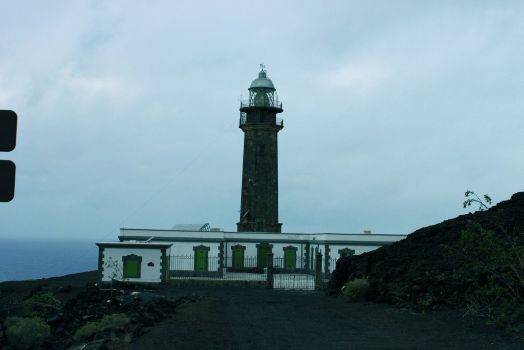
The lighthouse at Orchilla, the most important civil building of the island of El Hierro, stands behind the volcanic cones we can see on our descent. This lighthouse was constructed on Orchilla point using stones brought from Arucas, Gran Canaria. After many hardships, because of the inhospitable terrain, the lighthouse was completed in 1930, although its light, visible at a distance of 75 mi, was not turned on until 1933. At present, the lighthouse is no longer operational.

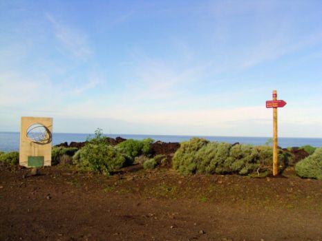
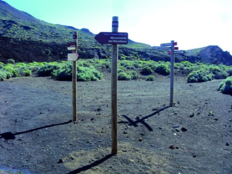
A path branches off trail GR-131 to reach the Prime Meridian monument. It starts from the mountain on which the lighthouse stands, where there is an intersection with GR-131 in the direction of the lighthouse at Orchilla.
This is a short trail, less than 1.5 mi, with hardly any slope, that follows a track that goes along a gentle ravine dominated by a landscape of solidified lava and lapilli. Lapillus is a material created in explosive eruptions and formed by the fragmentation of lava accreting to gas bubbles originating inside a volcano. These bubbles rise to the outside and burst out due to the difference between their internal pressure and that of the environment.
With little difficulty, and without going astray at any moment, the track reaches the Prime Meridian Monument, close to the volcanic plug Roque Barbudo. From 1634 to 1884, date on which Greenwich was adopted as the Prime Meridian, the so called El Hierro Meridian was considered to be the westernmost point of Europe.
Profile
Highlights
Further information
Appearance of the Virgin
January 6 is a red letter day for the inhabitants of El Hierro. Tradition has it that on January 6, 1546 a group of sailors leaving for America left a statue of the Virgin on the shores of Orchilla in exchange for food supplies for a hard journey.
The carved figure was placed in Cueva del Caracol (Cave of the Snail), which from that time became "Cueva de la Virgen" (‘Cave of the Virgin’), a place of worship for shepherds who offered gifts to the Virgin in honor of the day the image was discovered.
According to the historical records, the Virgin then became the protector and patron of the people and animals of La Dehesa, and thanks to the contributions of the shepherds – who offered for this purpose the first born lamb and the first cheese produced – a shrine was built in the vicinity of Caracol.
The first Mass celebrated in the shrine of the Virgen de los Reyes took place on April 25, 1577. For this reason, each April 25 there is a festivity in honor of the Virgin known as “feast of the shepherds”.
The Lighthouse at Orchilla
On September 25, 1933, the lighthouse keepers Carmelo Heredia and Rafael Medina turned on for the first time the light of the lighthouse at Orchilla, situated at the westernmost tip of El Hierro, known as the Meridian Island until the discovery of the New World because, from antiquity, cartographers had set in this place the imaginary line linking both poles, namely the Prime or Zero Meridian.
It is a building made of quarried stone brought from the municipality of Arucas, Gran Canaria. The base of the lighthouse is a square on which there stands a stonework octagonal superstructure and a cylindrical tower 21 m high. Next to the tower is an Isabelline style house used as lodging to the first lighthouse-keepers.
Punta de Orchilla was a reference point for vessels bound for the Americas, and, as early as the end of the nineteenth century, a new lighthouse was projected on the same location, but this project was left to gather dust until, in 1924, the construction of a new lighthouse started.
It seems that the project to build a new lighthouse at Orchilla had its inception shortly before the beginning of First World War, when a Spanish vessel coming from America was forced to sail precariously into the darkness in search of a landmark along the coastline. The presence of a rocky stretch of coast endangered the lives of crew and passengers, one of whom was the engineer José Herbella, who came up with the idea to illuminate the rocky coast of El Hierro and drafted the project.
The Prime Meridian
Considered the westernmost part of the world until the discovery of America, the Prime Meridian was set on the island of El Hierro from the second century, when the imaginary line joining the two poles crossed through the point of Orchilla in the maps of Ptolemy and the School of Alexandria. However, from 1492, with the discovery of the New World, geographical knowledge underwent deep changes, and the nations began to dispute about the location of the Prime Meridian in new maps.
Finally, it fell to the Geographical Society of London to contribute to the science of cartography a set of longitude, latitude and time measurements which took Greenwich Observatory as reference. In 1884, an international conference held in Washington with the participation of a total of 25 countries selected Greenwich as international standard for the single reference meridian or Prime Meridian. For this reason, the center of GMT (Greenwich Mean Time) governs hour variations for our planet.
Thus, El Hierro lost the Prime Meridian, but remained a strategic location for navigation.


