Net of Natural
Trails

Stage 11: Echedo-ermita Virgen de la Peña
Description
- - - - - - - -
IMPORTANT NOTICE!
DUE TO LANDSLIDES, SOME SECTIONS OF THIS NATURAL PATH ARE IN POOR CONDITION AND, FOR SAFETY REASONS, THIS SECTION IS TEMPORARILY CLOSED. ALTERNATIVE ROUTES ARE RECOMMENDED, AND EXTRA CAUTION SHOULD BE TAKEN IN AREAS CLOSE TO THE AFFECTED POINTS.
THE EVALUATION AND REPAIR WORK IS EXPECTED TO BE COMPLETED IN MAY.
THANK YOU FOR YOUR UNDERSTANDING.
- - - - - - - -
The Protector of Wanderers and Mirador de la Peña
Once past the village of Echedo and its vineyards, the next stage of the circular trail goes along pastures and crop lands in the vicinity of Jarales. It goes through the village of El Mocanal and reaches the shrine of the Virgen de la Peña (Virgin of the Rock), protector of walkers in the area. The landscape offers magnificent views for nature lovers from the vantage point of Mirador de la Peña, a viewpoint designed by the Canary architect César Manrique.

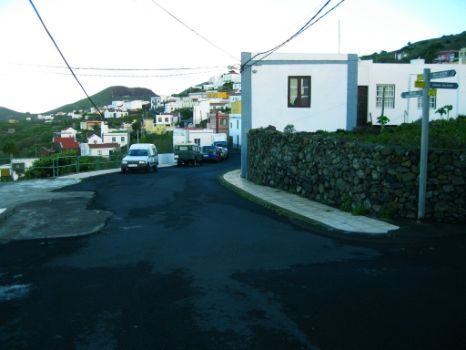
The eleventh stage of the circular track of El Hierro continues along the northwestern side of the island and begins in Echedo, where a directional sign will show us the way to El Mocanal. Moving away from Echedo, we will leave behind us increasingly scattered houses and buildings of the village, following a path that runs along seemingly abandoned fields which have been occupied by vegetation consisting mainly of sorrel (Rumex lunaria) and tabaiba (Euphorbia sp.).
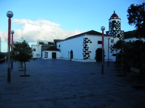
We arrive then to the village of Aguajiro and walk along its main street, flanked by white buildings, in the direction of El Mocanal. Surrounded by pastures and croplands, El Mocanal belongs to the municipality of Valverde, and is located at an altitude similar to that of the capital city. The weather there is usually quite humid, and frequently misty. A highlight of this village is the church of San Pedro - recently restored - characterized by its reddish dome and by the fact that it is something of an architectonic oddity, since it is an example of Moorish-Spanish “Mudéjar” art quite uncommon in the rest of the Canary Islands.
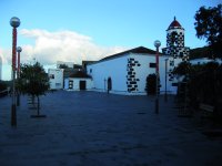
Further on, the trail leads us to the village of Guarazoca along beautiful paths covered by shrubs and hemmed in by high dry stone walls. Along the way, it is possible to admire the wide expanse of grasslands reaching up to the gentle slopes of the interior of the island, covered by trees.
In this village visitors can still see old wine presses, as well as the traditional El Hierro houses made of black volcanic stone, whitewashed and with roofs thatched with “colmo” (rye straw), and generally surrounded by small kitchen gardens.
The trail ascends gradually and gently to Guarazoca; having crossed the village, guided by information signs, the trail becomes moderately steeper as it goes through meadows which are increasingly close to the edge of the cliff that limits the valley named Valle de El Golfo. Nevertheless, we will have no difficulty in reaching the viewpoint and shrine of Virgen de la Peña, since the ground in this last stretch of the trail is quite firm.

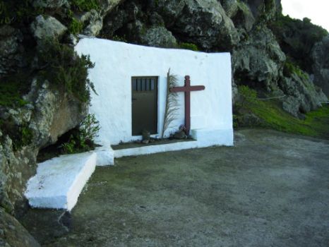
The shrine of the Virgen de la Peña (Virgin of the Rock), protector of walkers in the area, is a small construction caved into the rock, with a simple whitewashed façade consisting simply of a door and a cross. In the October festival it is customary to take the image of the Virgin from the shrine to the village of Guarazoca.
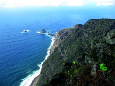
Taking advantage of the location of this small shrine, nature lovers can enjoy great views of the surrounding area. In the vicinity of the shrine, about 500 m away, there is Mirador de La Peña, a viewpoint designed by architect César Manrique, which boasts wonderful views of the sea and the Valle de El Golfo. The viewpoint is located 700 m above sea level on the eastern tip of Risco de Tibaje (Tibaje Cliff). The design of the building and surrounding gardens is based on the traditional architecture of El Hierro, with some modern elements added, and materials such as stone and wood were used in its construction.
Profile
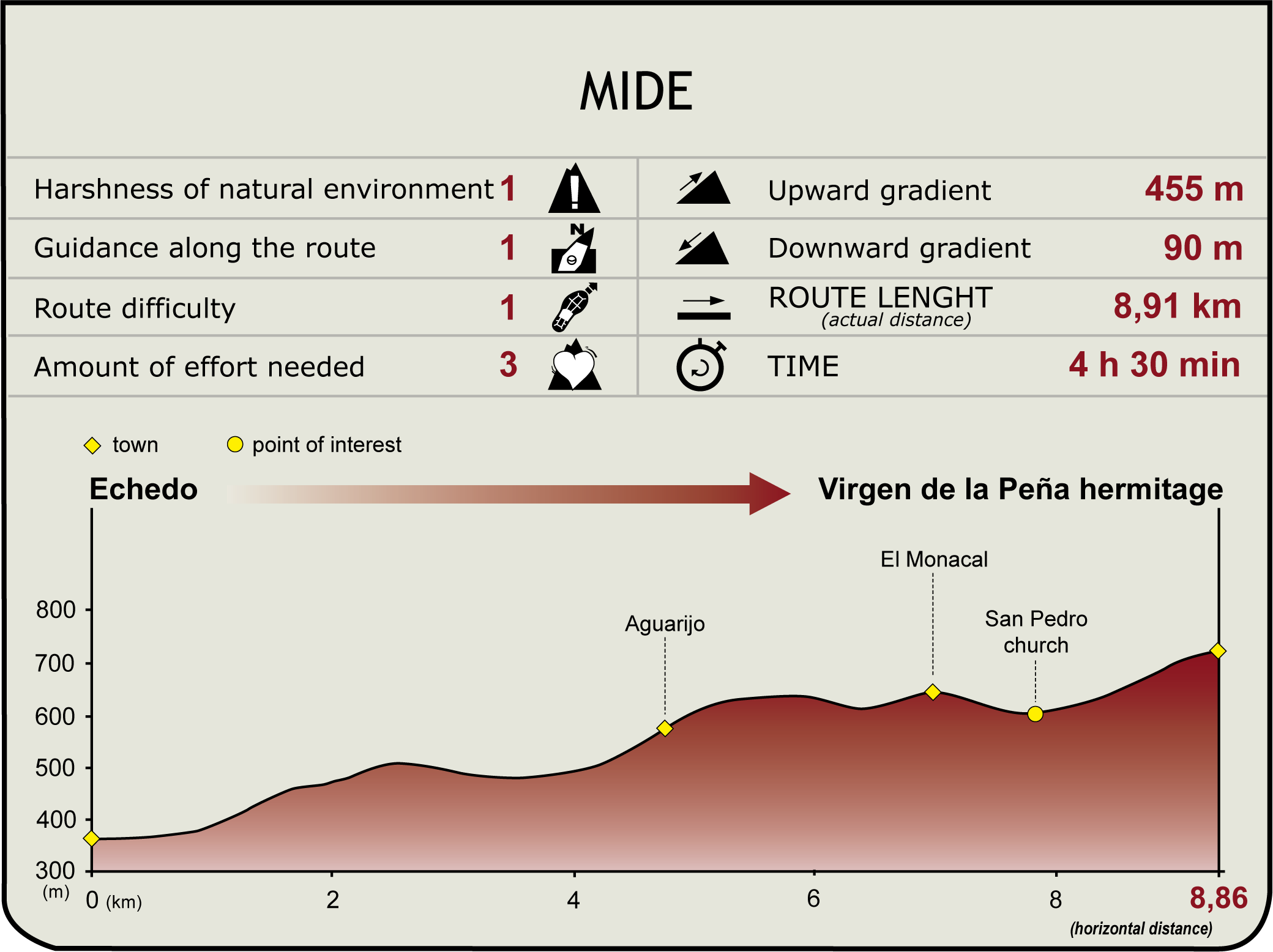
(Calculated according to the MIDE criteria for an average excursionist with a light load)
Highlights
Further information
Pozo de las Calcosas
On the coast of the village of El Mocanal, overlooked by cliffs, there are two large natural water swimming-pools next to which there is a hamlet that has been preserved in its original state: Pozo de las Calcosas. It is a small quiet spot, sheltered by the cliff, which can be reached by going down a narrow and steep path.
The houses of Pozo de las Calcosas are built with dry stone walls and thatched roofs, and have been lovingly restored by their current owners. This small village is only inhabited in summer and during the weekends.
The Betrayal of Guarazoca
The village of Guarazoca is named after an ancient Bimbache (native inhabitants of El Hierro) princess who betrayed her people for the love of a Castilian soldier. Water supply scarcity on the island – on the surface of which there aren’t any rivers or streams - stopped the settling of the island by colonizers, even though this problem had been no obstacle for the aboriginals.
Legend has it that Guarazoca revealed the best kept secret of her people to the conquerors: the way to obtain water. The princess showed a Castilian soldier a giant linden tree: the Arbol Santo (Holy Tree) of Garoé. The foliage of this tree – worshiped by the local people – trapped and condensed the moisture brought by the trade winds, which subsequently was turned into water drops, a phenomenon known as “horizontal rain”. Thanks to this rain tree, the natives secured their livelihood by collecting water in cisterns dug under the trunk of the tree.
According to historical chronicles, the sacred tree was toppled over by a hurricane in 1610. Today, it has been replaced by another tree of the Lauraceae family near Valverde, but it survives as a symbol of the identity of the island and is featured on the coat of arms of El Hierro.


