Net of Natural
Trails

Stage 1: Tamaduste - Valverde
Description
From the Coast to the Inland
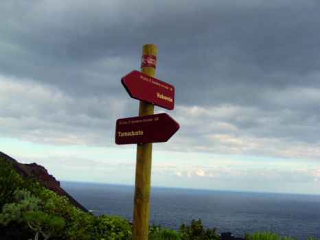
The first stretch of the track GR-131 begins in the north area of the island, in the small village of Tamaduste, a quiet nook surrounded by nature that is gradually turning into a summer resort. The trail ends in Valverde, the capital of El Hierro, where visitors can stroll through the historic quarter of the town.
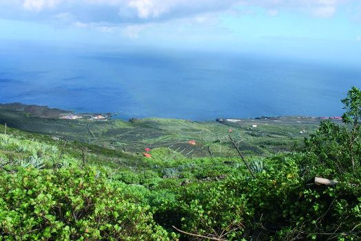
The small seaside village of Tamaduste, situated in the north-west of the island of El Hierro, is just three kilometers from the airport Los Cangrejos, which does not prevent this village from being one of the most peaceful places on the island and from becoming one of the favorite tourist destinations, selected by visitors looking for some relaxing days in this old fishing village, located in an environment of great natural beauty, excellent for hiking.

Tamaduste is renowned for its family-friendly beach, known as “El Río Tamaduste” (Tamaduste River). It is a creek or pond formed by a sea inlet, almost circular in shape, with calm, clear waters, which could very well be mistaken for a lake. The white of the houses surrounding “El Río” forms a sharp contrast to the black of the beach sands, of volcanic origin, and the calm waters of the beach are very inviting to bathers.
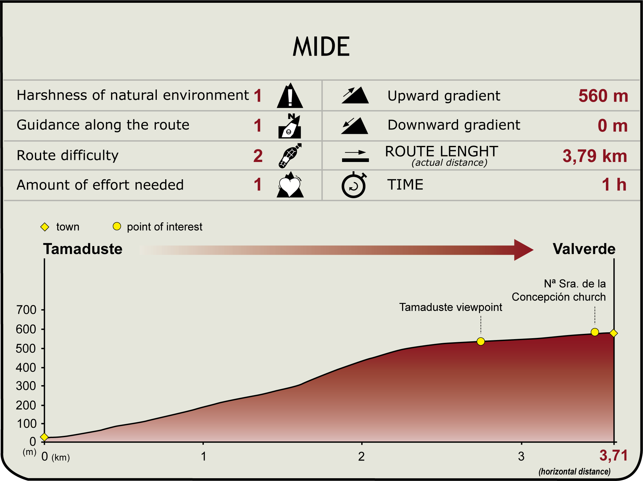
The first stretch of the GR-131 track is a little over three kilometers long, and starts next to an information panel located in the village. In its initial part, the track joins the section Tamaduste to Echedo of the circular track that runs around the whole island, until both tracks diverge.
A few meters before the beginning of the ascent to Echedo, we can make a detour to visit a viewpoint located at the entrance to Tamaduste, which offers magnificent views of the coastland and the small village. We continue along the path and climb steadily from the road, past several houses, until we reach some abandoned farms which have been occupied by diverse plants, such as spurge (Euphorbia sp.), vinagrera or Canary Island sorrel (Rumex lunaria), thyme (Thymus vulgaris) or prickly pear (Opuntia dillenii).

After we reach a crossroads, where we leave the track that heads to Echedo - marked with a vertical pole - the ascent continues along a surface composed of an earthy substrate with blackish hues, reflecting the volcanic youth of the island. Shortly afterwards, we begin to go along agricultural tracks and paved roads that run through areas dominated by the presence of the Canary Island sorrel or “vinagrera”, a species endemic to the Canary Islands and very widespread across the island of El Hierro, often associated to pervasive communities of another species, this one invasive: the century plant or pita (Agave americana).
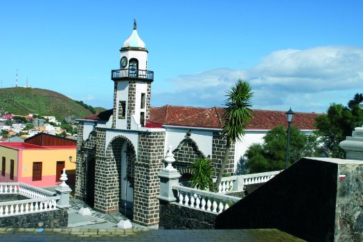
Along the way we find scattered houses, usually whitewashed and surrounded by crop lands, some of which have been abandoned. Soon afterwards, we reach the outskirts of the capital city, Valverde, and a pleasant walk through the streets will allow us to enjoy the small and cozy historic quarter until we reach the church of Nuestra Señora de la Concepción, traditional place of arrival of the image of the Virgen de los Reyes (Virgin of the Kings) at the end of the corresponding festivities.

Its elevated situation on a hillside about 600 m above sea level means that Valverde is the only capital city of the Canary Islands without a coastline. The town has a population of approximately 1,800, and consists of two main streets crossed by numerous alleys, many of which are quite steep. It is divided in three districts: Tesine, higher up, La Calle, in the middle, and El Cabo, in the lower part of the town.
The Cabildo Insular (Local Island Council) of El Hierro, as well as the main administrative offices and most of the headquarters of the institutions that provide the essential services are located in Valverde. From an architectural viewpoint, the town hall, designed in a typically Canary Island style, and the church of Santa María de la Concepción, built in the eighteenth century, are particularly interesting. The image of the Virgin, housed inside the church, belongs more or less to the same period. The church also has a Genoese sculpture of great artistic value, the Cristo de la Columna (Christ at the Column).
In the past, Valverde was a small shepherd’s village, until the manorial authorities decided to concentrate the administrative, military and religious activities in this town, granting it the title of “villazgo” (large village). The name of the town has its origin in the ancient laurel and tree heath forests that used to cover this area, which have been replaced by pasture lands.
The Villa de Santa Maria de Valverde or La Villa is the capital of the municipality of Valverde and El Hierro since the conquest of the island in early fifteenth century. Before the conquest, the island was inhabited by the Bimbaches. There ancient inhabitants of El Hierro were imazighen or Berbers, i.e. North African aboriginals. At present, the capital city rises over the old Bimbache settlement of Amoco.
Sites of interest
Profile
Highlights
Further information
The Descent of the Virgin
Every four years, the church of Nuestra Señora de la Concepción receives the image of the Virgen de los Reyes, patron of El Hierro, which is taken in procession from the shrine of La Dehesa down to the capital, after having toured the entire island.
This pilgrimage – which lasts almost a month – has its origin in a prolonged drought that took place in 1740 and caused the loss of crops and the death by starvation of a large number of animals.
As a response to this catastrophe, the shepherds carried the image of the Virgen de los Reyes to Valverde in order to pray a “novena” or Novem in honor of the Virgin. Soon after, it began to rain, and, as a token of appreciation, they promised to take the image of the Virgin in procession from the shrine where it is housed to the capital city every four years, in which is known as the festival of Bajada de la Virgen (Descent of the Virgin). The first Bajada took place in 1745.


