Net of Natural
Trails

Stage 6: Pájara - La Pared
Description
On the Boundary between two Kingdoms
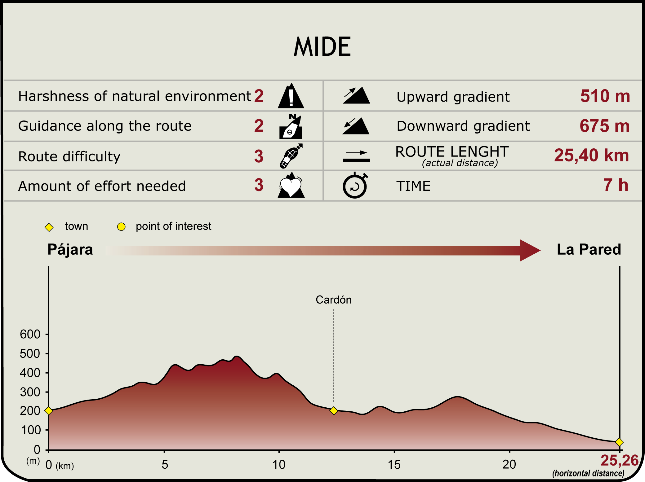
The stage takes us for the most part through a mountain range almost devoid of vegetation, reaching its greatest height at Filo de Tejeda. Then the path descends to El Cardón and leaves behind the rugged mountains, coming to its end at La Pared, a village named after a wall that used to separate the kingdoms of Guise and Ayose in aboriginal times.

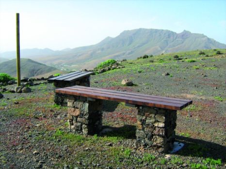
The trail starts at the square in front of the church of Nuestra Señora de Regla de Pájara and leaves the village, heading south past a cemetery - along a dirt track – until reaching a resting area with magnificent views of the valley and the farmlands, and with panels providing information on the Nature Trail.
We will continue down the valley until we reach a sign-posted intersection where we will turn left, up a gently sloping hill. The trail continues on a dirt track, along Degollada Honda and a number of small hills, until it detours from the track along a mountain trail, which goes continually uphill and downhill, testing our physical fitness.
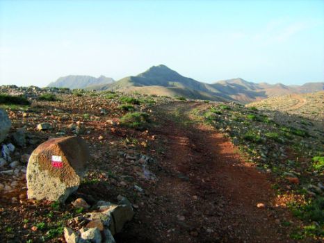
However, the trail is quite pleasant, surrounded at all time by a landscape of mountain ranges with gentle slopes, almost entirely without vegetation. While the path is clearly marked all along, we must pay special attention when we reach certain stretches, particularly when we ascend and skirt Filo de Tejeda (Tejeda Edge), where we should look for signs (red and white) painted on rocks and stone markers or pillars indicating the presence of trail GR.

Once we have reached the greatest height of Filo de Tejeda, and after a short walk on level ground along the crest of this mountain range, the trail begins to descend until it disappears at a given time. At this point, a metal fence that marks the fields shall be used as a point of reference to continue the trail. Walking parallel to this fence, we will soon find the path again.
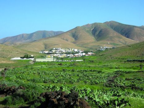
After a short climb to Morro del Morralito, there is a resting area where travelers can restore their energy in order to be able to face the descent to the village of El Cardón, where the green of palm trees and crop lands offers a marked contrast to the earth-colored scenery they have seen so far.
Near the end of the descent, and very close to the village of El Cardón, there is another resting area with a small stone house with wooden benches and tables, where hikers can take shelter from the heat.

From this point, we will go through the village of El Cardón, - without making any detour from the various intersections we will find along the way - until we reach a dirt path that leads to another rest area. As we leave the village, we take the path to the right. We go past a very long fence and continue down to the skirts of the mountain, past a cheese factory, in order to reach the village of La Pared, end of this section of the trail.
Profile

(Calculated according to the MIDE criteria for an average excursionist with a light load)
Highlights
Further information
La Pared
The village of La Pared is named after a wall (pared) that ran along the isthmus connecting the peninsula of Jandía with the rest of Fuerteventura in aboriginal times. Today, only vestiges of the entire wall remain in some places.
The story of this wall dates back to the time before the Norman conquest of the island, when Fuerteventura was divided into two kingdoms, one to the north and the other to the south, separated by a wall erected on the isthmus of La Pared. The kingdom of Guise comprised the northern part of the island, the Maxorata, while the kingdom of Ayose stretched to the south, along the peninsula of Jandia.
This territorial distribution does not seem to be very well balanced from a geographical standpoint, and, for this reason, some historians do not accept this vision of the past of the island. There are historical references to the existence of another wall that divided the island farther north, from the ravine of La Peña on the west to the ravine of La Torre on the east, near Betancuria. This would mean a more balanced distribution of lands, since the Peninsula of Jandía would be out of bounds for both kingdoms, as a common area which could be used by the two kingdoms to develop their resources.
However, the geographical division created by the isthmus of La Pared has been a constant factor throughout the history of the island, since, when the island ceased to be a dominion, the peninsula of Jandía continued to be owned by territorial lords; this fact highlights the special importance of the area.
These lords used to leave their lands in the hands of stewards or administrators who leased their lands on the peninsula to a third party. Gustav Winter was the last of these tenants who used to mark their territory by means of walls. Not only did he mark the boundaries of his possessions, but he also prevented the passage of people by building a two meter high fence along the entire isthmus of La Pared built on the remains of a dry stone wall that had existed there since aboriginal times.


