

Net of Nature
Trails

Stage 3. Chipude - Vallehermoso






Description
Immersed in dense laurisilva forest, this stage culminates by taking in the Canarian juniper landscape, with the volcanic outcrop of Roque Cano serving as a prelude to the village of Vallehermoso
Stretching 14.2 kilometres, the third stage of the Camino Natural starts at Plaza de Chipude and, after passing through the rural hamlets of El Cercado and Las Hayas, renowned for their artisan crafts and traditional cuisine, enters the very heart of Garajonay National Park, in the Jardín de Las Creces area, before ending in the village of Vallehermoso, historically one of the main centres of export agriculture.
At the foot of the archaeological site of the Fortress lies the village of Chipude, the starting point for the third stage of the Nature Trail. Starting from the information panel located on one side of the square, where the 16th-century Shrine of Nuestra Señora de la Candelaria stands, the route skirts the town until it joins the CV-18 road at the La Vica washhouses. After walking about 200 metres along the road, the path veers off to the left to cross the Barranco de Los Manantiales ravine, still under the imposing shadow of the Chipude Fortress, which we gradually leaves behind.

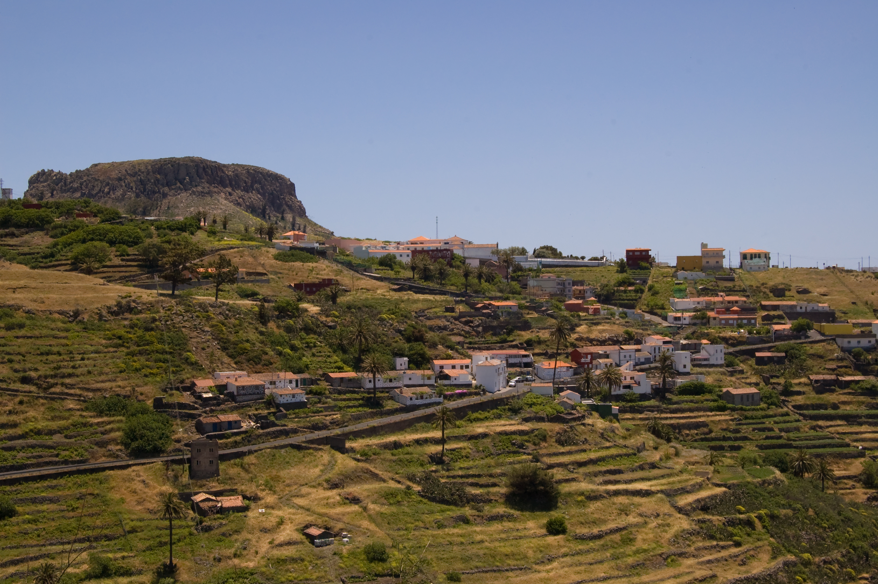
After crossing the CV-18 once more, the route continues to El Cercado, a rural village with a long tradition of pottery-making, where clay is still worked by hand in the pre-Hispanic style, without the use of a potter’s wheel. It's set against the backdrop of the Barranco de La Matanza ravine, dotted with Canary Island palm trees, vegetable gardens and ancient terraced fields. The path winds through the village until it reaches the information board at the outskirts, leaving the paved areas behind for a footpath that once again takes the us through a beautiful landscape of terraced slopes at the head of the Barranco del Agua ravine, part of Gran Rey valley, home to the rural park of the same name, and undoubtedly the most impressive of La Gomera’s ravines. In the higher areas, one can make out the layers of rock formed by successive volcanic eruptions, whilst in the background several hamlets can be seen nestled in the fertile valley floors. It is one of the most spectacular views along the route.

After a short but steady climb through a section where we must be wary of possible rockfalls, we reach the hamlet of Las Hayas, preceded by a magnificent palm grove. The final 680 metres follow the road that runs through Las Hayas. Taking the Coromoto path, we reach the local Shrine, where there is a designated area equipped with tables, barbecues and a drinking fountain. Within a few metres, the visitor enters the boundaries of Garajonay National Park once again.
Advancing along a narrow path, we come to another track that allows us to continue enjoying the magic of these laurisilva forests, which are often shrouded in the mist that provides the vegetation with what is known as ‘horizontal rain’, the water content of which can even exceed that of vertical rainfall. The route continues to the Las Creces recreation area, a former sheepfold where livestock was reared until the 1950s, which now offers visitors a spot to rest and cool off under the large trees.

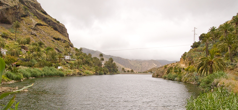
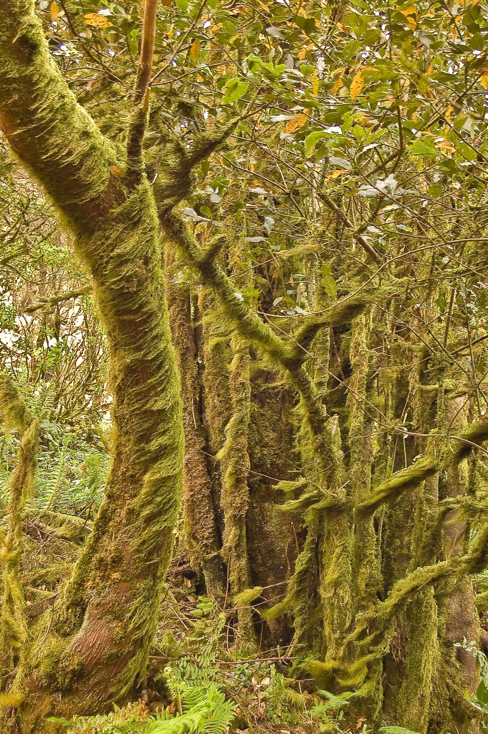
After leaving the Las Creces recreation area, continue along the path, crossing the main road (GM-2), before beginning the descent down the slope of Mount Araña through a beautiful laurisilva forest, where abundant moss and lichen continue to blanket the tree trunks. The Risquillo del Corgo viewpoint offers a sweeping panoramic view of the Vallehermoso basin, historically the island’s most productive agricultural area. The route continues along the summit, passing through the transition zone between montane forest and Canary Island juniper forest (Juniperus phoenicea var. canariensis) – the largest of its kind in the archipelago – an area known as the Vallehermoso plateau. Just past the 34-kilometre mark, the path crosses the forest track leading to the Shrine of El Carmen, beginning a winding descent, featuring a series of terraced sections with wooden steps, leading to a rocky hill from which you can gaze out over the fertile Vallehermoso valley, flanked by Roque Cano, as junipers dot the entire hillside like polka dots. Following the signposts, you come to another crossroads with a small water collection point, and then continue down a short but steep descent through terraced vineyards at the foot of a large rock face, which leads to the asphalt path heading towards La Rosa de las Piedras, a small rural hamlet in the Barranco de Ingenio ravine. After just over 400 metres, we reach La Encantadora Dam and one of the island’s main reservoirs, where a recreational area with several information boards invites visitors to relax and enjoy the surroundings.

The route continues along the right-hand side of the dam, following a 1.25-kilometre stretch of poorly surfaced paths that run at the foot of Roque Blanco. Here the route is shared with vehicle traffic and there is a risk of rockfalls so caution is advised. A footpath soon begins, marking the start of a challenging climb of some 500 metres, during which you can enjoy the scenery, the geology and the vegetation typical of the northern part of the island. In addition to the fayal-brezal woodland, the nearby north face of Roque Blanco is home to significant populations of rock-dwelling plants, many endemic, and the finest formation of Canary Island strawberry-tree (Arbutus canariensis) on the island.
At the end of the climb, walkers can enjoy the breathtaking views of the Barranco de Ingenio and Barranco de Garabato ravines to the west and east respectively, beneath the imposing silhouette of Roque Cano, at the foot of which lies Vallehermoso. From here, and as far as the village, the path winds downhill, offering beautiful views of the Barranco del Ingenio ravine and its valley, dotted with Canary Island palm trees and terraced fields.
The route enters Vallehermoso via the Barranco del Ingenio road and, following the signs at various points throughout the town, leads to the Town Hall square, where an information panel marks the end of the stage. From this very square, walkers have the choice of joining one of the stages of the Costas de La Gomera Nature Trail, which we meet again at Vallehermoso beach.
Managing Entities
Sites of interest
Puntos de interés
Culture
Hydrography
Information
Municipality
Orography
Vegetation
Profile
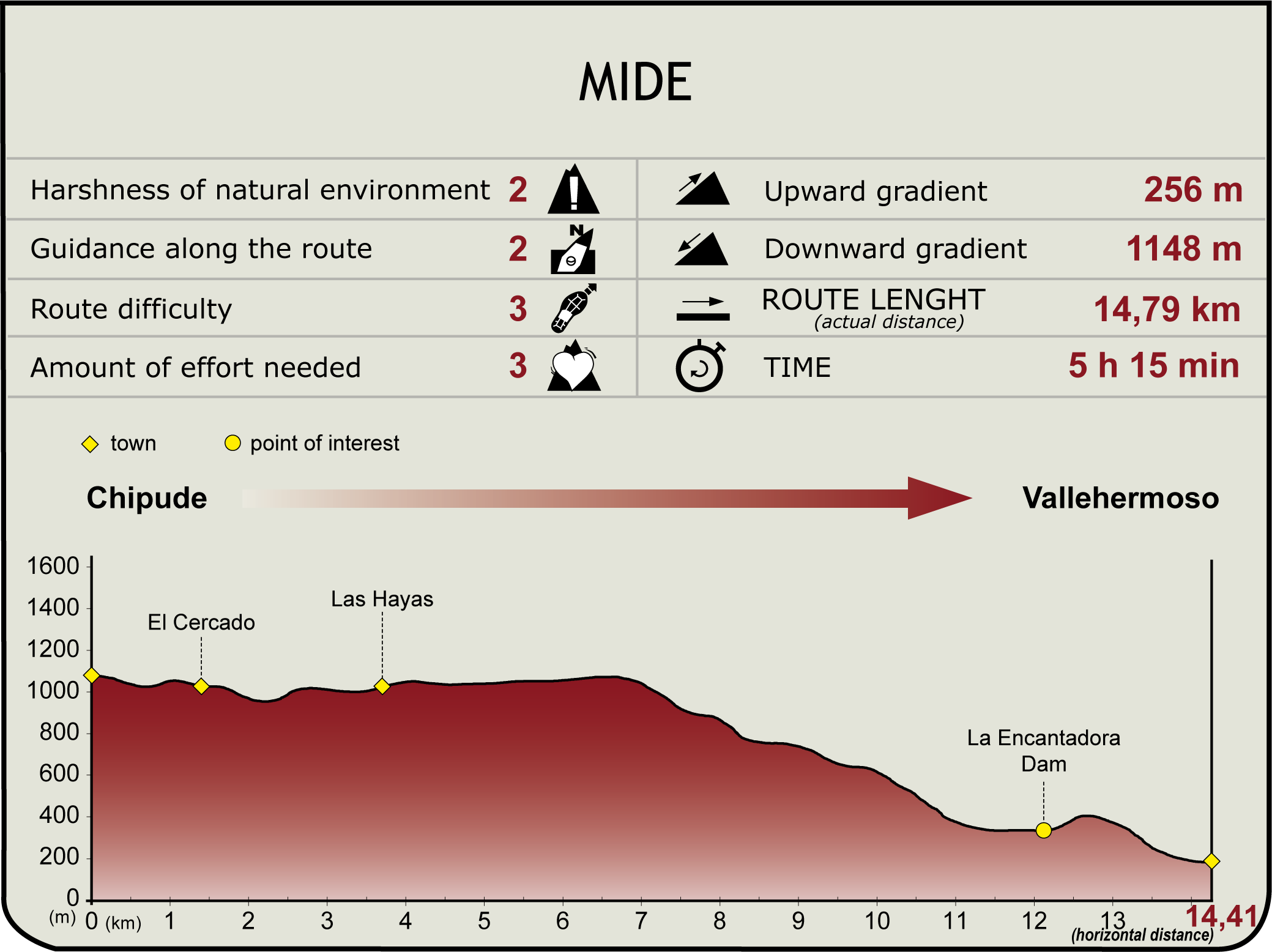
 Harshness of natural environment
- 1. The environment is not risk-free
- 2. There are more than one risk factors
- 3. There are various risk factors
- 4. There are quite a lot of risk factors
- 5. There are many risk factors
 Guidance along the route
- 1. Well defined trails and crossings
- 2. There is a clearly marked trail and signage
- 3. Requires the identification of geographic features and cardinal points
- 4. Requires off-path navigation
- 5. The trail is interrupted by obstacles that have to be gone around
 Route difficulty
- 1. Walking on a flat surface
- 2. Trails with different types of path
- 3. Walking on stepped paths or irregular terrain
- 4. The use of hands or jumping over the terrain is necessary
- 5. The use of hands is required to progress
 Amount of effort needed
- 1. Up to 1 hour of continuous walking
- 2. Between 1 and 3 hours of continuous walking
- 3. Between 3 and 6 hours of continuous walking
- 4. Between 6 and 10 hours of actual walking
- 5. More than 10 hours of continuous walking
(Calculated according to the MIDE criteria for an average excursionist with a light load)
Highlights
Further information
Garajonay National Park
Garajonay National Park was established in 1981 to protect the best-preserved example of Canarian laurisilva forest, and was added to the UNESCO World Heritage List in 1986 in recognition of its natural values, thereby achieving the highest status that a Protected Natural Area can attain. It covers an area of 3,984 hectares and is located on the central plateau of the island of La Gomera.
The year-round presence of a sea of clouds, caused by the collision of moist air carried by the north-easterly trade winds with the islands’ peaks, causes the air to rise and condense, forming a misty area that is essential to the survival of the Canarian montane forest, the dominant and characteristic vegetation of the Park.
The term ‘montane’ encompasses the two types of forest that cover 85% of the park’s area: the first being laurisilva, a subtropical cloud forest with trees whose leaves resemble those of the laurel, from which it takes its name—such as the viñátigo (Persea indica), til (Ocotea foetens), laurel (Laurus azorica), palo blanco (Picconia excelsa), Canary Island holly (Ilex canariensis) and sanguinero (Rhamnus glandulosa), with a wealth of moss, ferns and herbaceous plants occupying the dampest and shadiest spots. The second type is the fayal-brezal formations with a high presence of tree-like heathers (the Park being one of the places in the world where these plants reach their greatest size) and fayas, which appear in drier areas, with poorer soils – which is why they tend to appear at the upper limits of the laurisilva forest and in steep, wind-exposed areas – or as a result of the degradation of the laurisilva forest due to human activity.
Garajonay National Park is home to a wide variety of plant and animal species, including some 120 endemic plant species and more than 150 endemic animal species, making it the natural space with the highest number of endemic species per unit area in Europe.
Multimedia




Downloads

GPS Downloads