Net of Natural
Trails

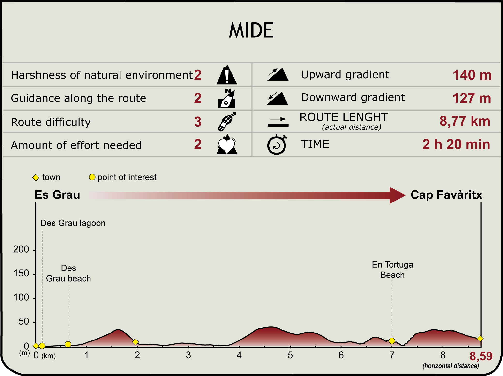
Stage 2: Es Grau - Faro de Favàritx
Description
Albufera des Grau and the coves of northeastern Menorca
This stage runs entirely through the Natural Park of S'Albufera d'Es Grau. It begins at the edge of the albufera, or lagoon, from which the park takes its name, but then moves away along the coast of the island, with its cliffs and coves, until it reaches Cape Favàritx.

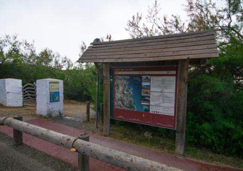
The second stage of the Camí de Cavalls starts about 400 m south of the village of Es Grau, next to the access gate to the Albufera d'es Grau, one of the most important natural habitats in Menorca. After crossing the gate (friendly reminder: whenever you need to open a gate along the trail, please leave it properly closed after you), you will continue across a footbridge over the branch of water that connects the lagoon and the sea. The Nature Trail turns off to the right after about 100 m, but it is worth taking a walk around the Albufera d'Es Grau, using the walkways that surround the water and stopping at the viewpoints to do some birdwatching: you can spot ducks, coots, cormorants, sea hawks...
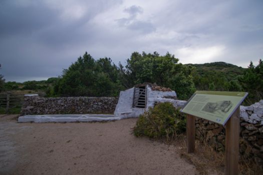
The route enters a small Aleppo pine patch (Pinus halepensis) and mastic trees (Pistacia lentiscus) along a sandy track and, after 500 m, next to a good example of the island's traditional farming practices, an old well with a cattle trough attached to the wall of a farm. Next to this wall the trail continues until it reaches the beach of Es Grau.

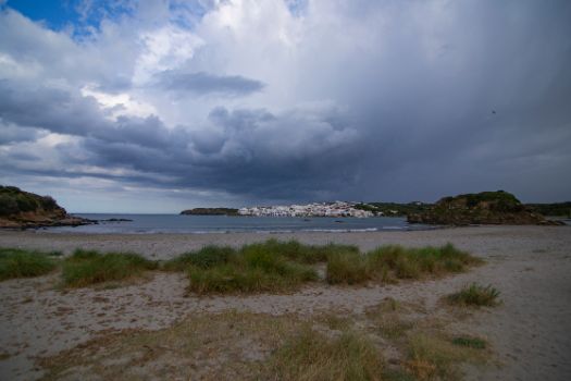
Southeast to the beach there is a picturesque view of the village of Es Grau. However, the trail leaves the beach and continues northwards along a pebble path between sand couch-grass and mastic trees, although, due to the strong winds, specimens here do not grow as tall as the ones found in the pine groves.
For 500 metres, the route goes back into another patch of pines and mastic trees, on which Mediterranean smilax (Smilax aspera) climb. After this patch, the trail returns to a scrubland area, towards the shore once again, and arrives at the coves in Tamarells. Although a rather primitive stairs have been carved in the ground to ease the climb down, please be careful as in this stretch the terrain is steep and uneven. To the northwest, at the tip of the Cape Rambla you can see one of the old defensive towers built during the time under the British rules.

From the cove of Tamarells des Sud you can still see the Rambla tower and, to the east, the Island of Colom. Just 200 m off from the island of Menorca, this island was used as a provisional lazaretto in the 18th century and has some archaeological remains such as an early Christian basilica. This island is home to population of the endemic Lilford's wall lizard (Podarcis lilfordi).
Their trail leaves the cove taking a sandy path that soon connects with a firmer dirt track. The trail continues along the scrubland landscape within view of the Cape Rambla and the Rambla tower towards the Cove of Tamarells des Nord, but without actually entering it. Very close to this cove is the starting point of the path that leads to the foot of the Rambla tower. After a little over 270 m, you will leave the trail on a path that starts on the right. Although the path is quite easy to spot, it is advisable to pay attention to the signposting. This diversion will allow you to visit the Sa Torreta cove (be careful, as like the climb down to Tamarells, the descent is somewhat steep) and continue along the beach until reaching the main trail that you had left behind.

Shortly after leaving Tamarells, you will pass by a picturesque fisherman's house with good views over the cove of Sa Torreta. Before descending towards it the path takes a small detour, going through a patch of trees, mostly pine trees with the occasional small mastic tree, for a few hundred metres.
As soon as you leave behind this tree patch, you will reach the cove of Sa Torreta. It is strictly forbidden to leave the marked path along the cove since, as the information signs explain, this is a natural area undergoing regeneration. Before leaving the cove, a path on the left leads to the Talaiotic settlement of Sa Torreta de Tramuntana, one kilometre away.
Leaving the cove behind, the trail crosses a gate and enters an entirely agricultural landscape of cereal crops and pasture, dotted by patches of mastic trees and green olive tree (Phillyrea latifolia). This landscape remains the same for just over 2 km, until you reach the access to the cove at Cavaller.

Without entering the cove, the trail turns to the left and once again enters a tree patch, against dominated by pine and mastic trees, before entering scrubland after a few metres. At this point, the trail is lined by scorpion broom and Labiatae herbs, with some wide-spaced trees.
The next cove, Morella Nou, is also left to the side without entering it, and 600 m further on, the trail reaches the Morella sandy area, popularly known as the En Tortuga cove. Before descending to this sandy area, you can enjoy a beautiful view of the entire Cape of Faváritx, with the lighthouse clearly visible at its eastern end.
The trail skirts the beach and then climbs up a rocky path, among cushion-shaped and composed bushes such as Mediterranean strawflower (Helichrysum stoechas) which are protected on their left side by a fence. The path leads to a wooden footbridge that allows you to walk along a sandy area. On the left hand side, you can see the Bassa de Morella, a shallow coastal lagoon that was declared a nature reserve in 2003. Surrounded by tamarisk (Tamarix sp.), this lagoon is an important wintering and nesting site for many water birds. It also stands out for its population of sea turtles, which has given it its popular name: En Tortuga cove.

The wooden footbridge gives way to a wide dirt track. It is lined by cushion-shaped bushes, again, as well as some specimens of the largest Euphorbiaceae to be found in Menorca, the tree spurge (Euphorbia dendroides). Here the trail connects to another track; you just have to take the right path.
After half a kilometre, and after passing the access to the Presili cove, the vegetation becomes sparser and the track becomes rockier; this is a sign that you are reaching the cape of Faváritx. The end of the stage is reached after another half kilometre, at the point where the track you have been following meets the access road to the lighthouse.
Although the second stage of the Nature Trail ends here, and the next stage begins by following the road to the west, it is well worth walking the short distance of just 1 km to the cape of Faváritx. Besides the stunning views from the end of the cape, the trail passes by El Cós del Síndic, a temporary lagoon flooded between autumn and spring that is home to two rather rare aquatic plants (Ruppia maritima and Althenia orientalis) and populations of waders.
Links of interest
Profile

(Calculated according to the MIDE criteria for an average excursionist with a light load)
Highlights
S'Albufera des Grau Natural Park
It is an area of high social value that was declared in 1995 after a long process carried out on the initiative and mobilisation of citizens. It has a total area of 5,067 ha located in the north-eastern sector of the island, following the coastline that goes from Caleta de Binillautí to Port d'Addaia.
This are has very diverse habitats that support the island's rich biodiversity, so much so that the core of the Menorca Biosphere Reserve and many of its spaces are included in the Natura 2000 Network.
In this natural park there are wetlands and temporary ponds where aquatic plant species such as Potamogeton pectinatus thrive, favouring the development of other species such as fish, arthropods, reptiles and molluscs and the birds and mammals that feed on them. Sea hawks (Pandion haliaetus), coots (Fulica altra), mallards (Anas platyrhynchos) or grey herons (Ardea cinerea), as well as the Mediterranean tree frog (Hyla meridionalis) or the Balearic-native suvpecies of the Algerian hedgehog (Atelerix algirus vagans) are especially noteworthy.
Along the coastline you can see dune systems, islets where numerous coastal birds nest and the underwater meadows of species that are becoming increasingly scarce on the Mediterranean seabed, such as Posidonia oceanica or Zoostera. These species regulate the temperature and oxygen levels of the sea water, serve as a shelter and food source for numerous species of fish, molluscs and crustaceans, and help to fix dune systems and beaches.
The inland areas of the park include wild olive forests combined with agroforestry mosaics made up of pasture and cultivated areas with patches of trees that showcase the rich agricultural and cultural heritage of the rural areas of Menorca.
Talaiotic settlement of Sa Torreta de Tramuntana
Located in the S'Albufera des Grau Natural Park, it is one of the few and most emblematic Talaiotic settlements that have been identified in the Tramuntana region. The origin of this prehistoric settlement date back 1600 B.C., and was occupied until thee Roman times and then re-occupied in the medieval Moorish period.
In 1930, Margaret Murray, a British archaeologist and researcher specialized in Menorcan prehistory, documented the discovery of this settlement, as well as the elements related to the rituals that took place there.
Today, the talaiot, the taula enclosure and a few scattered dwellings have been preserved. The talaiot is located in the highest part of the village. It is a stepped structure with an oval ground plan from which, thanks to its privileged location, the entire area can be controlled
. Below talaiot stands the taula, located in a small enclosure that remains intact and from which some of the pilasters that are still standing, as well as part of the façade in good condition. Finally, the ensemble is completed with the remains of four spaces for domestic use.
Also, near the village and in the direction of Rambles cove, you can see the base of a naveta intended for use as a burial chamber, built in Cyclopean masonry following a in what is known as a three-walled tomb, which dates back to between 1600 and 1300 BC.
Very close to the tomb there is a large evergreen oak (Quercus ilex), which is between six and seven hundred years old and is catalogued by the Balearic Government as a singular tree of the Balearic Islands.


