

Net of Nature
Trails

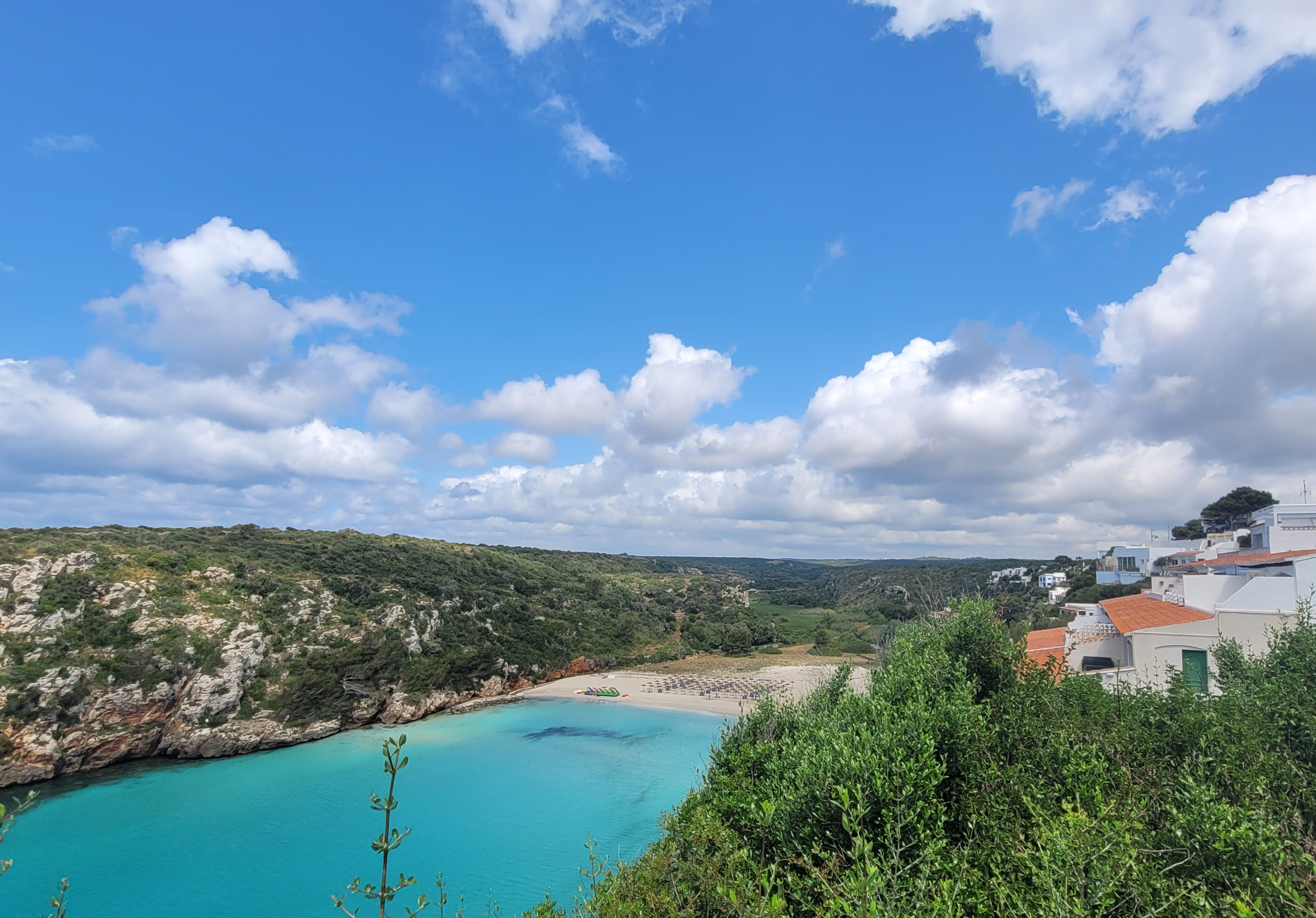
Stage 16: Son Bou – Cala en Porter
Description
Centuries-old orchards planted on ravines.
This stage has two distinct sections. At the beginning it runs through a rustic landscape between woods, rocky outcrops and cliffs flanking wild coves. Later, through an environment that bears many marks of human occupation for centuries, including farms and rural tourism establishments, orchards planted the bottom of the ravines and ending in the tourist resort of En Porter Cove. During the route you can access one of the most important Talaiotic settlements on the island via a detour: Torre d'en Galmés.

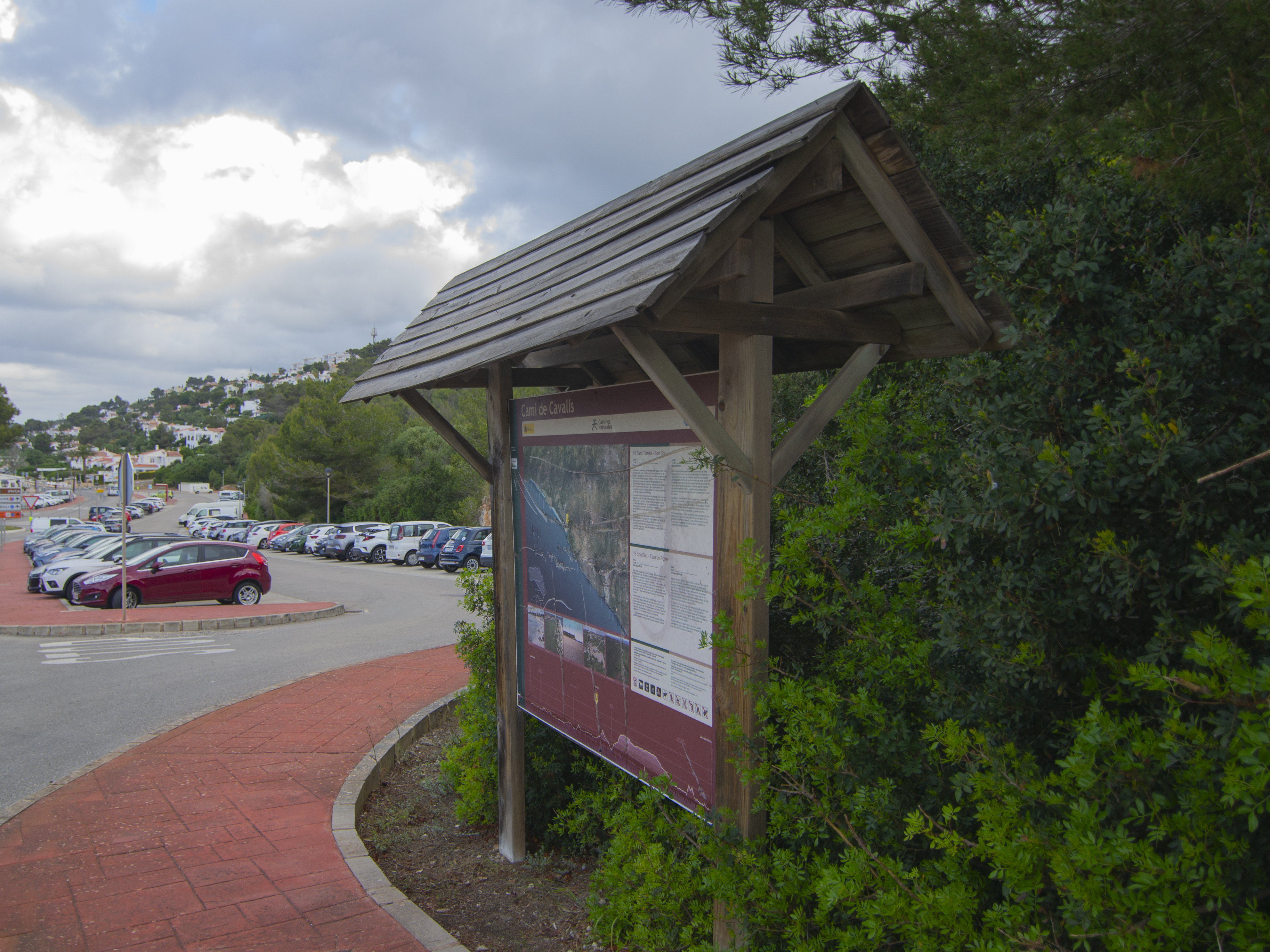
This stage starts in a car park on the outskirts of Son Bou, and you will walk a few metres along the road that links this town with Alaior and then cross it when it comes near a park. Although you then walk along one of the streets of the residential complex, you soon leave it to take a path that enters a mixed forest of Aleppo pines (Pinus halepensis), lentisk trees (Pistacia lentiscus), wild olive trees (Olea europaea var. sylvestris) and evergreen oaks (Quercus ilex).
At this point, the trail begins to go up, sometimes along a path of compacted earth and in others directly on rock, which aims to go around the northern side of the Penyes d'Alaior, one of the highest cliffs on the southern coast of Menorca. During the ascent, when the vegetation allows it, there are good views of Son Bou beach, and you can even see the site of the early Christian basilica. You will have to go up for only 300 m before reaching the Llucalari ravine. From here, you will go down the western slope of the valley, between high rock walls, until you reach the Llucalari cove, dry an almost wild pebble beach, flanked by high cliffs.
To leave this spot you have to go up the eastern slope of another of the ravines that lead to the cove. The surroundings are again similar to those at the start of Son Bou, a mixed forest on a somewhat uneven path. After almost a kilometre of somewhat challenging ascent, a major change of scenery becomes apparent, with the forest opening up more and more until it is just scattered trees in extensive pastures divided by stone walls. Leaving the ravine also means leaving the Son Bou i barranc de sa Vall SIC/SPA behind.

For the next kilometre, the path along follows one of those characteristic stone walls and crosses some Menorcan gates which, as recommended throughout this guide, should be left properly closed. The area is almost flat and crosses strips of pasture and crops dotted with pine and wild olive trees. The route then turns right to go along an asphalted road that leads to Alaior.
You will have to walk about 700 m along this road, heading east, so although you should not expect a lot of traffic, you should be very careful, especially as just at the point where the trail joins the asphalt road there is a bend with poor visibility. After a while, you will leave the road for a narrower path on the right that leads to a footbridge over the Torre Vella ravine and then to a wide track between stone walls.
If you rake this track to the north-east, it will lead you to one of the most important Talaiotic sites in Menorca, Torre d'en Gamés, whose entrance is reached after a kilometre of comfortable walking. This Talaiotic settlement is astonishing for its size and location, dominating the whole area. It has an interpretation centre and is converted into a museum, with marked routes and information boards on the use and occupation of the different structures that make up the complex.

But before reaching Torre d'en Gamés, after walking about 250 m from the crossroads with the Nature Trail, you can continue discovering Menorca's prehistory in two other sites that are located next to each other. On the one hand, there is the megalithic tomb of Ses Roques Lises, a communal burial chamber in the shape of a box built with large stone slabs and covered with earth and stones, giving it a tomb-like appearance. Just 50 m southwest of the tomb is the megalithic monument of Na Comerma de sa Garita, a large enclosure with several rooms that is unique in Menorcan archaeology, but whose exact function or dating is unknown because it has not been excavated.
Returning to the Camí de Cavalls, you continue along the track that leads to Torre d'en Galmés walking towards the southwest, along the stone walls. Here we can see, attached to the wall on the left, one of the traditional cisterns traditionally used for rainwater collection. A little further on, the trail leaves this track and crosses Menorcan gate on the left hand side, opening up a view of an esplanade with cereal crops.
This panoramic view can be enjoyed only for a short time, as the path goes back between stone walls, accompanied by increasingly dense trees as it enters a western branch of the En Porter Cove ravine. Pine trees become more scarce in favour of dicot trees, especially wild olive trees, of which large specimens can be found. As you go into the ravine, you will also enter a new area included in the Natura 2000 Network, the Des Canutells a Llucalari SIC/SPA.

When you reach the intersection with the main valley of the En Porter Cove ravine, the landscape changes substantially, as the bottom of the ravine is covered with crops, mainly vegetable gardens and fruit orchards, with the orange hues of ripe loquat fruits (Eriobotrya japonica) standing out among the green leaves. The appearance of water from the ravine is also manifest in the presence of species such as reeds(Phragmites australis), southern cattails (Typha domingensis) and rushes (Juncus sp.).
The route, which now uses a stretch of asphalted track, goes around some houses and crosses the ravine to continue along its left side, heading downstream. Just before crossing the ravine, two large trees will welcome on your left side. These are two specimens of pecan tree (Carya illinoinensis), a species native to Mexico that must have been planted by a retuning immigrant. Together with two other trees next to the watercourse, they are the only specimens of pecan trees on the island; they are locally known as the pacaners de s'Hort Squella and have been awarded the status of singular trees.
A new gate, this time a double gate, marks the end of the asphalt road and the start of a dirt road. After half a kilometre, the trail begins to go up between crops to the right and the ravine cliff on the left. The slope is quite steep, so wooden stairs have been installed to make it easier for hikers to climb. This challenging climb of about 150 m is rewarded by the magnificent views of the surroundings, both of the bottom of the ravine and its mosaic of crops, and of the walls that flank it, with many caves and hollows that are used as a refuge for Egyptian vultures (Neophron percnopterus).

Here you can also learn more about Menorca's agricultural traditions, including an ancient threshing floor. These circular, cobbled infrastructures were used for threshing the crops to separate the wheat from the chaff, and were placed high up to make use of the wind in the work being carried out.
A few metres further on, the path goes down again towards the ravine, where the bare rock and its shelters and hollows sometimes appearing on the left hand side. This winding section of the trail requires to place guardrails to the right to protect against potential falling. After a few twists and turns down, you reach a track next to the buildings of a farm and a well with a traditional cattle trough.
Continue south along the track for one kilometre, crossing the same landscape of agricultural fields on one side and wild dicot trees on the other, including a large lentisk tree which has also been declared a singular tree.
The track ends on the outskirts of the residential complex of En Porter Cove, near the beach car park, where this stage of the Nature Trail comes to an end. The beach, with clear water and fine sand, is only 250 m away.
Links of interest
Profile

 Harshness of natural environment
- 1. The environment is not risk-free
- 2. There are more than one risk factors
- 3. There are various risk factors
- 4. There are quite a lot of risk factors
- 5. There are many risk factors
 Guidance along the route
- 1. Well defined trails and crossings
- 2. There is a clearly marked trail and signage
- 3. Requires the identification of geographic features and cardinal points
- 4. Requires off-path navigation
- 5. The trail is interrupted by obstacles that have to be gone around
 Route difficulty
- 1. Walking on a flat surface
- 2. Trails with different types of path
- 3. Walking on stepped paths or irregular terrain
- 4. The use of hands or jumping over the terrain is necessary
- 5. The use of hands is required to progress
 Amount of effort needed
- 1. Up to 1 hour of continuous walking
- 2. Between 1 and 3 hours of continuous walking
- 3. Between 3 and 6 hours of continuous walking
- 4. Between 6 and 10 hours of actual walking
- 5. More than 10 hours of continuous walking
(Calculated according to the MIDE criteria for an average excursionist with a light load)
Highlights
Traditional uses of the landscape: the ravine of En Porter Cove
At twelve kilometres long, the En Porter Cove ravine is the longest of the ravines in the south of the island and the second longest in the whole of Menorca after the Algendar ravine.
The presence of a constant watercourse and the protection offered by the high walls of the ravine, promoted the use of the ravine by humans since ancient times, as attested by the orchards and fruit crops located in the bed of the ravine and on the terraces. This activity still determines the landscape of the En Porter Cove ravine today.
Talaiotic settlement Torre d'en Galmés
This is the best-preserved Talaiotic settlement in Menorca and one of the largest in the Balearic Islands. This settlement belongs to the late Talaiotic period, between the 5th and the 1st centuries BC. It includes a wall that, according to the studies carried out, surrounded and protected the settlement.
The iconic construction of these settlements and the one that gives its name to this culture are the talaiots, constructions in the shape of a primitive tower, normally with a circular ground-plan, used as watchtower for defensive powers, although it is not certain that this was its only function. Torre d'en Galmés has three talaiots.
From this location, the central area of the south coast of the island can be seen, so the location of the settlement was not accidental. Agriculture and livestock farming activities where carried out in the immediate surroundings of the settlement, and we know that its inhabitants also had some astronomical knowledge, as shown by the fact that all doors and dwelling are south-facing to avoid the north wind, and that they held ceremonies and celebrations worshipping different gods.
The most outstanding feature of the settlement is the taula enclosure, where the characteristic T-shaped construction formed by two large stone slabs (which due to their enormous weight, were very difficult to handle using the techniques available at the time) stand.
Multimedia


Downloads

GPS Downloads


