Net of Natural
Trails

Stage 1: Maó - Es Grau
Description
This first stage runs across the north-east of Menorca in a route that combines tradition and nature
The stage begins at the crossroads between the road to Sant Antoni and the Me-3 road, following the latter road towards the coastal village of Sa Mesquida. In this area, the tramontane and sea winds have carved the road, creating the coves of Sa Rinconada and Sa Mesquida, which stand under the guard of a 18th century watchtower. From here, the path continues along the cliffs that make up the natural space of El Macar de Binillautí, included in the Natura 2000 Network. The route turns inland again and runs between crop fields and tree patches, crossing the Natural Park of S'Albufera des Grau until it reaches the Gola des Grau marshes.

The beginning of the Camí de Cavalls is located to the east of the island of Menorca, in the municipal district of Maó. The information board indicating the start of stage 1 is located 1.80 km east of the port of Maó, next to the intersection at the first kilometre of the Me-3 road and the access road to the Sant Antoni neighbourhood. From here, the stage continues along the hard shoulder of the Me-3 for one kilometre, leaving the island's capital behind until it joins the road that leads to the coastal village of Sa Mesquida.
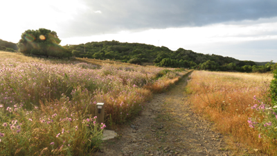
The landscape following the Me-3 consists of heath and scrubland. Private agricultural plots are bounded by traditional dry masonry walls and surrounded by Mediterranean scrub, including mastic trees (Pistacia lentiscus) and wild olive trees (Olea europaea sylvestris). These plots are accessed through the traditional Menorcan gates, which get their gnarly shapes from being built in wild olive tree wood.

Following the road to Sa Mesquida, the path rises, leaving behind the crop fields and gradually entering the northeast of the island, from which the coastline can be seen more clearly and the change in the landscape towards a more humid and saline one can be appreciated. The change in landscape is caused the strong Tramuntana winds that sweep over the northern part of the island and carve its rugged landscape: plants are generally smaller here, and other species are present, such as junipers or Menorcan-native herbaceous plants such as sand couch-grass or reeds, and species specially adapted to the extreme weather of the island's northern coast, such as the thorny and compact socarrells (Anthyllis hystrix).
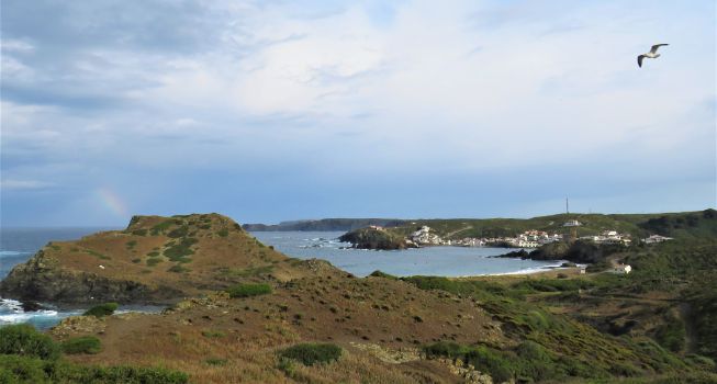
The trail continues down from the junction with the Es Murtar road until it enters the coastal village of Sa Mesquida, where the sea, geological formation, vegetation, salinity and human activity blend together to create a landscape that is both traditional and wild. The trail continues along the access road to the coves of Sa Rinconada and Sa Mesquida, with its rocky outcrops that emerge from the sea. At this spot stands the magnificent Sa Mesquida tower, built as a watchtower during the British occupation in the 18th century.

Once past the coves, visitors enter a protected dune ecosystem that is currently under restoration, which is why the walkways and gates that have been set up must be respected. At the same time, the road enters military territory under control of the San Isidro military base. This are is home to animal and plant species characteristic of the Mediterranean climate in general, as well as Menorcan native species in particular, as the Audouin's gull (Larus audouinii), the sea poppy(Glaucium flavum) or the Lilford's wall lizard (Podarcis lilfordi), which lives on the islets around Menorca.
From this point, this first stage of the trail continues for 3.5 km along the northeast coast of Menorca, which is characterised by gentle cliffs that do not exceed 60 m above sea level, interspersed with small coves and nooks that are part of the SCI and SPA of S'Albufera a la Molatí, which is included in the Natura 2000 Network. In this area, extreme caution must be taken as it is a bird nesting area under a special protection regime. In addition, coves do not have lifeguard services, first-aid stations and toilets, as they are isolated and difficult to access.

Once you reach Binillautí cove, the trial goes up and inland for approximately one kilometre from the coastline, entering a rugged landscape marked by undergrowth and Mediterranean scrubland, which is included in the S'Albufera des Grau Natural Park. This Natural Park constitutes the core area of the Menorca Biosphere Reserve. The vegetation of this stretch consist of typical Mediterranean shrub, such as mastic trees, wild olive trees and evergreen oaks (Quercus ilex).
The stage continues through this hilly area for 1.6 km, spotted with crop fields delimited by natural elements. Then, the trail goes down again to the Me-5 road that links Maó with Es Grau. Once the trail reaches the Me-5, the path follows the last 760 m along the shoulder of the Me-5 to reach the end of this first stage at S'Albufera des Grau.
Links of interest
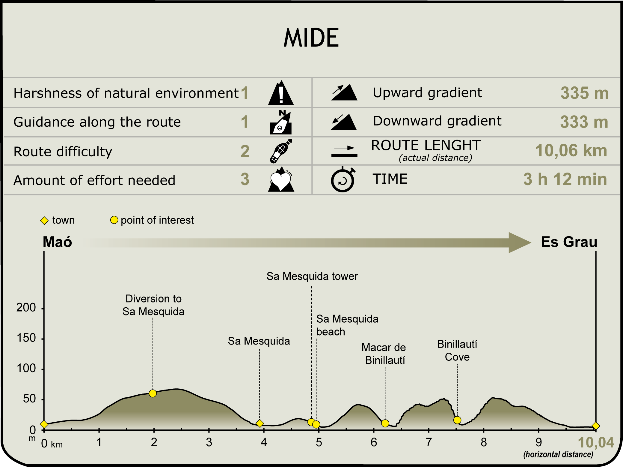
Profile

(Calculated according to the MIDE criteria for an average excursionist with a light load)
Highlights
Port of Maó
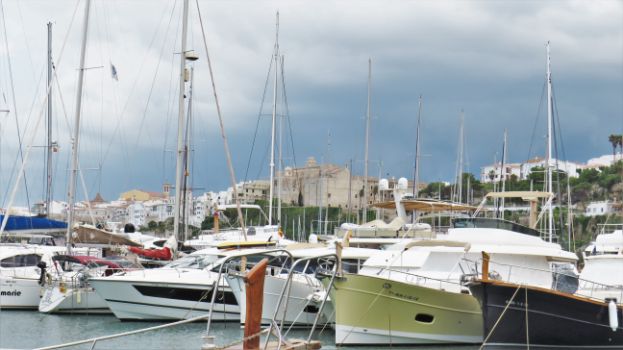
The geographical and geological characteristics of Menorca creates sea inlets all along its coastline, which may take the form of beaches, coves, bays and gulfs. These geographical characteristics have favoured the development of various activities on the island. However, the inlet around which Maó, in the east of the island, was built remains the largest in the island, followed by that of the second most important city, Ciutadella. The port of Maó is built on a sea inlet that reaches six kilometres inland, making it one of the longest natural ports in Europe.
The access to the port is located between the Mola Peninsula to the north and Cape Sant Felip to the south. It should be noted that, along the six kilometres that make up the port, there are other geographical features that have been used in the past and in the present for military purposes, such as the Figuera, Llonga, Rata and Teulera coves, where the towns of Maó and Es Castell were built.
The sea inlet that makes the port even has several islands on it with descriptive names: from the outer part to the inner part of the bay, stand Island of Llatzeret, in which a lazaretto, or a hospital for infectious diseases, stood; Island of Cuarentena, which literally means Quarantine Island; Isla del Rey, meaning Island of the King; and Isla d'en Pinto.
Given its characteristics and geographical location in the centre of the western Mediterranean, the port of Maó has been and continues to be one a major commercial port and military vantage point 3rd century BC. So much so, that the archaeological remains found all along its coastline range from an early Christian basilica, through the 15th century lazaretto still standing on Llatzeret Island, to the 18th- and 19th-century military fortresses from the British rule and subsequent Spanish defence, such as the Sant Felip Castle, Fort Marlborough and the Isabella II Fortress.
The port of Maó is currently used for commercial, tourism and industrial purposes, and even houses a thermal power station.
Sa Mesquida
Sa Mesquida is a village in the municipal district of Maó, 4.5 km northeast of the capital. This small seaside village has few residents, although many return during the summer season.
During the last years of the 18th century, this town was the setting of the conflict between the British troops, who had occupied the island in 1708, and the Spanish army of Charles III, who fought to re-conquer the island. For this reason, one of the key architectural highlights of the town is the Sa Mesquida tower, which was built in 1799 between the beaches of Sa Rinconada and Sa Mesquida. Besides this one, 10 other watchtowers were built along the shore as part of a defensive network of the coast.
These buildings present several common architectural features: they all are stone and lime and sand plaster building with a circular ground plan and are three storeys tall with a very large and reinforced western parapet, higher than that of the terrace, built to repel land attacks. In addition, the machicolation along the parapet allows defendants to fire attackers. The distinguishing feature of the Sa Mesquida tower is its upper platform, where a rotating cannon was located.


