Net of Natural
Trails

Inland. San Rosendo Nature Trail. Porto Quintela - Celanova section
Description
A walk through the history of Galicia. Porto Quintela to Celanova
The San Rosendo route from Quintela de Leirado to Ourense is part of the 225 kilometres of renovated pedestrian paths that link Porto-Quintela (Bande) and Foz (Lugo). The route is named after San Rosendo, the protector and peacemaker of Galicia. However, this itinerary is also mentioned in a play entitled "A via romana do Gerês" written by José Matos Ferreira after completing the route in 1728. Fine examples of religious heritage such as the Visigoth temple of Santa Comba, the church at Bande or the Monastery of Celanova can be found along this route.
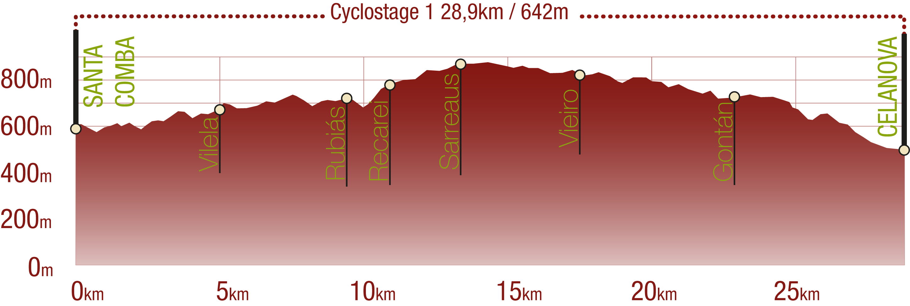
Although the name of this first section appears to suggest that the route starts at Porto Quintela, it actually begins at Santa Comba, near the Baixa Limia-Serra do Xurés Nature Park.
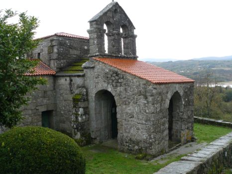
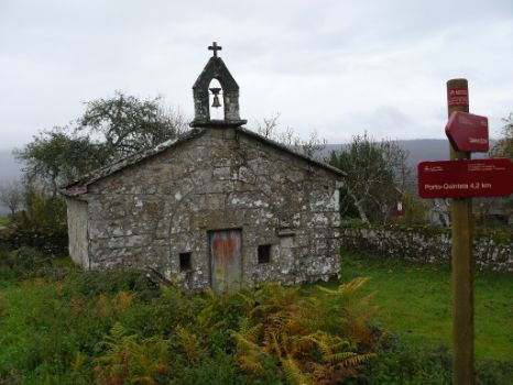
The first encounter with the history of Galicia takes place immediately after starting the route behind the parish church. The chapel of San Torcuato is situated alongside the route. The so-called "Visigothic jewel of Galicia", the chapel dates from the seventh century and was declared a National Monument in 1921.
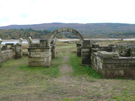
From here, the route heads to Quintela's town centre, where a side-track leads to Das Conchas Reservoir, a must-see for archaeology enthusiasts. The Aquis Querquennis excavation site is located on its banks. An ancient Roman camp, probably built to protect Iter XVIII or Via Nova, it linked "Bracara Augusta" (Braga, Portugal) and "Asturica Augusta" (Astorga, Leon). Before heading to Lobosandaus and Vilela, where a chapel and stone cross can be found, a visit to the hot springs and interpretation centre is advised.
Past Vilela, the itinerary continues towards O Souto and Rubias through mountains with names like O Uzal, Pena Maior or Monte do Souto. These names indicate geographical formations and vegetation. The route first passes through mountains with heath (uz in Galician), then reaches an area with large granite boulders, and finally a dense hardwood forest with birches (Betula sp.), oaks (Quercus robur) and chestnuts (Castanea sativa, souto in Galician). In fact, the next town is called Souto, in reference to these trees. Leaving behind this town, the route passes below Pazos on to Rubias.
The next stop is A Ponte Nova. However, before the Trail arrives at the crossing of the River Cadós, it heads to the parish church of Santiago with a spectacular stone cross.
From A Ponte Nova, the route climbs to Recarei where it passes next to the chapel of San Antonio. The main road continues to Sarreaus, however, there is a side-track between these two towns that leads directly to Bande, where the traveller can relax or stock up for the rest of the section. The baroque Church of San Pedro de Bande can also be visited.
It was built between the 17th and 18th centuries. The coat-of-arms of San Rosendo is carved into the arch. Next to it is the "Priorato", the name given to the old rectory.
From Bande, the route heads towards Sarreaus to resume the journey along the original itinerary to Vieiro, passing through the municipality of Verea. The Trail passes through the foothills of O Castro, Monte Calvo and Alto do Vieiro.
This last foothill is near OU-540, where there is a recreation area with a few junipers (Juniperus sp.) worth viewing. After Vieiro, there is a stone cross to the right and the silhouette of Ermida de Santa Eulalia can be seen in the distance. However, about 100 metres before, the route takes a side-track to the right that winds down a slope, heading towards Gontán through the foothills. At the edge of the town is the parish church of Santo André, and opposite the church, on the edge of the road, is a "peto de ánimas". Agricultural activity is the foundation of the good and noticeable conservation of the town.
The route heads from Gontán to Celanova, passing through the village of Cañón. At the edge of the town is a fountain for refreshment. The importance of water in Galician culture becomes evident in the next section from Cañón to Capilla de San Lourenço, where the route crosses several watercourses, and passes next to a natural well used to store water for irrigation.
A typical flight of steps on a wall give access to the top of a fence from the path. Near the Chapel, the route forks into two paths that come together at San Verísimo church cemetery. Opposite OU-540, and near the end of this section, the route passes next to the chapel of La Encarnación, and further on, reaches the Monastery of San Rosendo, where the Trail ends.
Sites of interest
Puntos de interés
Hostel
Profile

(Calculated according to the MIDE criteria for an average excursionist with a light load)
Highlights
Further information
Saint Rosendo
He was born on November 20, 907, under the reign of King Alphonse III the Great, in Salas Valley, or near Santo Tirso (present-day Portugal).
He received the bishopric of Dumio (present-day Mondoñedo), rebuilt the monastery of Caaveiro, and founded a monastery at Celanova in 936. In 1172, he was raised to the altars by the papal legate, Jacinto Cardinal Bobo in an episcopal canonisation, as was the custom in those days. This canonisation was confirmed by the prelate himself when he was elected Pope Celestine III. It appears that even at that time there was popular veneration for the Saint.
Monastery of San Rosendo Celanova
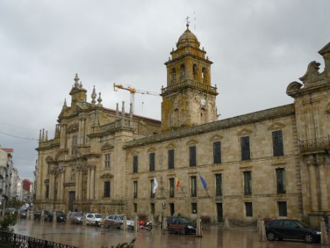
It is one of the most unique in Galicia, with two cloisters and a baroque church. Although construction begun in the mid-sixteenth century, the bulk of the building, one of the most outstanding examples of Galician baroque, dates from the seventeenth century. It is organised around two cloisters: the baroque or processional (16th century) cloister, and one popularly known as Poleiro (completed in 1722) owing to the interesting balcony or “poleiro” that gives access to the cells located between the floors.
Chapel of San Miguel
The Chapel of San Miguel, built in 940, can be found in the monastery's former vegeteable garden. Founded by Froila, the brother of San Rosendo, it is regarded as a Mozarabic gem, unique in Galicia.
Multimedia
Downloads
GPS Downloads
Cyclability
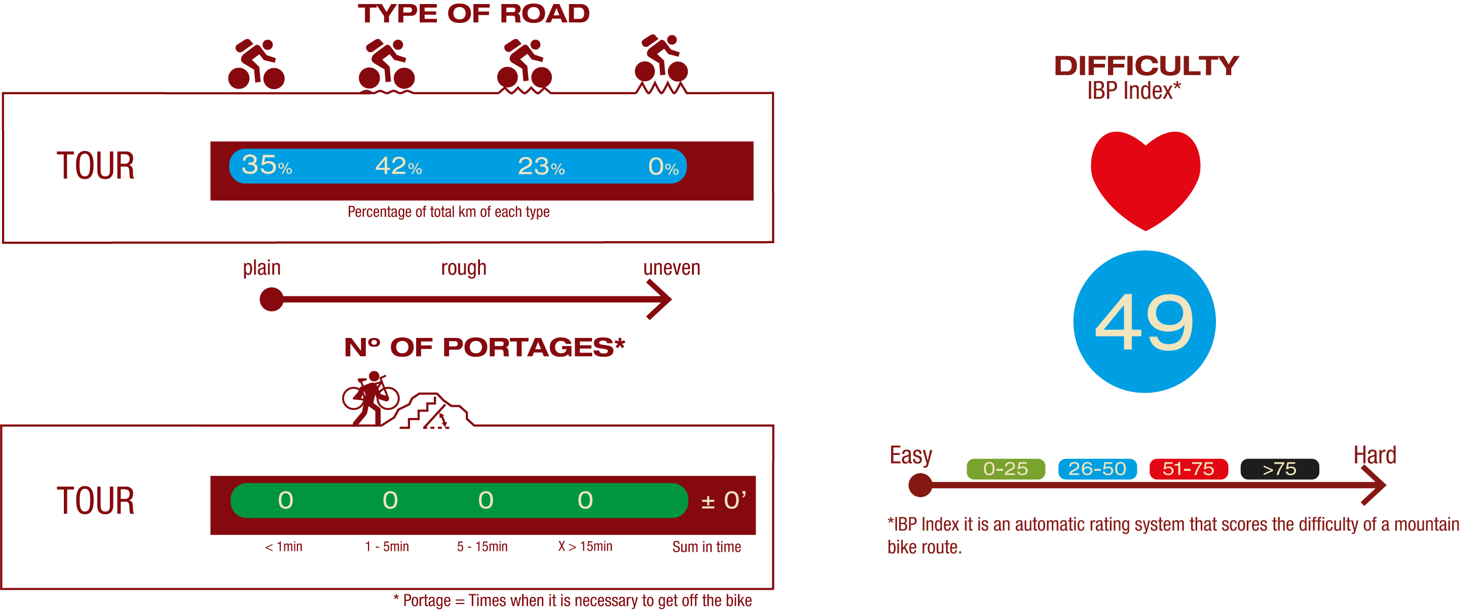
TYPE OF ROAD, PORTAGES & DIFFICULTY
SAFETY RECOMMENDATIONS
- Sections shared with hikers.
- Transit through the centre of some population centres.
GENERAL RECOMMENDATIONS
- Find out about the technical aspects of the route and the weather on the day.
- Take care of the environment. Take care not to disturb animals or damage vegetation. Respect private areas.
- You must give priority to pedestrians and comply with general traffic rules.
- The environment in which you will be riding is open, free to move around and an area where many activities are carried out (sporting, forestry, livestock and agricultural activities). Always have an understanding, prudent, responsible and respectful attitude.


