


Net of Nature
Trails

Stage 7: Gormaz - San Esteban de Gormaz






Description
Through vineyards
This Stage begins in the shadow of the impressive caliphal fortress of Gormaz. It initially traverses through juniper-oak forests, and later through almond trees and vineyards, which flank the River Duero throughout the route. The Stage ventures through the territory of Ribera de Duero, where the world famous wines with the namesake Designation of Origin are grown.
After visiting Gormaz, the route leaves the small town behind, and climbs up the road to the caliphal fortress with views of the fields and barren lands crossed by the Duero, and slopes blanketed by Spanish junipers (Juniperus thurifera).

Past the Romanesque shrine of San Miguel (11th-12th c.), the route skirts around the hill on which the fortress stands. The stunning and sweeping views from here attest to the past splendour of this site; a landscape in which sunflower and grain fields are interspersed with wastelands and junipers that are only beginning to colonise the lands where livestock have grazed since time immemorial.
The route continues through Spanish junipers towards the SO-160, along which it runs for about 2.5 kilometres. Caution should be exercised. The appearance of maritime pines (Pinus pinaster) and rockrose (Cistus) signals that the limestone-clay soil has been replaced by sand and pebble.
At a bend in the road, opposite a hamlet (Granja El Enebral), the route turns onto a path that emerges on the left. It is easy to encounter some of the many Azure-winged Magpies (Cyanopica cyanus) that populate this area.

The route traverses through farmland dotted with junipers, holm oaks (Quercus ilex), derelict pens and watchtowers. Abd al-Rahman III, the first Andalusian caliph, ordered the construction of these buildings along the border marked by the Duero to protect the places easily accessible through the Ebro Basin and Sistema Central. He built along the border a succession of watchtowers within sight of each other.
As the route advances, Spanish junipers gradually disappear, giving way to holm oaks, rockroses and Spanish lavender (Lavandula stoechas), a perfect environment for beekeeping, as shown by the numerous hives strewn that dot the route.
The route gradually drifts to the north, towards the town of La Olmeda. Past the old Valladolid-Ariza railroad, the path becomes wider. One can see to the left, the perfect aligned trees of the riparian forest along the River Ucero, a tributary of the Duero.
Past wastelands, an aggregates site and poplar plantations (Populus alba), the route arrives at La Olmeda. This town has many wood and adobe structures, although most are derelict. Adobe, a building material which consists of mud mixed with straw, was widely used in this area where no stones or rocks exist. Another interesting feature at La Olmeda is that the land on the farms near the town is formed by pebbles to prevent dust from threshing.
Past this hamlet, the route traverses through a grassland used by feedlot cattle and continues towards a riparian forest along the River Ucero, protected by a dense thorny hedge of brambles (Rubus sp.) and dog rose (Rosa canina rose), where Spotted Flycatchers (Muscicapa striata) frolic. In the background, one can see more watchtowers on the limestone moors. Further on, the route turns left at a fork, and continues through wasteland colonised by wild roses.
As the route advances, one begins to see almond trees (Prunus dulcis), clear evidence that this is a higher thermal zone. The vineyards indicate that the Trail is approaching the land that produces D.O. Ribera del Duero wines.
Wastelands, vineyards, sunflowers, almond trees and maritime pines flank the route to Ucero Recreational Area, located at the end of a small gorge leading to the town of El Burgo de Osma, where one can enjoy a well-earned rest. The ruins of the Celtiberian city of Uxama are located nearby. A pedestrian promenade links the recreational area with El Burgo de Osma.

The route crosses the bridge on the River Ucero, and then turns along the road, past the ruins of an old power plant. At the first interStage, it takes the road to the right, then turns left, and continues along a farm road. The Trail overlaps with the Camino del Cid in this stretch.
It heads through fields of cereal and vineyards, interspersed with walnut trees (Juglans regia), semi-derelict sheep pens and Spanish junipers that dot the embankment. After climbing up a small hill and changing direction, one can see Sierra de Ayllón across the plain. Further on, the route runs along a clay hill with heavily eroded limestone outcrops, where only the juniper can survive as a dense forest.
Past the juniper forest, the path arrives at an interStage where it turns south to the left, opposite Sierra de Ayllón. The route climbs down a gentle slope between farms to Pedraja de San Esteban, a town with numerous dovecotes near the slopes closest to the town, at the end of the River Duero Valley.
These dovecotes are an example of rural people's creativity. Built in adobe or stone, they were usually round with three concentric walls. The nests for breeding were dug out of the wall. These structures were usually built in places where pigeons would naturally roost.
The path leads to a local road that traverses through the village, and continues along the route. The slopes are dotted with wineries where for centuries wine has been made.
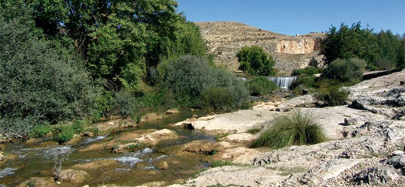
The route crosses a bridge and turns left onto a farm road that traverses the flood plains of the River Duero, whose presence is betrayed by trees aligned along its course. To the right are wastelands and small limestone cliffs.
Further on, the route comes upon farmed poplars, English poplars (Populus nigra) and white poplars, which form a beautiful riparian promenade leading to San Esteban de Gormaz.
Before entering San Esteban de Guzmán, the route passes next to several local attractions, including a recreational area, a pier on the River Duero for canoeing, and La Rambla river beach. The Stage ends at this town, whose streets and monuments, including the Romanesque Church of San Miguel and medieval castle, are well worth a visit.
Sites of interest
Puntos de interés
Culture
- Atalaya del Enebral
- Former Valladolid-Ariza Railway Line
- Atalaya de Uxama
- Celtiberian city of Uxama Argaela
- Chapel of San Roque
- Caliphate fortress Castle of Gormaz
- The Torre de la Mora
- Medieval Bridge of Gormaz
- Chapel of San Miguel
Hydrography
Information
Infrastructure
Municipality
- Canal de La Rasa
- El Burgo de Osma
- Navapalos
- La Olvera
- Alcubilla del Marqués
- Pedraja de San Estebán
- San Esteban de Gormaz
- Olmillos
- Osma
- Gormaz
- Vildé
Passport
Profile

 Harshness of natural environment
- 1. The environment is not risk-free
- 2. There are more than one risk factors
- 3. There are various risk factors
- 4. There are quite a lot of risk factors
- 5. There are many risk factors
 Guidance along the route
- 1. Well defined trails and crossings
- 2. There is a clearly marked trail and signage
- 3. Requires the identification of geographic features and cardinal points
- 4. Requires off-path navigation
- 5. The trail is interrupted by obstacles that have to be gone around
 Route difficulty
- 1. Walking on a flat surface
- 2. Trails with different types of path
- 3. Walking on stepped paths or irregular terrain
- 4. The use of hands or jumping over the terrain is necessary
- 5. The use of hands is required to progress
 Amount of effort needed
- 1. Up to 1 hour of continuous walking
- 2. Between 1 and 3 hours of continuous walking
- 3. Between 3 and 6 hours of continuous walking
- 4. Between 6 and 10 hours of actual walking
- 5. More than 10 hours of continuous walking
(Calculated according to the MIDE criteria for an average excursionist with a light load)
Highlights
Further information
Spanish juniper forests
Spanish juniper forests are remnants of the pre-glacial, steppe forests that had their heyday in periods with more arid conditions.
This steppe heritage has enabled the Spanish juniper to survive low winter temperatures and summer droughts. Indeed, the largest forests are located in areas with harsh continental climate.
The juniper is a medium-sized, cone-shaped, evergreen tree, which can grow up to 20 metres high, in more or less open forests.
The juniper dates back to the Tertiary, about 80 million years ago, when the temperate climate in the Mediterranean began to wane. It most likely widely colonised much of the territory before the great African and European mountain systems came into existence. During the Quaternary, its range was much reduced, making these forests extremely valuable as relict populations.
Other plant species that coexist with the Spanish juniper include holm oak, Portuguese oak (Quercus faginea), maritime pine, Scots pine (Pinus sylvestris), black pine (Pinus nigra) Pyrenean oak (Quercus pyrenaica), gorse (Genista scorpius), thyme (Thymus sp.), juniper (Juniperus communis), etc
Multimedia


Downloads

GPS Downloads