Net of Natural
Trails

Stage 34: Villarino de los Aires - Pereña de la Ribera
Description
Cabrones Creek: A journey to the Cantabrian environment
The feelings evoked by this Stage are varied and interesting. The initial stretch runs along a little-used road, market gardens, olive trees and vineyards, which, halfway through the route, give way to a path that climbs up along Cabrones Creek, under the thick canopy of Pyrenean oaks and chestnuts, in a fairy tale setting.
Before leaving the town of Villarino de los Aires, one should enjoy a stroll through the town and visit some of the many viewpoints that exist in the area, including Rachita, Duero and, in particular, La Faya and Teso de San Cristobal, where one can see the River Tormes emptying into the Duero.

The route kicks off at the crossroads between the DSA-560 road to Pereña de la Ribera and the road that gives access to the towns of Rachita and Soto, and leads to the evacuation gate of Villarino de los Aires hydroelectric plant. The route runs along the former road, flanked by many market gardens where beets, beans, cabbages and tomatoes grow in perfectly aligned rows. There are also orchards, vineyards and olive trees, some of which are centenarian and others recently planted.
After a double bend in the road, the route reaches the village of Soto. Here stood a bunkhouse where the workers who built the Villarino hydroelectric plant, La Almendra Reservoir and the gallery connecting both used to live. The village of Rachita was founded to house the engineers and skilled workers that also worked in the construction works. The hydroelectric plant is located 500 metres away, carved into the hard granite rock. The evacuation gate is located at the end of the road, 325 metres above sea level.

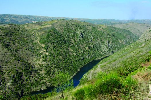
This area is populated with Pyrenean oaks (Quercus pyrenaica), Scotch brooms (Cytisus scoparius) and rockrose (Cistus ladanifer). The route continues along the same road until it reaches a point from where one can enjoy stunning views of the River Duero.
The route leaves the paved road where it makes a U-turn (180 degrees) to the right, in an area with towering chestnut trees that provide ample shade.
From here, the route continues upstream, towards the north, along Cabrones Creek, where the vegetation makes the visitor feel as if the path has ventured into a Cantabrian mountain range.
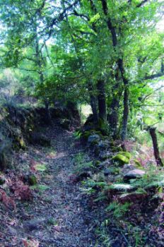
The path runs between Pyrenean oaks and chestnuts (Castanea sativa), bounded frequently by stone walls. This route was frequently used in the past by the residents of Pereña de la Ribera to access the River Duero and the farmsteads on the hillside.
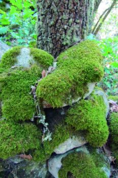
Cabrones Creek typically carries water throughout the year. The Pyrenean oak trees, whose trunks are covered with lichen, create a shady, wet area in which moss and ferns thrive. Chestnuts also flourish here owing to the shade and moisture. The large, broad leaves help create a purely nemoral environment in which the microclimate facilitates its regeneration.

The path rises gradually, drifting away from this landscape. It now ventures into a terraced area in which the land is colonised by brooms and oaks due to lack of agricultural activity. The large stone walls of the terraces hold back the ground, keep it flat and retain moisture, preventing water from seeping down the slopes.
Given the proximity of Cabrones Creek, in some stretches, the path narrows and is overgrown by shrubs and herbaceous species typical of wet or waterlogged areas. The path widens as it rises, giving way to vineyards and olive groves. Soon after, it reaches the village of Pereña de la Ribera, where the stage ends.
Sites of interest
Profile

Highlights
Further information
Chestnuts
Back in the Celt days, there was already a broad culture centred around the chestnuts, a staple food in many parts of Europe. The 18th century Dictionary of the Royal Academy of Language stated that the chestnut "makes up for the lack of wheat in many place”. Bread or sweets made with chestnut flour are common in towns in the west of Castile or Vizcaya.
In some counties in Zamora and Leon, the barter of chestnuts for wheat was common practice in the cereal plains of central Castile.
Furthermore, chestnut wood is prized for its hardness and resistance, and it is widely used for beams and woodwork.
Arribes wine
The production, processing, ageing and marketing of wine under the Arribes Designation of Origin was approved in 2007.
The existence of vineyards in Arribes is documented since the Middle Ages. However, until the eighteenth century, its wines had problems finding markets beyond the neighbouring towns in the peneplain. Owing to the change in trend in the 19th century, cereal fields were replaced with vineyards in the main towns in the area. This led to a shortage of wheat, causing great alarm amongst the town councils. The economic dependence upon the vineyard was such that, following the phylloxera epidemic in the 19th c., there was a major crisis due to mass emigration to South America.
These hardships were surmounted in the early twentieth century, when the vineyards were grafted over with an American varietal. Soon after, in the mid-20th century, the growers set up cooperative wineries to market most of the local wine.


