Net of Natural
Trails

Stage 2: Vinuesa - Soria
Description
Following the course of the river: from the mountain to the plateau
Surrounded by water and mountains, the town of Vinuesa sits amidst pinewoods, north of Cuerda del Pozo Reservoir, and to the east of Pinares County, on the foothills of Picos de Urbión and La Cebollera Mountain Range. The valley is at an altitude of more than 1,000 metres, and is crossed by many rivers and streams, including the nascent Duero, Revinuesa and Remonicio.
The Stage begins on the outskirts of Vinuesa, next to the Shrine of La Soledad, built in the late 15th century. A stroll through the town is recommended, as it is home to the parish church of Nuestra Señora del Pino, in Gothic-Renaissance style, and the Casa de los "Indianos", successful emigrants who struck it rich in the Americas.
The route crosses the bridge on the Revinuesa and continues about 300 metres along the SO-821 linking Vinuesa and El Royo. Caution should be exercised in this stretch as the road carries heavy traffic.
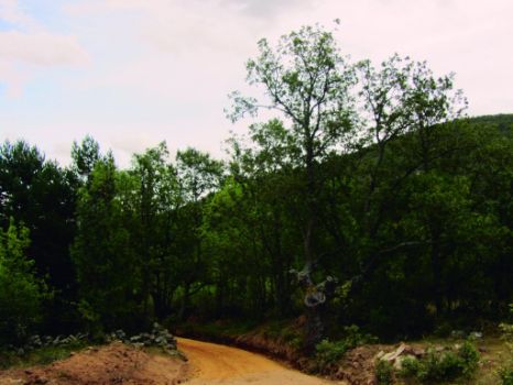
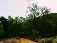
Near the Shrine of San Pedro, the route leaves the road behind and turns onto a red dirt track to the left. The track is wedged between stone walls marking the property line of several farmsteads; a perfect foraging ground for lizards.
Further on, the route leaves the track behind and crosses over a small wood and metal footbridge toward Majada de la Viuda.
Barely 100 metres ahead, the path turns right, leaving behind several "tenadas", and continues towards an area with meadows. The path is barely visible in this stretch; therefore, attention should be paid to the signs and wooden milestones. The route traverses through Los Estepares, so called because the area is covered with cross-leaved heath and heather, used for centuries to make brooms.
After crossing a metal gate, the road turns right, near a large Pyrenean oak (Quercus pyrenaica), known locally as "melojo". From here, it ventures into a dense oak forest dotted with Scots pine (Pinus sylvestris). A barbed wire fence runs along the path.

The oak forest disappears soon after, giving way to a young Scots pine forest, the dominant species in this land of pinewoods.
One can easily see a white cobweb-like bag on some pine trees. These are the nests of the processionary caterpillar (Thaumetopoea pityocampa), an insect that lays its eggs on the branches, and whose larvae feed on pine needles.
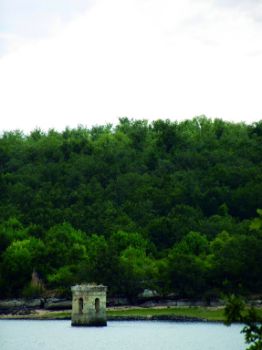
The road crosses the SO-801 and continues several kilometres along Cuerda del Pozo Reservoir. This reservoir supplies drinking water to Soria and to part of Valladolid. Its water is also used to irrigate an area (26,000 hectares) that spread to the confluence with the River Pisuerga.
In winter, when the reservoir is filled by rainfall, some Stages of the road may be flooded. In this case, part of the route run along the road.
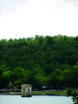
In summer, when the reservoir's water level declines, one can see the ruins of La Muedra, a small town flooded to create the reservoir. One can easily see a variety of waterfowl species who find shelter in this reservoir, including Mallards (Anas platyrhynchos) and Grey Herons (Ardea cinerea).
After 3 kilometres along the reservoir's edge, the route arrives at the pier of the Club Naútico Soriano. The path continues under the canopy of pine trees with beautiful views of the reservoir and the riparian vegetation, including ashes (Fraxinus angustifolia) and white willows (Salix alba), as well as cattails and bulrushes (Typha sp.).
The route continues to the road to Cidones and Cuerda del Pozo Dam, which regulates the flow of the Duero. After crossing the dam, a few hundred metres further on, the route turns sharply to the left on a conveniently marked forest trail. Leaving the dam behind, the landscape is now dominated by Pyrenean oaks. The heather under the trees paints a white and pink landscape.
Careful attention should be paid to the signs to continue along the main route, as there are many crossings along the way.
The path traverses through a pine forest that is undergoing reforestation. The route passes next to a dehesa known as "El Vergel de las Zarzas", populated with ashes and used by livestock for grazing. It then approaches the town of Vilviestre de los Nabos.
Despite the few inhabitants and size of Vilviestre de los Nabos, this municipality has significant natural wealth. Nearly 100% of the municipality lies within a protected area, be it an SPA (Special Protection Area for Birds) or an SCI (Site of Community Interest).

The trail leaves Vilviestre de los Nabos behind and heads towards Hinojosa de la Sierra. A wide forest track, which resembles more a vehicle road, runs between crop farms located along the River Duero.
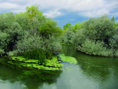
English poplars (Populus nigra), ashes and white willows line the banks of the River Duero, preventing the traveller from viewing the river in all its glory.
Halfway between Vilviestre and Hinojosa is a small rest area with tables and benches where one can enjoy a well-earned rest before proceeding.
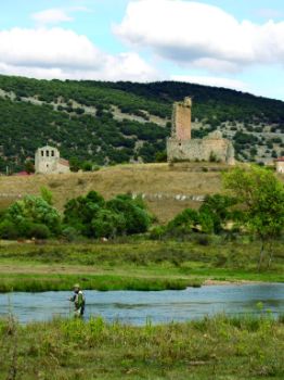
Under the watchful eye of the keep of the derelict Hinojosa Castle, the route continues along the River Duero.
A farm road that runs between several crop farms guides the route towards Las Mingarras. Barely a few hundred metres ahead is La Serna Lagoon, which is sometimes dry in summer.
Around 1500 m after leaving Hinojosa de la Sierra the stages is interrupted. The route is resumed in the SO-801 road, at the crossroads with the path that leads to Buitrago Reservoir next to the intersection of SO-P-6019 and SO-801 roads.
Past the dam, the route continues along a farm road with a cattle grid. It then ventures into Valonsadero Forest, an oak forest with a rich diversity of natural (geology, fauna, flora and mycology), as well as historical-artistic and cultural resources, including schematic cave paintings and the Festival of San Juan.
The route traverses the forest and reaches an interStage where it turns to the left towards the town of Garray.
One cannot leave Garray without visiting the chapels of San Juan Bautista and Santo Mártires, as well as the stone bridge over the River Duero.
From here, the Trail shares the route with the Agua Soriano-Camino Antonino Nature Trail. Both routes continue along the Cañada Real Soriana, leaving to the left the old Roman campsite of La Dehesilla, to cross under the N-122. Past an enormous wooden footbridge, the two Trails part ways at the information panel.
The Nature Trail winds through the historic centre of Soria capital, past the Church of Santo Domingo and the Cathedral of San Pedro, a must-see monument, and reaches the Paseo del Postiguillo, the endpoint of this Stage.
Sites of interest
Profile

Highlights
Further information
The landscape of the upper Stage
Water has always been very important to humans. Settlements were mostly built near rivers and streams.
Throughout the Senda del Duero, one can see how not only the river changes from the headwaters, but also its peoples and traditions.
In the upper Stage of the Duero, from its headwaters to Vinuesa, the white waters are highly oxygenated and clean. The wildlife that inhabit this part of the river, including insects like mayflies and European hoverflies, have adapted to these conditions, transforming their limbs into hooks to avoid being washed away, or, in the case of the common trout, learning to hunt and forage in torrents.
The landscape of the middle Stage
The river never stops flowing, and the landscape becomes flatter and wider as the River Duero slows down as it reaches the middle Stage.
The mayflies and trout that inhabit the headwaters give way to barbels (Barbus sp.), Northern straight-mouth nase (Pseudochondrostoma duriense) and crayfish that feed on small invertebrates. Otters (Lutra lutra), herons and Kingfishers (Alcedo atthis) also prefer these calmer waters. Insects abound and attract Eurasian Golden Oriole (Oriolus oriolus) and warblers (Acrocephalus sp.). The vegetation is more lush and diverse, which facilitates the presence of small herbivores.


