Net of Natural
Trails

Stage 19: Zamora - Pereruela
Description
Cereals in the plain
Between Zamora and the peneplain of Arribes del Duero lies a vast area devoted to rain-fed agriculture and livestock farming. The vast fields that stretch to the horizon are the hallmark of this Stage. This homogeneous and barren landscape plays host to a wide and diverse community of bird species.
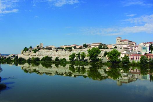
The Stage begins in the Dueñas district in Zamora, next to the Puente de Piedra. Downstream, the remains of Zamora's first bridge (built by the Romans) can be seen. It was destroyed due to the many floods of the Douro, although the first downfall was an earthquake that razed the entire city in the 10th century. On the opposite bank looms the Cathedral of El Salvador, high above the old town, casting its reflection in the calm waters of the River Duero, creating a beautiful image.

The route leaves the city along Fermoselle Street, which runs parallel to the river, and leads to San Frontis, another district in Zamora. The 13th century Romanesque church that bears the name of the district can be admired here.
After crossing with caution the road to Pereruela, the route heads down Camino Hondo; a wide, paved farm road that leads out of Zamora, with a few buildings alongside the road.
If one looks back as the road gains altitude, one can see the Cathedral of Zamora towering over the newer buildings of the city. Further on, the road regains its rural character, crossing through plains under cereal crops.
The landscape is constantly changing. In autumn and winter, brown fields ploughed in perfect rows dominate the landscape; in spring, the fields burst with colour owing to the warm weather, with the green grain interspersed with the yellow, white, red or blue of flowers that grow on slopes and ditches. The summer heat dries the grain, and the wind makes waves in the yellow cornfields.

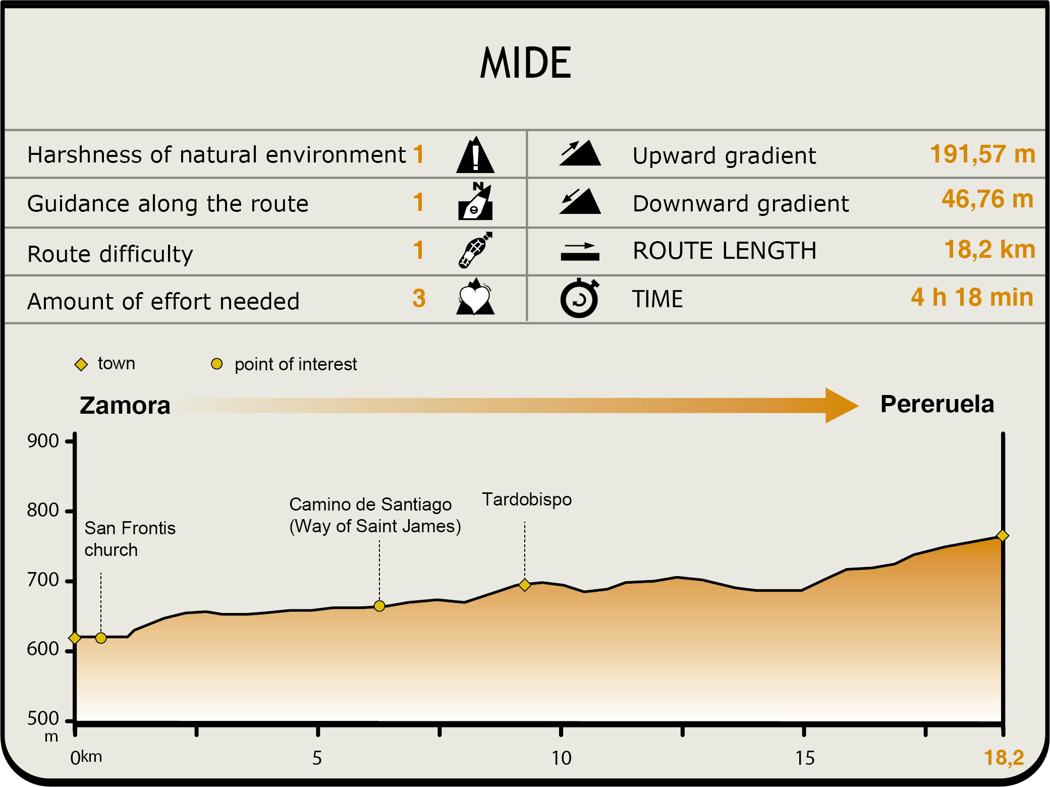
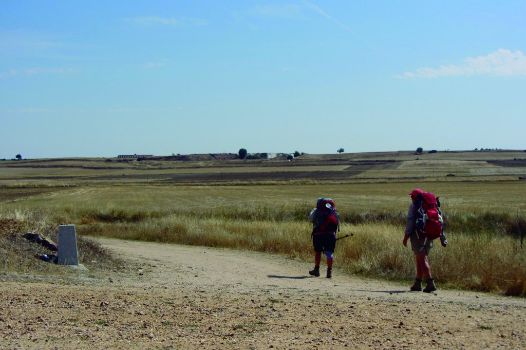
There are many forks and crossroads along the route. However, the route always runs along the widest path. Past a farmstead, the path turns left at a crossroads. There is a milestone indicating “Ruta de la Plata”, one of many routes leading to Santiago de Compostela. It is not uncommon to see pilgrims walking the Camino de Santiago.
There are many forks and crossroads along the route. However, the route always runs along the widest path. Past a farmstead, the path turns left at a crossroads. There is a milestone indicating “Ruta de la Plata”, one of many routes leading to Santiago de Compostela. It is not uncommon to see pilgrims walking the Camino de Santiago.
At a crossroad with a memorial, the route turns left onto a straight path that leads to another crossroad where it turns right. The arid landscape, broken only by hygrophilous vegetation near a fountain or a few scattered trees, does not equal absence of wildlife; quite on the contrary, many bird species find here their ideal habitat for living and breeding. Some species have adapted to this open environment: brown feathers to blend into the ground and a quick flight to escape from predators. Eurasian Stone Curlews (Burhinus oedicnemus), Meadow Pipits (Anthus pratensis), Calandra Larks (Melanocorypha calender), Eurasian Skylarks (Alauda arvensis) and Crested Larks (Galerida cristata) are some of the species that live here.
After about 700 m, the route arrives at a fork and takes the path on the left in worse condition and full of ruts. As the path gradually ascends, one can see the steeple of the church of Tardobispo, a small town around which the route skirts. However, there is a small recreational area where one may stop and rest.
About 100 m further, the route turns onto the first path on the right leading to San Roman de los Infantes. At the next crossroad, the path turns left towards Pueblica de Campeán, a small rural village in the countryside that the route passes by. This village was established in 1932, when Pueblica was flooded to build the nearby Ricobayo Reservoir on the River Esla and the inhabitants were moved to Campeán.
Notable in this town is Puente Patato, witness to the importance of this route for the seasonal migration of livestock.
The route continues along are several completely straight paths that run between re-parcelled farming lands. Past several conveniently signposted crossroads, the route reaches Pereruela. Near the town are several pottery industries, the main activity in this town.
Sites of interest
Profile

Highlights
Further information
Pottery
Pereruela, famous for its red clay and kaolin pottery, is known as the "town of pottery wares".
Although the techniques may vary, the process of pottery making basically consists of kneading the clay to distribute water homogeneously and blend all the particles together, and shaping the clay using water to maintain its plasticity and reduce cracks. The pieces are then left to air dry and harden. These pieces are very brittle and must be handled with care.
Once the pieces are finished, they are left to dry completely. When completely dry, the pieces are buffed with fine sandpaper and a damp sponge.
Finally, they are fired in the kiln to remove chemical moisture and increase resistance and resonance. The pieces of pottery are now finished.


