Net of Natural
Trails

Stage 15: Puente Duero - Tordesillas
Description
Tributaries of the Duero
Although the Stage begins in the backwaters of the River Duero, the route also passes close to the River Pisuerga, one of its main tributaries. The river has long been an important economic driver of a large part of Castile and León, whose many towns have prospered on the back of the Canal de Castilla. Before the Stage ends, the rivers Duero and Pisuerga meet at Tordesillas, a Valladolid town famous for its historical past and Plaza Mayor.
The Stage begins at Real de Puente de Duero Street. The signs indicate that the route heads northwest towards the River Duero, along which it will initially run. The Trail traverses through farmlands and riparian vegetation, while in the distance, on the opposite side of the river, one can see stone pine forests (Pinus pinea) typical of this area.

The road escorts the river, which gradually approaches Pinar de Antequera and the local road to Simancas. Before reaching the road, the route turns onto a paved road to the left, along the edge of the pinewood.
The route continues straight ahead ignoring several crossroads, until the Camino Natural sign indicates the path to the right that ventures through a pinewood along Camino del Batán. Shortly after, the path approaches the River Pisuerga, one of the main tributaries of the River Duero.
After crossing a road, the route continues along a small path that traverses through a riparian forest. Once can catch an occasional glimpse of the river, which flows calm and peaceful before it empties downstream into the Duero, only a short distance away.
The path skirts around a farmed poplar grove, and heads forward along the riparian forest, where, with a little attention, one can see the intense and busy activity of its inhabitants. The fish in the river attract a large variety of fish-eating birds, including Great Cormorants (Phalacrocorax carbo), Great Crested Grebes (Podiceps cristatus), Little Grebes (Tachybaptus ruficollis) and Grey Herons (Ardea cinerea).

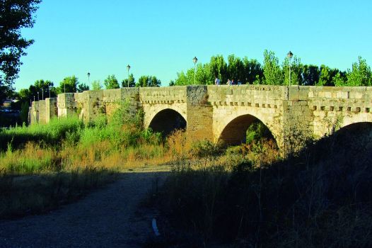
The path reaches Puente de Simancas, a 13th century Roman-medieval bridge on the River Pisuerga built with stone ashlars. The long bridge, with seventeen arches, is capable of withstanding strong currents and frequent floods. The bridge, which is pedestrian only, offers stunning views of the River Pisuerga and the town of Simancas, nestled atop a promontory, with the houses spilling down the hillside. Worthy of note in the town is the General Archive of Simancas.
On the opposite side is a park. The path turns left onto a street that runs parallel to the river, and continues until it reaches a farm road that traverses through the Pisuerga floodplain. At a fork, the path takes the left road to Valdeobispo, the closest to the river, which ventures through rain-fed and irrigated farmlands, in particular, cornfields.
The cropland landscape along the Trail is broken only by a row of trees that act as a vegetation screen along the nearby River Pisuerga.

The route heads toward another path, where it turns left (west). Shortly after, it arrives at the confluence of the rivers Pisuerga and Duero. Here, one can contemplate the slow flowing water of the Pisuerga, held back by a weir, before emptying into the Duero.
The route continues along the River Duero and its riparian forest, which consists mainly of English poplars (Populus nigra), silver poplars (Populus alba), ashes (Fraxinus angustifolia) and elderberries (Sambucus nigra). This forest is an important wildlife refuge. The path passes through a viewpoint from where one can see the Adaja river estuary, a tributary on the left bank.
Near a diversion dam and a pumping station, the route continues straight ahead to the small town of Villamarciel, from where it heads back to the River Duero to remain by its side.
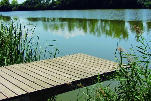
Los Pinares pinewood appears soon after. In this stretch, the Trail drifts away from the river and continues along the edge of the forest, with views of the extensive cornfields on the fertile Duero floodplain and the town of San Miguel del Pino. However, before reaching the town, the route turns left towards the riverbank, where a large number of wooden fishing platforms have been installed.
After skirting around the town, and past another diversion dam on the river, the route continues along the Duero, venturing into another pinewood. Leaving the firewall to the right, the signs indicate that at the first interStage on the left, the route must turn to continue through a gallery forest. The route continues along a recently renovated path that ventures through the dense greenery near the river towards Tordesillas. There are numerous Stages with stairs, walkways, low earth retaining walls, etc. that make the path walkable.
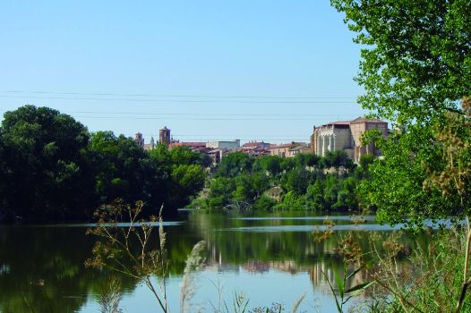
In the clearings, one can see both the river and Tordesillas, which is accessed from the park that runs between the town centre and the river. This Stage ends at the monument to the bull.
Sites of interest
Profile

Highlights
Further information
General Archive of Simancas
The General Archive of Simancas, started by Charles V and completed by his son Phillip II, holds all the documents produced by the different government agencies of the Spanish monarchy from reign of the Catholic Monarchs (1475) to the Liberal Regime (1834). It is therefore the most homogeneous and complete historical memory of the sixteenth to eighteenth century.
This important collection of documents has been safeguarded in this purpose-built building since the 16th century. Since then, the archivists have worked to preclude the loss or damage of the documents. They also study and describe the documents to better understand, disseminate and value its contents. Any citizen can easily access this information on one of the most outstanding periods of our historical past.
River Pisuerga
The River Pisuerga rises in the north of the province of Palencia, at Fuente or Cueva del Cobre in the Montaña Palentina. During part of its course, the river forms the boundary between the provinces of Palencia and Burgos. At Alar del Rey, much of its water is diverted into the Canal de Castilla, one of the largest civil engineering feats of the 19th century in Spain, which sought to facilitate transportation within the Castilian plateau. Canal de Castilla is currently used for irrigation and tourism activities.


