Net of Natural
Trails

Stage 13: Quintanilla de Onésimo - Tudela de Duero
Description
Canal del Duero
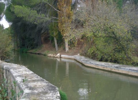
The Canal del Duero, along which this Stage runs, was built in the nineteenth century to supply drinking water to the city of Valladolid. Since the mid-twentieth century, it has been mainly used for irrigation, which required the construction of irrigation ditches to transport water from the canal to the surrounding areas. The abundant riparian vegetation along the canal makes this Stage especially pleasant.
After crossing the bridge on the River Douro at Quintanilla de Onésimo, the route continues along the opposite bank where the Canal del Duero begins, without entering this town in the province of Valladolid.
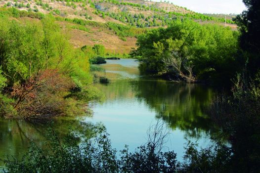
The route heads along the Canal del Duero service road, situated between the canal and the River Douro, flanked by abundant riparian vegetation and stone pine trees (Pinus pinea), which provide shade and cool breeze throughout the year.

The route continues along the left bank of the river and to the right of the canal on a smooth and even path ideal for cycling, where one can enjoy a nice, carefree walk. The canal is crossed by many bridges that service the surrounding farms and the canal itself. The route only crosses those conveniently signposted.
Most of the time, the route uses the Canal del Duero service road, on the left bank or River Douro, crossing some walkways in order to overcome the canal's locks, but always on this side of the river.
In some places, the distance between the canal and the river is minimal; therefore, one can easily see the Douro with a narrow strip of vegetation. With a little attention, one can probably see a variety of bird species, including Mallards (Anas platyrhynchos), Common Sandpipers (Actitis hypoleucos), Common Coots (Fulica atra) and Moorhens (Gallinula chloropus).
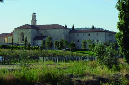
The route passes next to the Monastery of Santa Maria de Retuerta, the first Norbertine house in Spain, transformed today into a winery.
About one kilometre further, ther is a diversion dam that serves as a spillway for Canal del Duero, and as a crossing for the route.

Near Sardón de Duero, the road appears devoid of trees, offering a view of this riverside town on the opposite side of the river. Further on, the path reaches a park where one can admire different tree species, including Spanish firs (Abies Pinsapo), giant sequoias (Sequoiadendron giganteum), chestnuts (Castanea sativa) and maples (Acer platanoides).
The Trail becomes easy and wider from here, with views of the Canal and orchards that dot the path. Stones pines gradually increase in density until they dominate the landscape. Further on, however, the path narrows again, at times running very close to the water of the Canal, which brings some excitement to the experience. Nonetheless, caution should be exercised owing to the risk of falling into the Canal.
The landscape changes greatly with vineyards owned by some of the most important wineries protected under the Ribera del Duero Designation of Origin.
Further on, the Canal crosses a viaduct over the River Douro, and continues along the left bank of the river. From here, the road is very easy with many bridges that give access to farm roads. The landscape is far more humanised, with gallery forests reduced to rows of poplar that in autumn are tinged with green, yellow, ocher, and brown hues that create a chromatic harmony.
Sites of interest
Profile

Highlights
Further information
Monastery of Santa Maria de Retuerta
The monastery was established as the mother house of the Order in Castile. It was founded by Sancho Ansúrez, who travelled to France with his friend Domingo to study. There they met the monks of the Abbey of Prémontré.
Both joined the religious Order and, years later, were sent to Spain to found the monasteries of Retuerta and La Vid, respectively. Throughout the Middle Ages, the monastery received donations from kings and private individuals.


