Net of Natural
Trails

Stage 5: Orbaneja del Castillo - Valdelateja - Pesquera de Ebro
Description
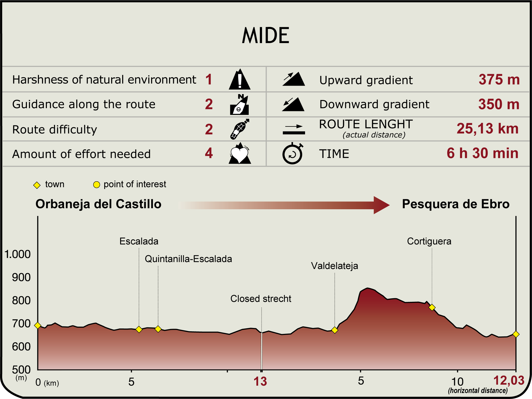
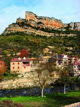
From Orbaneja del Castillo (660 m), past the bridge over the Ebro, the Nature Trail heads along the right bank, between the river and the rocky cliffs of the Ebro Canyon, through holm and gall oak forests, with Orbaneja to the left, next to the road. After skirting around the towering rocky cliffs of El Castillo and Arroyón, the Ebro River meanders along a breeding area for protected species, including vultures, peregrine falcons, golden eagles...
- - - - - - - -
IMPORTANT WARNING: THE WALKWAY BETWEEN "EL PORVENIR" HYDROELECTRIC POWER STATION AND NUESTRA SEÑORA DEL EBRO HERMITAGE IS CLOSED!
- - - - - - - -
A bridge stands over a sharp bend (next to which is the Fuente de la Torre, a fountain of chalybeate, medicinal waters), whence the route reaches Escalada. The village is protected by the Aidal and Espeluca cliffs. Worthy of note are its 12th century Romanesque church, with a beautiful façade with twelve jambs and carved archivolts, the 17th century palace of Gallo, and its unique mountain-style urban fabric.

The route continues over the bridge to the shrine of San Roque and Quintanilla-Escalada, (6.5 km, 1hr 40min). After crossing the N-623 towards Santander, the route heads along the track parallel to the Fábrica Canal through a protected wildlife area. It reaches the shrine of Nuestra Señora del Ebro, where a popular pilgrimage takes place every first Saturday in June. About 700 meters further on, the route reaches the hydroelectric power plant of El Porvenir (11.9 km, 2hr 50min).
About 200 m before reaching the power plant, the path crosses a footbridge to the right bank. The route heads southwest, through gall oaks, beeches, birches and riparian vegetation, skirting cliffs and waterfalls to the place where the Rudrón joins the Ebro. From here, it continues towards Valdelateja, a hamlet with a Romanesque church, a model for conservation of stone buildings (15.4 km, 3hr 50min). Nearby is a health spa, a 19th century bathhouse converted into a tourist inn.
The route heads down through kermes oaks until the road to Cortiguera, which is accessed by climbing down a hillside dotted with cork oaks, whence it is possible to see the Ebro confined between the canyon walls. Leaving the ravine of Mount El Crucero to the right, the route reaches Cortiguera. The state of abandonment of the buildings, in particular, the ruins of the 18th century masonry palace (under restoration), and the adjacent 16th century church, with a robust tower and cross vault, prompt further reflection on rural exodus.

The route heads down from behind the church to Turrientes Brook, also known as Molinillos, through a kermes oak grove, skirting around a ravine. After a bend to the left, it continues down a path through Incosturilla towards Cubillo Brook, near where it joins the Ebro, leaving behind a bridge. It follows the bend of a meander, under the V-5143, and continues to Pesquera de Ebro, a town accessed by a medieval bridge and guarded by the baroque chapel of San Antonio (645 m, 25.1 km, 6hr 35min).
The first document in which Pesquera is mentioned dates back to 941, although it was already inhabited in the 9th century. As its name suggests, it was a fishing place. The houses are widely scattered around the main road. The 17th and 18th centuries were the heyday of the town, when most of its inhabitants were noblemen. Its palaces and emblazoned houses, with magnificent stonework and arched doorways, make it one of the villages in Burgos with the largest number of coats-of-arms. The blazon of one coat-of-arm reads “Jesus Mary. This is a house of pleasure and brings joy to people. Hail Mary. Year 1712”). There are many fine examples of folk mountain architecture, including chimneys, the church of San Sebastián (possibly Roman) and a medieval stone cross.
Entidades gestoras:
- Ministerio de Agricultura, Pesca y Alimentación
Enlaces de interés
Puntos de interés
Culture
Geology
Infrastructure
Municipality
Vegetation
Profile

Highlights
Further information
Hoces del Alto Ebro y Rudrón Nature Reserve
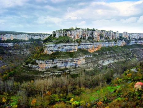
It has taken the mighty Ebro and its tributary, the Rudrón, thousands of years to carve their courses through the lands of Burgos. The relentless force of the water has eroded the limestone, resulting in impressive ravines, gorges and canyons, which at places are more than 200 m deep. This is in contrast with the vibrant colours of the beeches, cork and gall oaks, and lush riparian forests.


