Net of Natural
Trails

Stage 36: Mequinenza - Almatret
Description
From Aragon to Catalonia; the Aiguabarreig, the border between provinces
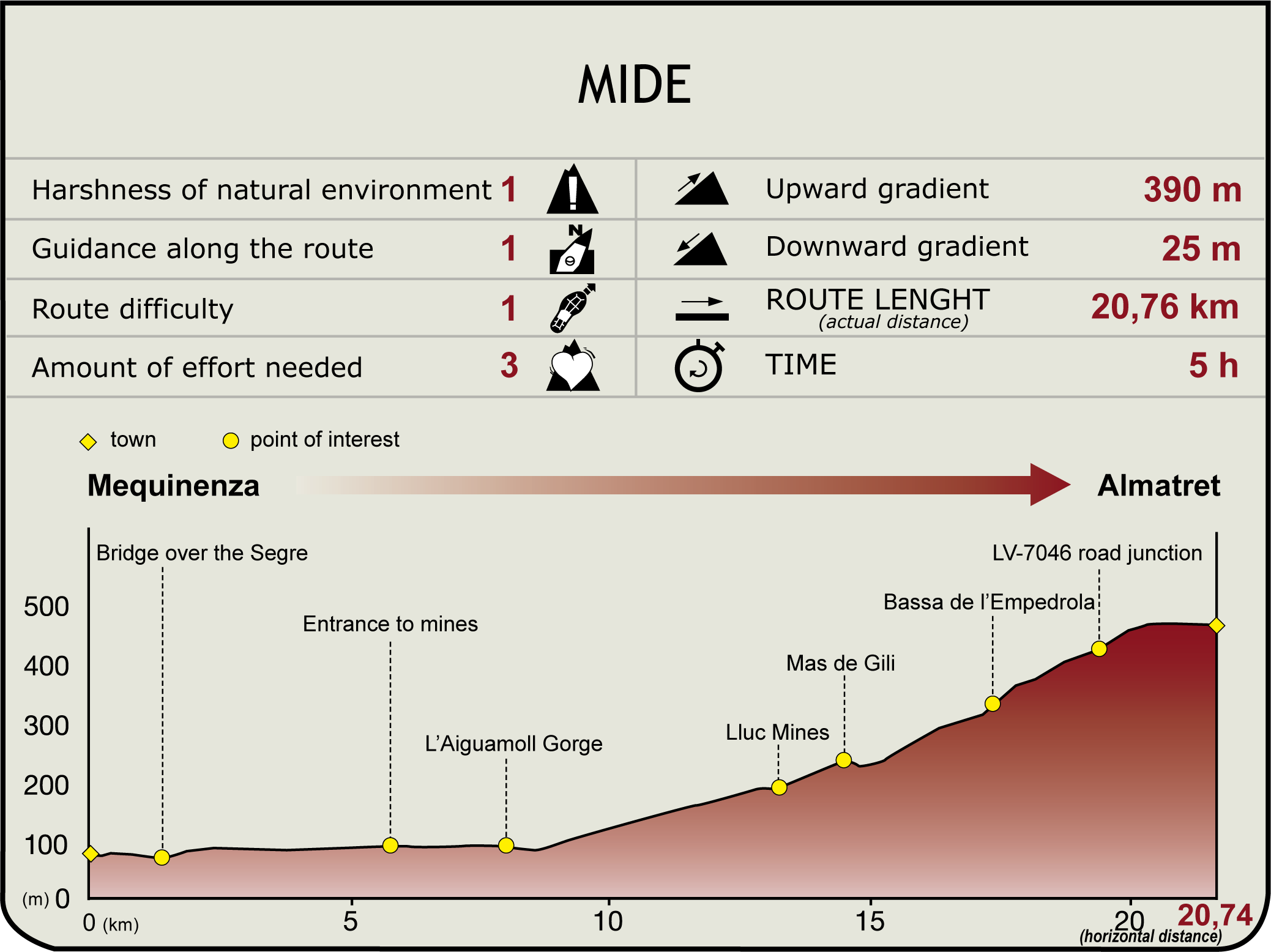
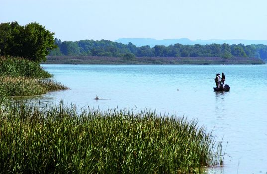
To move from Aragon to Catalonia, this stage moves away from the course of the river after crossing the Mequinenza bridge over the Segre. Here, the confluence of the rivers Segre, Cinca and Ebro forms the Aiguabarreig, the largest inland river body in Europe, and a site of great ecological value. Inland, you then go up the Aiguamoll gorge, crossing several mining operations as far as its headwaters, crossing the wide Mas de Gili valley and climbing up to the Empedrola reservoir and the Boixo watershed, which is remarkable for its views and its garrigue vegetation. From there, the LV-7046 road leads to the end of the route at Almatret.

You will leave Mequinenza via the long, narrow bridge over the branch of the Riba-roja reservoir, which leads to Granja d’Escarp, at the confluence of the rivers Segre and Cinca. The confluence of these three great rivers, the Ebro, the Segre and the Cinca, forms l’Aiguabarreig, an important site of natural interest. The Nature Trail follows the mining service road that runs along the shore of the reservoir. The path continues east, hugging the reservoir, after passing the strip or orchards separating it from the shore.
At the end of the paved path, the track turns southeast and, after passing some mine entrances, it reaches the deep l’Aiguamoll gorge, which acts as a dividing line between Aragon and Catalonia - and which at this point has a major water catchment facility on its left bank. It is time to leave the shore of the reservoir, turning left (north-east) to climb up the bottom of the open valley on its right bank, in view of the remnants of riparian vegetation that come as a surprise in the midst of so much mining debris. Several tracks on the right and left, which are signposted with no access allowed signs, mark the way to various mines. This section climbs up to a high point which still features the remains of disused mines, with precarious facilities: the well-known Lluc mines.

The path gradually gains altitude as the valley opens onto the upper plain. Shortly after that, hikers will reach a crossroads where they should ignore a branch on the left that leads to the village of Maials and instead take the one on the right, which turns upwards towards the large expanses of rainfed crops. Then, on the right, is the entrance to Mas de Gili (or Cisco).
After passing the entrance, a slight descent precedes a crossroads from which you will continue straight ahead. You will now enter an extensive valley to ascend the main track, leaving behind old derelict buildings until you reach the l’Empedrola pond, which precedes a sharp bend in the path. After this, you will reach a watershed in the sierra and, shortly after that, the widening of the LV-7046 (Maials-Almatret) road. At this point, the path offers excellent views to the north and east, amidst Mediterranean scrubland vegetation, which without a doubt enhance enjoyment of the place.
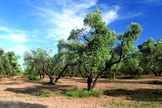
On the other side of the road, follow the course of the old road that descends to cross a stream and turns up the shady pine-clad slope. After following it for 1,300 m, the old road connects with the modern route, next to a livestock farm. You don’t have far to go until you reach your destination, since, in a little under two kilometres you will see the village of Almatret, a small settlement with a little over a thousand residents who work in agriculture. A premium quality olive oil is obtained here from the Arbequina variety. Although the village is some distance from the Ebro, it is no stranger to the vicissitudes of the river and the entire surrounding area is a continuous viewpoint over its entrenched course.
Sites of interest
Puntos de interés
Hydrography
Information
Infrastructure
Municipality
Hostel
Vegetation
Profile

Highlights
Further information
L’Aiguabarreig
L’Aiguabarreig is the confluence of the rivers Segre, Cinca and Ebro. This important river junction is a privileged place to discover in depth and enjoy the riverside forests, islands, reed beds, lagoons and oxbow lakes. Its importance as a wetland is obvious from the large number of birds who, whether in migratory periods or permanently, can be seen in the area. In the towns of Mequinenza, Seròs, La Granja d’Escarp and Massalcoreig you can find more information about this natural space.
Els Tossals d’Almatret
The Almatret “tossals” (hills) are northwest of Almatret, on the waters of the Ebro. They are part of the Pla d’Espais d’Interès Natural (Plan for Areas of Natural Interest) (PEIN) declared in 1992 by the Generalitat (Catalan Regional Government) and of the Catalan proposal for the Natura 2000 Network. It is a natural area of steep escarpments covered with Aleppo pines and associated continental vegetation, which forms an island of vegetation in an environment in which ecosystems of more arid environments are typical. Signposted routes (the path to the Cingle de la Pena viewpoint and the path along the banks of the Ebro) allow visitors to discover and enjoy this natural space.


