Net of Natural
Trails

Stage 34: Mas de la Punta - Vall de Freixes
Description
Walking between gorges along the banks of the River Ebro
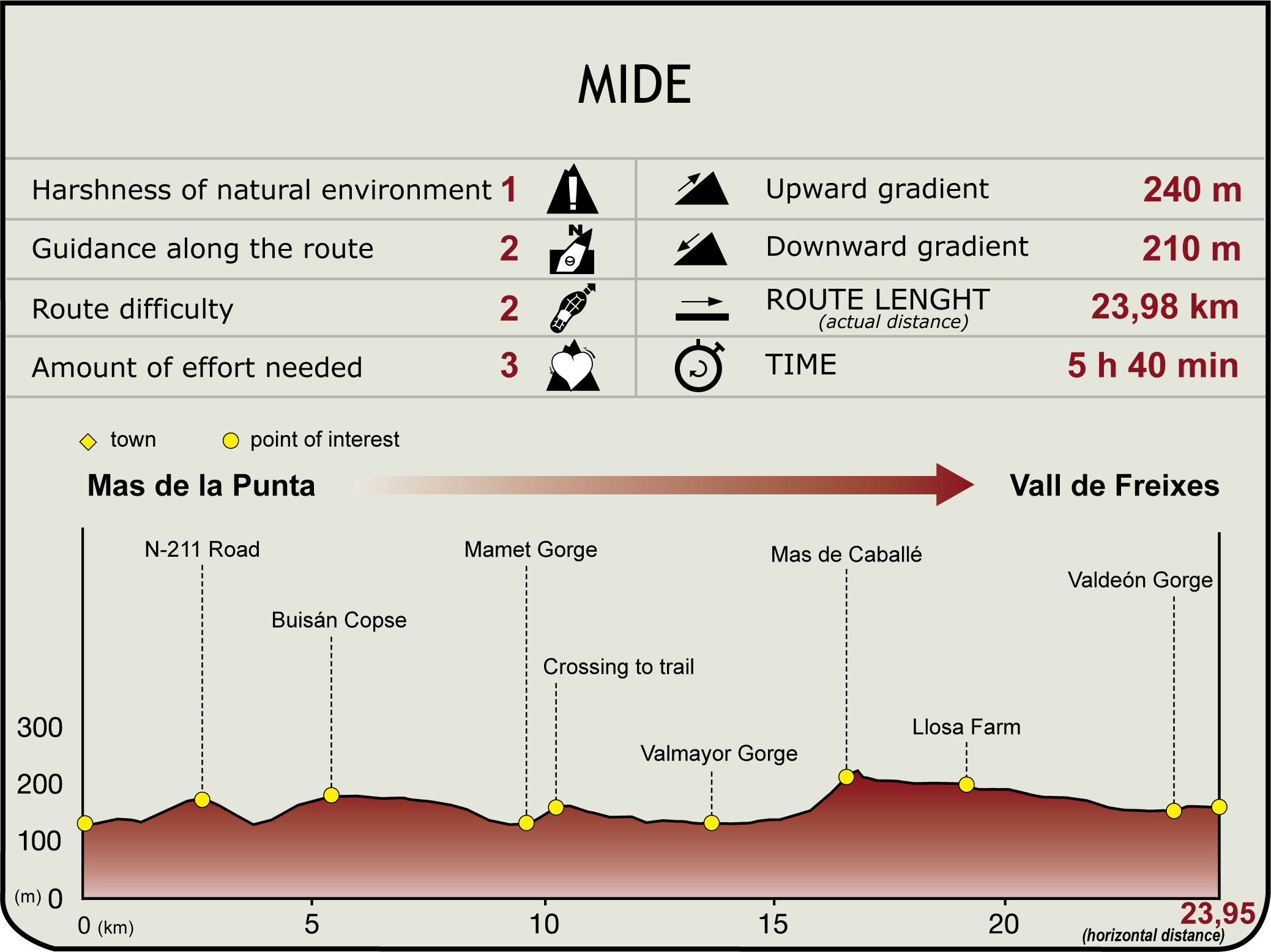
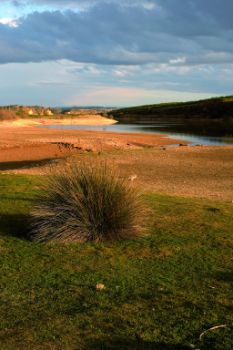
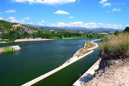
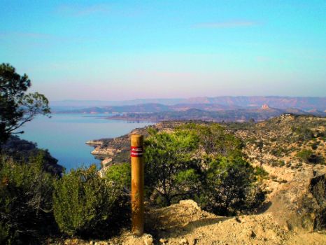
The route in this new stage is steep and runs along the rugged banks of the Ebro, between the mouth of the Valcomuna gorge and the lower part of the Vall de Freixes gorge, near the almond and olive groves of Llosa. A first section, between Mas de la Punta and the Valmayor gorge, runs through areas of reforested pine trees and streams dotted with patches of tamarisk trees; it also offers good views of the Ebro. At Valmayor, the path diverges slightly from the shore before returning to it further on. After crossing the Pauls and Valdelón gorges, the stage ends at the riverside Vall de Freixes shelter.

From the vicinity of the Mas de la Punta shelter, you will take the paved path that leads, after 2.5 km, to the N-211 road. Without reaching it, by following the left-hand shoulder, you will reach the bridge over the Val de Poblador gorge. On the other side of the bridge, under the right-hand shoulder, is the cattle track, the old route to Mequinenza.
The Nature Trail follows the old transhumance trails, along the drove road, thus avoiding this section of road. Further on, you climb until you reach a farm track running parallel to the road along the hard shoulder, heading east, before turning 90º to the left, crossing the road and entering a track next to a warehouse. This track, which is on the left, will end in fields, but before that, on an esplanade, you will come to a path that rises to the right, running along a small watershed for 200 metres. When it ends, the path enters and runs through the Buisán copse until you exit it through a path in good conditions leading from the N-211 road. Continue along this track to the left (northeast) and, after reaching a watershed with good views, it begins its descent through the Mamet gorge. To cross it, you must cross a clearing between tamarisk trees, before continuing, first to the north, among terraces and later, to the east, by a watercourse that goes uphill until it reaches a forest track.

The new track, which takes the route towards the left, runs along the arms the Mequinenza reservoir describes on the slopes and turns east until it meets the cove that forms the Valmayor gorge. Follow the course of the gorge, on its left side, until where the trail meets the N-211 and use that to cross to the other side. The path then returns along the right bank as far as the mouth of a little flat-bottomed and cultivated valley that opens on the right. At the crossroads we say goodbye to the gorge, since it is now time to leave it behind and take the path to the north-east, which climbs up one side of the cultivated valley. After 500 m, when the valley forks into three similar branches, take the path on the left, turning north and reaching an upper track. Ignore two detours on the right and take the third, which leads to some buildings in the old Mas de Caballé and to a track with a good surface.

Continuing in a north-westerly direction, you will see various watercourses that descend towards the reservoir and accompany the trail used to cross the Llosa estate, whose almond and olive trees stretch on either side of the track. This leads to its premises. You then go down, leaving behind some large warehouses on the right, until you reach another cluster of smaller buildings. Passing between the buildings, follow a path which, after crossing the Pauls gorge, slips between the crop fields and the mountainside for several kilometres. After crossing the watercourse in the Valdelón gorge, you will soon reach the Vall de Freixes gorge, which ends this stage in the best way possible, arriving at a riverside shelter where you can enjoy a well-deserved rest.
It is important to know that nowhere in this place sells food or offers lodging or water, so you will need a support vehicle or the necessary strength and supplies to continue with the next stage to Mequinenza.
Entidades gestoras:
- Ministerio de Agricultura, Pesca y Alimentación
Enlaces de interés
Puntos de interés
Information
Orography
Hostel
Profile

Highlights
Further information
Hydroelectric power stations
Since ancient times, the various cultures who have inhabited the banks of the Ebro have used it to navigate it, as well as to cross it, joining territories or defending them using bridges and boat crossings, but also as a source of water and energy, in order to improve their living conditions, building complex hydraulic devices. The various uses of the river are usually linked, inevitably, to building a weir on it. These transversal structures slightly dammed the water and channelled it towards either of its banks, guaranteeing the necessary flow rate and generating, downstream of the weir, a significant accumulation of sediments that have progressively been colonised by vegetation, creating leafy mejanas (islands or peninsulas).
On the shore, the water could go to a waterwheel where it was raised to be placed over the irrigation ditch that fed the irrigation system of the nearby fertile plains, allow the small irrigation fields to produce the necessary foods. It is also common to find flour mills, structures that over the centuries evolved from the simplest mills with a horizontal axis or water mills to the increasingly complex vertical-axis or impeller mills (open channel, bucket or regolfo mills). Fulling mills (textile processing machines) and oil mills were also found by the river. In recent times, the waterfalls created by the weir have also been used to produce electricity with small hydroelectric power stations.


