Net of Natural
Trails

Stage 30: Sástago - Escatrón
Description
The La Rosa path, strolling along the meanders of Sástago and Escatrón
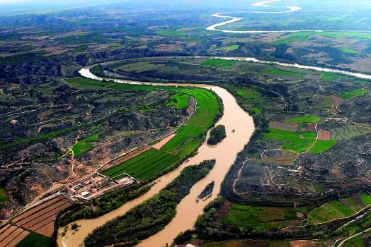
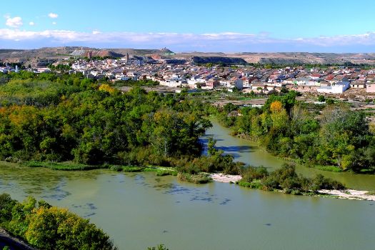
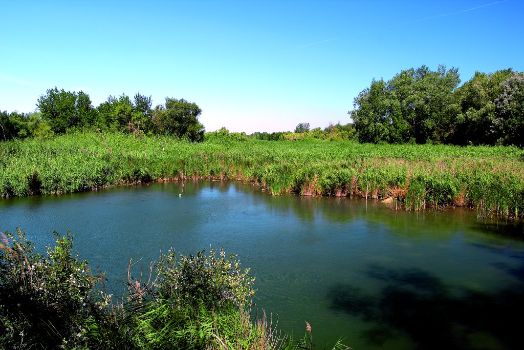
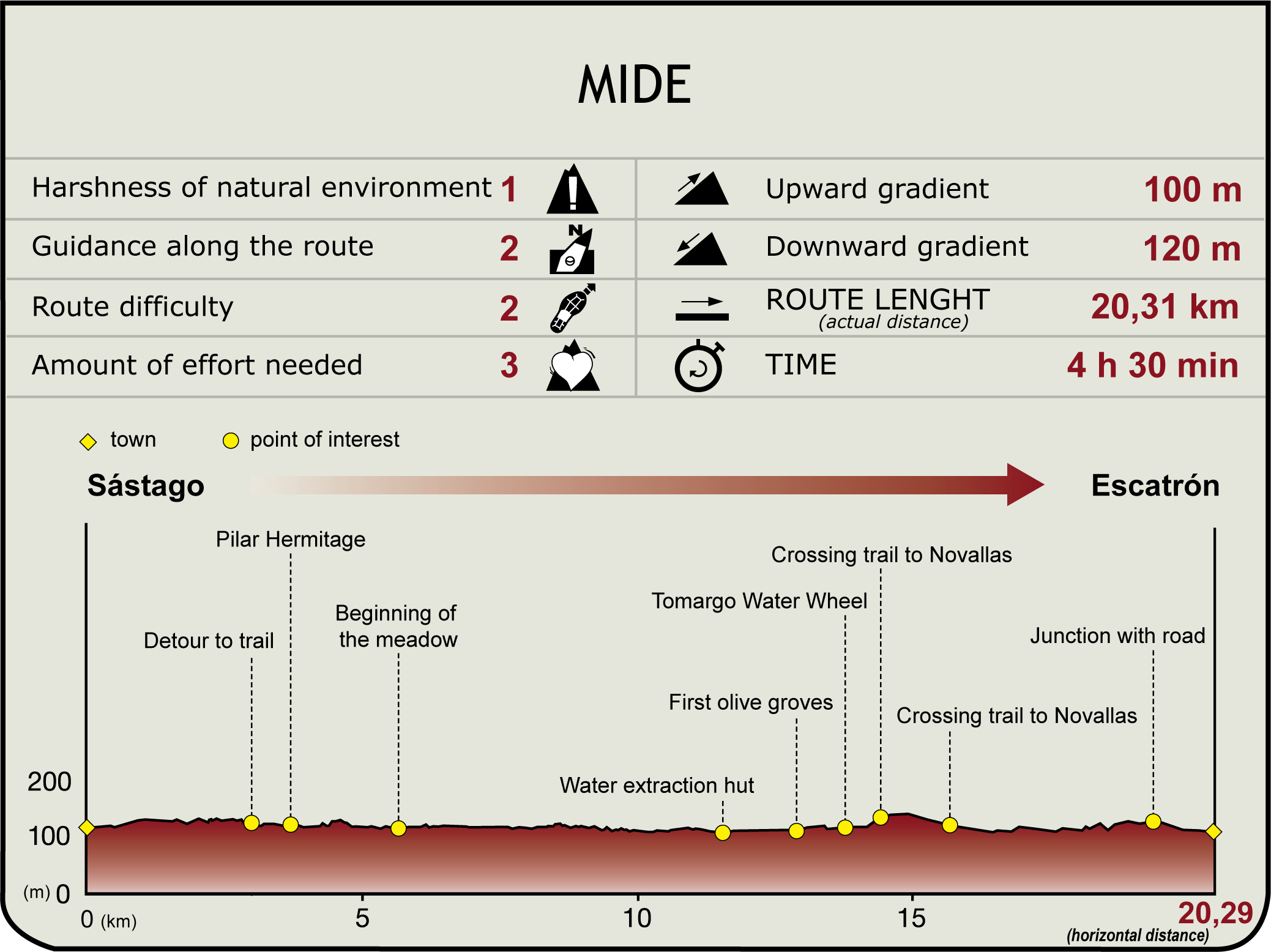
This stage of the route tuns along the last stretch of the entrenched meanders, following what is known as the La Rosa path. From Sástago, passing under La Palma Castle, you follow the right bank of the river, accompanying it on the curve of the Menuza bend, where you can see copses and islands in the calm waters. Shortly after that, you will cross the old Tomargo orchard, before it widens at Escatrón, a town hikers can enter after crossing the bridge. Before that, it is essential to admire the beauty of one of the best examples of Cistercian art: Rueda monastery. Another symbol of man’s relationship with the river that rises majestically and whose silhouette can be admired as you face the village, on the other side of the river (in the municipality of Sástago).

You leave Sástago on the A-221 road and head towards La Zaida. After crossing the extensive town centre and leaving behind its hydroelectric power stations (Sástago I and II), you leave the road and take the path which, on the left, hugs the bank of the Ebro downstream. You only have to go one kilometre down this path to reach the promontory protected by the ruins of the spectacular La Palma Castle. This building, which is of Muslim origin, includes the Pilar hermitage and a small 17th century Baroque church.
It then crosses the Gallipuente gorge, takes the Alaf path, which meets it on the right, and 2.5 km of trail later there opens a extensive meadow. The path runs along the outside until the end (the island of Puerto de la Mejana de Alaf, under Menuza weir can be seen nearby on the other side of the river). Enclosed by the escarpment and the Mejana de Menuza copse (featuring a good stand of white poplar – Populus alba), the track continues for another kilometre.

When it begins to ascend, the Nature Trail turns onto a path that opens up to the left and which winds down the slope until it reaches a water pumping station.
After passing the building, it follows the access road leading to it as far as the bend at the entrance to a gorge. This is where it follows a path that descends towards the left and which later crosses a stream and continues along the hillside, very near the bank. After crossing another steep gorge, a section of the now-abandoned irrigation ditch begins, where the path meets the Tomargo track, and which offers a view of an area populated by olive trees.

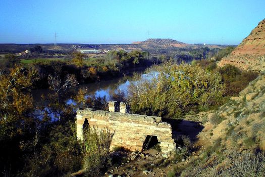
After passing the arable fields, the path narrows against the hillside (below you can make out the ruins of the Tomargo waterwheel) and turns away from the riverbank to cross a gorge; after crossing the riverbed, it begins a steep ascent. At the top, it leaves the road to the left that runs down to the Novallas riverbank, and continues east and southeast, between stands of pine trees and abundant olive groves. Further down, you take the Novallas path on the right, to approach the river again.
Here a new, narrower section begins that runs over the riverbed between cultivated plots that squeeze into the narrow pass. After passing several gullies on either side, the path reaches the wide Escatrón plain, moving away from the riverbank, which further down is enclosed by the Escatrón thermal power station complex (built in 1946 and a traditional source of employment for the residents).
The Novallas road ends at the A-221 road, where the route continues on the left as far as Escatrón bridge. The village’s hostel and jetty are on the right before the bridge; this is where this stage ends. From here, hikers can leave the trail and following a paved path barely 200 m long that will take them to the village itself.
Sites of interest
Puntos de interés
Culture
Infrastructure
- Central Hidroeléctrica Sástago I
- Central Hidroeléctrica Sástago II
- Azud de Menuza
- Central Térmica de Escatrón
- Central Eléctrica de Menuza
Municipality
Hostel
Profile
Highlights
Further information
Sástago
Located on a steep meander, the town of Sástago has been inhabited since the early Iron Age, although it was not until the Roman era that there was certain proof of the current settlement. Its Muslim period left a legacy of numerous hydraulic works and later, after the Christian conquest, Rueda monastery was founded on its lands. In 1511 the town was donated by Ferdinand the Catholic to Blasco de Alagón, and it would be one of the eight great houses of Aragon.
In the town centre, and also in the municipality’s adjacent lands, Rueda monastery makes for an interesting visit (see stage 31), La Palma Castle, Montler hermitage (an excellent viewpoint and meeting point for Sástago’s residents), and the Carlist War watchtowers (Tambor tower) and Sástago fort.
Since the early 20th century, Sástago has been a major producer of hydroelectric energy, with two power stations that contributed to revitalising the village.
Handicrafts in Sástago
Ever since it was inhabited by Mudejars, the town has been noted for its handicrafts. Glass was produced during the Muslim period and, since the 18th century, it has been known for its knives with handles made from mother-of-pearl shells (extracted from Spengler’s freshwater mussels - Margaritifera auricularia - an endangered Ebro bivalve) and Sástago hats, which are part of the traditional Aragonese costume that has all but disappeared today.


