Net of Natural
Trails

Stage 27: El Burgo de Ebro - Pina de Ebro
Description
- - - - - - - -
IMPORTANT WARNING!
DUE TO RIVER EROSION IN THE RIVERBANKS, SOME SECTIONS OF THIS STAGE MAY BE IN POOR CONDITION OR CLOSED.
IT IS RECOMMENDED TO PLAN ALTERNATIVE ROUTES AND USE EXTREME CAUTION WHEN TRAVELING THROUGH THIS STAGE.
THANK YOU FOR YOUR UNDERSTANDING.
- - - - - - - -
The route heads downstream to the intersection at the entrance to El Burgo de Ebro (180 m). Immediately after, there is a bend from where a track in poor condition leads to Las Norias grove, with abundant greenery and trees. Past this offshoot track, the trail turns right and joins another path that runs beneath the embankment of Virgen de la Columna housing estate (2.5 km, 30 min).
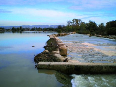
It then heads down this track to the left (east), leaving the housing estate aside, and turns again towards the Ebro to continue downstream along its bank. About 5.5 km from El Burgo, an off-route road to the left gives access to Pina Reservoir: a huge dam that holds the waters of the river, feeding the irrigation ditches of Pina de Ebro and Quinto. The reservoir, built in 1910, irrigates more than 4,000 ha on both sides of the river. Islands and groves of ecological interest have appeared on both sides of the dam. Further on (500 m), the track joins the former road from El Burgo to Fuentes de Ebro. A possible Roman road that connected Celsa Lepida (Velilla de Ebro) and Caesaraugusta (Saragossa), it is currently used as a livestock road.
It now heads left (east) along a path that runs along the right side of the Fuentes irrigation ditch. Opposite an industrial plant, it crosses the ditch and continues another 500 m until it reaches again the Ebro. The route winds along the levee through a cypress-lined track until it reaches an urbanised area (10.8 km, 2hr 15 min).
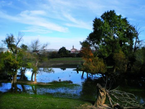
Past the housing estate, the Nature Trail curves around a bend and skirts the Mejana del Marqués (or Mejana Baja) grove, somewhat removed from the river. At the end of the bend, back on the riverbank, the levee ends at a shed and an intersection. Another 700 m further on along the Ebro, the route heads down (east, then northeast) along a main track in better conditions. Soon, the trail drifts away from the bank and begins to skirt around one the best-preserved groves in this section: the Viudas (15.4 km). This grove, comprised of reeds and a mature riparian forest, stretches 2.5 km. The sign at the km 16.7 intersection (3hr 15 min) indicates the road to Fuentes de Ebro (a town famous for its onions).
After a short stretch along the bank, before turning right at an intersection, the road is separated from the river by willows and poplars. Further on, to the left, is a forest strip that signals the beginning of the Osera sedimented meander, a branch of the river fed by groundwater, used for livestock farming. The town of Osera can soon be seen on the opposite bank of the Ebro. After crossing the AVE bridge (20.6 km, 4hr 15 min) opposite Aguilar de Ebro grove, the route continues along the levee without detours. A riverside haven can be found on a straight section (north) of the road, flanked by poplars and reeds, near Km 23. Further, to the left, is also a small but interesting tamarisk grove.

Past Pina Island (with a large colony of collared sand martins), the route strays from the river to reach the CV-605, which crosses the Ebro via Pina Bridge. At the north end of the bridge, over the railing, a road passes next to the water treatment plant and continues downstream through Pina's river park. At the end of this road, a path leads into the town (160 m, 30.8 km, 6hr).
Sites of interest
Puntos de interés
Culture
Hydrography
Information
Municipality
Profile
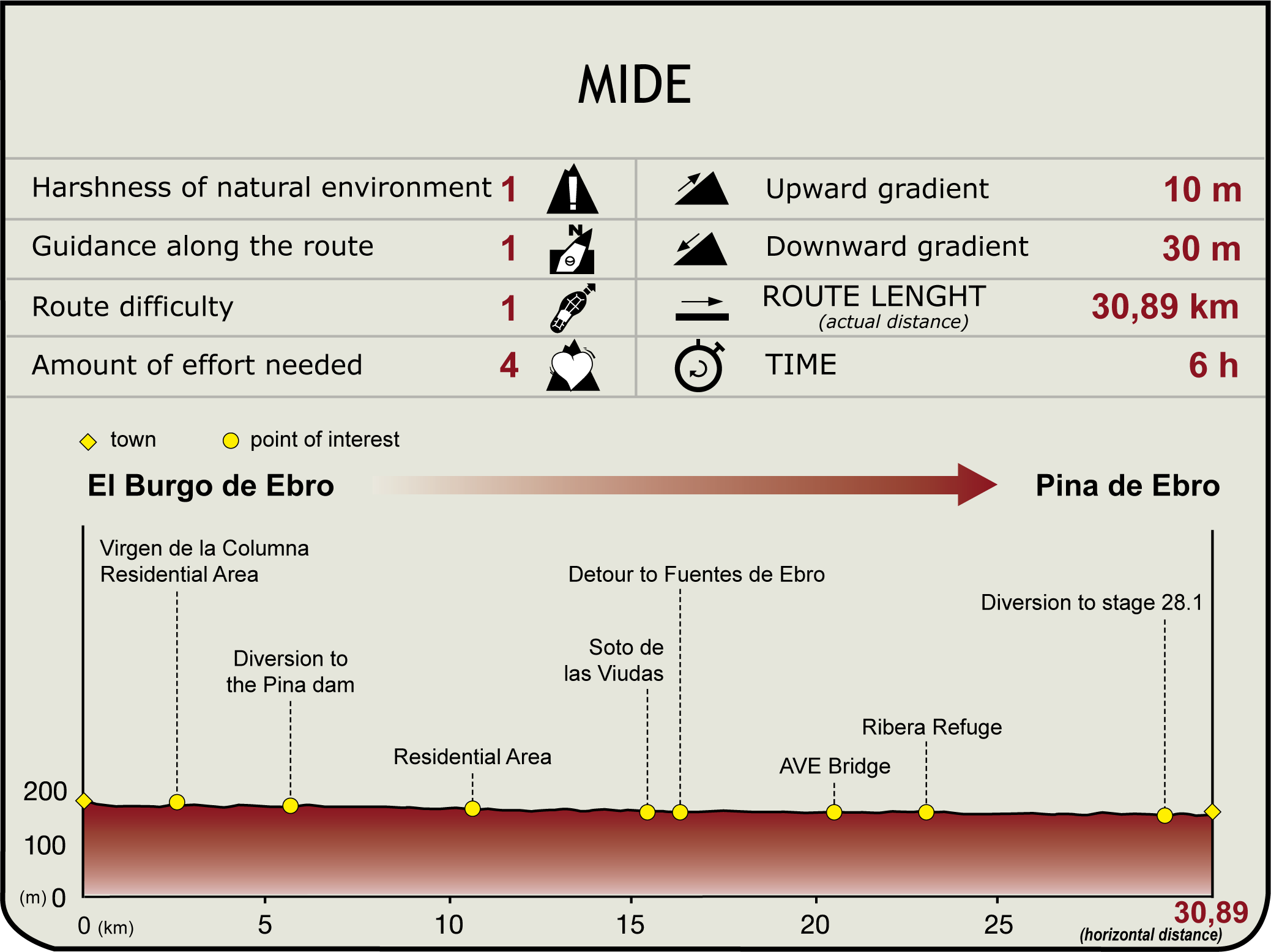
(Calculated according to the MIDE criteria for an average excursionist with a light load)
Highlights
Further information
Some towns in Ribera Baja del Ebro County
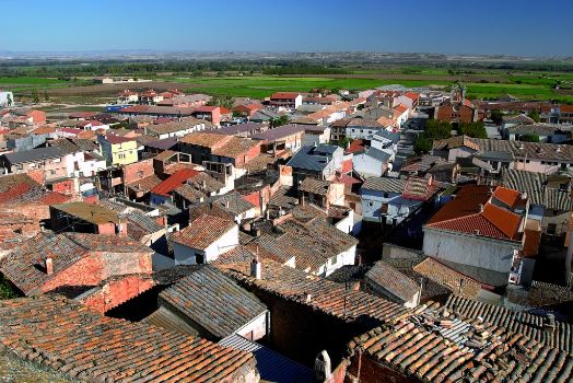
Pina de Ebro has been frequently ravaged by floods. The fertility of its orchards and the local industries help to maintain a stable population. Neither the ferryboat nor the train station is currently in operation. The town is home to a Moorish and Baroque tower.
Gelsa is also tied to the whims of the river. Its many dams were refurbished in summer, when locks that had to remain open during the rest of the year to allow the passage of barges and rafts could be closed. Its fertile orchards are currently complemented by the industrial activity of several plaster companies, whose products are manufactured with gypsum mined in the area.
Several islands and a network of interlacing sandbars protect Velilla de Ebro from flooding. The remains of the Roman city of Celsa can be found behind the Romanesque chapel of San Nicolás. A stone bridge mentioned by Strabo must have been built somewhere along the bank, connecting the Via Augusta (Astorga-Tarragona). Today, a museum commemorates those days of splendour.
The town of Quinto stretches along both sides of the N-232, at the foot of El Piquete Hill, one of its most emblematic features, together with the ancient Moorish parish church. Although mainly an agricultural town, there are also a few workshops of alabaster artisans. The stone is taken from local and neighbouring quarries, which are unique in Spain.


