Net of Natural
Trails

Stage 20: Milagro - Tudela
Description
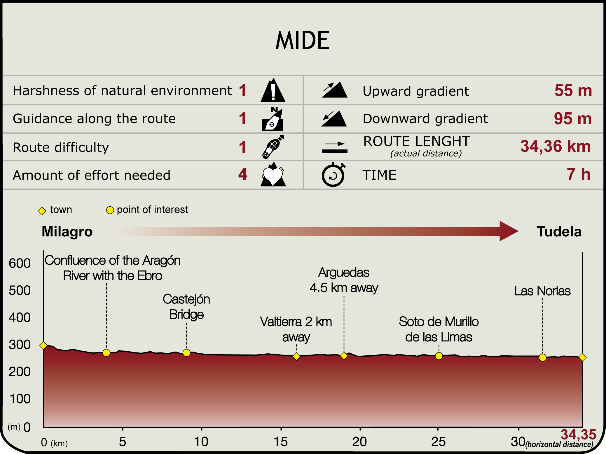
This Section begins next to the shrine of Nuestra Señora del Patrocinio, in the newer part of Milagro (290 m), and runs along the NA-134. Soon after, it reaches the bridge over the River Aragón and, continues along a track to the right (south), on the opposite side of the road. This track runs parallel to the river, surrounded by crops and with views of Villafranca, until the place where it joins the River Ebro (3.7 km, 45 min). It is a place of special interest in terms of hydrological, landscape and bird watching value.

From here, the Ebro Nature Trail turns to the left along a track that runs over the defence dyke, venturing into La Rioja, where the Sotos de Alfaro Nature Reserve begins. Leaving behind the woodlands of the Reserve, characterised by well-preserved abandoned meanders and black poplar groves, the route wanders during a long stretch along a path lined with fine examples of white poplars.
The path crosses under the Saragossa-Alsasua railway line, and continues through an area with high biodiversity; a combination of natural woodland vegetation and a fertile plain rich in asparagus, fruits and vegetables. Past the railway bridge, the GR 99 turns onto the “Ruta de los Regadíos” (BTT) towards Castejón de Ebro Bridge (11 km, 2hr 15min) on the NA-113, where it links with Section 19.2 on the opposite bank. The route continues downstream (east) and crosses under the bridge of the AP-15, notable for the boldness of its structure with 146 m long girders. Soon after, the route ventures into the Peripheral Protection Zone of Soto Alto Nature Site, home to several groves (Giraldelli, Ramalete, Arguedas, etc.) included in Navarre's List of Protected Areas, situated along both sides of the River Ebro to the boundary with Aragón.

The course of the route is determined by the dam. The path runs along the bend of the former course of the Ebro, as is evidenced by the reeds that grow at groundwater level. Two kilometres further on, the route reaches a side-track to the left (north) that leads to the town of Valtierra. The Bardenas Reales Nature Park and Biosphere Reserves begins here. The path continues east, then south, in search of the Ebro, skirting around Sotos de Sardavilla Nature Site.
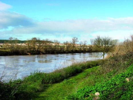
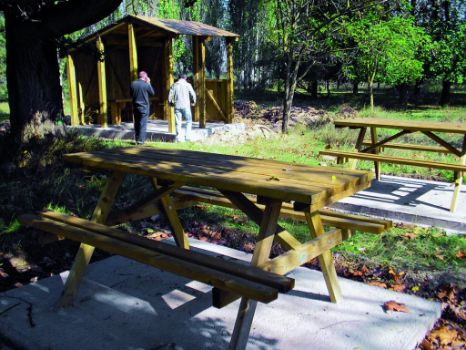
Further on, the road continues along a large jetty, and on the opposite side, in a river bend, is El Vivero, a landscaped rest area covered with exotic trees. Immediately after, a restored path leads to the town of Arguedas, 4.5 km down Camino del Soto (19 km, 3hr 50min). A tamarisk and white poplar wood indicate that the route has reached Soto de Vergara Nature Site, where an information panel has been placed by the Regional Government of Navarre.
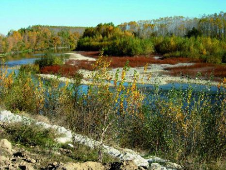
Past several tracks to the left (northeast), the route skirts around a power supply cubicle and continues parallel to the Ebro to a ravine and Soto de Murillo de las Limas Nature Site (24.9 km, 5hr), with two river islands rich in vegetation and fauna.

The ravine cannot be crossed at the River Ebro. Hence, the route turns left (east) to the N-121, then right (west) along the river to Tudela. Past Soto de las Norias Nature Site, next to the namesake house and dam, and Soto de Traslapuente Nature Site, is a rural road that leads to the N-121, through reed beds and hedgerows.
Here, the route turns right, crosses the beautiful Ebro Bridge and ends at the western edge of Prado Park, past the spot where the River Queiles joins the Ebro (250 m, 34 km, 6hr 50min). The town boasts the Romanesque church of the Madeleine, the Gothic Cathedral of Santa María la Blanca and the Plaza de los Fueros amongst other landmarks.
Sites of interest
Puntos de interés
Culture
Hydrography
Information
- Enclave Natural Soto de Traslapuente
- Enclave Natural Soto de los Tetones
- Reserva Natural de los Sotos de Alfaro
- Enclave Natural Sotos de Murillos de las Limas
- Reserva Natural Sotos de la Remonta
- Reserva Natural Soto del Ramalete
- Enclave Natural Soto Giraldelli
- Enclave Natural Soto Alto
- Reserva Natural de los Sotos del Ebro en Alfaro
- Parque Natural Bardenas Reales
Municipality
Hostel
Vegetation
Profile

Highlights
Further information
The River Aragón
A major tributary of the Ebro, its basin covers 8,524 km² and is 195 km long. The river rises in the Pyrenees in Huesca, in the crystal clear waters of Ibón de Escalar, at an altitude of 2,092 m. It soon begins a southbound descent into the valley of Aragón, towards Jaca, over numerous rapids, whence it heads west to Navarre. It first receives the Aragón Subordán at Reina de Jaca Bridge. On the boundary between Aragón and Navarre, its waters are channelled into the Yesa Reservoir (where it joins the Esca). It goes past Sangüesa, Cáseda, Carcastillo, Santacara, Caparroso (where it joins the Cidacos from Navarre) and Marcilla. Past this last town, it joins the Arga, passes near Milagro and flows into the Ebro. Other tributaries are the rivers Estarrún (Huesca), Onsella and Regal (Saragossa) and Lubierre (Navarre). The basin has a rich diversity of vegetation, including species from different climates and environments: black and Scots pine, kermes oak, beech, fir, birch, maple, white poplar, ash, rowan, boxwood, gorse, juniper and gall oak.


