


Net of Nature
Trails

Stage 2: Montes Claros - Villanueva de la Nía






Description
Romanesque art and mountain architecture
From the Montes Claros monastery, the stage descends to the halt bearing the same name before continuing through an exceptional stretch of alders and willows that is registered in the National Inventory of Habitats. Afterwards, the path crosses magnificent gall oaks and pedunculate oak trees before ascending to Aldea de Ebro, a village that has been declared a Rural Historic Site. Among fields, pastures and groves, the path repeatedly ascends and descends before reaching the bridge over the Molino Mardancho stream, at Villanueva de la Nía. All the towns and villages that this stage visits have remarkable monuments, from Romanesque churches to modern palaces, as well as interesting examples of traditional mountain architecture.
This second stage begins at the Montes Claros monastery, retracing the last kilometre of Stage 1. An asphalted trail leads down to the Montes Claros halt and, after crossing the tracks, it continues on the track, amidst pines, beeches, pedunculated oaks and gall oaks, before joining another one along which the Stage 1 branch track runs parallel to the river from the bridge over the Ebro at Bustasur. From this point, the path advances without leaving the track along a section of river whose alder and willow groves are listed in the National Inventory of Habitats. After skirting a hill and crossing Valdeteje and El Hoyo, the path passes a cluster of ruined buildings. Further on, on the left bank of the river, lies Baños de Aldea de Ebro (facilities with a spa and hostel areas), which is surrounded by enormous pine trees.
Continue on this route over the Roblayoso bridge, now on the left bank of the Ebro, before changing to an asphalted track among oak groves leading to the Rabiquis bridge, which will help travellers to cross the Albergue stream. It is at this point that the ascent to Aldea de Ebro begins. Once you have passed through this village, continue southwards, beside a fountain with a water trough, where the old road to Loma Somera begins. To begin with the route gains ground among farms, flanked by gall oaks, with views of the road and the Dondevilla hermitage. The plain soon gives way to a steep slope that enters the Los Tricherios oak grove and reaches its highest point, where it is worth stopping to enjoy the good panoramic views of the Ebro and its surroundings. The Way descends among magnificent pedunculate oak and beech trees, crossing the Costeriza stream, before ascending again and reaching a broad braña with views of the Cabrero hill. After leaving it behind, the path enters another oak grove, next to a stone wall, leading to Loma Somera.

Once here, travellers can visit the San Miguel hermitage, before leaving this hamlet on a gravel track beside the church. The route descends again via the Isilla until the second bend on the left, where the old bridle path leading to La Renegada mill starts; it descends among walls, fields, cobbled sections and gall oaks. On the way back to the river, you will walk parallel to it on the south, among gall oaks, beeches and black poplars, until you reach the bridge over the Ebro. Once you have crossed it, you will recognise the village of Aroco.
Without entering the village, the route continues on an old road amidst fields, pastureland and cattle. The gall oak grove is accompanied by stone walls and cobbled sections, first flat and later climbing to crown El Colladillo, where you can enjoy good panoramas of the town, the Ebro and the surrounding hills. As you head towards Bárcena de Ebro, you can see the road that crosses the valley and the village of Reocín de los Molinos.

To reach Bárcena you will begin walking among gall oaks. After a short section along the road to Loma Somera and Bustillo del Monte, which crosses the Ebro, a path begins on the right before a road junction. This road ascends again among gall oaks and restored pine forest through the La Lechosa hill, gains altitude and reaches the Las Llanas braña, which has the same type of forest. The road, by now a track, leads to Otero del Monte, after crossing Campa Llana.
The route crosses the village via a road that leaves the Romanesque church on the outskirts on the right. Shortly afterwards, a path leading from the right enters a gall oak grove and meets the road again; it then leads down to Cubillo de Ebro, with views of Villanueva de la Nía. The path leaves the village via the road and a small path returns to the CA-272 among gall oaks; it must be crossed to reach the old bridge over the Ebro. You will now finish this stage by entering Villanueva de la Nía via the CA-273, reaching the finish line at the bridge over the Molino Mardancho stream.
Entidades gestoras:
- Ministerio de Agricultura, Pesca y Alimentación
Puntos de interés
Culture
Municipality
Profile
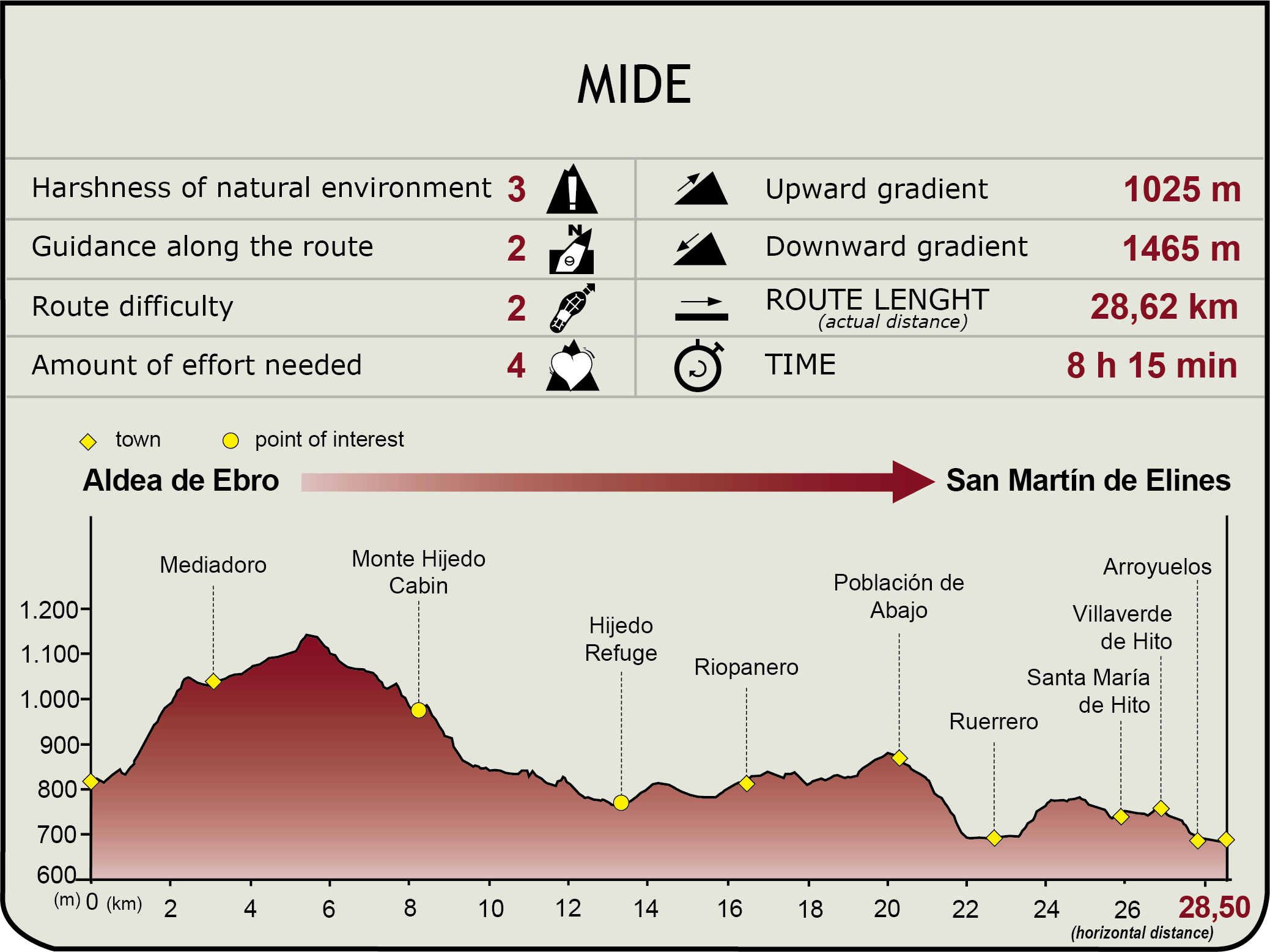
 Harshness of natural environment
- 1. The environment is not risk-free
- 2. There are more than one risk factors
- 3. There are various risk factors
- 4. There are quite a lot of risk factors
- 5. There are many risk factors
 Guidance along the route
- 1. Well defined trails and crossings
- 2. There is a clearly marked trail and signage
- 3. Requires the identification of geographic features and cardinal points
- 4. Requires off-path navigation
- 5. The trail is interrupted by obstacles that have to be gone around
 Route difficulty
- 1. Walking on a flat surface
- 2. Trails with different types of path
- 3. Walking on stepped paths or irregular terrain
- 4. The use of hands or jumping over the terrain is necessary
- 5. The use of hands is required to progress
 Amount of effort needed
- 1. Up to 1 hour of continuous walking
- 2. Between 1 and 3 hours of continuous walking
- 3. Between 3 and 6 hours of continuous walking
- 4. Between 6 and 10 hours of actual walking
- 5. More than 10 hours of continuous walking
(Calculated according to the MIDE criteria for an average excursionist with a light load)
Highlights
Further information
Heritage
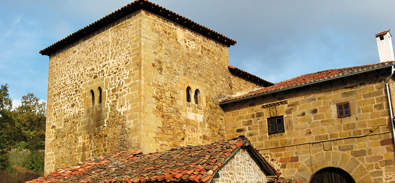
All the towns included in this Section have interesting examples of typical mountain architecture, as well as notable monuments. In Aldea de Ebro, designated a Historic Rural Site, there are emblazoned houses, the church of San Juan Bautista with an interesting “standalone” steeple (13th century), and the Romanesque shrine of Dondevilla. The hamlet of Bárcena de Ebro is also famous for its robust towers, defensive systems, two bridges, and a steepled church. The parish churches of Aroco (16th C.), Cubillo de Ebro (17th C.) and Villanueva de la Nía (12th C.), with interesting corbels, as well as several modern palaces are also noteworthy.
Multimedia


Downloads

GPS Downloads