Net of Natural
Trails

Stage 18.1: Alcanadre - San Adrián
Description
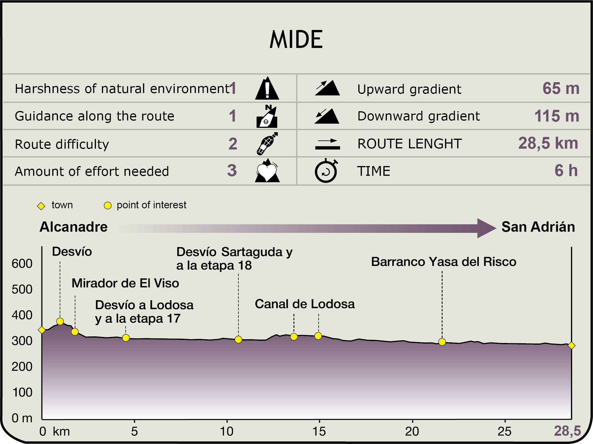
Leaving behind Alcanadre (340 m) to the east, towards the LR-260, the route climbs back up to Alcanadre's anticline platform. Once at the top, the route turns onto a wide track to the left (on the border between La Rioja and Navarre) that skirts around the escarpment. There are magnificent panoramic views of the Ebro basin, its farmlands and steppe landscape from El Viso viewpoint (360 m, 1.8 km, 25min).
The route now follows the contour line of the escarpment along a smaller track, which soon blends into the vineyards. About 200 m further on, the route winds down the hillside through a grass path (with good views of the Acueducto de los Moros, the town of Lodosa and the head of the Lodosa Canal) to a dirt track at the bottom of the mountain. Here, it turns left (west) through an underpass that crosses the Castejón-Bilbao railway line. To the right (east) are the sluices of the Lodosa Canal and the Mártires Reservoir. The route runs along the canal and crosses a bridge. Once on the left bank of the canal, it continues past the 17th century shrine of saints Emeterio and Celedonio until it reaches Lodosa Bridge.

On the opposite side of the bridge (at the intersection of the NA-6540 and N-123) is Lodosa, a town that offers a range of services and is home to the church of San Miguel Arcángel (16th C.), the 18th century shrine of Nuestra Señora de Montserrat, and a fair share of emblazoned houses. The town is also known for its most famous crop: “piquillo” red pepper.
However, the GR 99 continues straight ahead (east) to the opposite side of the N-123, without crossing the bridge, along a track parallel to the Ebro known as “Cañada de los Comuneros”. After about 500 m, the route turns onto a path, then returns to the Cañada 500 m further on, only to abandon it again one kilometre ahead to continue along a track to the left that runs parallel to the riverbank, flanked by the river and the vegetable gardens. The road heads towards Sartaguda Dam, a large weir that supplies water to the left bank via the Sartaguda Canal. Further along the Ebro, the route reaches Lodosa Canal (right). On the opposite side, atop a hill, stand the ruins of the medieval manor of Torre de Rada.
Parallel to the river, with magnificent views of the riparian forest on the left, populated by poplars, willows and ashes, and the Lodosa Canal to the right (west), the route reaches the bridge over the N-6221 (10.5 km, 2hr 10min). After crossing the road via a track, the town of Sartaguda appears on the left bank. The bridge links Sections 18 and 18.1).
Some 2.5 km further on, the Ebro Nature Trail drifts away from the bank, and begins a gentle climb over Ramillo Escarpment. About 1.5 km ahead, it crosses the Lodosa Canal over a bridge. The route continues to climb, ventures into Pradejón municipality (La Rioja) and turns onto a paved track that traverses again the canal. This gives a sense of the magnitude of this construction.
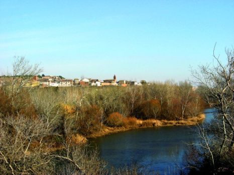
The route runs northeast along the paved track, past the entrance to a gravel pit, then retraces its steps to climb down to the edge of the Ribera Dam, near the town of Calahorra. The route winds along La Veguilla meander, situated opposite its namesake woodlands, several cliffs and the shrine of Santa Cruz in Navarre. Further on lies Yasa del Risco Ravine, spanned by a small bridge, (21.4 km, 4hr 25min). Back in the jetty, parallel to the Ebro, and past several meanders, the route reaches the old bridge of San Adrián (290 m, 28.7 km, 5hr 55min), where it links with Sections 19 and 18.
Sites of interest
Puntos de interés
Culture
Infrastructure
Municipality
Hostel
Profile


