Net of Natural
Trails

Stage 18: Sartaguda - San Adrián
Description
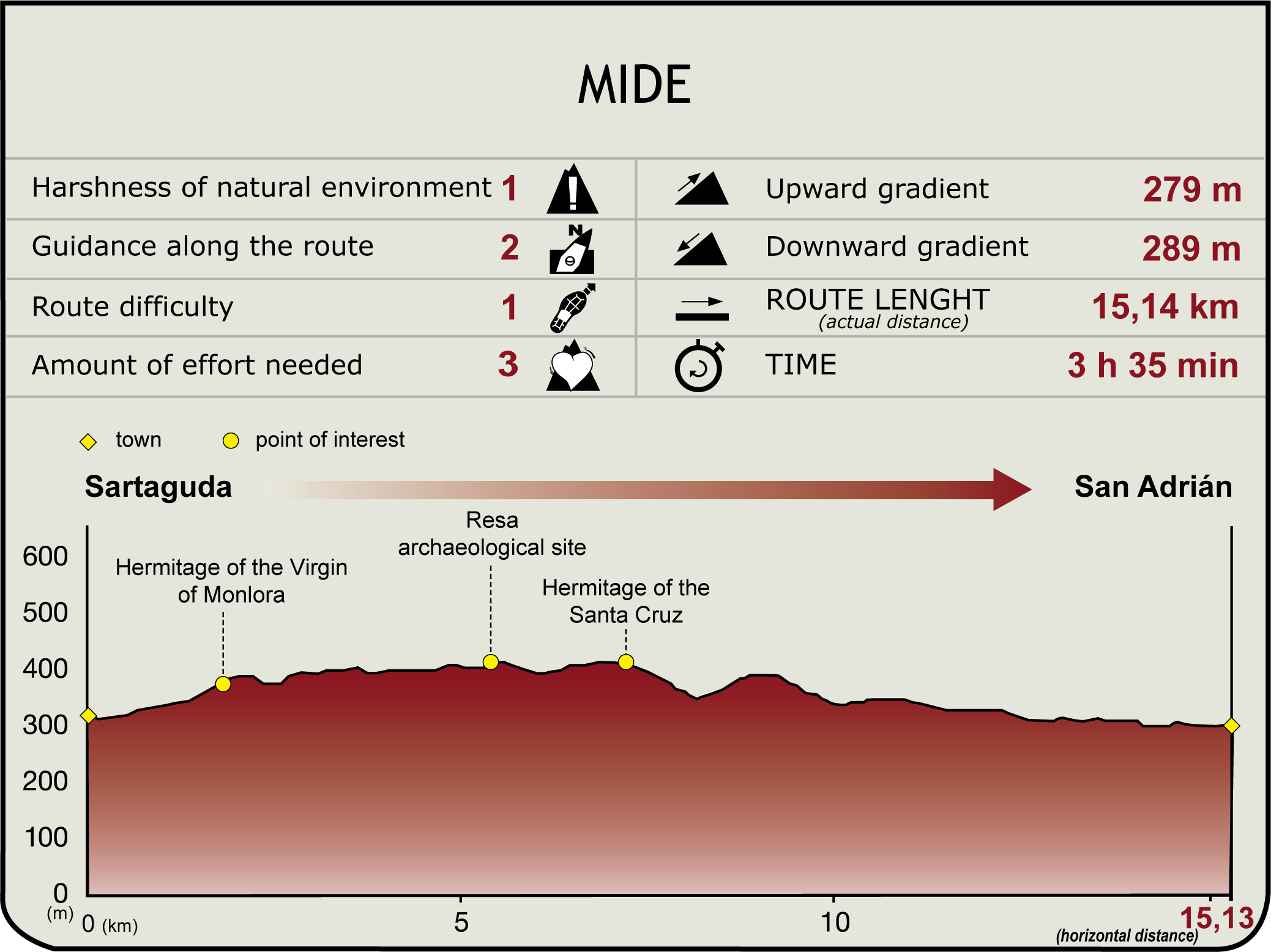
The route begins at Sartaguda Bridge (310 m). After crossing the bridge, it turns right through the lower end of the town of Sartaguda, which offers a range of services and is home to the church of Virgen del Rosario. The route passes near La Arboleda recreation area, then continues along a southbound paved track that turns into a dirt road near the river jetty. The road runs parallel to the Ebro, skirting around the vegetables grown on the wide meander of Ramillo. On the opposite bank (La Rioja are cliffs in which herons and cormorants nest. About four kilometres further on (1hr), the route leaves to the right La Ribera Weir, which supplies water to its namesake power plant. There are several islands populated with riparian vegetation within the dam.
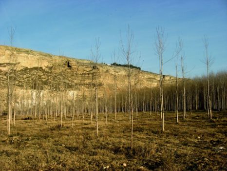
The Ebro Nature Trail disregards all the paths that give access to Sartaguda Orchard (left) and continues along the bank, which, past the weir, is flanked by a wide strip of riparian vegetation. The orchard tapers gradually until it forms a “fruit tree corridor” between the River Ebro and the gypseous escarpments, where the remains of ancient cave dwellings excavated in the soft strata can be seen. A new bend leads to a widening of the bank, where La Veguilla woodland stands (Andosilla Timber Estate).

From here, the route crosses the woodland and climbs north towards the gypsiferous cliffs of Santa Cruz, where a viewpoint and the shrine of Santa Cruz can be found (375 m, 7.8 km, 2 hr 40 min). The shrine, which dates back to the seventeenth and eighteenth centuries, is a magnificent place to watch raptors, including griffon vultures, black and red kites, Egyptian vultures, peregrine falcons, short-toed eagles and kestrels. Not only are the views of the River Ebro and the interaction between the meanders and the woodlands visible from here, but there are also panoramic views of the orchards and croplands of La Rioja Baja, and the extensive poplar groves at the foot of the cliffs. The GR 99 coincides here with the SL-NA 190 “Sendero de la Tierra de Estella”, endorsed by the Federación Navarra de Montañismo.

Past the Aleppo pine forest near the shrine, the route heads downhill to the north, towards the town of San Adrián, along a wide and well-maintained track. The first two kilometres are part of the road leading to Andosilla from the shrine of Santa Cruz, which crosses a stream wedged between rainfed fields. The route then climbs up the east slope of this small valley, and, further on, turns onto a path to the right, down to the edge of the cliff.
Through vineyards, the Ebro Nature Trail ventures into the industrial estate of San Adrián, past Sotillo de la Peña (an enclave restored and preserved by the town council). Once on the eastern edge of the woodland, the route descends to the right (south), towards the sports area. Parallel to the Ebro, it traverses the riverside park, crosses the old bridge, and reaches the trail end of this Section and the place where it links with Sections 19 and 19.1 (290 m, 15.7 km, 3hr 40min).

Prominent among the buildings in this town is the ancient church of San Adrián with an 18th century baroque tower, and the now-defunct Palace of Marichalar. The urban layout of the town, with remains of the castle and the River Ega caves, nestled in a nearly inaccessible vertical wall over the River Ebro, are also noteworthy. These caves may have been formed by water erosion, or, according to some theories, even by human activity, during the Muslim occupation or the Celtiberian period.
Sites of interest
Puntos de interés
Culture
Municipality
Hostel
Profile


