Net of Natural
Trails

Stage 17.1: Agoncillo - Alcanadre
Description
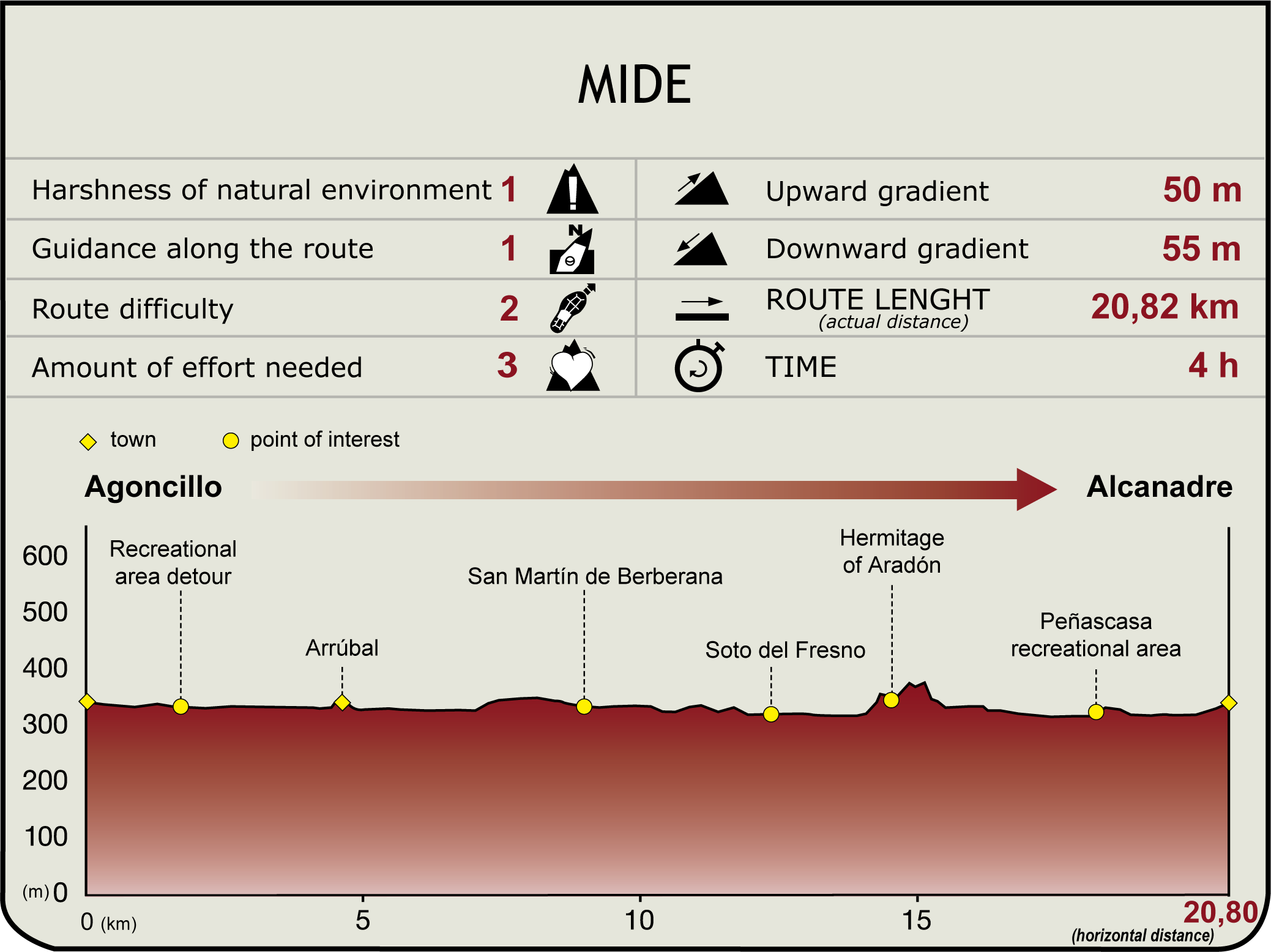
In Agoncillo (345 m), the route heads north towards the banks of the Ebro and a recreation area, located a few metres from the road (km 0.9). From here, it runs to the right (east) along the river to a water treatment plant. It then turns right (south) through vegetable gardens, with the El Sequero industrial estate in the distance (municipalities of Agoncillo and Arrúbal). After crossing the Plantío road, the route reaches the Río Grande irrigation ditch, from where it continues east towards Arrúbal, located on a promontory overlooking the valley, where asparagus and peppers are grown. Under the hill on which stands the town, the route turns left (north), skirting the Tranquera irrigation ditch. At a fork near some buildings, it climbs up the right branch to the hamlet of Arrúbal (4.6 km, 55min), with the 16th-17th century parish church of El Salvador.

Back at the intersection, the route turns right towards the river, and continues along the bank for about two kilometres until it reaches a water treatment plant. The riverside path ends here. The route therefore climbs to a higher area, and moves back to the west, making a sharp bend to the left. It then continues along the road from Arrúbal to Alcanadre that runs parallel to the railroad tracks, past the buildings of San Martín de Berberana Farm (9 km, 1hr 50min), along the road from San Martín to Mendavia.
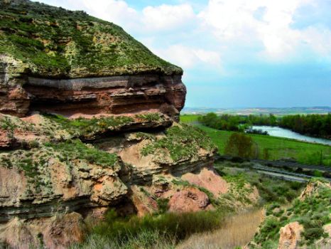
It first skirts around a vast field of cereals, then returns to the riverbank. The Urzagal woodlands (municipality of Mendavia) stretch over the opposite bank (north), while the beginning of the Aradón Escarpment (clay and sandstone scarp crowned by pine forests and a richly diverse bird life) towers to the right (south).

The route then traverses a dense riparian forest (mainly poplar and ash) and a vast landscape of vineyards to reach a wide expanse of croplands in the Fresno woodlands. The woodlands of Mendivia can also be seen on the opposite bank.
The woodlands shape a bend in the Ebro and the Trail. Leaving behind the dense forest, the route heads south to the railway line, traverses the level crossing, and continues east, past the shrine of Nuestra Señora de Aradón (14.5 km, 2hr 55min) and its namesake escarpments.
In front of the shrine, the route approaches the underpass to cross the railway tracks, and runs parallel to the tracks, along a narrow path on the left side, with the Aradón Cliffs always to the north. This narrow path leads to the end of the cliffs, where the landscape opens onto the Peñascasa flood plain, a vast expanse of croplands that the route traverses through a huge poplar grove. Past this municipality, the path reaches a recreation area.

Leaving Peñascasa behind, the route runs parallel to the railway and ventures into the Alcanadre Valley. Shortly after passing next to the railway station, the route crosses the road at a level crossing and enters the town of Alcanadre, (340 m, 20.6 km, 4hr 10min). The town offers a range of services (meals, rural tourism, etc.) to the visitors. It is also home to the parish church of Santa María (16th-18th C.). Inside is a 12th century Romanesque statue of the Virgen de Aradón, for whom the shrine is named. It is a magnificent vantage point from where panoramic views of Mendavia, Lodosa and its vast expanses of croplands can be seen.
Sites of interest
Puntos de interés
Culture
Municipality
Orography
Hostel
Profile


