Net of Natural
Trails

Stage 17: Mendavia - Lodosa
Description
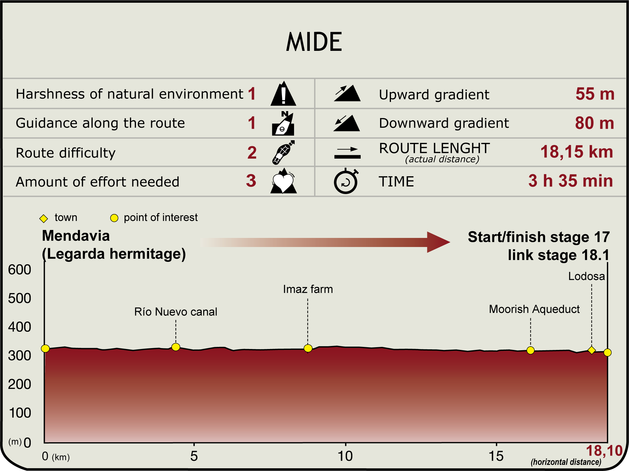
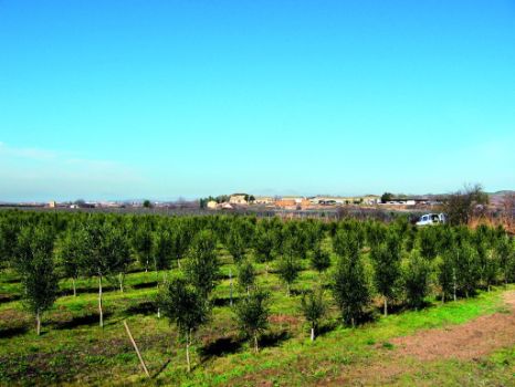
From the town of Mendavia (340 m), the route must retrace the final part of Section 16 and return to the shrine of Legarda (1.8 km, 20min). Once there, it heads towards the intersection of Urzagal woodlands, and continues left (east) through farmlands, leaving the Ebro and the Aradón escarpment cliffs to the south, where a namesake shrine can be found. The Ebro Nature Trail takes a long detour, before returning to the riverbank, along the Regadío de Imas and El Soto hunting preserve. The path leads to Granja Imaz, a former monastery, currently used as a farm, that consists of a cluster of 17th century buildings surrounded by vineyards (9.8 km, 2hr).

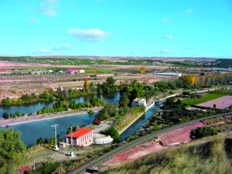
At about 800 m to the right, the route joins the NA-134, along which it continues for about 1.2 km until it reaches a side-track to the right near la Escuela Familiar Agraria (border between Navarre and La Rioja). Through the lands of El Campillo (La Rioja), parallel to the River Ebro, the route reaches a woodland with a small power station and the Alcanadre Weir, from where water is supplied to the El Plantío estate. With views of the town of Alcanadre, there used to be here a ferry that the inhabitants used to cross the river and farm their extensive lands.
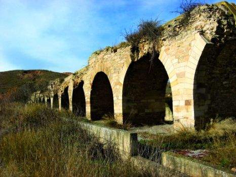
Shortly after, the route continues along a stretch of eroded road lined with lush vegetation. It reaches the aqueduct or Puente de los Moros (16.1 km, 3hr 20min), a feat of Roman engineering, built in the second century at the head of the Lodosa Canal, where a power station and the Mártires Reservoir can be found. The journey continues down a small path to the jetty of the canal, leaving behind tamarisks, two small ravines and an area of quarries. The route arrives at a wooded picnic area with tables. Soon after, it ventures into the town of Lodosa, always parallel to the Ebro, and heads towards the Álamos de Lodosa National Monument (315 m, 18.8 km, 3hr 55min).

Lodosa's history has always been closely tied to the Ebro. It uses its waters and banks to maintain its fertile vegetable gardens, where its famous “piquillo” red pepper and other vegetables are grown. Also worthy of note is the church of San Miguel (16th-18th C.), the emblazoned houses (17th-18th C.), and various cave dwellings in the hills, date unknown, carved out of the chalk layers.
Sites of interest
Puntos de interés
Culture
Municipality
Hostel
Profile

Highlights
Further information
Puente de los Moros
The Alcanadre-Lodosa aqueduct, listed as a historic-artistic monument, is an excellent work of Roman engineering, and one of the more important public works built in Hispania in the second century (during the time of the emperors Trajan and Hadrian). The aqueduct, known since ancient times as the “Puente de los Moros” (Bridge of the Moors), is a watercourse constructed to carry water from the junction of the rivers Linares and Odrón (with a Roman dam) to Calagurris Iulia, present-day Calahorra (La Rioja). It consists of about 30 km of open channel, embedded into the terrain, 2-2.5 m wide and up to 2 m deep. Currently, only 13 of its 108 original arches have been preserved.
Lodosa Canal
The first concession was awarded in 1861, when José de Gama from Saragossa submitted a project to create a canal to channel water from the Ebro in order to irrigate and fertilise the lands from Lodosa to the Jalón. Although this concession expired in 1881, the idea of building a canal continued until 1903, when the Directorate General for Public Works included a Lodosa Canal project in its General Canal and Reservoir Plan. In 1907, Cornelio Arellano drafted the project that was approved in 1910. The works of the so-called “Victoria-Alfonso Canal” began in 1915. The Lodosa Canal was finally opened in 1935. This canal carries water from Mártires de Lodosa weir or reservoir on the River Ebro, next to “Puente de los Moros”, and covers 127 km, more or less parallel to the “great river”, with a capacity of 19 m³/s. The irrigated area is about 29,000 ha, distributed amongst the Autonomous Communities of Navarre, La Rioja and Aragón.


